Topics > Northumberland > Civil Parishes in Northumberland > Corbridge Civil Parish > Historic Buildings and Monuments in Corbridge Civil Parish
Historic Buildings and Monuments in Corbridge Civil Parish
Listed buildings and scheduled monuments in Corbridge, Northumberland, from the National Heritage List for England[1]. Use the Search (below) if looking for a specific building / monument.
| Structure | List No. | Grade | Built~ | Note |
|---|---|---|---|---|
| Nos. 12-16, Front Street | 1044780 | II | ||
| Nos. 14,16, Hill Street | 1303539 | II | ||
| Nos. 28-34, Hill Street | 1154995 | II | ||
| No. 3, St Helens Street | 1155324 | II | ||
| Nos. 4-6, Watling Street | 1044763 | II | ||
| Nos. 5 and 7, Princes Street | 1044758 | II | ||
| Nos. 8,10, Front Street | 1154985 | II | ||
| No. 9, Market Place | 1370574 | II | ||
| Aydon Castle Main Buildings and Courtyard Walls | 1303707 | I | C13th | Aydon . Scheduled Monument(1011645) |
| Aydon House | 1154726 | II | Aydon | |
| Aydon North Farmhouse | 1303717 | II | Aydon | |
| Aydon South Farmhouse | 1370526 | II | Aydon | |
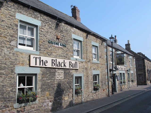
| Black Bull Inn | 1044753 | II | 1765 | |
| Black House Crafts | 1155537 | II | ||
| Boundary Walls to North and North-West of Parish Hall | 1370541 | II | ||
| Bridge Bank Cottage and Adjacent Workshop to North | 1044809 | II | ||
| Bridge on Old Road over Cor Burn | 1303704 | II | C18th | |
| Bridge over the Devils Water | 1370545 | II | 1788 | Dilston |
| Cartshed and Privy to East of Farnley Farmhouse | 1044778 | II | ||
| Dilston Chapel | 1303600 | I | C17th | Dilston . Scheduled Monument(1006591) |
| Chapel Cottage | 1154881 | II | ||
| Church of St Andrew | 1303508 | I | C7th | Corbridge |
| Churchyard Wall with Hearse House and Entrance Gateway | 1155512 | II | C18th | Corbridge. Wall includes the 'King's Oven' |
| Coachhouse to East of Dilston New Town Farmhouse | 1370548 | II | ||
| Corbridge Bridge (Tyne Bridge) | 1044808 | I | 1674 | Scheduled Monument(1006574) |
| Corbridge House | 1155054 | II | ||
| Corbridge Mill, Mill House and Adjacent Byre | 1044811 | II | c1800 | |
| Corbridge War Memorial | 1436760 | II | ||
| Cottage Occupied by Miss Smith, with Adjacent Stable Block | 1155009 | II | ||
| Croft House | 1044806 | II | ||
| Cross House East and Cross House West | 1303416 | II | ||
| Dilston Castle | 1044775 | I | C15th | Dilston. Tower house. Scheduled Monument(1006590) |
| Dilston Crossing House with Attached Outbuilding to West | 1044773 | II | Dilston | |
| Dilston Haugh Farmhouse | 1370546 | II | Dilston | |
| Dilston New Town Farmhouse with Adjacent Walls and Outbuilding to West | 1044774 | II | Dilston | |
| Earls Bridge over Devils Water, 150 Metres North-West of Dilston Hall | 1044777 | II | C17th | Dilston |
| East Portal of Farnley Scar Tunnel | 1370551 | II | ||
| Farm Buildings to North and West of Farnley Farmhouse | 1154898 | II | ||
| Farm Buildings West of Dilston Haugh Farmhouse | 1044772 | II | ||
| Farmbuildings North-East of Aydon North Farmhouse | 1044804 | II | ||
| Farnley Farmhouse | 1303609 | II | ||
| Farnley Gate Cottage | 1154912 | II | ||
| Fawcet Headstone One Metre West of South Transept of Church of St Andrew | 1044789 | II | ||
| Forecourt Wall and Gate Piers to Low Hall | 1155036 | II | ||
| Forecourt Walls and Attached Outbuilding to North of Orchard Vale | 1303367 | II | ||
| Forecourt Walls and Gatepiers to Cross House East and Cross House West | 1044759 | II | ||
| Garden House with Attached Garden Walls 40 Metres South-East of White House Farmhouse | 1044765 | II | ||
| Garden Wall to East of Bridge Bank Cottage | 1154756 | II | ||
| Garden Walls and Gate Piers to South and West of North Farmhouse | 1303683 | II | ||
| Garden Walls, Gate Piers and Privy to South and West of Aydon South Farmhouse | 1303687 | II | ||
| Gatepiers to Dilston Hall | 1303606 | II | ||
| Glenthorne | 1044785 | II | ||
| Ha-Ha Wall and Attached Garden Wall to South of Corbridge Mill and Mill House | 1044770 | II | ||
| Hay Barn at Rear of Outbuilding to East of Aydon North Farmhouse | 1303678 | II | ||
| Heron House | 1044781 | II | ||
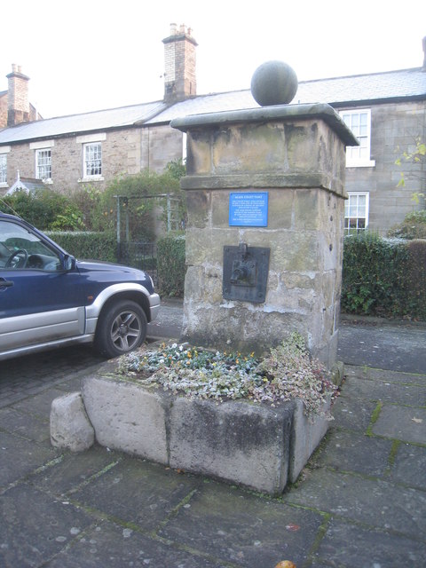
| Hydrant and Trough 15 Metres West of Wheatsheaf Public House | 1044762 | II | C19th | Stagshaw Road, Corbridge |
| Hydrants and Trough at Junction with Orchard Crescent | 1370540 | II | ||
| Limekiln on West Side of Road 190 Metres South of Thornborough Kiln House | 1370543 | II | ||
| Linnels Bridge | 1303209 | II | 1698 | Linnels. Scheduled Monument(1003703) |
| Little Whittington Farmhouse | 1044782 | II | ||
| Lloyds Bank | 1044754 | II | ||
| Low Hall with Pele Tower | 1044784 | I | C13th | |
| Lumley Headstone 5 Metres SE of Chancel of Church of St Andrew | 1044790 | II | ||
| Lumley Memorial 8 Metres East of Chancel of Church of St Andrew | 1370572 | II | ||
| Lych Gate to Churchyard | 1044788 | II | 1920 | War Memorial. Corbridge |
| Main Group of Farmbuildings, to North-West of Thornbrough High Barns Farmhouse | 1155478 | II | ||
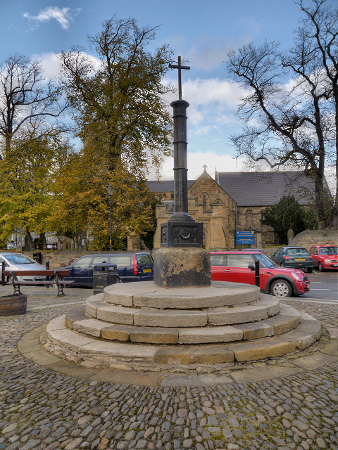
| Market Cross | 1155090 | II | 1814 | Corbridge |
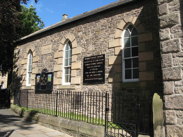
| Market Place Chapel and Area Railings | 1044751 | II | 1867 | Corbridge |
| Milestone 440 Metres East of Portgate Roundabout | 1303661 | II | c.1757 | B6318, Portgate |
| Milestone at NY98486585 | 1370524 | II | ||
| Monksholme | 1370555 | II | ||
| Noble Headstone 3 Metres South of Chancel of Church of St Andrew | 1155140 | II | ||
| Norma James Dress Shop and Attached Cottage to Rear | 1044752 | II | ||
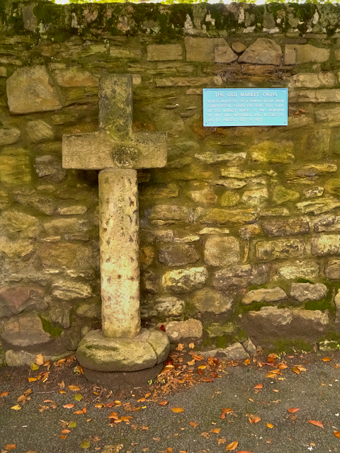
| Old Market Cross Set Against Churchyard Wall 2 Metres East of Vicars Pele | 1370573 | II | C13th | |
| Old Prior Manor and Prior Manor Cottage | 1303394 | II | ||
| Old Stable 20 Metres South-East of White House Farmhouse | 1155550 | II | ||
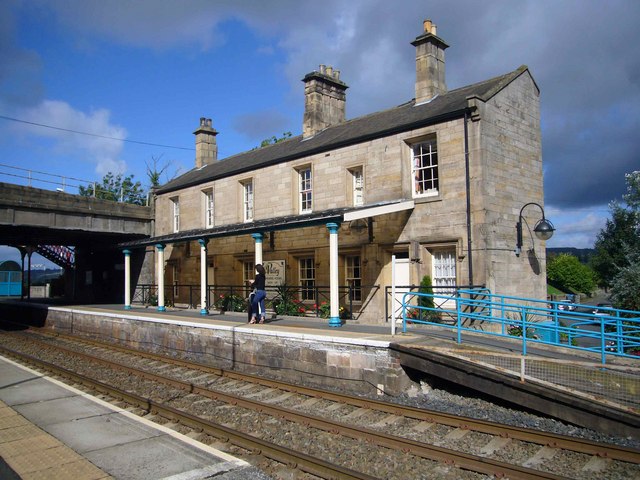
| Old Station Building | 1044802 | II | C19th | Corbridge Station |
| Orchard Vale and Orchard Vale Cottage | 1044761 | II | ||
| Outbuilding 10 Metres North of Dilston Haugh Farmhouse | 1370547 | II | ||
| Outbuilding to East of Aydon North Farmhouse | 1370525 | II | ||
| Outer Bailey Walls and Attached Farmbuildings | 1044803 | I | C14th | Aydon Castle |
| Panache Restaurant | 1154989 | II | ||
| Pant | 1044787 | II | 1815 | Main Street, Corbridge |
| Pant in Front of No 5 | 1155073 | II | ||
| Portgate House | 1044756 | II | C19th | Portgate |
| Premises Occupied by Smiths Gore and Christies Limited | 1303552 | II | ||
| Princes Street | 1155308 | II | ||
| Pump and Trough at End of Little Whittington Farmhouse | 1044783 | II | ||
| Range of Farmbuildings 20 Metres North-East of Portgate House | 1155292 | II | Portgate | |
| Range of Farmbuildings 60 Metres East of Portgate House | 1370577 | II | Portgate | |
| Remains of Old Bridge on West Bank of Devils Water 120 Metres South of A695 | 1044771 | II | ||
| Retaining Wall at Head of Valley Side, 50 Metres North-East of Dilston Castle | 1044776 | II | ||
| Riverside Hotel | 1044786 | II | ||
| Roadside spring 500 metres south of Holly Bush Sawmill | 1154730 | II | ||
| Shawwell Farmhouse | 1155335 | II | ||
| South House, North House and the Old Vicarage Flat | 1370527 | II | ||
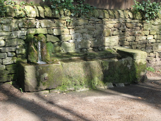
| Spout Well | 1154752 | II | C18th | Spoutwell Lane, Corbridge |
| St Andrews Cottage | 1370553 | II | ||
| Stable Cottage | 1044805 | II | ||
| Stable/Dovecote 60 Metres South of Ravenstone | 1303544 | II | ||
| Sundial in Garden 16 Metres East of Shildon Farmhouse | 1044760 | II | ||
| Sydgate House | 1370575 | II | ||
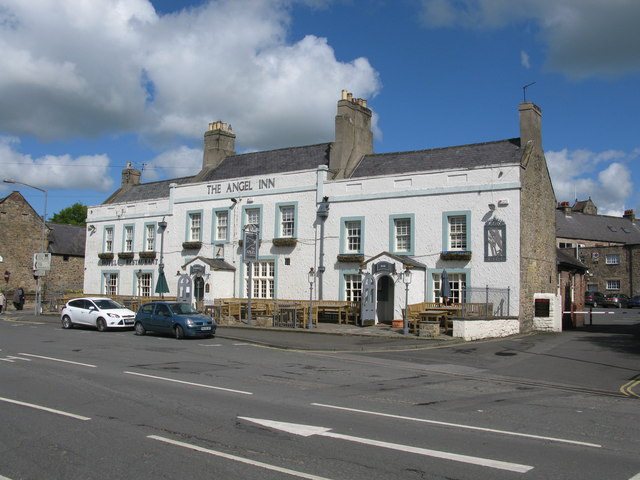
| The Angel Inn | 1370554 | II | C17th | |
| The Forge | 1303669 | II | ||
| The Forge House | 1044810 | II | ||
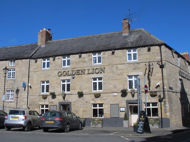
| The Golden Lion Public House | 1370552 | II | C18th | Hill Street, Corbridge |
| Thornborough Farmhouse and Attached Garden Wall to South-West | 1303341 | II | ||
| Town Farmhouse and Garage to West | 1370542 | II | ||
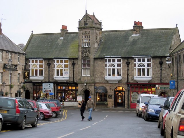
| Town Hall with Shops | 1044757 | II | 1887 | |
| Vicars Pele | 1044750 | I | c.1318 | In churchyard of St Andrew's, Corbridge. Scheduled Monument(1006604) |
| Walkers Pottery Downdraught Kiln with Adjacent Chimney | 1044755 | II | ||
| Walkers Pottery Newcastle Kilns with Attached Buildings | 1155244 | II | ||
| Walkers Pottery West Bottle Kiln | 1370576 | II* | ||
| Walkers Pottery: East Bottle Kiln | 1155212 | II* | ||
| Wall and Gateway Adjoining East End of Chapel | 1370549 | II | ||
| Wellhead and Troughs 50 Metres North of Portgate House | 1303410 | II | C18th | Portgate |
| West Portal of Farnley Scar Tunnel | 1044779 | II | ||
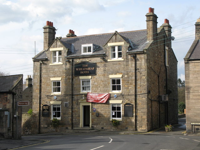
| Wheatsheaf Inn | 1370544 | II | C18th | St Helen's Street, Corbridge |
| White House Farmhouse | 1044764 | II | ||
| Whittingham Fell | 1044807 | II | ||
| Wilson Tomb 3 Metres East of Church of St Andrew | 1044749 | II | ||
| Yard Walls and Outbuildings to North of Farnley Farmhouse | 1370550 | II | ||
| Hadrian's Wall and vallum between the track to Portgate Cottage and the field boundary east of milecastle 24 in wall miles 22 and 23 | 1010626 | n/a | Roman | Scheduled Monument |
| Walker's Pottery | 1006441 | n/a | Scheduled Monument | |
| Corbridge (Corstopitum) Roman station | 1006611 | n/a | Roman | Scheduled Monument |
| Romano-British farmstead, 900m north east of Thornborough High Barns | 1017723 | n/a | Scheduled Monument | |
| Haltonchesters Roman fort, settlement and Hadrian's Wall and vallum between the field boundary east of Haltonchesters fort and the Fence Burn in wall mile 21 | 1010624 | n/a | Roman | Scheduled Monument |
| Hadrian's Wall and vallum between the Fence Burn and the track to Portgate Cottage in wall miles 21 and 22 | 1010625 | n/a | Roman | Scheduled Monument |
| Three temporary camps at Farnley Grange | 1009156 | n/a | Roman | Scheduled Monument |
| Corbridge Conservation Area | - | n/a | Conservation Area |
Primary source: the National Heritage List for England - NHLE is the register of nationally protected historic buildings and sites in England, including listed buildings, scheduled monuments, protected wrecks, registered parks and gardens, and battlefields. The list is maintained by Historic England. Check NHLE for updates and new entries. Secondary sources: British Listed Buildings and Keys to the Past.
Co-Curate Page
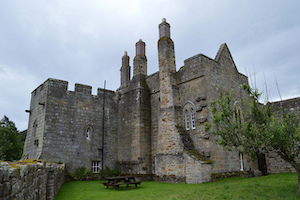
Aydon Castle
- Overview About Aydon Castle Map Street View Aydon Castle is a 13th century English manor house, located one mile from Corbridge. The house was heavily fortified on the outbreak of …
Co-Curate Page
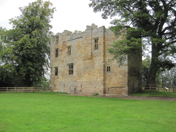
Dilston Castle
- Overview About Dilston Castle Map Dilston Castle is a ruined 15th century tower house, located in Dilston, near Corbridge. It was built by Sir William Claxton on the site of …
Co-Curate Page
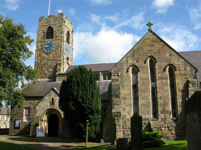
Church of St. Andrew
- Overview Map Street View St Andrew's Church, located by the Market Place in Corbridge, dates from the late 7th or early 8th century. The building includes stone reused from the …
Co-Curate Page
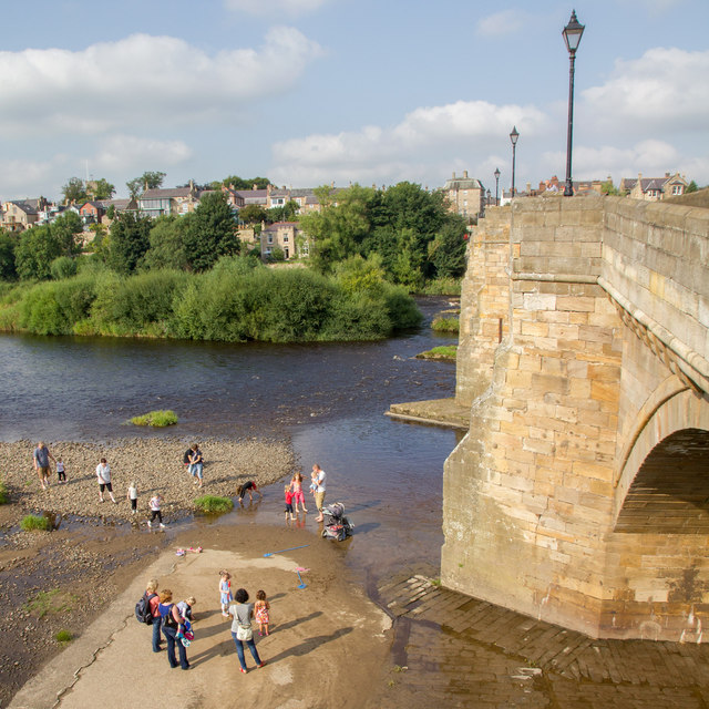
Tyne Bridge
- Overview About Corbridge Bridge Map Street View The seven arched stone bridge over the River Tyne at Corbridge was completed in 1674. It replaced an earlier bridge of 1235 and …
Co-Curate Page
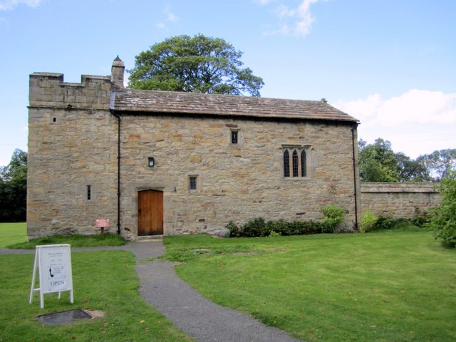
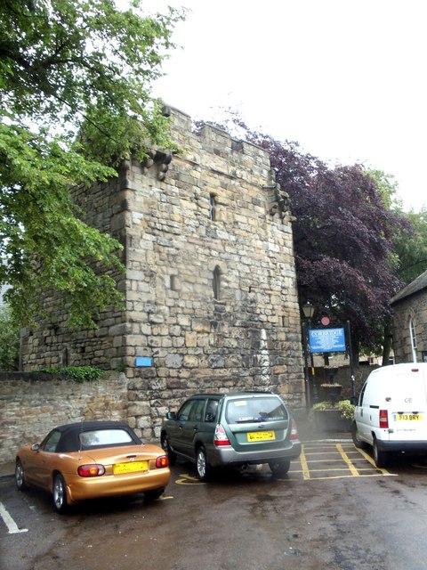
Vicar's Pele
- Overview Map Street View The Vicar's Pele (defensive tower) was built in the churchyard of St Andrew's Church, Corbridge, in c.1318.[1] The Pele incorporates reused Roman masonry and has a …
Co-Curate Page
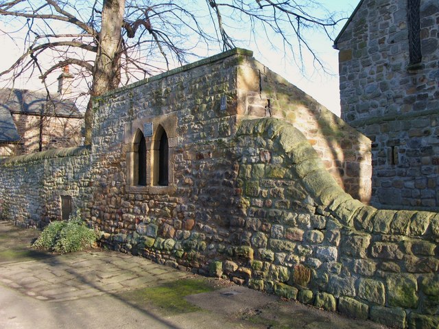
Hearse House and King's Oven
- Overview Map Street View The churchyard wall and hearse house at St Andrew's Church in Corbridge were built in the 18th century, incorporating stone from earlier structures. Adjacent to the hearse …
Co-Curate Page
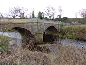
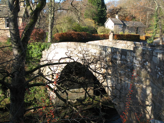
Linnels Bridge
- Overview Map Street View The stone bridge over Devil's Water in Linnels in Northumberland is thought to have been built in 1698.[1] It incorporate and inscribed tablet from an earlier bridge …
Co-Curate Page
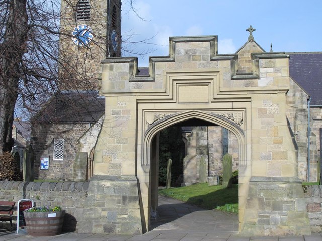
Lych Gate and War Memorial, St Andrew's
- Overview Map Street View The stone Lych Gate at St Andrew's Church, Corbridge, was built as a memorial iin commemoration of 108 local servicemen who lost their lives in the …
Co-Curate Page
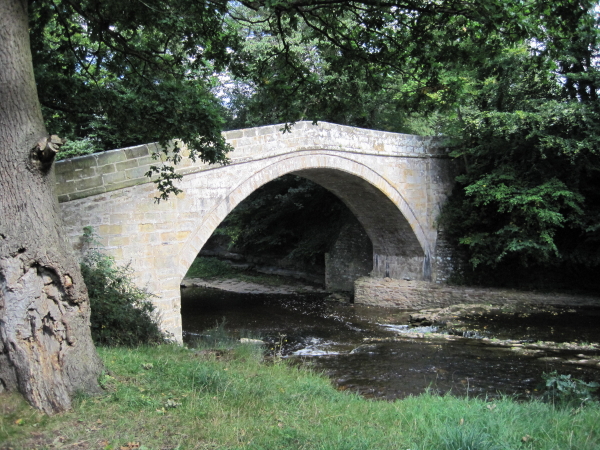
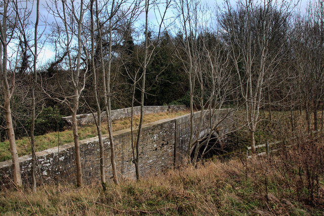
Old Mill by Cor Burn
- Overview Map The old mill to the west of Corbridge dates from c.1800. It is located by Cor Burn, close to it's confluence with the River Tyne. The mill and mill …
Co-Curate Page
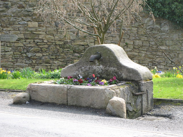
Spout Well
- An old well, from which Spoutwell Lane in Corbridge gets its name. Grade II listed.
Co-Curate Page
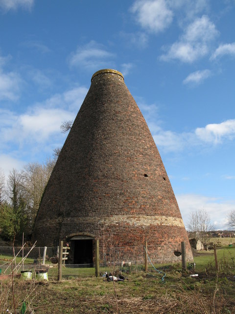
Bottle kilns
- Overview Map Street View Walker's Pottery on Milkwell Lane in Corbridge operated from the early 19th century until 1910. The pottery produced pipes, tiles and low-grade pottery for agricultural use, …
Co-Curate Page
Portgate House
- Portgate House was built in the early 19th century. The building in Portgate is Grade II listed on the National Heritage List for England.


Co-Curate Page
Aydon Castle
- Overview About Aydon Castle Map Street View Aydon Castle is a 13th century English manor house, located one mile from Corbridge. The house was heavily fortified on the outbreak of …
Co-Curate Page
Dilston Castle
- Overview About Dilston Castle Map Dilston Castle is a ruined 15th century tower house, located in Dilston, near Corbridge. It was built by Sir William Claxton on the site of …
Co-Curate Page
Church of St. Andrew
- Overview Map Street View St Andrew's Church, located by the Market Place in Corbridge, dates from the late 7th or early 8th century. The building includes stone reused from the …
Co-Curate Page
Tyne Bridge
- Overview About Corbridge Bridge Map Street View The seven arched stone bridge over the River Tyne at Corbridge was completed in 1674. It replaced an earlier bridge of 1235 and …
Co-Curate Page
Vicar's Pele
- Overview Map Street View The Vicar's Pele (defensive tower) was built in the churchyard of St Andrew's Church, Corbridge, in c.1318.[1] The Pele incorporates reused Roman masonry and has a …
Co-Curate Page
Hearse House and King's Oven
- Overview Map Street View The churchyard wall and hearse house at St Andrew's Church in Corbridge were built in the 18th century, incorporating stone from earlier structures. Adjacent to the hearse …
Co-Curate Page
Linnels Bridge
- Overview Map Street View The stone bridge over Devil's Water in Linnels in Northumberland is thought to have been built in 1698.[1] It incorporate and inscribed tablet from an earlier bridge …
Co-Curate Page
Lych Gate and War Memorial, St Andrew's
- Overview Map Street View The stone Lych Gate at St Andrew's Church, Corbridge, was built as a memorial iin commemoration of 108 local servicemen who lost their lives in the …
Co-Curate Page
Old Mill by Cor Burn
- Overview Map The old mill to the west of Corbridge dates from c.1800. It is located by Cor Burn, close to it's confluence with the River Tyne. The mill and mill …
Co-Curate Page
Spout Well
- An old well, from which Spoutwell Lane in Corbridge gets its name. Grade II listed.
Co-Curate Page
Bottle kilns
- Overview Map Street View Walker's Pottery on Milkwell Lane in Corbridge operated from the early 19th century until 1910. The pottery produced pipes, tiles and low-grade pottery for agricultural use, …


