Topics > Northumberland > Civil Parishes in Northumberland > Bywell Civil Parish > Historic Buildings and Monuments in Bywell Civil Parish
Historic Buildings and Monuments in Bywell Civil Parish
Listed buildings and scheduled monuments in Bywell Civil Parish, Northumberland, from the National Heritage List for England[1]. Use the Search (below) if looking for a specific building / monument.
| Structure | List No. | Grade | Built~ | Notes |
|---|---|---|---|---|
| Bridge over Clockey Burn 70 Metres North of Bywell Castle Entrance | 1370520 | II | ||
| Brocks Bushes Farmhouse | 1044827 | II | C18th | Brocksbushes |
| Bywell Bridge over River Tyne | 1303849 | II | 1838 | Replaces earlier bridge here. |
| Bywell Castle Gatehouse | 1370558 | I | C15th | Scheduled Monument (1006584) |
| Bywell Hall | 1370556 | II* | 1766 | |
| Bywell Home Farmhouse (Now Estate Office) with Adjacent Outbuilding to West | 1044797 | II | ||
| Bywell House | 1044791 | II | ||
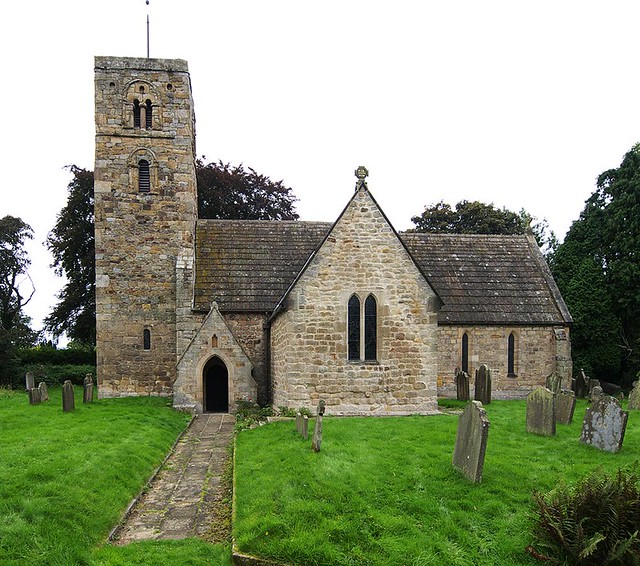
| Church of St Andrew | 1044831 | I | C11th | Bywell. C19th alterations by John Dobson. |
| Church of St James | 1044799 | II | 1857 | Newton Hall |
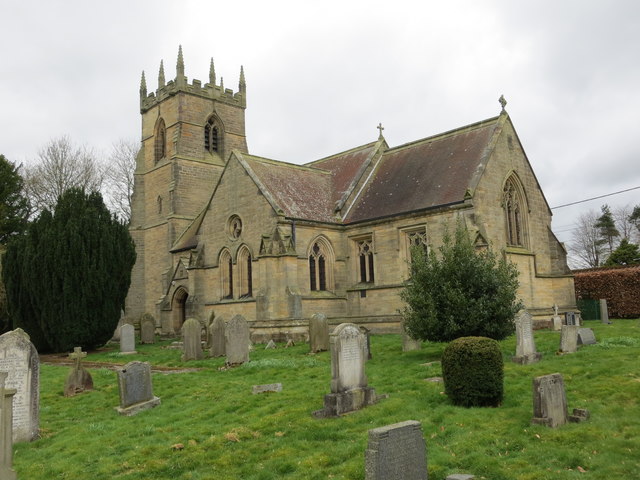
| Church of St Peter | 1044828 | I | C8th | Bywell. Saxon chancel and Roman stone. |
| Cross Slab 1 Metre East of South Aisle of Church of St Peter | 1303806 | II | ||
| Engine House and Attached Outbuildings 30 Metres North-West of Shildonhill Farmhouse | 1303732 | II | ||
| Farmbuildings 30 Metres West of Home Farmhouse | 1370521 | II | ||
| Farmbuildings to North of Newton Fell Farmhouse | 1154612 | II | ||
| Farmbuildings to North-East of Town Farmhouse | 1044798 | II | ||
| Garden Walls 60 Metres North of Styford Hall | 1044801 | II | ||
| Garden Walls and Railings to South and East of Home Farmhouse | 1154580 | II | ||
| Gate Piers to Churchyard of Church of St Peter | 1154473 | II | ||
| Gatepiers at Entrance to Bywell Park, on South Side of Road Junction at NZ 04306190 | 1044796 | II | ||
| Green Headstone 2.5 Metres South of South-East Angle of Nave of Church of St Peter | 1044829 | II | ||
| Hearse House to West of Church of St Peter | 1044830 | II | ||
| Joicey Memorial 18 Metres South of Church of St John | 1303723 | II | ||
| Maxnil Headstone 10 Metres West of South Aisle of Church of St Peter | 1154464 | II | ||
| Milepost 90 Metres East of Styford Lodge | 1370538 | II | ||
| Newton Fell Farmhouse | 1370522 | II | ||
| Old Kilns 30 Metres South-East of Newtonkiln House | 1044800 | II | ||
| Old Vicarage | 1154496 | II | ||
| Orangery/Conservatory 40 Metres North-East of Bywell Hall, and Attached Garden Wall | 1370557 | II | C18th | |
| Pair of Urns Flanking Path 20 Metres South-West of Bywell Hall | 1044793 | II | ||
| Remains of Castle Curtain Wall and Tower Incorporated in Bywell Castle House | 1044795 | II | ||
| Roadside Walls with Attached Trough and Hydrant to South of Town Farmhouse | 1303718 | II | ||
| Shaw House Farmhouse | 1154362 | II | ||
| Stable Block 30 Metres North-East of Styford Hall | 1154646 | II | ||
| Stable Range 10 Metres North of Bywell Hall | 1044792 | II | ||
| Styford Hall | 1370523 | II | c1800 | |
| Sundial in Centre of Walled Garden 60 Metres North-East of Bywell Hall | 1044794 | II | ||
| Town Farmhouse and Attached Outbuilding to East | 1154583 | II | ||
| Village Cross | 1044832 | II | C13th | Bywell |
| Water Mill at West End of Farmbuildings 80 Metres West of Brocks Bushes Farmhouse | 1303823 | II | C19th | Brocksbushes |
| Yard Wall with Gate Piers to East of Shaw House Farmhouse | 1044826 | II | ||
| Defended settlement and Romano-British settlement on Shildon Hill | 1017729 | n/a | Scheduled Monument | |
| Newton Conservation Area | - | n/a | Conservation Area |
Primary source: the National Heritage List for England - NHLE is the register of nationally protected historic buildings and sites in England, including listed buildings, scheduled monuments, protected wrecks, registered parks and gardens, and battlefields. The list is maintained by Historic England. Check NHLE for updates and new entries.
Secondary sources: British Listed Buildings and Keys to the Past.
Co-Curate Page
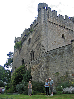
Bywell Castle
- Overview About Bywell Castle Map Street View Bywell Castle was built in the early 15th century for Ralph Neville, the second earl of Westmorland.[1] It was originally built in Bywell …
Co-Curate Page
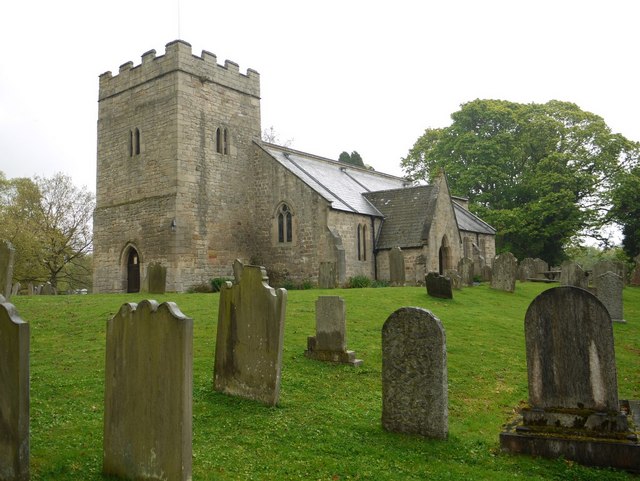
Church of St Peter
- Overview Map Street View St Peter's Church in Bywell, Northumberland, dates from Anglo Saxon times, probably the 8th century.[1] It originally belonged to the Benedictine monastery of Durham and in …
Co-Curate Page
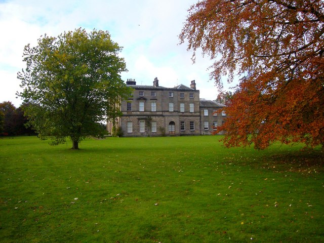
Bywell Hall
- Overview About Bywell Hall Map Bywell Hall is a privately owned 18th-century country house situated on the north bank of the River Tyne at Bywell, Northumberland. It is Grade …
Co-Curate Page
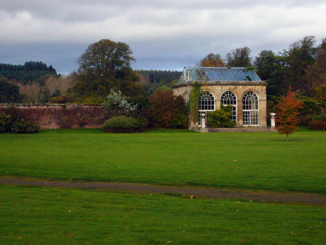
Orangery, Bywell Hall
- Overview Map The Orangery at Bywell Hall was built in the 18th century and is Grade II listed on the National Heritage List for England.[1]
Co-Curate Page
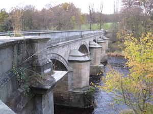
Bywell Bridge, over the Tyne
- Overview Map Street View Bywell bridge over the River Tyne was built 1836-1838, designed by George Basevi. The stone bridge carries the B6309 road over the Tyne, with Bywell on the north …
Co-Curate Page
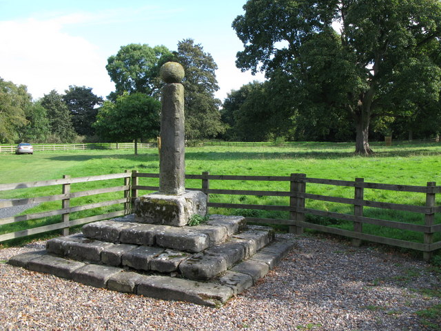
Village Cross
- Overview Map Street View The village Cross in Bywell dates from the 13th century. Having being damaged the structure was altered in the 18th century when a stone ball was …
Co-Curate Page
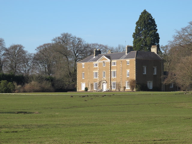
Styford Hall
- Overview Map Styford Hall is a large country house in Northumberland located by the north banks of the River Tyne, over the river from Riding Mill, and about 2 miles …

Co-Curate Page
Bywell Castle
- Overview About Bywell Castle Map Street View Bywell Castle was built in the early 15th century for Ralph Neville, the second earl of Westmorland.[1] It was originally built in Bywell …
Co-Curate Page
Church of St Peter
- Overview Map Street View St Peter's Church in Bywell, Northumberland, dates from Anglo Saxon times, probably the 8th century.[1] It originally belonged to the Benedictine monastery of Durham and in …
Co-Curate Page
Bywell Hall
- Overview About Bywell Hall Map Bywell Hall is a privately owned 18th-century country house situated on the north bank of the River Tyne at Bywell, Northumberland. It is Grade …
Co-Curate Page
Orangery, Bywell Hall
- Overview Map The Orangery at Bywell Hall was built in the 18th century and is Grade II listed on the National Heritage List for England.[1]
Co-Curate Page
Bywell Bridge, over the Tyne
- Overview Map Street View Bywell bridge over the River Tyne was built 1836-1838, designed by George Basevi. The stone bridge carries the B6309 road over the Tyne, with Bywell on the north …
Co-Curate Page
Village Cross
- Overview Map Street View The village Cross in Bywell dates from the 13th century. Having being damaged the structure was altered in the 18th century when a stone ball was …


