Topics > Northumberland > Horton (Blyth) > Horton Parochial Chapelry, 1855
Horton Parochial Chapelry, 1855
Extract from: History, Topography, and Directory of Northumberland...Whellan, William, & Co, 1855.
HORTON PAROCHIAL CHAPELRY.
HORTON is a parochial chapelry comprising the townships oi Bebside, Cowpen, Hartford East, Hartford West; and Horton, whose united area is 5,550 acres, It is bounded on the north by the river Blyth, on the west by the parish of Stannington, on the south by Earsdon parish and Cramlington chapelry, and on the east by the parish of Earsdon and the port of Blyth. The number of its inhabitants in 1801, was 1,197; in 1811, 1,449; in 1821, 2,099; in 1831, 2,423; in 1841, 2,838; and in 1851, 4,449 souls. This chapelry abounds in coal and stone, and the soil is a strong clay, which produces excellent crops. Until 1768, It formed a portion of the parish of Woodhorn, but at that period it was made into a parochial chapelry, and obtained all the privileges of a distinct parish.
BEBSIDE is a township and hamlet, the property of William Ward, Esq., of London. The township contains 464 acres, and its population in 1801, was 126; in 1811, 102; in 1821, l23; in 1831, 100; in 1841, 91; and in I851, 121 souls. The rateable value is £760. This manor was anciently the property of the priors of Tynemouth, but after the dissolution of the religious houses and the confiscation of their property, it was possessed by John Ogle, Esq., and afterwards by Edward Delaval, Esq., from whom it passed ill succession to John Johnson, Esq., Mrs. Mary Fielding, and Robert Ward. Esq. of London, coming ultimately into the possession of the present proprietor. THE HAMLET of Bebside is situated on the river Blyth, six miles south-east by south of Morpeth.
DIRECTORY. Isaac Brown, farmer, Bebside North Farm; Thomas Dunn, farmer, Bebside South Farm; and George Gardner, miller and farmer, Bebside Mill.
COWPEN is a township and village the principal landowners of which are Marlow John F. Sidney, Esq., Archdeacon Croft, and others. The township comprises an area of 1,707 acres, and its rateable value is £8,152. The population in 1801, was 853; in 1811, 1,095; in 1821, 1,765; in 1831, 2,081; in 1841, 2,464; and in 1851, 4,045 souls. The eastern portion of this township, including Cowpen Quay, Cowpen Square, Crofton, Crofton Mills, and Waterloo, forms part of the town and part of Blyth, under which head the directories, etc. will be found. THE VILLAGE of Cowpen is situated on the southern bank of the river Blyth, about seven miles S.S.E. of Morpeth. Here is a beautiful Catholic Church dedicated to St. Cuthbert, which was erected and endowed by M.J.F. Sidney, Esq. in 1840. It is in the early English style of architecture, and the cost of its erection is said to have exceeded £,4000. The entrance is by a porch of very superior workmanship, and the interior is not more admired for its chaste simplicity and just proportions, than for the beautiful carving of Its massive pulpit, altar-screen, rood-loft, and splendid altar, on the decoration of which neither labour nor expense seems to have been spared. The Rev. James W. Burchall, O.S.B. and the Rev. J. Bradley, O.S.B. are the priests. The School attached to this church is a neat and substantial edifice, built in 1843. The late Mrs. Sidney contributed £200 towards its erection. Mary Ann Nolan, teacher.
DIRECTORY
|
Armstrong Adam boiler builder, Cowpen Bell Jane, shopkeeper Bell Thomas, tailor Bradley Rev. J.B. O.S.B. (Catholic) Burchall Rey. James W. O.S.B. (Catholic) Marshall John, smith Moffitt Ralph, assistant overseer |
Percy John, gardener Reed Thomas, teacher, Church School Robinson Edward, grocer Sidney Marlow John Francis, Esq. J.P. Cowpen Hall Sidney M.W. J. solicitor, office, Blyth Sidney W.H.M. Esq. Cowpen House Swan Dorothy, shopkeeper |
|
Boot and Shoe Makers Davison John Dixon Mary - Thomas Watson, manager
Butcher Thompson Neveison |
Farmers Bell William Brown Henry Darling William, Cowpen Red House Grimson Jos. Kitty Brewster Moffitt Edward |
Pattison Edward, High House Smith Thomas, Cowpen, South Farm Inns Duke of York, Elizabeth Bolam King's Arms, James How Windmill, John Storey |
HARTFORD (EAST) is a township situated five ana a half miles S.S.E. of Morpeth. lt comprises an area of 303 acres, and its rateable value is £100. The number of its inhabitants in 1801, was 18; in 1811, 13; in 1821, 15; in 1831, 12; in 1841, 26 ; and in 1851, 10 souls. It is the property of Nathaniel Bates, Esq. of Melbourne Hall, and consists of one farm which Is in the occupation of Mrs Hannah Potts.
DIRECTORY. Mrs. Hannah Potts, farmer; and John Potts, farm-manager for Mrs. Potts.
HARTFORD (WEST) is a township and hamlet, the property of Robert Hedley, Esq. The township contains 521 acres, and its rateable value is £328. Population in 1801, 87; in 1811, 97; in 1821, 57; in 1831, 55; in 1841, 89; and in 1851, 57 souls. THE HAMLET of west Hartford is situated in a beautiful and picturesque valley, south of the river Blyth, whose banks, in this neighbourhood, are thickly covered with trees. It is five miles S.S.E. of Morpeth.
DIRECTORY. Samuel Elstob, farmer, West Hartfod Hall; Jane Davison, vict. Hartford Bridge Inn; and John Rowell, farmer.
HORTON is a township and scattered village giving name to the chapelry in which it is situated. The area of the township is 2,555 acres, and the rateable value is £4,376. The number of inhabitants in 1801, was 113; in 1811, 142; in 1821, 139; in 1831, 175; in 1841, 218; and in 1851, 210 souls. In the time of Henry III. Horton belonged to a family who assumed the local name, but in the latter part of the same reign, it had fallen into the hands of Guiscard de Charron, who obtained leave, in 1203, to fortify his manor house of Horton. This was the fortalice to which the adherents of Gilbert de Middleton, after his capture in Mitford Castle, in 1317, retreated under the banner of his friend and ally Waiter de Selby. After this time, the castle and manor house seem to have been held under the Mombouchers and their successors, for a considerable period by the Delaval family, and in the beginning of the last century two maiden sisters of Admiral George Delaval resided here. The castle is stated to have been defended by a double moat and rampart of earth, but the greater part of its foundations were razed and the rampart levelled in 1809.
The VILLAGE of HORTON is situated three miles west by south of Blyth. The CHAPEL is a modern erection, the old one having been taken down in 1827, and the present neat structure erected upon its site in 1828. The cost of the present edifice was upwards of £500. The register of this chapelry commences in 1648. The living, a perpetual curacy in the archdeaconry of Northumberland and deanery of Newcastle, is valued in the Liber Regis at £16; returned at £80; gross income £91. Patron the Vicar of Woodhom, incumbent, the Rev. Nathaniel Atkinson, M.A.
LAVERICK HALL, in this township, is now in the occupation of George and Gilbert Wigham, farmers.
DIRECTORY
|
Bower John, merchant tailor, North Moor Edge, near Seaton Delaval Cairns Thomas, boot and shoemaker Hornsby William, brick & drain-tile manufacturer, North Moor Tile Works McPherson George, tailor, North Moor Edge |
Mood Matthew, schoolmaster, North Moor Edge, near Seaton Delaval Robinson Thomas, boot and shoemaker Smith Henry, farm-manager, Stickley Wood George, blacksmith |
|
Farmers Herdman Ann Robson George Stephenson Thomas |
Wigham Gilbert and George, Laverick Hall Inns Folly, William Simm |
Astley Arms, Paul Jamieson, North Moor Edge, near Seaton Delaval
|
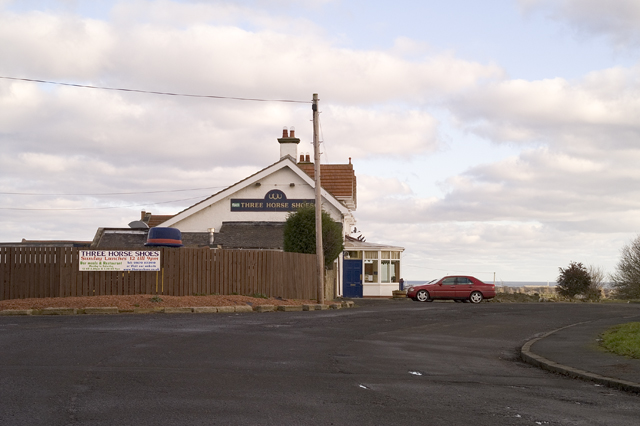
CARRIER - Joseph Percy, from the Three Horse Shoes Inn, Horton; and from Seaton Delaval, and East Cramlington, to Newcastle, on Tuesdays, Thursdays, and Saturdays.

Co-Curate Page
Blyth, 1855
- Extract from: History, Topography, and Directory of Northumberland...Whellan, William, & Co, 1855. BLYTH (SOUTH) is a chapelry, township, and seaport, in Earsdon parish, situated on the southern bank of the …
Co-Curate Page
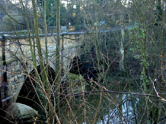
West Hartford
- Overview Map Street View West Hartford is a hamlet immediately north of Cramlington. West Hardford Farm, farm cottages and The Grange are located on the north side of the A192, …
Co-Curate Page
East Hartford
- Overview Map Street View East Hartford is a village located immediately north of Cramlington in Northumberland. Historically, East Hartford was a small farming community and township in the ancient Parish …
Co-Curate Page
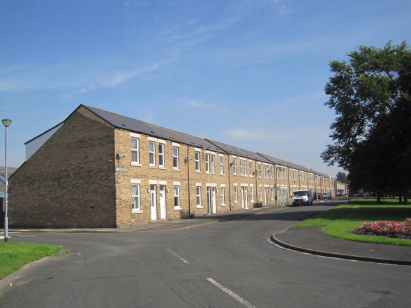
Cowpen
- Overview Map Street View COWPEN, or Coopen, a township, in the chapelry of Horton, union of Tynemouth, E. division of Castle ward, S. division of Northumberland, 8 miles (E.S.E.) from …

Co-Curate Page
Blyth, 1855
- Extract from: History, Topography, and Directory of Northumberland...Whellan, William, & Co, 1855. BLYTH (SOUTH) is a chapelry, township, and seaport, in Earsdon parish, situated on the southern bank of the …
Co-Curate Page
West Hartford
- Overview Map Street View West Hartford is a hamlet immediately north of Cramlington. West Hardford Farm, farm cottages and The Grange are located on the north side of the A192, …
Co-Curate Page
East Hartford
- Overview Map Street View East Hartford is a village located immediately north of Cramlington in Northumberland. Historically, East Hartford was a small farming community and township in the ancient Parish …