Topics > Northumberland > Civil Parishes in Northumberland > Haydon Civil Parish > Historic Buildings and Monuments in Haydon Civil Parish
Historic Buildings and Monuments in Haydon Civil Parish
Listed buildings and scheduled monuments in Haydon Civil Parish, Northumberland, from the National Heritage List for England[1]. In the absence of a published 'local list', some other public buildings of interest may also be included. Use the Search (below) if looking for a specific building / monument.
| Structure | List No. | Grade | Built~ | Notes |
|---|---|---|---|---|
| 'The Golf House' Outbuilding | 1154494 | II | C16th | Chesterwood. Former bastle. |
| Nos. 1-25, Shaftoe Terrace | 1045003 | II | 1805 | Haydon Bridge. Almshouses. |
| Nos. 18-24, Shaftoe Street | 1045002 | II | C19th | Haydon Bridge |
| Alton Side House and Cottage Adjoining | 1370844 | II | C16th | Alton Side. Pair of bastle houses |
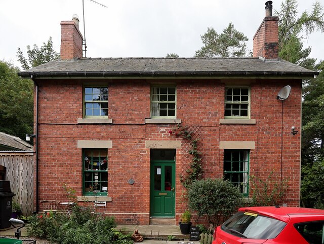
| Anchor Hotel | 1042509 | II | C18th | Haydon Bridge |
| Barn Adjoining West Wharmley Farmhouse to South West | 1154984 | II | C18th | Wharmley |
| Barn and Adjoining Shelter Shed to East of West Wharmley Farmhouse | 1370427 | II | C16th | Wharmley. Former bastle house |
| Barn and Gingang 50 Metres South-West of Wood Hall Farmhouse | 1045012 | II | C19th | |
| Building 10m West of House Adjoining West End of Mellom Cottage | 1154518 | II | C16th | Chesterwood |
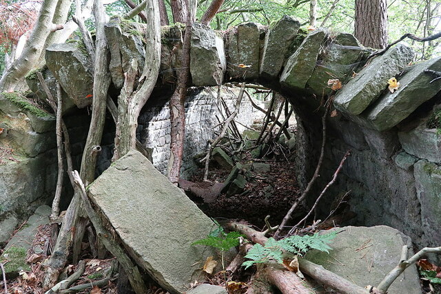
| Chimney to Flue from Former Langley Lead Smelting Mill | 1154466 | II | C19th | nr Langley |
| Church of St Cuthbert | 1154539 | II* | 1796 | Church Street, Haydon Bridge |
| Coastley Farmhouse | 1042503 | II | C19th | |
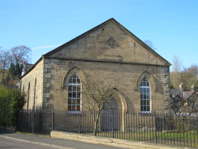
| Congregational Chapel | 1303671 | II | 1863 | North Bank, Haydon Bridge |
| East Wharmley Farmhouse | 1154980 | II | C19th | |
| Elrington Hall Farmhouse | 1154553 | II | C17th | Elrington |
| Esp Hill Farmhouse | 1154451 | II | 1824 | A686 |
| Garden Gate Piers Wall and Railings to South of West Wharmley Farmhouse | 1155012 | II | C19th | |
| Garden Wall and Area Railings to No 2 Station Cottages | 1303749 | II | c.1835 | Haydon Bridge |
| Garden Wall Railings and Gate to South East of Coastley Farmhouse | 1154547 | II | C19th | |
| Garden Walls to South and West of High Staward Farmhouse | 1303725 | II | C19th | High Staward |
| Garden Walls to the East of Threepwood Hall | 1045009 | II | C18th | Threepwood |
| Gatehouse to Staward Pele 65 Metres South East of Pele | 1045007 | II | C14th | Staward Gorge. Part of Scheduled Monument (1006592). |
| Harsondale Farmhouse | 1042505 | II | C19th | Harsondale |
| Haydon Old Church | 1042512 | I | C12th | Haydon Bridge |
| Haydon Spa | 1042499 | II | 1863 | |
| High Shaw (House 300 Metres East of High Staward Farmhouse) | 1303754 | II | c.1700 | |
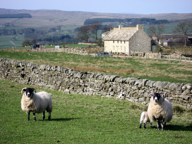
| High Staward Farmhouse with Back Yard Walls and Outbuildings Attached | 1042507 | II* | C19th | High Staward |
| House Adjoining West End of Mellom Cottage | 1042500 | II | C16th | |
| Langley Castle | 1154672 | I | 1350 | Langley. Now a hotel. |
| Lipwood House | 1303696 | II | c.1800 | |
| Lipwood House Cottage to North West of Lipwood House | 1042510 | II | c.1800 | |
| Lipwood House Gate Piers to Stable Yard | 1154748 | II | C19th | |
| Main Group of Farm Buildings and Walls to North East of High Staward Farmhouse | 1042508 | II* | C19th | High Staward |
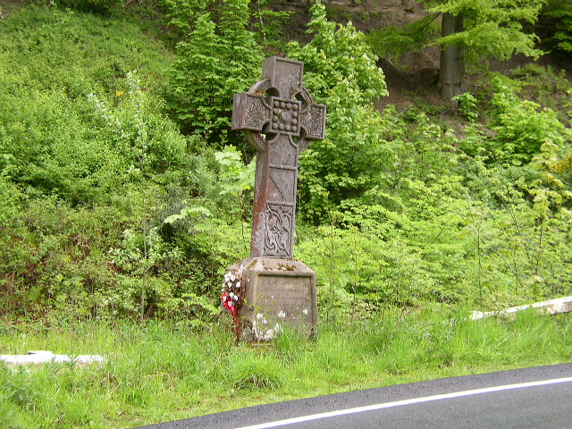
| Memorial Cross 300 Metres East of Light Birks Farmhouse | 1042498 | II | C19th | A686. Derwentwater memorial. |
| Middle Lipwood Farmhouse | 1370848 | II | c.1700 | |
| Old Bridge Now Footbridge | 1154570 | II | C17th | Haydon Bridge |
| Old Coal Mine Buildings South-East of Stublick Farmhouse | 1370425 | II* | C19th | nr Langley |
| Old Cottage and Shelter Sheds 50m South-West of West Wharmley Farmhouse | 1045011 | II | C18th | |
| Outbuilding to South-East of Green | 1042501 | II | C16th | Chesterwood |
| Pigsties 30 Metres North East of High Staward Farmhouse | 1370846 | II* | C19th | High Staward |
| Roman Altar on Lawn Immediately South of Staward Manor | 1045006 | II | Roman | |
| Sewingshields Farmhouse | 1045001 | II | C19th | |
| Smithy and Shelter Sheds 60 Metres North East of High Staward Farmhouse | 1303736 | II* | C19th | High Staward |
| Springhead Structure and 4 Troughs | 1393495 | II | C18th | Chesterwood Green |
| Stable Range to North of Lipwood House | 1042511 | II | c.1800 | |
| Station Cottages | 1042506 | II | c.1835 | Haydon Bridge |
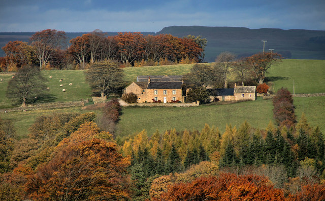
| Staward Manor | 1045005 | II | C17th | |
| Staward Pele | 1370424 | II | C14th | Staward Gorge. Part of Scheduled Monument (1006592). |
| Threepwood Hall | 1045008 | II | C17th | Threepwood |
| Threepwood Hall Farmhouse | 1370426 | II | C19th | Threepwood |
| Vicarage to East of Parish Church | 1370845 | II | 1820 | Haydon Bridge |
| Wall and Gate Piers to West of Threepwood House | 1154977 | II | C18th | Threepwood |
| Wall with Attached Outbuildings to Rear of Numbers 1 to 25 | 1045004 | II | c.1805 | Haydon Bridge |
| Walls Enclosing Garden to East of Lipwood House | 1303666 | II | C19th | |
| War Memorial 30 Metres South West of Parish Church | 1042502 | II | 1921 | Haydon Bridge |
| West Deanraw Farmhouse | 1042504 | II | C19th | |
| West Wharmley Farmhouse | 1045010 | II | C16th | |
| Whinnetley Farmhouse | 1303831 | II | 1744 | |
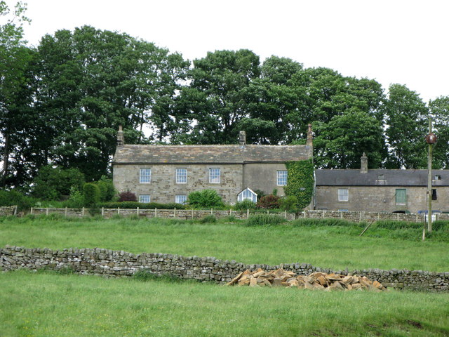
| Wood Hall Farmhouse and Adjacent Cottages | 1303554 | II | C19th | |
| Workshop 200 Metres Due East of B6295/A686 | 1370847 | II | C19th | B6295 |
| Bridge at Haydon Bridge | 1006490 | n/a | C17th | Scheduled Monument |
| Langley Barony Mines, Haydon Bridge | 1006413 | n/a | C19th | Scheduled Monument |
| Bastles at Chesterwood | 1006432 | n/a | C16th | Scheduled Monument |
| Roman camp, 290m north west of Seldom Seen | 1006497 | n/a | Roman | Scheduled Monument |
| Staward pele | 1006592 | n/a | C14th | Scheduled Monument |
| Earthwork and buried remains of Stublick Colliery, immediately south east of Stublick | 1021259 | n/a | C19th | Scheduled Monument |
| Coesike East Roman temporary camp | 1010937 | n/a | Roman | Scheduled Monument |
| Coesike West Roman temporary camps 1 and 2 | 1010938 | n/a | Roman | Scheduled Monument |
| Grindon School Roman temporary camp | 1010939 | n/a | Roman | Scheduled Monument |
| The vallum and early Roman road between the field boundary east of turret 34a and the field boundary west of milecastle 36 in wall miles 34, 35 and 36 | 1010965 | n/a | Roman | Scheduled Monument |
| Langley and Blagill lead smeltmills, flue and chimney | 1018211 | n/a | 1768 | Scheduled Monument |
| Hadrian's Wall and vallum between the field boundary at Brown Dikes and the field boundary east of turret 34a in wall miles 32, 33 and 34 | 1010963 | n/a | Roman | Scheduled Monument |
| Housesteads fort, section of Wall and vallum between the field boundary west of milecastle 36 and the field boundary west of turret 37a in wall miles 36 and 37 | 1018585 | n/a | Roman | Scheduled Monument |
| Hadrian's Wall and associated features between the boundary east of turret 34a and the field boundary west of milecastle 36 in wall miles 34, 35 and 36 | 1010964 | n/a | Roman | Scheduled Monument |
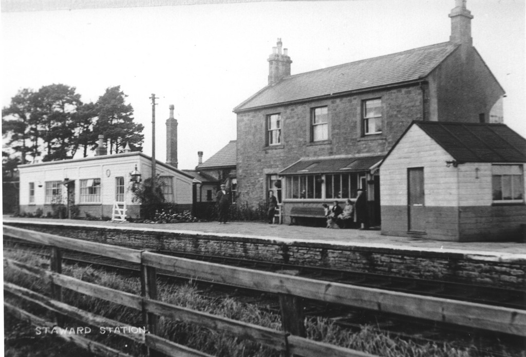
| Staward Station House | not listed | n/a | C19th | Former railway station |
| Langley Garden Station | not listed | n/a | C19th | Former railway station |
| Elrington Station House | not listed | n/a | C19th | Former railway station |
Primary source: the National Heritage List for England - NHLE is the register of nationally protected historic buildings and sites in England, including listed buildings, scheduled monuments, protected wrecks, registered parks and gardens, and battlefields. The list is maintained by Historic England. Check NHLE for updates and new entries. Secondary sources: British Listed Buildings and Keys to the Past.
Co-Curate Page
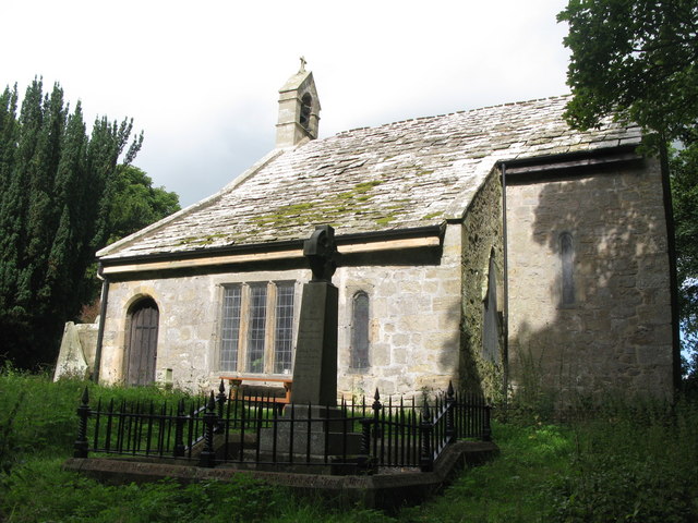
Haydon Old Church
- Overview Map Street View This former parish church dates from the 12th century. It is located in an isolated position, situated in a walled churchyard surrounded by trees, about half …
Co-Curate Page
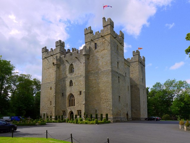
Langley Castle
- Overview About Langley Castle Map Street View Langley Castle is a medieval tower house, now a hotel, located north-east of the village of Langley and about a mile and a …
Co-Curate Page
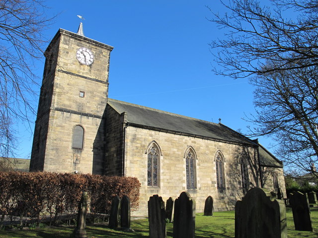
St Cuthbert's Church, Haydon Bridge
- Overview Map Street View St Cuthbert's Church is located on Church Street in Haydon Bridge The parish church was built in 1796 by the Greenwich Hospital Commissioners. It replaced a …
Co-Curate Page
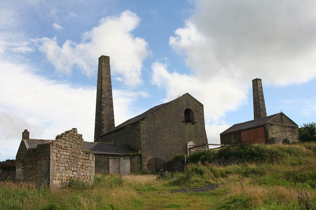
Stublick Colliery
- The former Stublick Colliery buildings are located by Stublick farm, about half a mile south-west of Langley in Northumberland. The colliery worked the small Stublick coalfield and supplied coal to …
Co-Curate Page
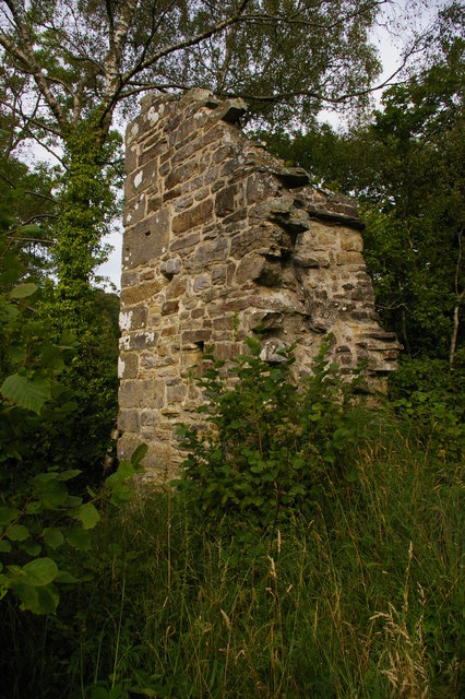
Staward Pele
- Overview Map Street View The ruins of Staward Pele (tower) are situated on a highly defensible promontory which over looks the River Allen as it flows through Steward Gorge. A timber …
Co-Curate Page
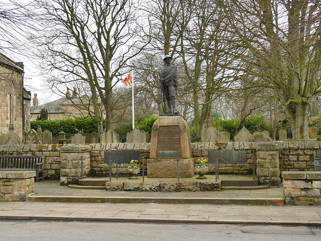
War Memorial, Haydon Bridge
- Overview Map Street View The war memorial at Haydon Bridge is located on Church Street, outside St Cuthbert's Church. The memorial was unveiled on the 25th of September 1921 by General Sir …
Co-Curate Page
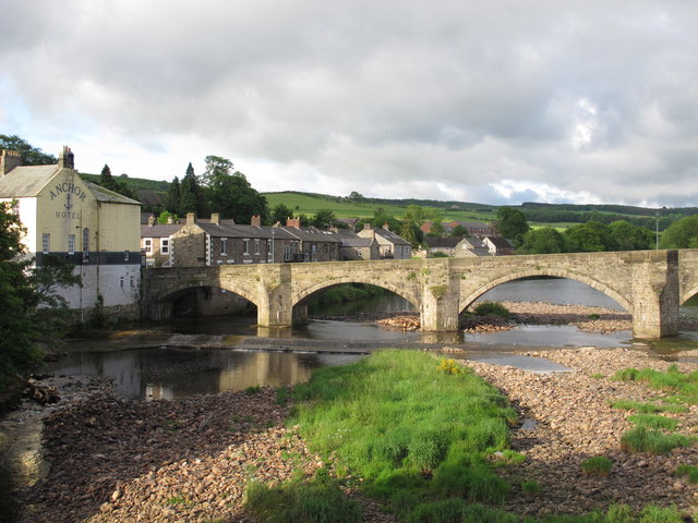
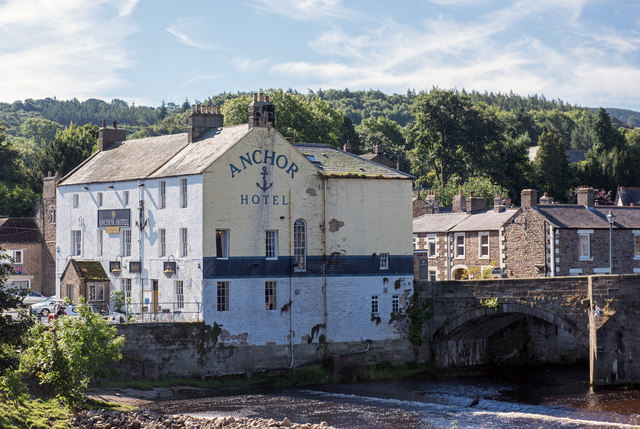
Anchor Hotel, Haydon Bridge
- Overview Map Street View Anchor Hotel is located on John Martin Street, next to the old bridge in Haydon Bridge. The building dates from the 18th century, with later alterations. …
Co-Curate Page
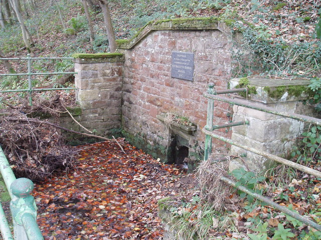
Old Spa Well, nr Haydon Bridge
- Overview Map Street View Haydon Spa is located about 1 mile east of Haydon Bridge, situated in Spa Well Wood, near the south bank of the River Tyne. The spa …
Co-Curate Page
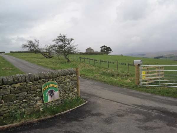
High Staward
- Overview Map Street View High Staward farmhouse dates from the early 19th century. it is a Grade II* listed building on the National Heritage List for England. Contemporary to the …
Co-Curate Page
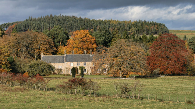
Staward Manor
- Overview Map Street View Staward Manor (Low Staward) is a large house, set back from the A686 road, about 7½ miles west of Hexham. It is situated by Dewey Syke, …
Co-Curate Page
Former Staward Station
- Overview Map Street View Staward Station House, located off the A686 road, about 8 miles west of Hexham, is a former railway station on the Hexham to Allendale branch line. …
Co-Curate Page
Harsondale
- Overview Map Harsondale is a farm in the Allendale area of Northumberland, situated to the north of Harsondale Burn, about 7½ miles west of Hexham. Harsdale farmouse dates from the …
Co-Curate Page
High Shaw, Haydon
- Overview Map Street View High Shaw is located 300 metres east of High Staward Farmhouse in Haydon Civil Parish, Northumberland. It is a former farmhouse, now agricultural store, which dates …
Co-Curate Page
Former Congregational Chapel, Haydon Bridge
- Overview Map Street View This former Congregational Chapel is located on the eastern side of North Bank (street) in Haydon Bridge. The chapel is dated 1863 and is a Grade …

Co-Curate Page
Elrington Hall Farm
- Overview Map Elrington Hall Farmhouse dates from the late 17th century, with alterations made to it in the 19th century. The building is Grade II listed on the National Heritage …

Co-Curate Page
Former Elrington Station
- Overview Map Street View Elrington Station, on the Hexham and Allendale Railway, opened in 1867. In 1926, the station became unstaffed and was renamed Elrington Halt. The station was closed …

Co-Curate Page
Threepwood Hall
- Overview Map Street View Threepwood Hall is a large country house located in Threepwood, to the south-east of Haydon Bridge, Northumberland. The Hall dates from the late 17th century, built …

Co-Curate Page
Threepwood Hall Farm
- Overview Map Street View Threepwood Hall Farm is located a short distance south-west of The Hall in Threepwood, south-east of Haydon Bridge, Northumberland. The farmhouse here dates from the early …
Co-Curate Page
Derwentwater Memorial Cross
- Overview Map Street View This carved memorial cross is located on the roadside on the A686 between Langley Castle and Haydon Bridge. The Celtic-style wheel cross was erected by Cadwallader …

Co-Curate Page
Wall Mile 36
- Overview Map Street View Hadrian's Wall Glossary <Mile 35 | Mile 36 | Mile 37> Hadrian's Wall - Wall Mile 36 Hadrian's Wall stretches from the east to west coast …

Co-Curate Page
Langley Barony Lead Mines
- Overview Map Scheduled Monument areas - based on Historic England data (Open Government Licence). The remains of Langley Barony Mines are located about 2½ miles north-west of Haydon Bridge. The …
Co-Curate Page
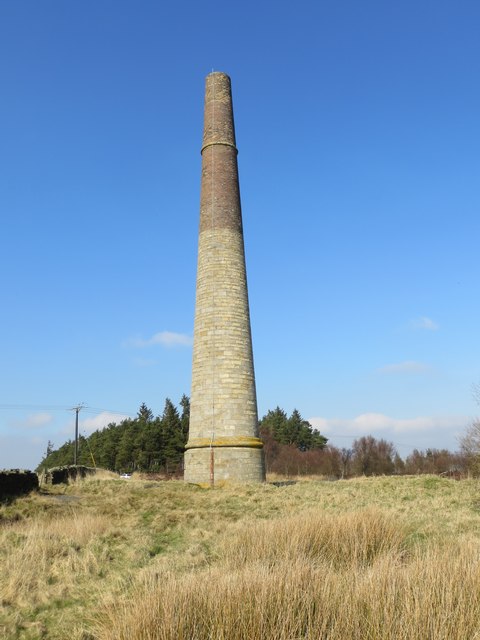
Langley & Blaghill Lead Smelt Mills
- Langley and Blagill were adjacent lead smeltmills, sharing a massive, long horizontal flue system leading to the prominent Stublick Chimney to disperse poisonous fumes. The Langley smelt mill was built …

Co-Curate Page
Milecastle 34 (Grindon), Hadrian's Wall
- Overview Map Street View Interactive Glossary There are no visible surface remains of Milecastle 34, but the site is marked by a distinctive copse of trees in a walled enclosure, …

Co-Curate Page
Turret 34A (Grindon West), Hadrian's Wall
- Overview Map Street View Interactive Glossary Turret 34A (Grindon West) in Wall Mile 34 of Hadrian's Wall, about ¾mile north-west of Grindon Farm. It is a well-preserved, consolidated watchtower, noted …
Co-Curate Page
Sewingshields Farm
- Overview Map Street View Sewingshields Farm was built in the early 19th century, parts of which were built with stone reused from Hadrian's Wall, which runs very close to the …

Co-Curate Page
Grindon School Roman Camp
- Map showing Grindon School temporary camp, to the south-east of Milecastle 35 on Hadrian's Wall, and north-west of Grindon Farm. There was a Roman temporary camp at Grindon, just south …

Co-Curate Page
Coesike East Roman temporary camp
- Map showing the Scheduled Monument area to the north of Grindon Farm and east of Milecastle 35 on Hadrian's Wall. Scheduled Monument (#1010937): Coesike East Roman temporary camp Click the …
Co-Curate Page
Coesike West Roman temporary camps
- Map showing the Scheduled Monument area of Coesike West Roman temporary camps to the north-west of Grindon Farm. Scheduled Monument (#1010938): Coesike West Roman temporary camps 1 and 2 Click …

Co-Curate Page
Haydon Old Church
- Overview Map Street View This former parish church dates from the 12th century. It is located in an isolated position, situated in a walled churchyard surrounded by trees, about half …
Co-Curate Page
Langley Castle
- Overview About Langley Castle Map Street View Langley Castle is a medieval tower house, now a hotel, located north-east of the village of Langley and about a mile and a …
Co-Curate Page
St Cuthbert's Church, Haydon Bridge
- Overview Map Street View St Cuthbert's Church is located on Church Street in Haydon Bridge The parish church was built in 1796 by the Greenwich Hospital Commissioners. It replaced a …
Co-Curate Page
Stublick Colliery
- The former Stublick Colliery buildings are located by Stublick farm, about half a mile south-west of Langley in Northumberland. The colliery worked the small Stublick coalfield and supplied coal to …
Co-Curate Page
Staward Pele
- Overview Map Street View The ruins of Staward Pele (tower) are situated on a highly defensible promontory which over looks the River Allen as it flows through Steward Gorge. A timber …
Co-Curate Page
War Memorial, Haydon Bridge
- Overview Map Street View The war memorial at Haydon Bridge is located on Church Street, outside St Cuthbert's Church. The memorial was unveiled on the 25th of September 1921 by General Sir …
Co-Curate Page
Anchor Hotel, Haydon Bridge
- Overview Map Street View Anchor Hotel is located on John Martin Street, next to the old bridge in Haydon Bridge. The building dates from the 18th century, with later alterations. …
Co-Curate Page
Old Spa Well, nr Haydon Bridge
- Overview Map Street View Haydon Spa is located about 1 mile east of Haydon Bridge, situated in Spa Well Wood, near the south bank of the River Tyne. The spa …
Co-Curate Page
High Staward
- Overview Map Street View High Staward farmhouse dates from the early 19th century. it is a Grade II* listed building on the National Heritage List for England. Contemporary to the …
Co-Curate Page
Staward Manor
- Overview Map Street View Staward Manor (Low Staward) is a large house, set back from the A686 road, about 7½ miles west of Hexham. It is situated by Dewey Syke, …
Co-Curate Page
Former Staward Station
- Overview Map Street View Staward Station House, located off the A686 road, about 8 miles west of Hexham, is a former railway station on the Hexham to Allendale branch line. …
Co-Curate Page
Harsondale
- Overview Map Harsondale is a farm in the Allendale area of Northumberland, situated to the north of Harsondale Burn, about 7½ miles west of Hexham. Harsdale farmouse dates from the …
Co-Curate Page
High Shaw, Haydon
- Overview Map Street View High Shaw is located 300 metres east of High Staward Farmhouse in Haydon Civil Parish, Northumberland. It is a former farmhouse, now agricultural store, which dates …
Co-Curate Page
Former Congregational Chapel, Haydon Bridge
- Overview Map Street View This former Congregational Chapel is located on the eastern side of North Bank (street) in Haydon Bridge. The chapel is dated 1863 and is a Grade …
Co-Curate Page
Elrington Hall Farm
- Overview Map Elrington Hall Farmhouse dates from the late 17th century, with alterations made to it in the 19th century. The building is Grade II listed on the National Heritage …
Co-Curate Page
Former Elrington Station
- Overview Map Street View Elrington Station, on the Hexham and Allendale Railway, opened in 1867. In 1926, the station became unstaffed and was renamed Elrington Halt. The station was closed …
Co-Curate Page
Threepwood Hall
- Overview Map Street View Threepwood Hall is a large country house located in Threepwood, to the south-east of Haydon Bridge, Northumberland. The Hall dates from the late 17th century, built …
Co-Curate Page
Threepwood Hall Farm
- Overview Map Street View Threepwood Hall Farm is located a short distance south-west of The Hall in Threepwood, south-east of Haydon Bridge, Northumberland. The farmhouse here dates from the early …
Co-Curate Page
Derwentwater Memorial Cross
- Overview Map Street View This carved memorial cross is located on the roadside on the A686 between Langley Castle and Haydon Bridge. The Celtic-style wheel cross was erected by Cadwallader …
Co-Curate Page
Wall Mile 36
- Overview Map Street View Hadrian's Wall Glossary <Mile 35 | Mile 36 | Mile 37> Hadrian's Wall - Wall Mile 36 Hadrian's Wall stretches from the east to west coast …
Co-Curate Page
Langley Barony Lead Mines
- Overview Map Scheduled Monument areas - based on Historic England data (Open Government Licence). The remains of Langley Barony Mines are located about 2½ miles north-west of Haydon Bridge. The …
Co-Curate Page
Langley & Blaghill Lead Smelt Mills
- Langley and Blagill were adjacent lead smeltmills, sharing a massive, long horizontal flue system leading to the prominent Stublick Chimney to disperse poisonous fumes. The Langley smelt mill was built …
Co-Curate Page
Milecastle 34 (Grindon), Hadrian's Wall
- Overview Map Street View Interactive Glossary There are no visible surface remains of Milecastle 34, but the site is marked by a distinctive copse of trees in a walled enclosure, …
Co-Curate Page
Turret 34A (Grindon West), Hadrian's Wall
- Overview Map Street View Interactive Glossary Turret 34A (Grindon West) in Wall Mile 34 of Hadrian's Wall, about ¾mile north-west of Grindon Farm. It is a well-preserved, consolidated watchtower, noted …
Co-Curate Page
Sewingshields Farm
- Overview Map Street View Sewingshields Farm was built in the early 19th century, parts of which were built with stone reused from Hadrian's Wall, which runs very close to the …
Co-Curate Page
Grindon School Roman Camp
- Map showing Grindon School temporary camp, to the south-east of Milecastle 35 on Hadrian's Wall, and north-west of Grindon Farm. There was a Roman temporary camp at Grindon, just south …
Co-Curate Page
Coesike East Roman temporary camp
- Map showing the Scheduled Monument area to the north of Grindon Farm and east of Milecastle 35 on Hadrian's Wall. Scheduled Monument (#1010937): Coesike East Roman temporary camp Click the …


