Topics > Northumberland > Civil Parishes in Northumberland > Hauxley Civil Parish
Hauxley Civil Parish
Parish boundaries may have changed - for the latest map see the Parish Council or Northumberland County Council.
About the Parish
| Overview: |
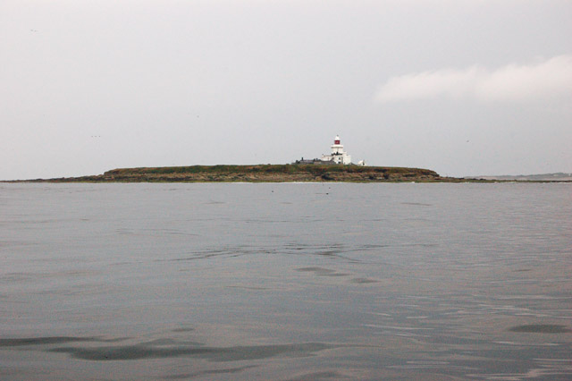
Hauxley is a small costal civil parish in Northumberland, located immediately south of Amble and about 11 miles north-east of Morpeth. The parish includes Coquet Island, located about ½ mile off the coast, which was the site of a monastic cell, first recorded in AD 684. Most of the population of the parish is in the village of High Hauxley and the smaller settlements of Low Hauxley and Radcliffe (the latter being partly in Amble Civil Parish). Historically, there was coal mining at Radcliffe Colliery and later opencast mining, with part of the site later reclaimed to form Hauxley Nature Reserve, which now has a Discovery Centre for visitors. |
| Settlements: | High Hauxley (with Kirkwell Cottages), Low Hauxley and part of the small village of Radcliffe. Hauxley Moorhouse Farm. |
| Population: |
230 (2021 Census) 279 (2011 Census) 220 (2001 Census) |
| Area: | 3.03 km2 |
| Parish Council: |
Hauxley Parish Council -the Parish Council has a bi-monthy meeting in Hauxley Village Hall |
| Unitary Authority: | Northumberland County Council |
Historical |
|
|
Ancient Township (in modern CP area) |
Townships became civil parishes in their own right in 1866 (see below). |
| Ancient Parish: |
Hauxley was in Warkworth Parish (St Lawrence) Ancient parishes refer to the parishes before the split between ecclesiastical (church) and civil parishes in the 19th century. They had a parish church and often were composed of multiple townships and chapelries. In many cases, townships and parishes were originally based on the territory of manors from the feudal system during medieval times. Civil parishes were created following the Poor Law Amendment Act 1866, in which Church of England parishes, extra-parochial areas, townships and chapelries, became "civil parishes" which could set their own poor rate (tax). Then the reforms of Local Government Act 1894 established elected civil parish councils (or parish meetings for parishes with less than 300 residents) and created urban and rural districts. Boundaries of parishes and civil parishes may have changed over time. |
| Ancient District: |
Coquetdale (ward) - East division |
| Poor Law Union: |
Alnwick Poor Law Union, formed in 1836. Alnwick Union Workhouse was built in 1841 on Wagon Way Road, south-east of Alnwick, built to house 120 inmates. Prior to that there were smaller workhouses in Alnwick, Birling and Warkworth. Under the Poor Law Amendment Act of 1834 parishes were grouped into Unions, each of which had to build a workhouse if they did not already have one. It ended the old system of locally provided poor relief which had come under strain as numbers out of work grew, following increasing mechanisation of agriculture and the economic downturn after the Napoleonic Wars, along with changing social attitudes. The workhouse provided those unable to support themselves financially with accommodation and work. Inmates were generally segregated into men, women, boys and girls. The workhouse system was abolished by the Local Government Act 1929, but many workhouses lived on as ‘Public Assistance Institutions’ until the National Assistance Act 1948. |
|
District Council: |
Alnwick Rural District, formed in 1894. The district was abolished in 1974, following the Local Government Act 1972. Alnwick District from 1974 to 2009. Alnwick District covered the area of 4 former districts (Alnwick Urban District, Amble Urban District, Alnwick Rural District and Rothbury Rural District). The district council was abolished when Northumberland became a unitary authority on the 1st of April 2009. |
|
County / Unitary Authority |
The ancient county of Northumberland was enlarged following the Counties (Detached Parts) Act 1844; Bedlingtonshire, Norhamshire, Islandshire, the Farne Islands and Monks' House all became part of Northumberland. Up to then they had been enclaves of County Durham. Northumberland County Council formed 1889. Major boundary changes came into effect on the 1st April 1974. This followed the Local Government Act 1972, which formed the non-metropolitan county of Northumberland. This excluded the City of Newcastle upon Tyne and North Tyneside, which up to then had been part of Northumberland, but now became part of the newly formed Tyne & Wear. Northumberland County Council became a unitary authority on the 1st of April 2009. |
See also: ![]() Historic Buildings and Monuments in Hauxley Civil Parish. Note: listed buildings are generally the responsibility of the county council / unitary authority, rather than the parish council.
Historic Buildings and Monuments in Hauxley Civil Parish. Note: listed buildings are generally the responsibility of the county council / unitary authority, rather than the parish council.
Co-Curate Page
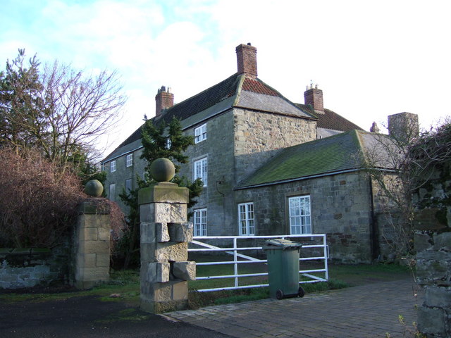
High Hauxley
- Overview Map Street View High Hauxley is a village in Northumberland south of Amble. It is just inland from the coast and together with Low Hauxley and part of Radcliffe, forms …
Co-Curate Page
Low Hauxley
- Overview Map Street View Low Hauxley is a small village on the Northumberland coast, about 1 mile south of Amble. Along with nearby High Hauxley and part of Radcliffe, it is part …
Co-Curate Page
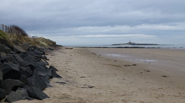
Coquet Island
- Overview About Coquet Island Map Coquet Island lies just under a mile off the Northumberland coast near Amble and Low Hauxley. The island is managed by the Royal Society for …

from https://keystothepast.info/se…
Hauxley - Local History
- "Hauxley parish lies on the North Sea coast in mid-Northumberland. The parish is relatively low lying and made up of fertile farmland and a rocky island called Coquet Island, which …
Added by
Simon Cotterill
Co-Curate Page
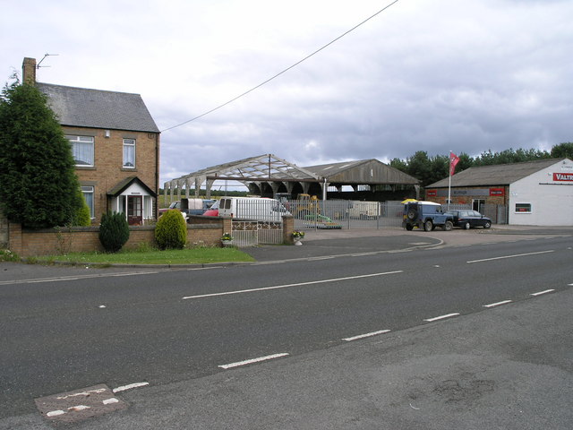
Radcliffe
- Overview History Map Street View Radcliffe is a small village in Northumberland, located just over 1 mile south of Amble. In the past Radcliffe was a more substantial pit village …

from https://northumberlandparishe…
Hauxley Parish Council
- Hauxley Parish Council pages on the Northumberland Council Website.
Added by
Simon Cotterill


Co-Curate Page
High Hauxley
- Overview Map Street View High Hauxley is a village in Northumberland south of Amble. It is just inland from the coast and together with Low Hauxley and part of Radcliffe, forms …
Co-Curate Page
Low Hauxley
- Overview Map Street View Low Hauxley is a small village on the Northumberland coast, about 1 mile south of Amble. Along with nearby High Hauxley and part of Radcliffe, it is part …
Co-Curate Page
Coquet Island
- Overview About Coquet Island Map Coquet Island lies just under a mile off the Northumberland coast near Amble and Low Hauxley. The island is managed by the Royal Society for …
from https://keystothepast.info/se…
Hauxley - Local History
- "Hauxley parish lies on the North Sea coast in mid-Northumberland. The parish is relatively low lying and made up of fertile farmland and a rocky island called Coquet Island, which …
Added by
Simon Cotterill
Co-Curate Page
Radcliffe
- Overview History Map Street View Radcliffe is a small village in Northumberland, located just over 1 mile south of Amble. In the past Radcliffe was a more substantial pit village …
from https://northumberlandparishe…
Hauxley Parish Council
- Hauxley Parish Council pages on the Northumberland Council Website.
Added by
Simon Cotterill


")