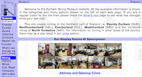
Topics > Northumberland > Radcliffe
Radcliffe
Radcliffe is a small village in Northumberland, located just over 1 mile south of Amble. In the past Radcliffe was a more substantial pit village with a population of about 700. Radcliffe Colliery began producing coal in 1837, but later suffered persistant problems with flooding and was closed at the turn of the century. Most of Radcliffe was demolished in 1970, in advance of open-cast mining there. People from the Radcliffe community were relocated to new estates in Amble. The Radcliffe War Memorial was moved to Amble at that time. When operations at Radcliffe Opencast Mine came to an end, some of the land was returned to agriculture, and some redeveloped as was landscaped to produce a lake with island forming the Hauxley Wildlife Discovery nature reserve, near Low Hauxley. Parts of the village fall within Hauxley Civil Parish, and other parts in Amble Civil Parish.
Radcliffe is a settlement in the county of Northumberland, England. It is located 1 km south of the town of Amble.
Radcliffe was a mining community, once home to over 700 people. A colliery was worked here until 1892, when a fault in the seam, then fire and flooding, made coal extraction uneconomical. New pit shafts were sunk nearby at Newburgh and later at Hauxley, but flooding remained a problem with the pits in this area.
Through much of the 19th and early to mid-20th century, the name of the settlement included the word Terrace - "Radcliffe Terrace, Hauxley" giving the erroneous impression that it was part of Hauxley (or another local town); despite this, it was an independent (and somewhat isolated) settlement. The first word can be found spelt with many variations, even relatively recently: Ratliff, Radcliffe, Ratcliffe, Ratcliff, and Radcliff (and possibly others).
By the mid twentieth century, the surviving pits in this area of Northumberland were also becoming uneconomical to run, especially when compared to extraction using opencast mining techniques. The last shift worked underground at Radcliffe was on 2 February 1962. In 1965 plans were drawn up to opencast mine the coal seam beneath Radcliffe and Newbrough.
The aging, and somewhat run-down, colliery-owned housing stock of the village was demolished in 1971 to allow for opencast operations. The inhabitants that had not already moved voluntarily to take advantage of better housing, were relocated to Amble, onto an estate named the Radcliffe estate. Various streets in this town, such as Dandsfield Square, an award winning project when first built , are named after the demolished streets of Radcliffe.
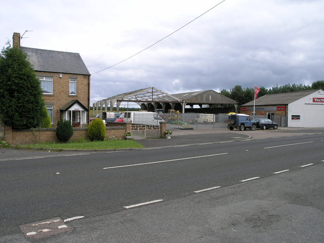
As of 2009, opencast mining continues in the area, but the mining operations at Radcliffe have ceased, and the land returned to agriculture, and turned over to a nature reserve at Hauxley. Little is now visible at the site of the village - a farm, a few private houses,a mechanic's workshop and the old sports pavilion survived the demolition. The workshop was the site of Craiggs' Bus Garage, and has re-opened as a repair workshop specialising in agricultural machinery. The house opposite was the home of Charlie Nyberg, who ran a newsagency and barbershop from there. This house, built circa 1960, replaced the previous house and Post Office, demolished for road widening. At the nature reserve, the footings of some features (paths, picnic area, etc.) are partially made with bricks, some of which show the imprint of Radcliff (many collieries included a brickworks). Some newer homes have also been built along the A1068 Amble to Ashington road.
On Sunday, 15 February 1942, at 8:22 pm, a landmine was dropped on Radcliffe by a German aeroplane being chased by an RAF fighter plane. Three houses, a school and a church were demolished. Three members of the Craiggs' extended family were killed, and several others injured. Casualties would have been much higher if the service in the church had not finished shortly before, and the congregation dispersed.
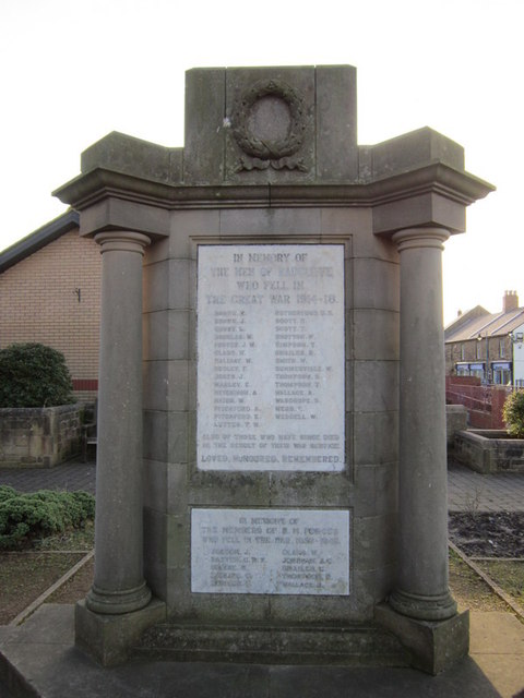
The Radcliffe War Memorial, erected in 1928 for the First World War, and with an additional roll of honour added for the fallen of the Second World War, was removed from Radcliffe and relocated to Amble, opposite the Amble Clock Tower Memorial in the Town Square. The original location can still be seen at the west side of the A1068 to the south of the village, where the surrounding wrought iron railings remain.
Governance
Radcliffe is in the parliamentary constituency of Berwick-upon-Tweed.
Visit the page: Radcliffe, Northumberland for references and further details. You can contribute to this article on Wikipedia.
from http://www.fusilier.co.uk/rad…
The Rise and Fall of Radcliffe
- A timeline of the life and death of a Northumberland mining community 1835-1972
Added by
Simon Cotterill
from Geograph (geograph)
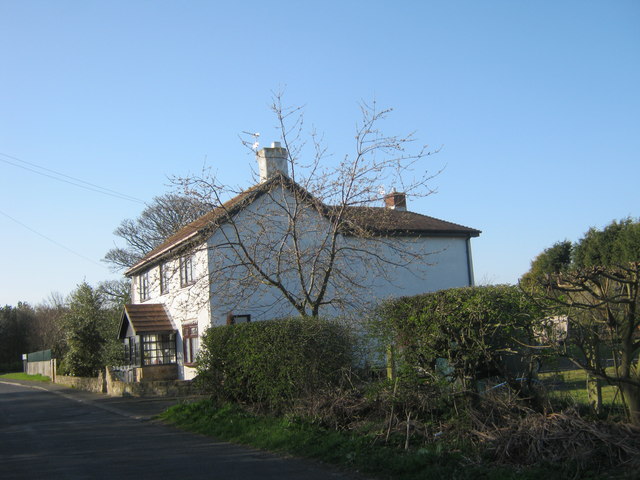
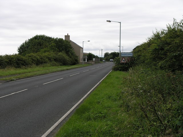
Residence next to the road from High Hauxley to the A1068
Pinned by Simon Cotterill
Co-Curate Page
Amble
- Overview History Map Street View Amble is a costal town in Northumberland located at the mouth of the River Coquet, opposite Coquet Island. The town is located just north of …

Co-Curate Page
Low Hauxley
- Overview Map Street View Low Hauxley is a small village on the Northumberland coast, about 1 mile south of Amble. Along with nearby High Hauxley and part of Radcliffe, it is part …
Co-Curate Page
War Memorial for Radcliffe at Amble
- Overview Map Street View The War Memorial was dedicated to the men of Radcliffe in Northumberland who lost their lives in the First World War. The memorial was unveiled on …

from http://www.fusilier.co.uk/rad…
The Rise and Fall of Radcliffe
- A timeline of the life and death of a Northumberland mining community 1835-1972
Added by
Simon Cotterill
from Geograph (geograph)
Residence next to the road from High Hauxley to the A1068
Pinned by Simon Cotterill
Co-Curate Page
Amble
- Overview History Map Street View Amble is a costal town in Northumberland located at the mouth of the River Coquet, opposite Coquet Island. The town is located just north of …
Co-Curate Page
Low Hauxley
- Overview Map Street View Low Hauxley is a small village on the Northumberland coast, about 1 mile south of Amble. Along with nearby High Hauxley and part of Radcliffe, it is part …


