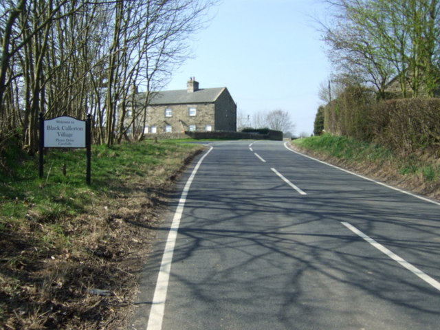
Topics > Tyne and Wear > Newcastle upon Tyne > Black Callerton > Dewley Pits, SW of Black Callerton
Dewley Pits, SW of Black Callerton
Scheduled Monument areas (7) - based on Historic England data (Open Government Licence).
Scheduled Monument (#1016194): Coal workings at Dewley Pits, 650m south west of Black Callerton
Click the headings below to expand (selected extracts from the Historic England scheduling)
The coal mining remains at Dewley Pits survive well and represent a remarkable and well defined concentration of late 18th and 19th century shaft mounds and an associated transport system. Its earthwork remains, and buried deposits in the area immediately surrounding each shaft, provide information for both the historical and technological development of coal mining in this area and for the operation of the individual shafts themselves.
The Dewley Pits will contribute towards an understanding of the transition from small scale, low investment mining to the more capital intensive, nucleated mines that emerged in the late 18th century and thus represents a rare example nationally from this period of transition. Areas of ridge and furrow, the remains of earlier agricultural activity, are included in the scheduling because their physical relationship to the mining remains is illustrative of the impact of industrialisation on the rural landscape in the post-medieval period.
The monument is situated to the south west of the hamlet of Black Callerton, some 3.5km south of Ponteland, and includes the earthworks and other remains of a number of late 18th century mine shafts, the earthwork remains of part of an associated transport system and areas of ridge and furrow cultivation.
The monument lies within seven separate areas. Documentary sources indicate that coal extraction had begun at the site by the 17th century. The surface remains of the monument include dispersed shaft mounds which provide evidence for the transition from small, low investment, dispersed collieries of the 18th century and earlier, to the capitally intensive nucleated mines which emerged in the latter 18th century.
The Dewley Pits continued to be worked into the 19th century and were the workplace of George Stephenson during the early part of his career.
The largest area of the monument is situated to the south of Broom Hall and includes the earthwork remains of Lady Pit, which was mined in the later 18th and early 19th centuries. It includes a large sub-circular shaft mound measuring approximately 50m by 40m, and other features associated with the operation of the shaft will survive as buried remains. To the west of the shaft mound are the well-preserved remains of a waggon way embankment running north-south, which is linked to Lady Pit by two short branch lines. Both the shaft mound and the waggon way overlie an area of ridge and furrow cultivation, which is included in the scheduling because its relationship to the mining features illustrates the impact of the Dewley Pits on the earlier rural landscape.
Approximately 260m south west of Lady Pit, in a separate area, is a further shaft mound with an irregular-shaped shaft collar. The remains of a waggon way which originally ran along the south side of the mound has been modified by ploughing and is therefore not included in the scheduling.
To the east of Lady Pit, in four separate areas, are the earthwork remains of four widely-spaced shaft mounds which are aligned north east-south west. Map evidence indicates that at least three of these shafts were originally linked by a waggon way which ran adjacent to each shaft. This waggon way has been modified by ploughing along much of its length and is not included in the scheduling, but its route is marked by a public footpath that follows its course.
The southernmost shaft mound, known as Engine Pit, is situated immediately to the north of Stamfordham Road. It measures approximately 50m by 40m and has an irregular plan. Further to the north east, on the east side of Andrew Plantation, is a large shaft mound and its associated spoil heap. Both are irregular in plan and overlie the earthwork remains of earlier ridge and furrow cultivation. A sample, 20m wide area, of the ridge and furrow on the south west and south east sides of the shaft mound is included in the scheduling in order to preserve the relationship between these features. Some 160m to the north east are the earthwork remains of the shaft mound and spoil heap of the mine formerly known as Brass Pit, whilst 580m further north east, on the east side of the hamlet of Black Callerton, are the remains of a sub-circular shaft mound which is also included in the scheduling. The area immediately surrounding each of these shafts will retain buried features, including the post holes and timber supports for winding gear, which will contribute towards an understanding of how the shafts were worked. A further sub-circular shaft mound is visible approximately 350m to the north east of Lady Pit and is included in the scheduling in a separate area. It measures 40m by 30m and will also retain buried deposits associated with the operation of the shaft.
from https://www.geograph.org.uk/p…
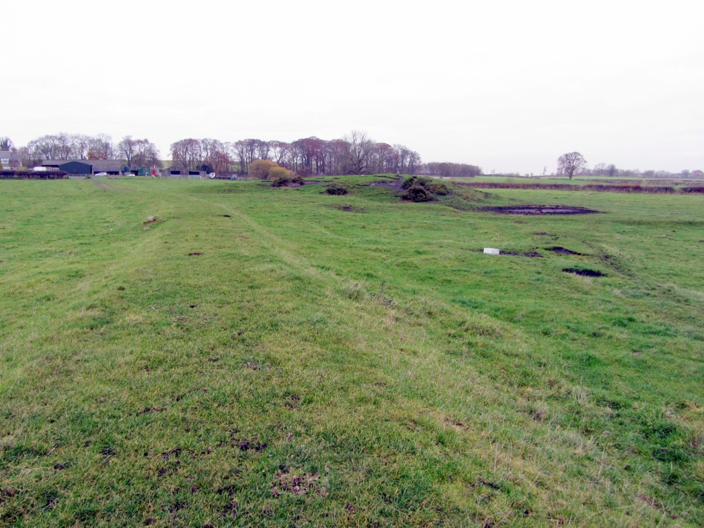
Waggonway embankment south of Broomhall Farm
- Walbottle Moor Waggonway is known to have been in operation from 1769. This Waggonway ran from old pits north of Hexham Road past the location of Duke Pit in Walbottle …
Added by
Simon Cotterill

from https://historicengland.org.u…
Coal workings at Dewley Pits, 650m south west of Black Callerton
- ....The coal mining remains at Dewley Pits survive well and represent a remarkable and well defined concentration of late 18th and 19th century shaft mounds and an associated transport system. …
Added by
Simon Cotterill

from https://www.geograph.org.uk/p…
Waggonway embankment south of Broomhall Farm
- Walbottle Moor Waggonway is known to have been in operation from 1769. This Waggonway ran from old pits north of Hexham Road past the location of Duke Pit in Walbottle …
Added by
Simon Cotterill
from https://historicengland.org.u…
Coal workings at Dewley Pits, 650m south west of Black Callerton
- ....The coal mining remains at Dewley Pits survive well and represent a remarkable and well defined concentration of late 18th and 19th century shaft mounds and an associated transport system. …
Added by
Simon Cotterill