Topics > County Durham > Civil Parishes in County Durham > Barforth Civil Parish
Barforth Civil Parish
Parish boundaries may have changed - for the latest map see the Parish Council or Durham County Council.
About the Parish
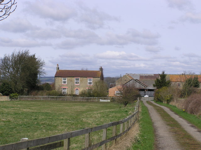
Barforth Civil Parish in County Durham is located about 7 miles west of Darlington and 1 mile north east of the village of Ovington. The parish is bounded to the north by the River Tees.
| Main Settlements: | Barforth (village), High Close |
| Population: | <100 (2021 Census) - information held by Ovington |
| Area: | 7.1 km² |
| Parish Council? | Annual Parish Meeting |
| Unitary Authority: | Durham County Council |
Historical |
|
| Ancient Township: |
Townships became civil parishes in their own right in 1866 (see below). |
| Ancient Parish: |
Forcett (parochial chapelry, St Cuthbert's) - in the North Riding of Yorkshire Ancient parishes refer to the parishes before the split between ecclesiastical (church) and civil parishes in the 19th century. They had a parish church and often were composed of multiple townships and chapelries. In many cases, townships and parishes were originally based on the territory of manors from the feudal system during medieval times. Civil parishes were created following the Poor Law Amendment Act 1866, in which Church of England parishes, extra-parochial areas, townships and chapelries, became "civil parishes" which could set their own poor rate (tax). Then the reforms of Local Government Act 1894 established elected civil parish councils (or parish meetings for parishes with less than 300 residents) and created urban and rural districts. Boundaries of parishes and civil parishes may have changed over time. |
| Poor Law Union: |
Teesdale Poor Law Union, formed in 1837. Teesdale Union Workhouse was located at Barnard Castle. Under the Poor Law Amendment Act of 1834 parishes were grouped into Unions, each of which had to build a workhouse if they did not already have one. It ended the old system of locally provided poor relief which had come under strain as numbers out of work grew, following increasing mechanisation of agriculture and the economic downturn after the Napoleonic Wars, along with changing social attitudes. The workhouse provided those unable to support themselves financially with accommodation and work. Inmates were generally segregated into men, women, boys and girls. The workhouse system was abolished by the Local Government Act 1929, but many workhouses lived on as 'Public Assistance Institutions' until the National Assistance Act 1948. |
| Ancient County: |
North Riding of Yorkshire Transferred to County Durham on the 1st of April 1974, following the Local Government Act 1972. |
|
District Council: |
Teesdale District (County Durham) from 1974 to 2009. The district council was abolished when County Durham became a unitary authority on the 1st of April 2009. |
|
County / Unitary Authority |
The ancient County Palatine of Durham has a history that can be traced back to the Liberty of Durham in the 7th Century. Until the Counties (Detached Parts) Act 1844; Bedlingtonshire, Norhamshire, Islandshire, the Farne Islands and Monks' House were enclaves of County Durham. Durham County Council was formed in 1889. Major boundary changes came into effect on the 1st April 1974, following the Local Government Act 1972. Hartlepool, Stockton, and Billingham, were transferred to the newly formed non-metropolitan county of Cleveland (abolished 1996). Darlington, Stockton, and Hartlepool then became unitary authorities, now within Tees Valley (areas originally in County Durham remain within the Ceremonial County, but not in the County Durham Council area). Durham County Council became a unitary authority on the 1st of April 2009. The seven district councils (Chester-le-Street, Derwentside, Durham (city), Easington, Sedgefield, Teesdale, and Wear Valley) were abolished. The unitary authority area covers a population of 530,100 (DCC, 2025) |
See also: ![]() Historic Buildings and Monuments in Barforth Note: listed buildings are generally the responsibility of the county council, rather than the parish council.
Historic Buildings and Monuments in Barforth Note: listed buildings are generally the responsibility of the county council, rather than the parish council.
Co-Curate Page
Barforth
- Overview About Barforth Map Street View Barforth is a hamlet and a civil parish near Gainford in County Durham. Barforth was a manor during medieval times and there are remains …

Co-Curate Page
Barforth Township, 1848
- BARFORTH, a township, in the parish of Forcett, union of Teesdale, wapentake of Gilling-West, N. riding of York, 6 miles (E.) from Barnard Castle; containing 114 inhabitants. It is on …

from https://keystothepast.info/se…
Local History: Barforth
- "The parish of Barforth stands in Teesdale, just on the south bank of the river. It is about half way between Darlington and Barnard's Castle.
The earliest evidence for settlement …
Added by
Simon Cotterill

Co-Curate Page
Barforth
- Overview About Barforth Map Street View Barforth is a hamlet and a civil parish near Gainford in County Durham. Barforth was a manor during medieval times and there are remains …
Co-Curate Page
Barforth Township, 1848
- BARFORTH, a township, in the parish of Forcett, union of Teesdale, wapentake of Gilling-West, N. riding of York, 6 miles (E.) from Barnard Castle; containing 114 inhabitants. It is on …
from https://keystothepast.info/se…
Local History: Barforth
- "The parish of Barforth stands in Teesdale, just on the south bank of the river. It is about half way between Darlington and Barnard's Castle.
The earliest evidence for settlement …
Added by
Simon Cotterill


")
")

")
