Topics > Historical Periods > 19th Century > 1860s > 1863
1863
In Northern England:
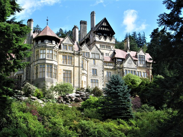
- 1863: Cragside estate, near Rothbury, established by industrialist William Armstrong.
- 1863: Lands Viaduct over the River Gaunless built for the South Durham and Lancashire Union Railway.
- 1863: Vane Tempest Hall built in Gilesgate, Durham, originally a militia barraks.
from Newcastle libraries (flickr)
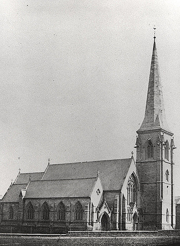
040982:Christ Church Shieldfield Unknown 1863
Pinned by Simon Cotterill
from Newcastle libraries (flickr)
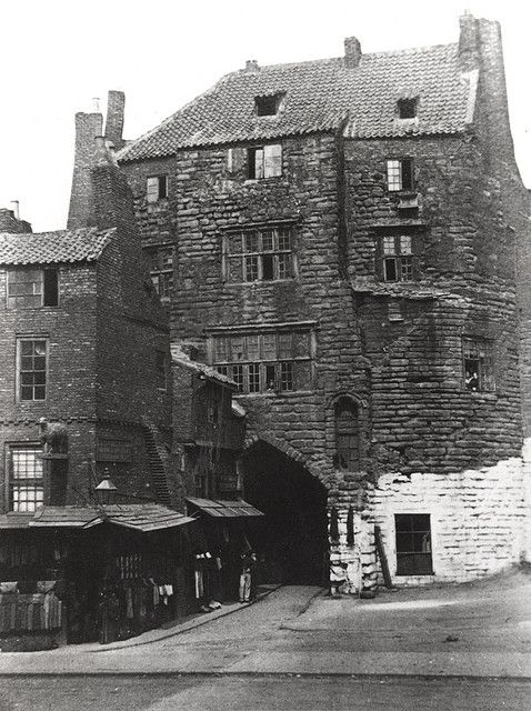
040972:Black Gate Newcastle upon Tyne Unknown 1863
Pinned by Simon Cotterill
from Newcastle libraries (flickr)
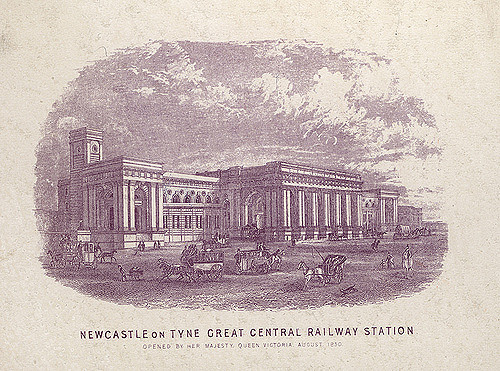
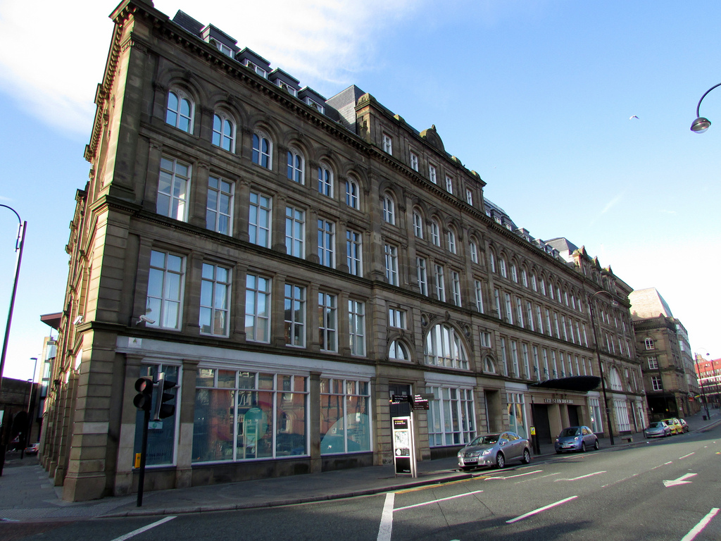
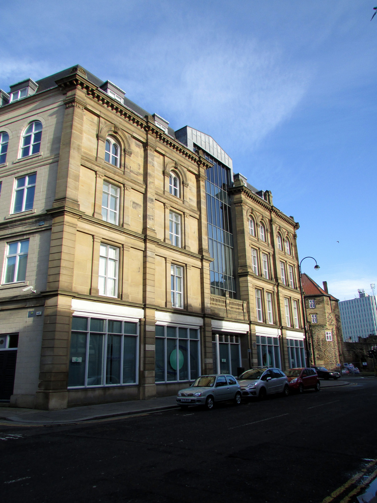
008802:Central Station Newcastle upon Tyne 1863
Pinned by Simon Cotterill
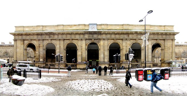
from Geograph (geograph)
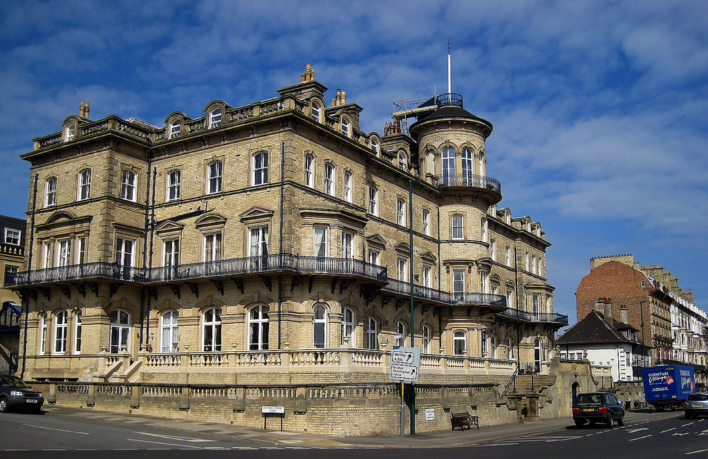
Portico, Newcastle Central Station, Neville Street
Pinned by Simon Cotterill

from Newcastle libraries (flickr)
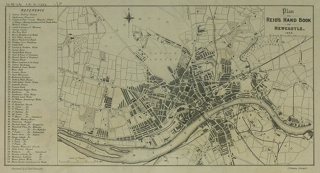
Plan to Reid's Handbook of Newcastle, 1863
Pinned by Simon Cotterill
Co-Curate Page
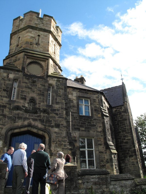
Vane Tempest Hall, Gilesgate
- Overview Map Vane Tempest Hall, now a community centre of the Gilesgate Community and Welfare Association, is located in Gilesgate, Durham. It was originally built in 1863 as a militia …
Co-Curate Page
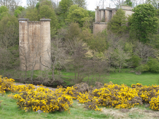
Lands Viaduct (remains)
- Overview About Lands Viaduct Map Lands Viaduct was built in 1863 to carry the South Durham and Lancashire Union Railway over the River Gaunless. Gaunless Viaduct, also known as the …

Co-Curate Page
Methold Houses, Beamish
- Overview Map Street View Almshouses inscribed "1863 BUILT AND ENDOWED BY JOHN EDEN". The houses are Grade II Listed.
Co-Curate Page
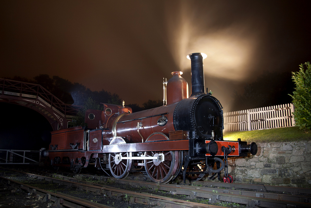
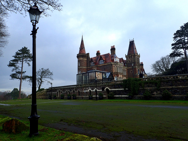
Cragside
- Overview About Cragside Map Street View Cragside was the country house and estate of industrialist Lord William Armstrong and Lady Margaret Armstrong. It was the first house in the world …
Co-Curate Page
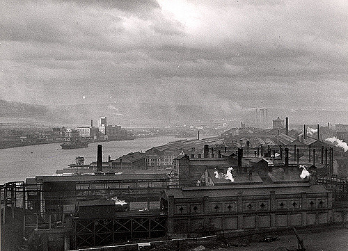
Elswick Leather Works (1863 - 1971)
- Elswick Leather Works (also known as Richardson's Tannery) was located in Elswick between Water Street and Dunn Street, by the north bank of the River Tyne. Richardson's was an established …
Co-Curate Page
Barbon Manor
- Overview Map Street View Barbon Manor is located on the northern slope of Barbondale, about 1km west of the village of Barbon in Cumbria. It was originally built as a …
Co-Curate Page
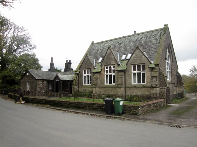
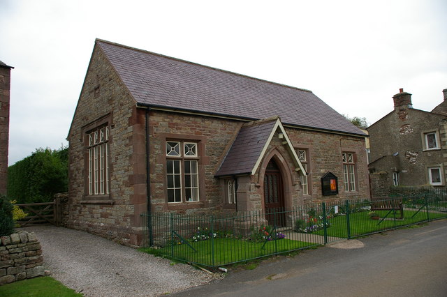
Old School
- The former school in Tallentire was built in 1863 by William Browne. The school closed during Second World War, when it was used as a hostel for the Land Army.[1] It was …
Co-Curate Page
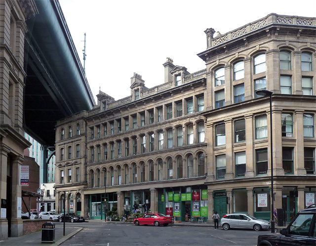
Princes Buildings, Newcastle
- Overview Map Street View Princes Buildings is a substantial block of buildings which straddle Queen Street (No.1-23), King Street (No. 2) and Akenside Hill (Nos 11-14) in Newcastle. They were designed …
Co-Curate Page
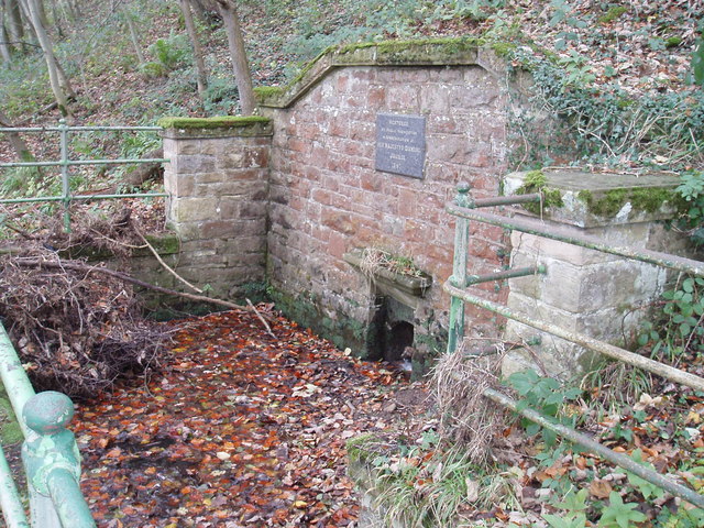
Old Spa Well, nr Haydon Bridge
- Overview Map Street View Haydon Spa is located about 1 mile east of Haydon Bridge, situated in Spa Well Wood, near the south bank of the River Tyne. The spa …
Co-Curate Page
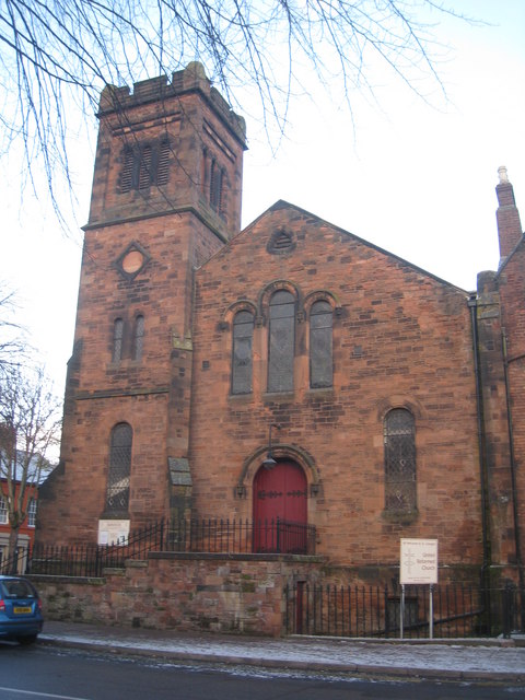
Old Church of St George, Carlisle
- Overview Map Street View The former Church of St. George, United Reformed Church, is located at 35 Warwick Road, Carlisle. Originally a English Presbyterian Church, the foundation stone was laid …
Co-Curate Page
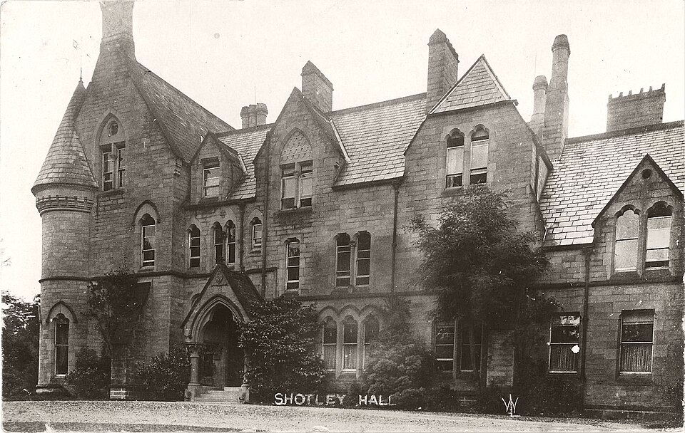
Shotley Hall
- Overview Map Shotley Hall is located about ¼ mile west of Shotley Bridge. The Hall is in Northumberland, close to the border with County Durham. The house was built in …
Co-Curate Page
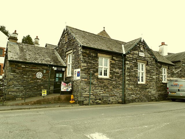
Park House, Hawkshead
- Overview Map Street View Park House is located on Main Street (no. 34), in Hawkshead. The building dates from 1863 and was originally a school, built in the grounds of …
Co-Curate Page
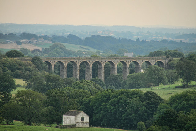
Langley Viaduct
- Overview Map Langley Viaduct is a former railway viaduct over the valley of Langley Beck (Langleydale). The 11 arched bridge was built c.1863 for the North Eastern Railway Company. It …
Co-Curate Page
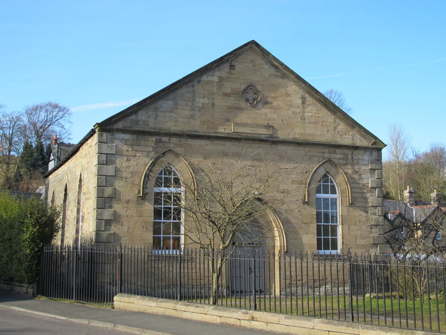
Former Congregational Chapel, Haydon Bridge
- Overview Map Street View This former Congregational Chapel is located on the eastern side of North Bank (street) in Haydon Bridge. The chapel is dated 1863 and is a Grade …
Co-Curate Page
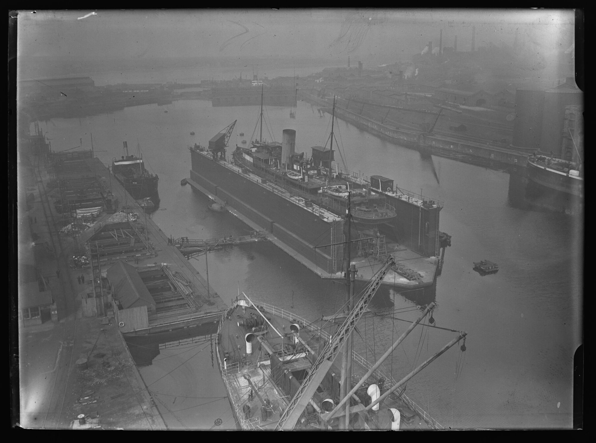
Devonshire Dock, Barrow-in-Furness
- Devonshire Dock is the oldest of the four docks which make up the Royal Port of Barrow in Barrow-in-Furness. Construction of the dock started in 1863 , funded by the …
Co-Curate Page
Winton United Church
- Overview Map Street View Winton United Church (aka Winton Chapel) is a united Baptist and Methodist church on Hall Bank Way in Winton. The building is dated 1863 and was …
Co-Curate Page
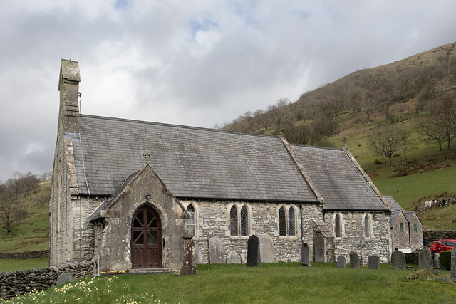
Church of St Mary, Longsleddale
- Overview Map Street View St Mary's Church in in Longsleddale was built in 1863. A Vicarage (now a private home) and school (now the Community Hall) were built at the …

from Newcastle libraries (flickr)
040982:Christ Church Shieldfield Unknown 1863
Pinned by Simon Cotterill
from Newcastle libraries (flickr)
040972:Black Gate Newcastle upon Tyne Unknown 1863
Pinned by Simon Cotterill
from Newcastle libraries (flickr)
008802:Central Station Newcastle upon Tyne 1863
Pinned by Simon Cotterill
from Geograph (geograph)
Portico, Newcastle Central Station, Neville Street
Pinned by Simon Cotterill
from Newcastle libraries (flickr)
Plan to Reid's Handbook of Newcastle, 1863
Pinned by Simon Cotterill
Co-Curate Page
Vane Tempest Hall, Gilesgate
- Overview Map Vane Tempest Hall, now a community centre of the Gilesgate Community and Welfare Association, is located in Gilesgate, Durham. It was originally built in 1863 as a militia …
Co-Curate Page
Lands Viaduct (remains)
- Overview About Lands Viaduct Map Lands Viaduct was built in 1863 to carry the South Durham and Lancashire Union Railway over the River Gaunless. Gaunless Viaduct, also known as the …
Co-Curate Page
Methold Houses, Beamish
- Overview Map Street View Almshouses inscribed "1863 BUILT AND ENDOWED BY JOHN EDEN". The houses are Grade II Listed.
Co-Curate Page
Cragside
- Overview About Cragside Map Street View Cragside was the country house and estate of industrialist Lord William Armstrong and Lady Margaret Armstrong. It was the first house in the world …
Co-Curate Page
Elswick Leather Works (1863 - 1971)
- Elswick Leather Works (also known as Richardson's Tannery) was located in Elswick between Water Street and Dunn Street, by the north bank of the River Tyne. Richardson's was an established …
Co-Curate Page
Barbon Manor
- Overview Map Street View Barbon Manor is located on the northern slope of Barbondale, about 1km west of the village of Barbon in Cumbria. It was originally built as a …
Co-Curate Page
Old School
- The former school in Tallentire was built in 1863 by William Browne. The school closed during Second World War, when it was used as a hostel for the Land Army.[1] It was …
Co-Curate Page
Princes Buildings, Newcastle
- Overview Map Street View Princes Buildings is a substantial block of buildings which straddle Queen Street (No.1-23), King Street (No. 2) and Akenside Hill (Nos 11-14) in Newcastle. They were designed …
Co-Curate Page
Old Spa Well, nr Haydon Bridge
- Overview Map Street View Haydon Spa is located about 1 mile east of Haydon Bridge, situated in Spa Well Wood, near the south bank of the River Tyne. The spa …
Co-Curate Page
Old Church of St George, Carlisle
- Overview Map Street View The former Church of St. George, United Reformed Church, is located at 35 Warwick Road, Carlisle. Originally a English Presbyterian Church, the foundation stone was laid …
Co-Curate Page
Shotley Hall
- Overview Map Shotley Hall is located about ¼ mile west of Shotley Bridge. The Hall is in Northumberland, close to the border with County Durham. The house was built in …
Co-Curate Page
Park House, Hawkshead
- Overview Map Street View Park House is located on Main Street (no. 34), in Hawkshead. The building dates from 1863 and was originally a school, built in the grounds of …
Co-Curate Page
Langley Viaduct
- Overview Map Langley Viaduct is a former railway viaduct over the valley of Langley Beck (Langleydale). The 11 arched bridge was built c.1863 for the North Eastern Railway Company. It …
Co-Curate Page
Former Congregational Chapel, Haydon Bridge
- Overview Map Street View This former Congregational Chapel is located on the eastern side of North Bank (street) in Haydon Bridge. The chapel is dated 1863 and is a Grade …
Co-Curate Page
Devonshire Dock, Barrow-in-Furness
- Devonshire Dock is the oldest of the four docks which make up the Royal Port of Barrow in Barrow-in-Furness. Construction of the dock started in 1863 , funded by the …
Co-Curate Page
Winton United Church
- Overview Map Street View Winton United Church (aka Winton Chapel) is a united Baptist and Methodist church on Hall Bank Way in Winton. The building is dated 1863 and was …
Co-Curate Page
Church of St Mary, Longsleddale
- Overview Map Street View St Mary's Church in in Longsleddale was built in 1863. A Vicarage (now a private home) and school (now the Community Hall) were built at the …
Church of St. Michael with St. Lawrence, Byker
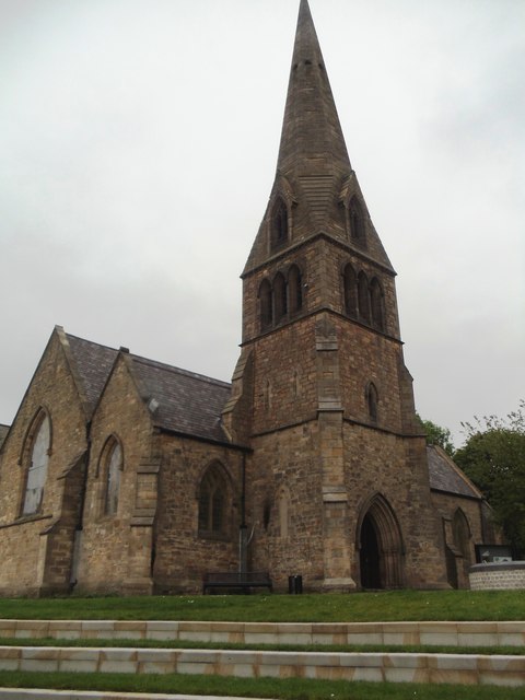
Old Church of St George, Carlisle
Former Congregational Chapel, Haydon Bridge
Church of St Mary, Longsleddale
Elswick Leather Works (1863 - 1971)
Old Spa Well, nr Haydon Bridge
Devonshire Dock, Barrow-in-Furness
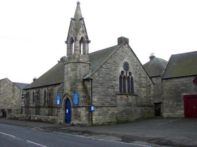
United Reformed Church, Thropton


