Topics > Landmarks, Parks and Buildings > Watermills
Watermills
Co-Curate Page
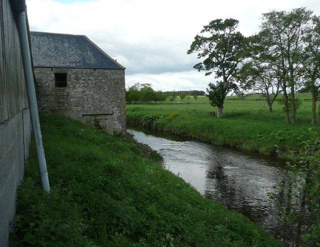
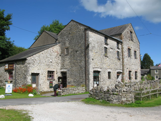
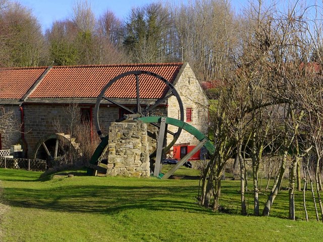
Abberwick Mill
- Overview Aerial View Abberwick Mill is an early 19th century water powered mill by the River Aln. The mill was in working order until about 1925.[1] The mill and associated …
Co-Curate Page
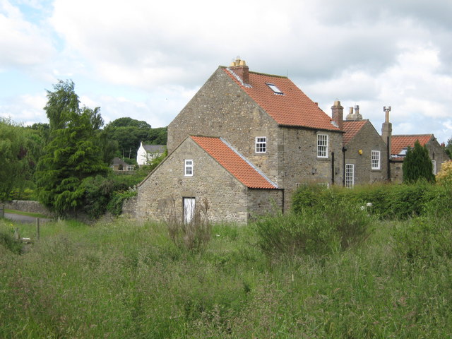
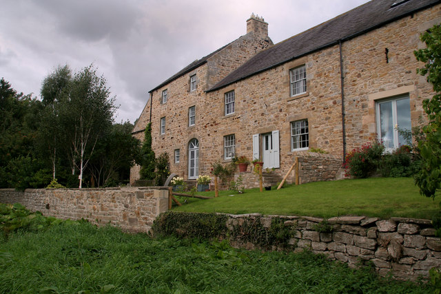
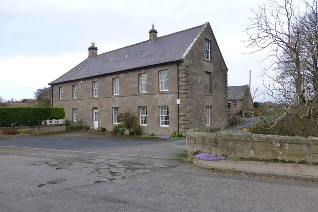
Mill House, High Coniscliffe
- Overview Map The former water mill by Unalby Beck on Mill Lane in High Coniscliffe was built in the late 18th and early 19th century. Now a house, this is …
Co-Curate Page
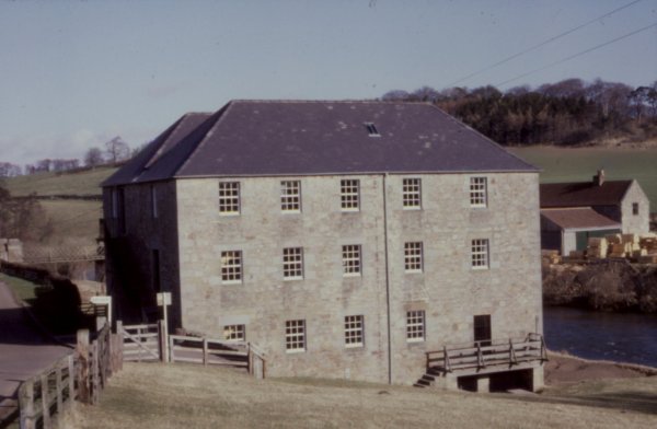
Heatherslaw Mill
- Overview Map Street View An 18th century watermill by the River Till in Heatherlaw, near Etal, in Northumberland. It is a double mill with two water wheels. The mill is …
Co-Curate Page
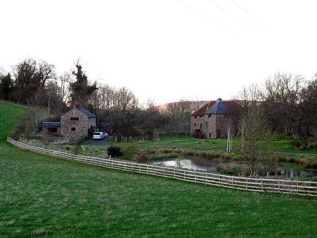
Earle Mill
- Overview Map Earle Mill is a watermill located by Wooler Water. It was built in the 18th century and has a distinctive 19th century drying kiln attached. It is aproximately …
Co-Curate Page
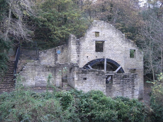
Jesmond Dene Mill
- The old water mill is located by the Ouseburn (river) in Jesmond Dene. A water mill was first recorded here in 1739, at that time known as 'Mabel's Mill'; in the …


Co-Curate Page
Tocketts Mill
- Overview Map Tocketts Mill iis a watermill by Tocketts Beck, located about a mile and a half north-east of Guisborough. The mill seen today was built in c.1810, erected on site …
Co-Curate Page
Old Mill by Cor Burn
- Overview Map The old mill to the west of Corbridge dates from c.1800. It is located by Cor Burn, close to it's confluence with the River Tyne. The mill and mill …
Co-Curate Page
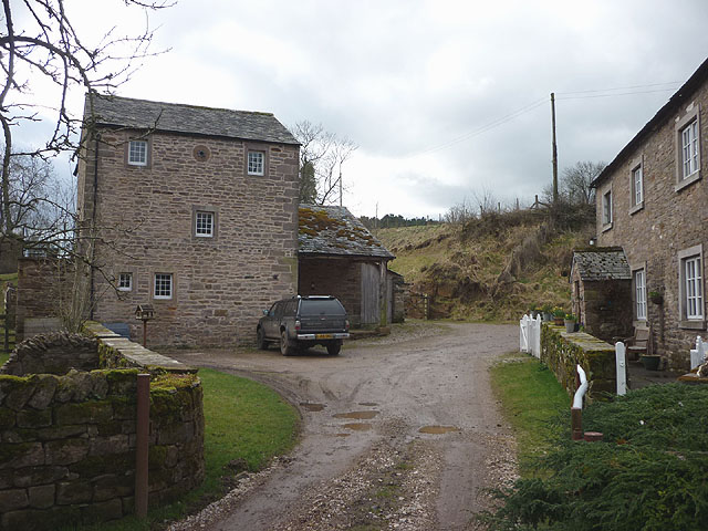
King's Meaburn Mill
- Overview Map Former corn mill by the River Lyvennet a short distance south-west of the village of King's Meaburn. The water powered mill was built in 1811. It has now been converted …
Co-Curate Page
Path Head Water Mill, Blaydon
- Overview Map Street View The 18th Century Water Mill at Path Head, on Summerhill near Blaydon. The mill was derelict by 1974, but has been restored and renovated by the Vale …
Co-Curate Page
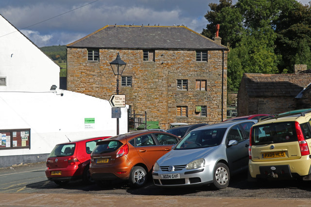
High Mill, Alston
- Overview Map Street View - Front Street View - Rear High Mill, off Front Street in Alston, was originally built as a water-powered corn mill in 1767, by the eminent …
Co-Curate Page
The Mill
- Overview Map Street View The corn mill and miller's house in Waren Mill is located by Waren Burn on the edge of Budle Bay. A water-powered corn mill is documented at Waren …
Co-Curate Page
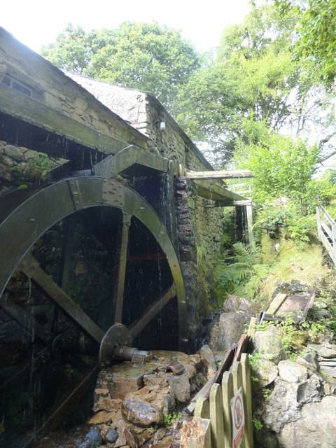
Eskdale Mill
- Overview Map Street View Eskdale Mill is located by Whillan Beck in the village of Boot in Eskdale, Cumbria. Eskdale Mill is one of the oldest water powered corn mills …
Co-Curate Page
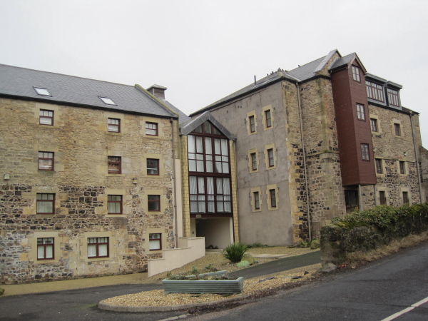
Bridge Mill, Haggerston
- Overview Map Street View Bridge Mill is a former water mill located by Allerdalemill Burn, just north-west of Haggerston, and about a mile and a half south-east of Ancroft. The …
Co-Curate Page
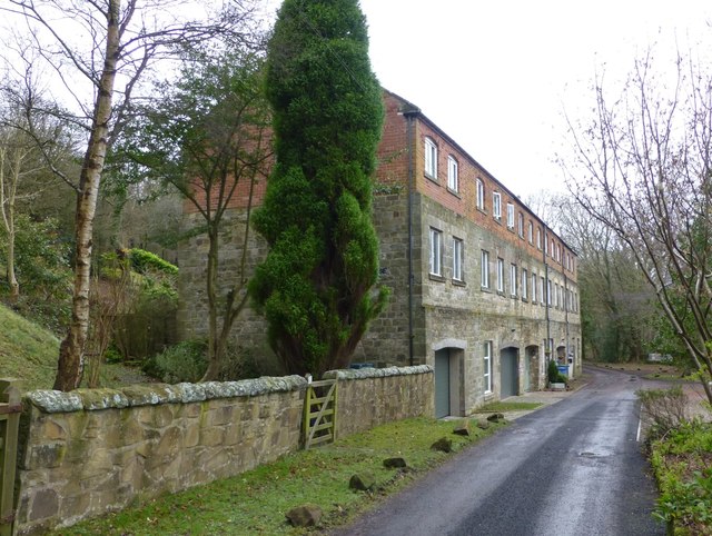
The Dye House, Acklington Park
- Overview Map Street View Dye House is a residential building on the south banks of the River Coquet in Acklington Park, about a mile south of Guyzance. It was originally …
Co-Curate Page
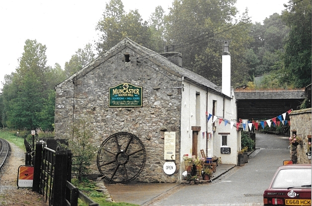
Muncaster Mill
- Overview Map Street View Muncaster Mill is a former water-powered corn mill, now a private residence, located off the A595 road, about 1 mile north-east of Ravensglass and 1 mile …

Co-Curate Page
Abberwick Mill
- Overview Aerial View Abberwick Mill is an early 19th century water powered mill by the River Aln. The mill was in working order until about 1925.[1] The mill and associated …
Co-Curate Page
Mill House, High Coniscliffe
- Overview Map The former water mill by Unalby Beck on Mill Lane in High Coniscliffe was built in the late 18th and early 19th century. Now a house, this is …
Co-Curate Page
Heatherslaw Mill
- Overview Map Street View An 18th century watermill by the River Till in Heatherlaw, near Etal, in Northumberland. It is a double mill with two water wheels. The mill is …
Co-Curate Page
Earle Mill
- Overview Map Earle Mill is a watermill located by Wooler Water. It was built in the 18th century and has a distinctive 19th century drying kiln attached. It is aproximately …
Co-Curate Page
Jesmond Dene Mill
- The old water mill is located by the Ouseburn (river) in Jesmond Dene. A water mill was first recorded here in 1739, at that time known as 'Mabel's Mill'; in the …
Co-Curate Page
Tocketts Mill
- Overview Map Tocketts Mill iis a watermill by Tocketts Beck, located about a mile and a half north-east of Guisborough. The mill seen today was built in c.1810, erected on site …
Co-Curate Page
Old Mill by Cor Burn
- Overview Map The old mill to the west of Corbridge dates from c.1800. It is located by Cor Burn, close to it's confluence with the River Tyne. The mill and mill …
Co-Curate Page
King's Meaburn Mill
- Overview Map Former corn mill by the River Lyvennet a short distance south-west of the village of King's Meaburn. The water powered mill was built in 1811. It has now been converted …
Co-Curate Page
Path Head Water Mill, Blaydon
- Overview Map Street View The 18th Century Water Mill at Path Head, on Summerhill near Blaydon. The mill was derelict by 1974, but has been restored and renovated by the Vale …
Co-Curate Page
High Mill, Alston
- Overview Map Street View - Front Street View - Rear High Mill, off Front Street in Alston, was originally built as a water-powered corn mill in 1767, by the eminent …
Co-Curate Page
The Mill
- Overview Map Street View The corn mill and miller's house in Waren Mill is located by Waren Burn on the edge of Budle Bay. A water-powered corn mill is documented at Waren …
Co-Curate Page
Eskdale Mill
- Overview Map Street View Eskdale Mill is located by Whillan Beck in the village of Boot in Eskdale, Cumbria. Eskdale Mill is one of the oldest water powered corn mills …
Co-Curate Page
Bridge Mill, Haggerston
- Overview Map Street View Bridge Mill is a former water mill located by Allerdalemill Burn, just north-west of Haggerston, and about a mile and a half south-east of Ancroft. The …
Co-Curate Page
The Dye House, Acklington Park
- Overview Map Street View Dye House is a residential building on the south banks of the River Coquet in Acklington Park, about a mile south of Guyzance. It was originally …


