Topics > Heritage Sites > Hadrian's Wall > Wall Mile 66
Wall Mile 66
Hadrian's Wall - Wall Mile 66
Hadrian's Wall stretches from the east to west coast of England and was an important frontier of the Roman Empire. Building of the wall began in AD 122 and took six years to complete it’s 84 mile (80 Roman mile) length. Soldiers were garrisoned along the line of the wall in large forts, smaller milecastles, and intervening turrets. The Vallum, a large ditch with mounds on either side, ran along the south side of the wall, protecting the rear of the frontier. Hadrian's Wall was designated as a World Heritage Site in 1987.
Wall mile 66 was originally a turf wall, later replaced by stone. From Milecastle 49 to the western end of Hadrian's Wall on the Solway Firth, the wall was originally constructed from turf, possibly due to the absence of limestone. Subsequently, the turf wall was demolished and replaced with a stone wall.
Wall Mile 66:
- Milecastle 66 (Stanwix Bank) - no visible remains
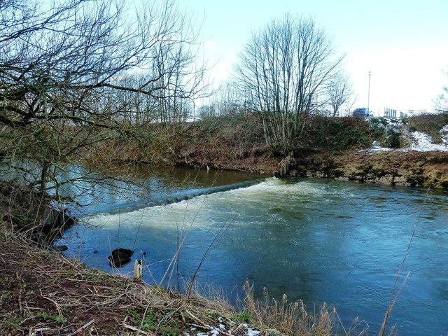
- Roman Bridge over the River Eden - some stones reputedly from the bridge are in Bitts Park
- Turret 66a - location unknown
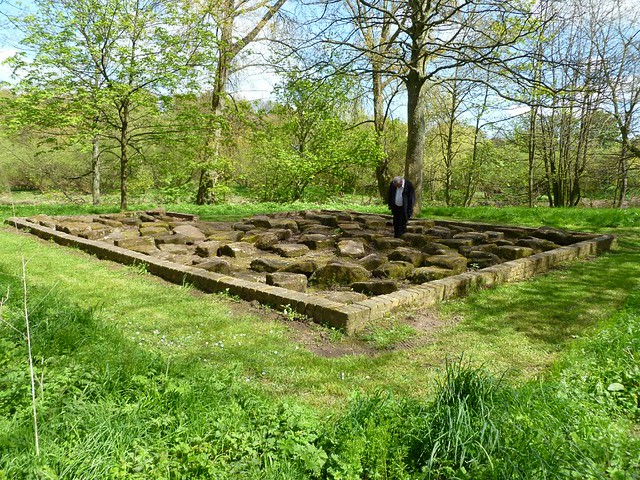
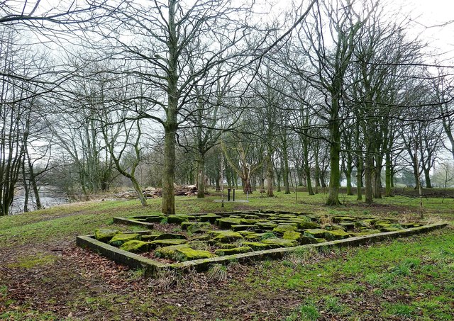
- Luguvalium Roman Fort - overlain by Carlisle Castle and other parts of the city.
- Turret 66b - location unknown
Hadrain's Wall National Trail runs along the riverside boundary of Bitts Park, in which are stones reputedly from the Roman bridge. Carlisle Castle occupies the central and northern part of the Roman fort Luguvalium. Tullie Museum in Carlisle includes Roman artifacts.
Scheduled Monument (#1007248): Hadrian's Wall and vallum in wall mile 66, Stanwix Bank to Stainton
Click the headings below to expand (selected extracts from the Historic England scheduling)
%
Scheduled Monument (#1014579): Carlisle Castle; medieval tower keep castle, two lengths of city wall, a 16th century battery, and part of an earlier Roman fort, which was known as Luguvalium
Click the headings below to expand (selected extracts from the Historic England scheduling)
%
The monument includes the upstanding and buried remains of Carlisle medieval tower keep castle, two lengths of Carlisle city wall, a 16th century battery, and the buried remains of much of the Roman fort known as Luguvalium, a large part of which underlies the later castle. It is strategically located at the northern end of a steep bluff overlooking the confluence of the Rivers Caldew and Eden at the northernmost tip of Carlisle city centre.
The monument includes the majority of a Roman fort which originally occupied this location. A turf and timber Roman fort was established here in the early AD 70s and limited excavations close to the castle have located parts of the west and south defences of this fort including a waterlogged and remarkably well preserved timber gateway. Further excavation has found that in the second century the fort's defences were moved further south and this may imply an enlargement of the fort area. In the third century the fort appears to have been enlarged yet again; limited excavation in Abbey Street and Castle Street found evidence for the defences of a stone fort south of the earlier defences. The Roman fort continued in use until the AD 330s, its fate after this is uncertain. Scattered traces of a number of crudely built stone structures, of unknown purpose but dating to the late fourth century, were built on the site of the fort's barracks. Carlisle Castle occupies the central and northern part of the Roman fort.


from https://historicengland.org.u…
Carlisle Castle; medieval tower keep castle, two lengths of city wall, a 16th century battery, and part of an earlier Roman fort known as Luguvalium - List Entry
- "....The monument includes the upstanding and buried remains of Carlisle medieval tower keep castle, two lengths of Carlisle city wall, a 16th century battery, and the buried remains of much …
Added by
Simon Cotterill
Co-Curate Page
Bitts Park
- Overview Map Street View Bitts Park in Carlisle is located east and north of Carlisle Castle, by the River Eden, near its confluence with the River Caldew. It was the …

Co-Curate Page
Turma! Hadrian's Cavalry Charge
- Turma! Hadrian's Cavalry Charge was a Roman cavalry re-enactment event 1st-2nd July 2017 held at Bitts Park, Carlisle. It is thought to be first time in over 1,500 years, that a …


from https://www.heritagegateway.o…
Milecastle 66
- Grid Ref : NY3973056780
Summary : The possible site of milecastle 66, part of the defences on Hadrian's Wall. The milecastle is situated south of the fort at Stanwix close …
Added by
Simon Cotterill
from https://www.megalithic.co.uk/…
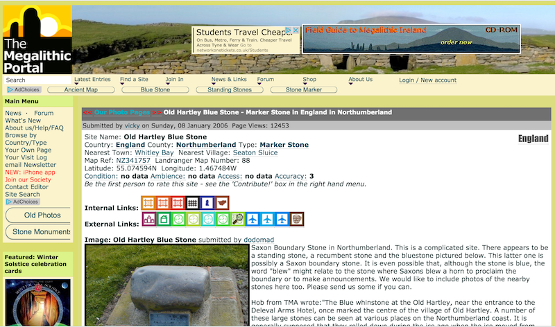
Roman Bridge Remains (Bitts Park)
- .....The remains of the bridge are almost diagonally opposite (south-west) from the Holme Hyssop holy well, which is on the northern side of the River Eden, near to where Milecastle …
Added by
Simon Cotterill
from https://historicengland.org.u…
Hadrian's Wall and vallum in wall mile 66, Stanwix Bank to Stainton - List Entry
Added by
Simon Cotterill

from https://historicengland.org.u…
Carlisle Castle; medieval tower keep castle, two lengths of city wall, a 16th century battery, and part of an earlier Roman fort known as Luguvalium - List Entry
- "....The monument includes the upstanding and buried remains of Carlisle medieval tower keep castle, two lengths of Carlisle city wall, a 16th century battery, and the buried remains of much …
Added by
Simon Cotterill
Co-Curate Page
Bitts Park
- Overview Map Street View Bitts Park in Carlisle is located east and north of Carlisle Castle, by the River Eden, near its confluence with the River Caldew. It was the …
Co-Curate Page
Turma! Hadrian's Cavalry Charge
- Turma! Hadrian's Cavalry Charge was a Roman cavalry re-enactment event 1st-2nd July 2017 held at Bitts Park, Carlisle. It is thought to be first time in over 1,500 years, that a …
from https://www.heritagegateway.o…
Milecastle 66
- Grid Ref : NY3973056780
Summary : The possible site of milecastle 66, part of the defences on Hadrian's Wall. The milecastle is situated south of the fort at Stanwix close …
Added by
Simon Cotterill
from https://www.megalithic.co.uk/…
Roman Bridge Remains (Bitts Park)
- .....The remains of the bridge are almost diagonally opposite (south-west) from the Holme Hyssop holy well, which is on the northern side of the River Eden, near to where Milecastle …
Added by
Simon Cotterill
from https://historicengland.org.u…
Hadrian's Wall and vallum in wall mile 66, Stanwix Bank to Stainton - List Entry
Added by
Simon Cotterill

")
