Topics > Heritage Sites > Hadrian's Wall > Wall Mile 3
Wall Mile 3
Hadrian's Wall - Wall Mile 3
Hadrian's Wall stretches from the east to west coast of England and was an important frontier of the Roman Empire. Building of the wall began in AD 122 and took six years to complete it's 84 mile (80 Roman mile) length. Soldiers were garrisoned along the line of the wall in large forts, smaller milecastles, and intervening turrets. The Vallum, a large ditch with mounds on either side, ran along the south side of the wall, protecting the rear of the frontier. Hadrian's Wall was designated as a World Heritage Site in 1987.
Wall Mile 3:
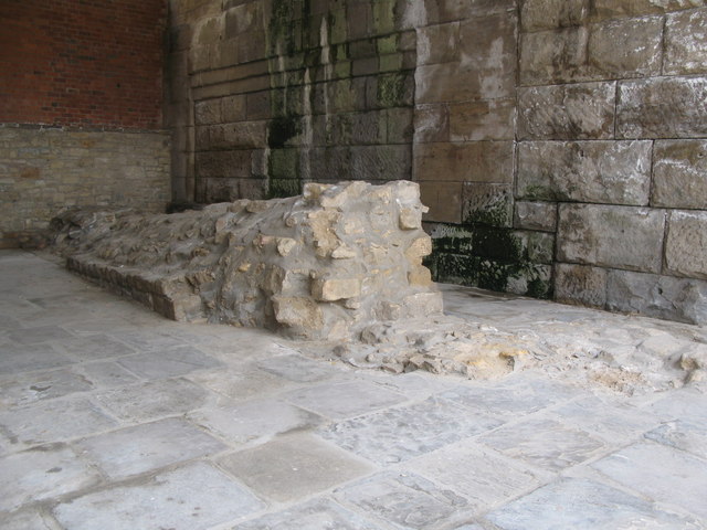
The exact course of the wall from Stephen Street, across the Ouse Burn, to the west end of Stepney Bank is unknown, in spite of excavations in 1928 and 1989. West of Stepney Bank the curtain wall has been located in several places: the west side of Crawhall Road (in 1981), south of St. Dominic's (1928 & 1981), Gibson Street (1928), Grenville Terrace (1929 & 1978), Jubilee Road (1978), and Garth Heads (1994). A 2.8 metres section of Wall was located under a car showroom at the corner of Melbourne Street/Gibson Street at a depth of 2.3 metres in 2003.[1]
- Milecastle 3 (Ouseburn) - no visible surface remains - thought to be located at the junction of the A187 Byker Bridge and Stephen Street.
- Turret 3a - exact location unknown
- Turret 3b - located beneath the site of the former Norris House on Crawhall Road in 2021.
- Pons Aelius - Roman Fort and Bridge
Scheduled Monument (#1003508): Hadrian's Wall in wall mile 2, Byker section of Hadrian's Wall and presumed site of milecastle 3 at Shields Road West
Click the heading below to expand (map of the Scheduled Monument area)
Map showing the buried remains of Hadrian's Wall and Milecastle 3 in this section (Scheduled Monument area).
%
Scheduled Monument (#1003512): Hadrian's Wall in wall mile 4, sections of wall between Crawhall Road and Jubilee Road
Click the heading below to expand (map of the Scheduled Monument area)
Map showing the buried remains of Hadrian's Wall in this section (Scheduled Monument area).
%
Note: The scheduling listing includes a map, but no descriptive text. The title states Wall Mile 4, but shouldn't this be Wall Mile 3?


from https://historicengland.org.u…
Hadrian's Wall in wall mile 2, Byker section of Hadrian's Wall and presumed site of milecastle 3 at Shields Road West - List Entry
Added by
Simon Cotterill

from https://www.twsitelines.info/…
Hadrian's Wall, Stephen Street to Dean Street (Wall mile 3)
- The course of the curtain wall and ditch from Stephen St, across the Ouse Burn, to the top (west end) of Stepney Bank is unknown, in spite of excavations in …
Added by
Simon Cotterill
from https://www.twsitelines.info/…
Hadrian's Wall, Newcastle Fort (Pons Aelius)
- Though the late Roman document known as the Notitia Digitatum referred to a fort called Pons Aelius, which has always been assumed to be in Newcastle, its precise site was …
Added by
Simon Cotterill
Co-Curate Page
Pons Aelius
- Overview About Pons Aelius Remains The Romans built Pons Aelius, a bridge to cross the River Tyne, around 122AD. A fort was built there, eventually becoming known under the same …

from https://perlineamvalli.wordpr…
Wall Mile 3
- Wall Mile 3 (May 17, 2012). Mike Bishop's PLV blog about walking Hadrian’s Wall written from an archaeologist’s point of view. "....Newcastle was the original eastern terminus of the Wall …
Added by
Simon Cotterill
from https://historicengland.org.u…
Hadrian's Wall in wall mile 4, sections of wall between Crawhall Road and Jubilee Road
Added by
Simon Cotterill

from https://historicengland.org.u…
Hadrian's Wall in wall mile 2, Byker section of Hadrian's Wall and presumed site of milecastle 3 at Shields Road West - List Entry
Added by
Simon Cotterill
from https://www.twsitelines.info/…
Hadrian's Wall, Stephen Street to Dean Street (Wall mile 3)
- The course of the curtain wall and ditch from Stephen St, across the Ouse Burn, to the top (west end) of Stepney Bank is unknown, in spite of excavations in …
Added by
Simon Cotterill
from https://www.twsitelines.info/…
Hadrian's Wall, Newcastle Fort (Pons Aelius)
- Though the late Roman document known as the Notitia Digitatum referred to a fort called Pons Aelius, which has always been assumed to be in Newcastle, its precise site was …
Added by
Simon Cotterill
Co-Curate Page
Pons Aelius
- Overview About Pons Aelius Remains The Romans built Pons Aelius, a bridge to cross the River Tyne, around 122AD. A fort was built there, eventually becoming known under the same …
from https://perlineamvalli.wordpr…
Wall Mile 3
- Wall Mile 3 (May 17, 2012). Mike Bishop's PLV blog about walking Hadrian’s Wall written from an archaeologist’s point of view. "....Newcastle was the original eastern terminus of the Wall …
Added by
Simon Cotterill
from https://historicengland.org.u…
Hadrian's Wall in wall mile 4, sections of wall between Crawhall Road and Jubilee Road
Added by
Simon Cotterill