Topics > Civil Parishes in Cumbria > St Cuthbert Without Civil Parish
St Cuthbert Without Civil Parish
The civil parish of St Cuthbert Without in Cumbria is located to the south of Calisile and includes the villages of Blackwell, Brisco, Burthwaite, Durdar, Scalesceugh, Carleton Village, Carleton Grange, Pennine View, Parkland Village and Wreay.
Area: 32.6 km²
Population:
5,154 (2021 Census)
3,422 (2011 Census)
2,232 (2001 Census)
St Cuthbert Without, or simply St Cuthbert, is a civil parish within the City of Carlisle in Cumbria, England.
The parish lies immediately to the south of Carlisle itself and comprises the following settlements - Blackwell, Durdar, Carleton, Brisco and Wreay (the first three are usually regarded as outlying parts of Carlisle, although were not part of the former county borough of Carlisle). According to the 2001 census it had a population of 2,043.
The civil parish was formed in 1866 and has seen various boundary changes during its existence, mostly due to the expansion of Carlisle, although the former separate parish of Wreay was absorbed in 1934.
The parish is named after St Cuthbert's Church in Carlisle city centre. The "Without" part of the name means this was the part of the ecclesiastical parish of St Cuthbert's that was outside the city boundary or walls. The original civil parish of Carlisle St Cuthbert was split in 1866 to form St Cuthbert Without and St Cuthbert Within - the latter of which became part of a merged Carlisle civil parish in 1904.
St Mary's Church (Wreay), built in 1842, is notable for its architecture.
At one time the parish included the modern Carlisle suburbs and districts of Botchergate, St Nicholas, Currock, Upperby and Harraby.
The M6, A6 and West Coast main railway line all run through the parish. The A6 meets the M6 at junction 42 (the Golden Fleece Roundabout) in Carleton. At different times there have been railway stations at Wreay and Brisco.
The main river in the parish is the River Petteril.
Blackwell
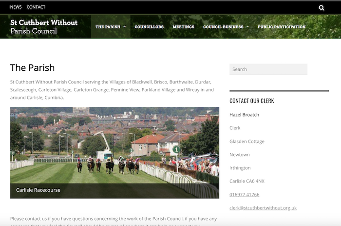
Blackwell (54.868°N 2.932°W) is a village in the parish, just south Carlisle. Carlisle Racecourse is in the village.
Brisco
Brisco (54.858°N 2.902°W; postcode district CA4) is a village in the parish. It is located a few miles south of Carlisle, near Junction 42 of the M6 motorway. There is St Ninian's well in the village. In the Imperial Gazetteer of England and Wales of 1870-72 it had a population of 323. Brisco railway station served the village.
Carleton
Carleton (54.867°N 2.893°W; postcode district CA1) is a hamlet on the A6 road, in the parish; it is near the residential area (suburb of Carlisle) of Harraby. In the Imperial Gazetteer of England and Wales of 1870-72 it had a population of 181. It is a few miles to the south-east of the city centre of Carlisle and is near the River Petteril.
Durdar
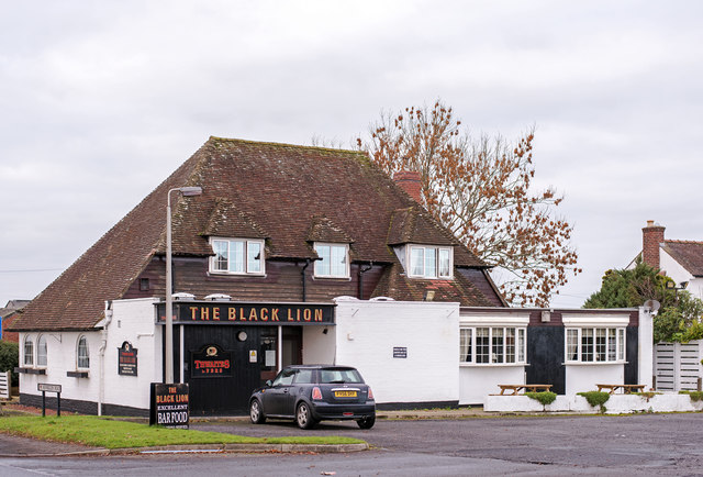
Durdar (54.850°N 2.928°W; postcode district CA2) is a small suburban area based around a crossroads (with a pub the Black Lion, and a petrol station/garage) in the parish, 2 km to the south of the city of Carlisle.
Visit the page: St Cuthbert Without for references and further details. You can contribute to this article on Wikipedia.
from http://www.stcuthbertwithout.…
St Cuthbert without Parish Council
- Official Website of St Cuthbert without Parish Council. "St Cuthbert Without Parish Council serving the Villages of Blackwell, Brisco, Burthwaite, Durdar, Scalesceugh, Carleton Village, Carleton Grange, Pennine View, Parkland Village …
Added by
Simon Cotterill
Co-Curate Page
Wreay
- Overview About Wreay Map Street View Wreay is a villiage in Cumbria, located near Carlisle. Wreay is a small village in Cumbria, incorporated in 1934 into the Carlisle parish of …
Co-Curate Page
Brisco
- Overview Map Street View Brisco is a small village in the civil parish of St Cuthbert Without, which falls within the City of Carlisle in Cumbria. It is about 2 …

from https://www.cumbriacountyhist…
Carlisle: St Cuthbert Without
- "CP in St Cuthbert’s parish, Carlisle, Cumberland ward, Cumberland, comprising townships of High and Low Blackwell, Botcherby, Brisco, Carleton, Harraby, and Upperby. Carlisle city boundary extended 1887 and 1894, resulting …
Added by
Simon Cotterill
Co-Curate Page
Carleton, Carlisle
- Overview Map Street View Calerton is a village located about 2 miles south-east of Carlisle city centre, just beyond the Harraby suburb of Carlisle. Calerton is situated near the River …
Co-Curate Page
Durdar
- Overview Map Street View Durdar is a village in the Allerdale district of Cumbria, located about 3 miles south of the centre of Carlilse. Durdar forms part of the Civil Parish …

Co-Curate Page
Blackwell, Carlisle
- Overview Map Street View Blackwell is a village, located immediately south of Carlisle, and is within the Cumberland Unitary Authority area and in the ceremonial county of Cumbria. Carlisle Racecourse …

from http://www.stcuthbertwithout.…
St Cuthbert without Parish Council
- Official Website of St Cuthbert without Parish Council. "St Cuthbert Without Parish Council serving the Villages of Blackwell, Brisco, Burthwaite, Durdar, Scalesceugh, Carleton Village, Carleton Grange, Pennine View, Parkland Village …
Added by
Simon Cotterill
Co-Curate Page
Wreay
- Overview About Wreay Map Street View Wreay is a villiage in Cumbria, located near Carlisle. Wreay is a small village in Cumbria, incorporated in 1934 into the Carlisle parish of …
Co-Curate Page
Brisco
- Overview Map Street View Brisco is a small village in the civil parish of St Cuthbert Without, which falls within the City of Carlisle in Cumbria. It is about 2 …
from https://www.cumbriacountyhist…
Carlisle: St Cuthbert Without
- "CP in St Cuthbert’s parish, Carlisle, Cumberland ward, Cumberland, comprising townships of High and Low Blackwell, Botcherby, Brisco, Carleton, Harraby, and Upperby. Carlisle city boundary extended 1887 and 1894, resulting …
Added by
Simon Cotterill
Co-Curate Page
Carleton, Carlisle
- Overview Map Street View Calerton is a village located about 2 miles south-east of Carlisle city centre, just beyond the Harraby suburb of Carlisle. Calerton is situated near the River …
Co-Curate Page
Durdar
- Overview Map Street View Durdar is a village in the Allerdale district of Cumbria, located about 3 miles south of the centre of Carlilse. Durdar forms part of the Civil Parish …


