Topics > Heritage Sites > Scheduled Monument > Scheduled Monuments in Darlington (Borough)
Scheduled Monuments in Darlington (Borough)
This page includes some of the Scheduled Monuments in the Borough of Darlington.
Scheduled Monuments are sites of national significance which have been given the top-level of legal protection under the Ancient Monuments and Archaeological Areas Act 1979. They range from archaeological sites (prehistoric, Roman, Medieval etc) to ruins or surviving structures (including some 19th/20th century industrial and military sites).

Co-Curate Page
Low Dinsdale Manor House
- Note: Map data from Historic England c/o Open Data UK, under the Open Government Licence, imported into Google MyMaps, March 2026. The medieval manorial site at Low Dinsdale was the …

Co-Curate Page
Archdeacon Newton Medieval Settlement
- Note: Scheduled Monument area - map data from Historic England c/o Open Data UK, under the Open Government Licence, imported into Google MyMaps, March 2026. Archdeacon Newton is the site …
Co-Curate Page
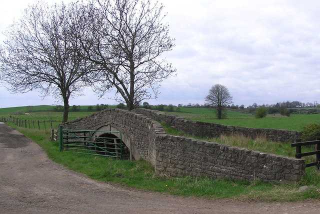
Ketton Packhorse Bridge
- Overview Map Ketton Packhorse Bridge is located off Ketton Lane, to the north of Darlington. The bridge dates from the late 17th or early 18th century and crossed the River …
Co-Curate Page
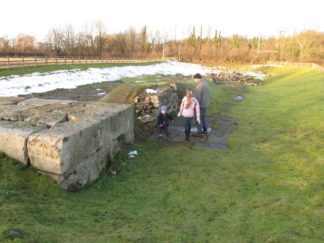
Piercebridge Roman Bridge
- Overview About the Roman Bridge Map Street View The Roman bridge at Piercebridge crossed the River Tees, carrying Dere Street, the Roman road that linked York with Corbridge, near Hadrian’s …
Co-Curate Page
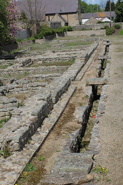
Morbium - Roman Fort at Piercebridge
- Note: Scheduled Monument area - map data from Hstoric England c/o Open Data UK, under the Open Government Licence, imported into Google MyMaps, March 2026. "Piercebridge is located on the …
Co-Curate Page
Summerhouse moated site
- Note: Map data from Historic England c/o Open Data UK, under the Open Government Licence, imported into Google MyMaps, March 2026 In medieval times there was a defended manor house …

Co-Curate Page
Low Dinsdale Manor House
- Note: Map data from Historic England c/o Open Data UK, under the Open Government Licence, imported into Google MyMaps, March 2026. The medieval manorial site at Low Dinsdale was the …
Co-Curate Page
Archdeacon Newton Medieval Settlement
- Note: Scheduled Monument area - map data from Historic England c/o Open Data UK, under the Open Government Licence, imported into Google MyMaps, March 2026. Archdeacon Newton is the site …
Co-Curate Page
Ketton Packhorse Bridge
- Overview Map Ketton Packhorse Bridge is located off Ketton Lane, to the north of Darlington. The bridge dates from the late 17th or early 18th century and crossed the River …
Co-Curate Page
Piercebridge Roman Bridge
- Overview About the Roman Bridge Map Street View The Roman bridge at Piercebridge crossed the River Tees, carrying Dere Street, the Roman road that linked York with Corbridge, near Hadrian’s …
Co-Curate Page
Morbium - Roman Fort at Piercebridge
- Note: Scheduled Monument area - map data from Hstoric England c/o Open Data UK, under the Open Government Licence, imported into Google MyMaps, March 2026. "Piercebridge is located on the …

