Topics > Civil Parishes in Cumbria > Penrith Town Council area
Penrith Town Council area
About the Parish
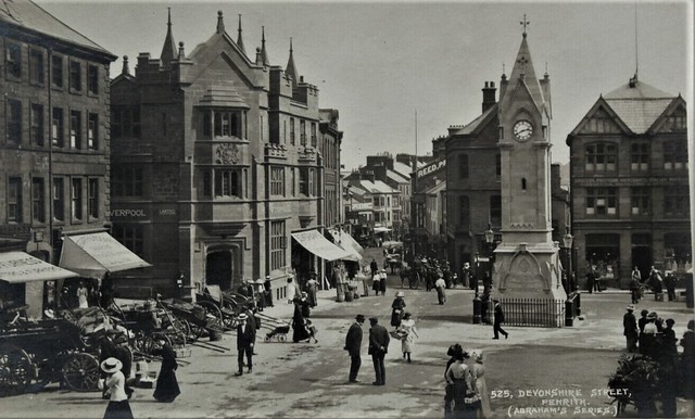
Penrith is a civil parish in Cumbria, located about 17 miles south of Carlisle. It is situated to the north of the River Eamont and is less than 3 miles outside the Lake District National Park. Penrith had a population of 16,984 at the time of the 2021 Census. The town is within the Westmorland and Furness authority area, but had been part of the historic county of Cumberland.
| Main Settlements: |
The market town of Penrith and several farms and hamlets to the north of the town, including Plumpton Head, Roundthorn, Bowscar. |
| Population: |
16,984 (2021 Census) 15,487 (2011 Census) 14,756 (2001 Census) |
| Area: | 30.7 km² |
| Parish Council: |
Penrith Town Council Penrith Town Council was established on April 1, 2015, when a civil parish was reintroduced to the town. Penrith civil parish had previously been abolished in 1974, when Eden District Council was formed (the district council was based in the old Town Hall in Corney Square). |
| Unitary Authority: | Westmorland & Furness Council |
| Ceremonial County: | Cumbria |
Historical |
|
| Ancient Townships |
Penrith (Market Town) Townships became civil parishes in their own right in 1866 (see below). |
| Ancient Parishes: |
Ancient parishes refer to the parishes before the split between ecclesiastical (church) and civil parishes in the 19th century. They had a parish church and often were composed of multiple townships and chapelries. In many cases, townships and parishes were originally based on the territory of manors from the feudal system during medieval times. Civil parishes were created following the Poor Law Amendment Act 1866, in which Church of England parishes, extra-parochial areas, townships and chapelries, became "civil parishes" which could set their own poor rate (tax). Then the reforms of Local Government Act 1894 established elected civil parish councils (or parish meetings for parishes with less than 300 residents) and created urban and rural districts. Boundaries of parishes and civil parishes may have changed over time. |
| Ancient District: |
Leath (ward) |
| Poor Law Union: |
Penrith Poor Law Union, formed in 1836. Penrith Union Workhouse was located by Greystoke Road, opening in 1838. This replaced smaller existing workhouses in Penrith (Middlegate), Ainstable and Heskett. Under the Poor Law Amendment Act of 1834 parishes were grouped into Unions, each of which had to build a workhouse if they did not already have one. It ended the old system of locally provided poor relief which had come under strain as numbers out of work grew, following increasing mechanisation of agriculture and the economic downturn after the Napoleonic Wars, along with changing social attitudes. The workhouse provided those unable to support themselves financially with accommodation and work. Inmates were generally segregated into men, women, boys and girls. The workhouse system was abolished by the Local Government Act 1929, but many workhouses lived on as ‘Public Assistance Institutions’ until the National Assistance Act 1948. |
| County: |
Cumberland, until 1974, then: Cumbria, which was created on the 1st of April 1974, following the Local Government Act 1972. The new county absorbed Cumberland and Westmorland, and added some parts of Lancashire and the West Riding of Yorkshire. Cumbria County Council was abolished in 2023 and replaced by 2 new Unitary authorities. Cumbria remains a ceremonial county; retaining ceremonial boundary and the roles and responsibilities of the Lord Lieutenant and High Sheriff of Cumbria - based on 'The Cumbria (Structural Changes) Order 2022'. |
|
District Council: |
Penrith Urban District (1894 - 1974). Penrith Urban District Council built the (old) Town Hall on Corney Square in 1906. The Wetheriggs, Skirsgill, and Castle Hill areas were developed by the council, for housing, in the 1920s on land previously known as "Scumscaw". Eden District (1974 - 2023) Created by the Local Government Act 1972. Eden District was formed from an amalgamation of Penrith Urban District, Alston with Garrigill Rural District and Penrith Rural District (Cumberland), and Appleby Municipal Borough, part of Lakes Urban District and North Westmorland Rural District (Westmorland). Eden District Council and the 5 other district councils of Cumbria, along with the county council, were abolished as part of local government reorganisation in 2023; and replaced by two unitary authorities on 1st April 2023. |
|
Unitary Authority: |
Westmorland & Furness Council was created on the 1st April 2023. The 'new' Westmorland & Furness unitary authority area includes the historic county of Westmorland, along with parts of historic Cumberland, including Penrith and it's surrounding area, and also parts of historic Yorkshire and Lancashire. |
See also: ![]() Historic Buildings and Monuments in Penrith. Note: listed buildings are generally the responsibility of the county council / unitary authority, rather than the parish council.
Historic Buildings and Monuments in Penrith. Note: listed buildings are generally the responsibility of the county council / unitary authority, rather than the parish council.

from https://www.penrithtowncounci…
Penrith Town Council
- "Penrith is located just off Junction 40 of the M6 and has excellent cross country links with the east and west coast via the A66. Lying just north of the …
Added by
Simon Cotterill

from https://www.cumbriacountyhist…
Penrith Ancient Parish
- "Market town and ancient parish in Leath Ward, Cumberland, including village of Carleton....Honour of Penrith created 1242 and granted to king of Scots; seized by Edward I 1295 and conferred …
Added by
Simon Cotterill
Co-Curate Page
Penrith
- Overview About Penrith Map Street View Penrith is a market town and civil parish in the county of Cumbria, England. Penrith lies less than 3 miles (5 km) outside the …

Co-Curate Page
Penrith Parish, 1848
- PENRITH (St. Andrew), a market-town and parish, and the head of a union, in Leath ward, E. division of Cumberland, 18 miles (S.E. by S.) from Carlisle, and 283 (N.N.W.) …
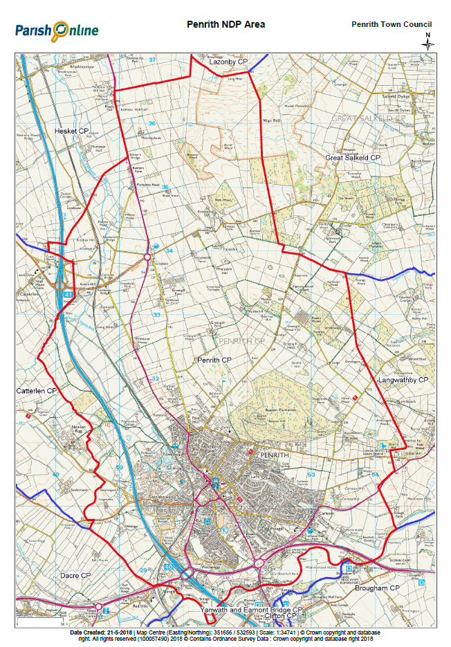
from https://www.penrithtowncounci…
Map of Penrith Town Council Area
- Map on the Penrith Town Council Website.
Added by
Simon Cotterill
Co-Curate Page
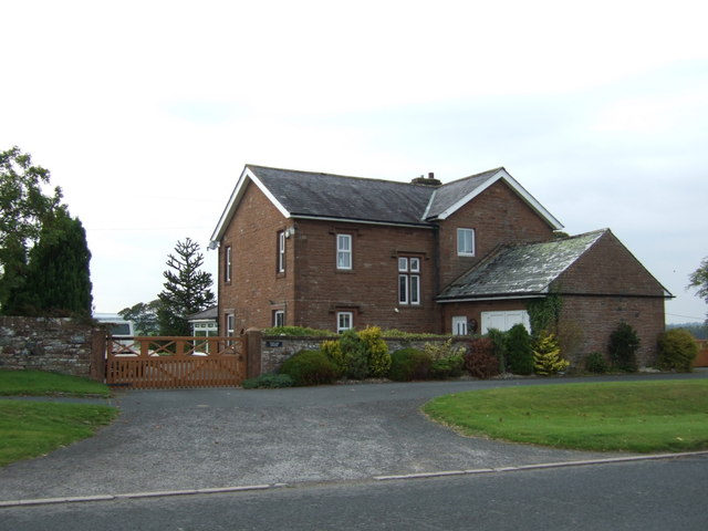
Plumpton Head
- Overview Map Street View Plumton Head is a hamlet in Cumbria, located by the A6 road, about 3 miles north of Penrith and just over 1 mile south of the …

Co-Curate Page
Penrith, Historical Account, 1890
- Extract from: Kelly's Directory of Durham, 1890 PENRITH is a market and union town, parish and township, situated in a valley near the river Eamont, and is the head of …

from https://www.penrithtowncounci…
Penrith Town Council
- "Penrith is located just off Junction 40 of the M6 and has excellent cross country links with the east and west coast via the A66. Lying just north of the …
Added by
Simon Cotterill
from https://www.cumbriacountyhist…
Penrith Ancient Parish
- "Market town and ancient parish in Leath Ward, Cumberland, including village of Carleton....Honour of Penrith created 1242 and granted to king of Scots; seized by Edward I 1295 and conferred …
Added by
Simon Cotterill
Co-Curate Page
Penrith
- Overview About Penrith Map Street View Penrith is a market town and civil parish in the county of Cumbria, England. Penrith lies less than 3 miles (5 km) outside the …
Co-Curate Page
Penrith Parish, 1848
- PENRITH (St. Andrew), a market-town and parish, and the head of a union, in Leath ward, E. division of Cumberland, 18 miles (S.E. by S.) from Carlisle, and 283 (N.N.W.) …
from https://www.penrithtowncounci…
Map of Penrith Town Council Area
- Map on the Penrith Town Council Website.
Added by
Simon Cotterill
Co-Curate Page
Plumpton Head
- Overview Map Street View Plumton Head is a hamlet in Cumbria, located by the A6 road, about 3 miles north of Penrith and just over 1 mile south of the …


