Penrith
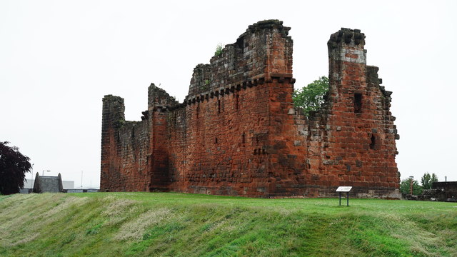
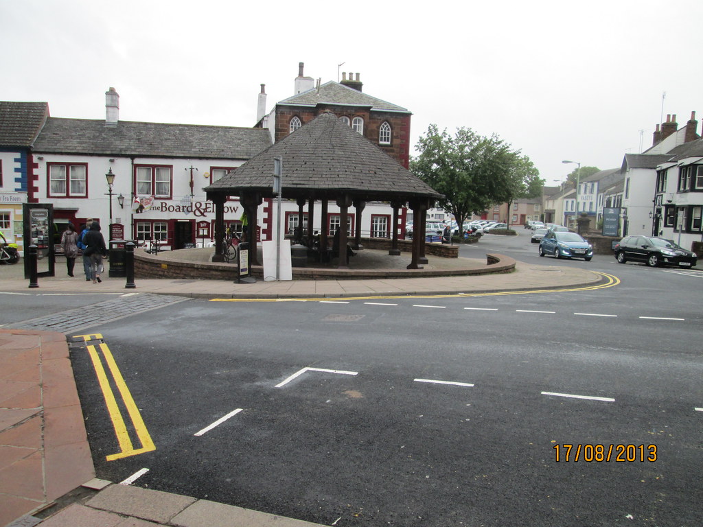
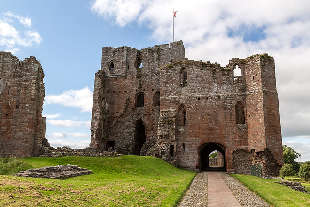
Penrith is a historic market town in Cumbria, located about 16 miles south of Carlisle and 5 miles south-west of Ullswater (lake); it is often considered as the "Gateway to the North Lakes". The town, with it’s distinctive red sandstone buildings, has been an important crossroads since Roman times, and this remains true today, with the town situated by the junction of the M6 motorway and the A66. There has been a church on the site of St Andrew’s Church since before the Norman Conquest; parts of todays church date from the 12th century. In 1223, Penrith was granted it’s Market Charter, allowing weekly markets and annual fairs. The Market Square and Clock Tower remain a focal point for the town centre. For a short time (1242 - 1295), Penrith was part of the Kingdom of Scotland, until it was seized by Edward I. Construction of Penrith Castle was begun in 1399. The Beacon tower was built on a hill overlooking the town in 1719; historically, beacons were lit to warn of incoming raids from the north. Historic Inns, like The George Hotel and Dockray Hall (associated with Richard III) reflect the town's history as a major coaching stop. Penrith Station was opened in 1846; the arrival of the railway boosted tourism and trade, leading to the town's expansion well beyond its medieval core. Much of the town centre is a Conservation Area, as is the New Streets area.
Penrith is a market town and civil parish in the county of Cumbria, England. Penrith lies less than 3 miles (5 km) outside the boundaries of the Lake District National Park. Historically a part of Cumberland, Penrith's local authority is currently Eden District Council, which is based in the town. Penrith was formerly the seat of both Penrith Urban and Rural District Councils. From 1974 to 2015, Penrith had no town council of its own, and was an unparished area. A civil parish of Penrith was recreated in 2015. Penrith Town Council was formed in 2015 and the first elections to the council took place on May 7, 2015.
Toponymy
The exact etymology of the name has been debated. Several toponymists argue for a derivation from the Cumbric or Welsh pen 'head, chief, end' (both noun and adjective) + Cumbric 'rid', Welsh rhyd 'ford'. On this basis, the name would mean 'chief ford', 'hill ford', 'ford end' or Whaley's suggestion: 'the head of the ford' or 'headland by the ford'.
Penrith, however, lies around from the nearest crossing point on the River Eamont at Eamont Bridge. An alternative has been suggested consisting of the same pen element meaning 'head, end, top' + the equivalent of Welsh rhudd 'crimson'. The name 'red hill' may refer to the large Beacon Hill to the north east of the current town. There is also a place called 'Redhills' to the south west near the M6 motorway.
History
Romans
The Roman fort of Voreda occupied the site now known as Old Penrith, five miles north of the town.
The Roman road from Manchester to Carlisle ran through the area. Excavations in advance of an extension to Penrith Cemetery showed that the road survived better at the edges of the field. The cobble and gravel surfaces appeared to have been entirely ploughed out at the centre. The road was constructed by excavating a wide, shallow trench below the level of subsoil. Large cobbles were probably obtained from nearby, as they did not appear frequently within the subsoil in the excavated area. The cobbles were added to the excavated subsoil and this was dumped back into the cut to form a stable foundation, which was raised in the centre of the road to form a camber.
Local government
Penrith was an urban district between 1894 and 1974, when it was merged into Eden District. The authority's area was coterminous with the civil parish of Penrith although when the council was abolished Penrith became an unparished area. The area had previously been an urban sanitary district presided over by the Local Board of Health. As well as the town of itself the district also contained the hamlets of Carleton (now a suburb of Penrith), Bowscar, Plumpton Head and part of the village of Eamont Bridge. The district was divided into 4 wards: North, South, East and West, which remained the basis of local government divisions in the town until the 1990s. From 1906 the council was based at Penrith Town Hall which had previously been two houses believed to have been designed by Robert Adam.
In the 1920s Penrith Castle came into the possession of the council. The grounds were turned into a public park, and Castle Hill or Tyne Close Housing Estate was built nearby. Further pre-war council housing was built at Fair Hill and Castletown and after World War II at Scaws, Townhead and Pategill. The district was surrounded on three sides by the Penrith Rural District; the southern boundary, marked by the River Eamont, was with Westmorland.
Governance
UK Parliament
For purposes of electing MP's to the Parliament of the United Kingdom Penrith lies within the constituency of Penrith and The Border which since 2010 has been represented in Parliament by Conservative member Rory Stewart.
Local Government
Penrith has 3 levels of local government – county, district and parish (town).
For county purposes Penrith is governed by Cumbria County Council whose social services and education departments used to have area offices in the town.
Penrith is the seat of administration for Eden District Council one of the largest districts by area in England the council is based at offices in Penrith Town Hall and the building now known as Mansion House but was formerly known as Bishop Yards House.
A civil parish of Penrith was first formed in 1866 between 1894 and 1974 the Urban District council acted as the parish council but on the abolition of the UDC its successor authority Eden District Council decided that Penrith would become an unparished area under the district council's direct control. In 2014 a referendum was held open to all registered voters in the unparished area of Penrith to see if the people wanted a parish council for Penrith, and the result was in favour of a new town council. The first elections to this council were held on 7 May 2015. At first the town council was based in offices in St Andrews Place but since 2017 has moved to the former county council offices in Friargate.
Local government divisions
For the purposes of electing councillors to Eden District Council and to Penrith Town Council the civil parish of Penrith is divided into six wards:
Penrith West which includes Castletown and parts of the town centre and Townhead.
Penrith North: part of the town centre, the New Streets, most of Townhead and the outlying settlements of Roundthorn, Bowscar and Plumpton Head.
Penrith South: Wetheriggs, Castle Hill, a small part of the town centre, part of Eamont Bridge and part of the Bridge Lane/Victoria Road area.
Penrith East: part of the town centre, Scaws, Carleton Parklands and Barco
Penrith Carleton (formerly part of Penrith East): Carleton Village, High Carleton, Carleton Heights, Carleton Hall Gardens
Penrith Pategill (also formerly part of Penrith East): Pategill, Carleton Drive/Place, Tynefield Drive/Court and part of Eamont Bridge.
Penrith West and South wards make up the Penrith West Electoral Division of Cumbria County Council whereas East, Carleton and Pategill wards combine to form Penrith East division. Penrith North, along with the rural Lazonby ward, makes up Penrith North division.
Geography
Watercourses
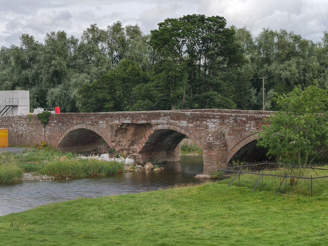
Penrith is located in the Eden Valley, just north of the River Eamont. Other local rivers bounding the town are the River Lowther and the River Petteril. Thacka Beck flows through the centre of the town in a partially man-made watercourse, remaining mostly underground. It connects the River Petteril and the River Eamont. For many centuries, the Beck provided Penrith's main water supply. Thacka Beck Nature Reserve provides flood storage which protects homes and businesses in Penrith. Another stream, known as The Myers or Dog Beck, flows through and under the southwestern area of the town, joining Thacka Beck near Tynefield Court. The Dog Beck section has also been referred to as Scumscaw Beck or Tyne Syke. In 2014 the pub chain Wetherspoons opened a branch in Penrith, naming it after the Dog Beck. Thewre are also streams or becks running through the Carleton area of the town.
Divisions and suburbs
Castletown
Castletown is the area to the west of the West Coast Main Line railway line and includes the Gilwilly Industrial Estate and part of the Penrith or Myers Industrial Estate. The area - which was originally built to house workers on the railway line - mostly consists of late 19th and early 20th century (mainly terraced housing) including some council housing but since the 1990s developments such as Greystoke Park, Castletown Drive and Castle Park have sprung up.
There was until March 2010 a pub in the suburb, The Castle Inn and in previous years there was a sub-post office, a Co-op store and other shops all now closed. Until the 1970s Castletown had its own church, St Saviour's in Brougham Street which acted as a chapel of ease to Penrith's parish church of St Andrew and was originally built as a primitive methodist chapel. As of 2017 the Oasis Evangelical Church holds services at the Brackenber Court sheltered housing complex in Musgrave Street and The Church in the Barn Elim Pentecostal church have services at the community centre at Gilwilly.
The suburb has a community centre on the recreation ground at Gilwilly and did until recently hold an annual gala day and parade throughout Penrith. At one time in the mid-20th century elections were held amongst regulars at the Castle pub to find a Mayor of Castletown. There is a long-standing rivalry between the Castletown and Townhead districts.
Townhead
Townhead is the general name for the northern area of the town, which also includes the Fair Hill district and the Voreda Park or Anchor housing estate. The main part of area is built along both sides of the A6 road heading up the hill in the direction of Carlisle. The road is streetnamed as Stricklandgate and Scotland Road but on maps dating before the mid-19th century was just marked as Town Head.
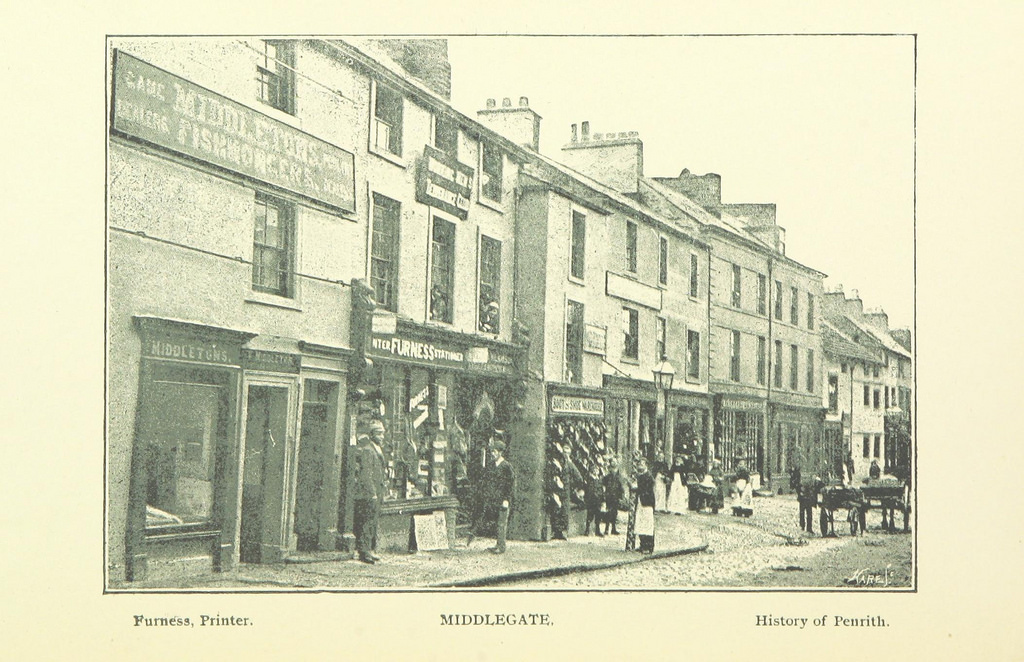
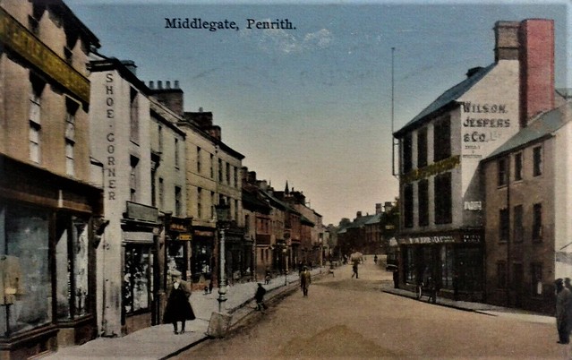
Town Head was one of the 7 constablewicks that the ancient parish of Penrith was divided into the others were Middlegate, Burrowgate, Dockray and Netherend within the town proper and Plumpton Head and Carleton outside the town.
New Streets
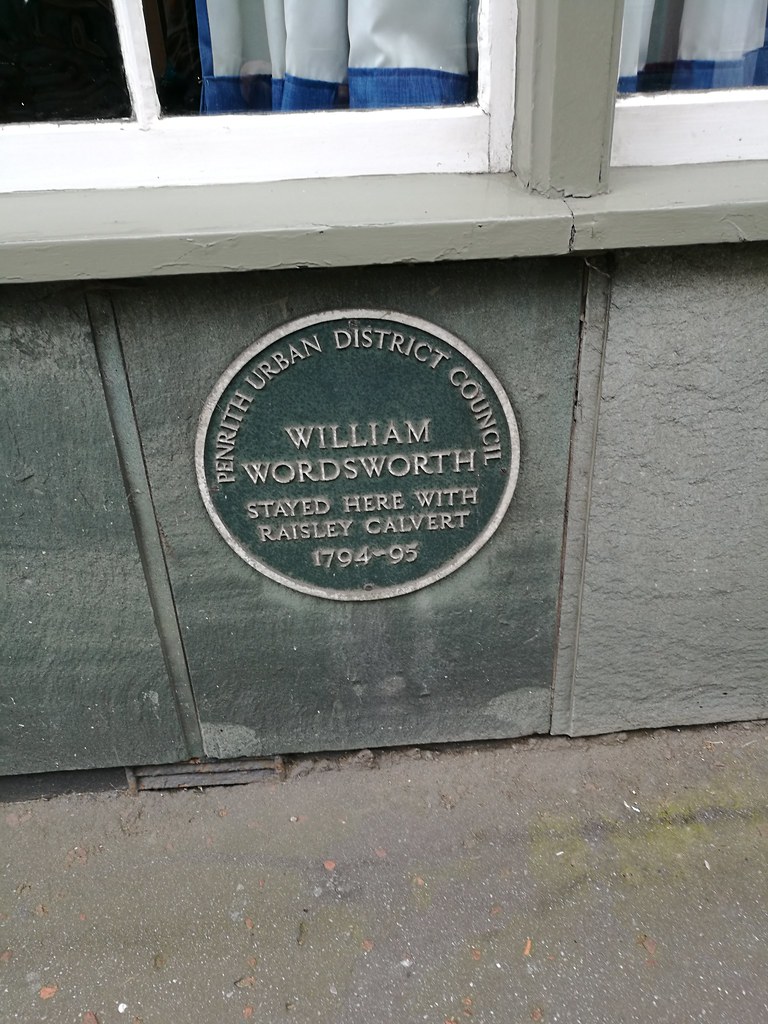
The New Streets is a name for the area between Townhead and Scaws on the side of the Beacon Hill (or Fell) which consists of steep streets of some terraced housing but mainly large detached and semi detached houses mostly laid out in the late 19th century going up the hill. The streets are - from north to south - Graham Street, Wordsworth Street, Lowther Street, and Arthur Street. The term is sometimes extended to include Fell Lane (which is actually the ancient east road from Penrith town centre leading to Langwathby), and Croft Avenue and Croft Terrace (dating from c.1930). However, the late date of the development of the latter streets place them outwith the traditional definition of the term. At the foot of the streets is Drovers Lane formerly known as Back Lane which is sub-divided in parts into Drovers Terrace, Wordsworth Terrace, Lowther Terrace, Bath Terrace, Arthur Terrace, Lonsdale Terrace and finally Meeting House Lane. Running along the top of the streets is Beacon Edge from which extensive views can be seen over the town and towards the Lake District. Until about the turn of the 20th century, Beacon Edge was known as Beacon Road. As well as the streets going up the fellside there are some that connect the streets such as Beacon Street and smaller housing developments in the gaps between the individual streets. The fellside is known to have been used as a burial ground for victims of the many attacks of plague which struck Penrith down the centuries, and there are also areas which still bear the names of the farming which took place in the area. For example, a now wooded enclosed area on Fell Lane is still known as 'the Pinfold' (or Pinny) and was used to house stray animals until their owner paid a fine to release them. Also, a lane off Beacon Edge is still known as 'Intack Lane' (that is, the lane to farmed land). Most of the land that formed the "intack" itself was used to form Penrith Cemetery.
Scaws
The Scaws Estate was first built by Penrith Urban District Council almost immediately after World War II on land previously known as The Flatt Field and Scaws Farm which formed part of the Lowther Estates. Scaws Farm is now known as Coldsprings Farm. The name was changed following a murder which took place at the farm. In later years some private housing was built on the higher parts of the estate. Beaconside Infants and Junior Schools are located in the centre of the estate and there were at one time 3 corner shops and a launderette in the area. Adjoining Scaws are the privately owned Barcohill and Meadow Croft housing estates.
Carleton
Carleton, once a separate settlement, is an area of Penrith. Carleton Village itself is a small line of houses along one side of the A686 road that forms part of the boundary of the town's built up area.Carleton Hall is the headquarters of the Cumbria Constabulary.
Pategill
Adjoining Carleton is the Pategill Housing Estate which started as a council estate on land that once formed part of the Carleton Hall estate in the 1960s and is still mostly owned by housing associations. Two streets on the estate namely Prince Charles Close and Jubilee Close were opened by HRH The Prince of Wales in 1977. The centre of the estate is accessible by foot only and there was until 2012 a small convenience store here. Several properties are run as sheltered housing for the elderly.
Wetheriggs
The Wetheriggs, Skirsgill and Castle Hill or Tyne Close areas were first developed in the 1920s by the Penrith UDC on land formerly known as Scumscaw and the first private housing to be developed was Holme Riggs Avenue and Skirsgill Gardens just prior to World War II. Further development did not start until the 1960s and 1970s when land between Wetheriggs Lane and Ullswater Road was built on though it was not until the late 1980s that the two roads were connected after the building of the Clifford Road extension which saw the Skirsgill area developed. Within the area are three schools: Ullswater Community College. North Lakes Junior and Queen Elizabeth Grammar School (QEGS). The Crescent on Clifford Road is a block of elderly sheltered accommodation. There was formerly a shop at the junction of Huntley Avenue and Clifford Road next to North Lakes School. The large North Lakes Hotel and Spa stands at the junction of Clifford and Ullswater Roads overlooking the Skirsgill Junction 40 Interchange of the M6 motorway, A66 and A592 roads.
Penrith New Squares
Plans to expand the town centre of Penrith southwards into the Southend Road area began to be achieved with the expansion of the swimming pool into a modern leisure centre complex. Previously the area was used as car park and sports fields including ones used by Penrith and Penrith United Football Clubs. The plans for the rest of the scheme were developed by the property company Lowther Mannelli and included a new Sainsbury's supermarket (though previously it was thought that it was going to be a branch of Tesco or Booths), new shopping streets, car parking and housing. The name of the scheme is Penrith New Squares as the new shops were going to be centred around two squares which would provide parking and places for public entertainment.
Work on the development was suspended in October 2008 due to a lack of funding during the financial crisis, but a new deal was agreed with Sainsbury's and work was resumed in 2011. This updated scheme includes less new housing and parts of the scheme were deferred for up to five years. Sainsburys opened in December 2011. In June 2013 the first shop in the squares opened together with the walk through from Sainsburys to the town centre.
Climate
As with the rest of the British Isles and North of England, Penrith experiences a maritime climate with cool summers and mild winters. The nearest Met Office weather station is at Newton Rigg, about a mile outside of the town centre. Temperature extremes range from during August 1990, down to in February 1969, although this was nearly eclipsed by a temperature of during December 2010. Newton Rigg also holds the record for the coldest April temperature reported in England during April 1917.
Landmarks
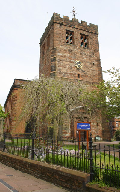
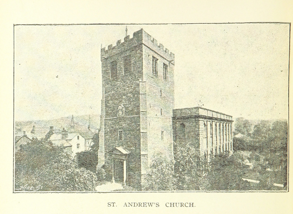
The main church is St. Andrew's, built from 1720 to 1722 in an imposing Grecian style, abutting an earlier 13th-century tower. The churchyard has some ancient crosses and hogback tombstones in it known now as "Giant's Grave", and "Giant's Thumb" which is the remains of a Norse cross dated to 920 AD.
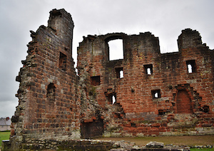
The ruins of Penrith Castle (14th-16th centuries) can be seen from the adjacent railway station. The castle is run as a visitor attraction by English Heritage. To the south-east of the town are the more substantial ruins of Brougham Castle, also under the protection of English Heritage. To the south of the town are the ancient henge sites known as Mayburgh Henge and King Arthur's Round Table. Both are under the protection of English Heritage.
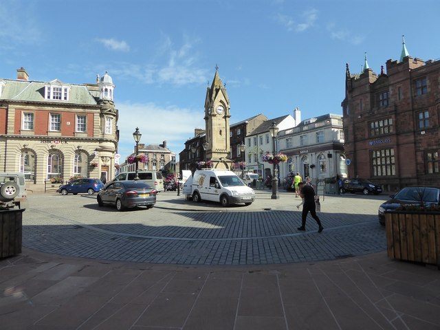
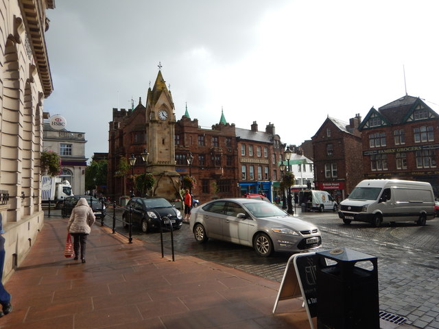
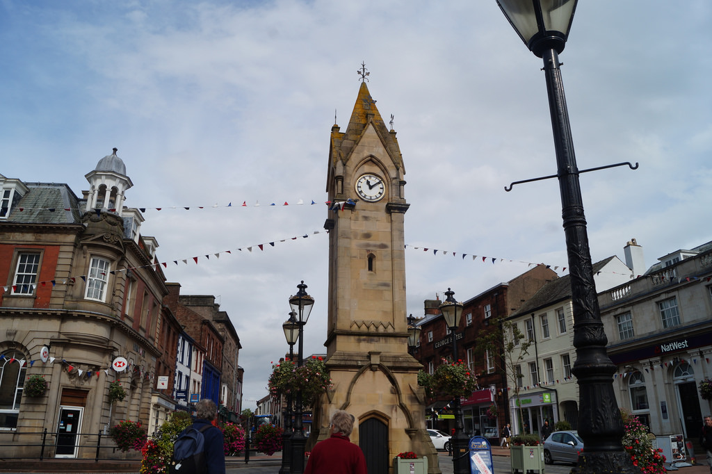
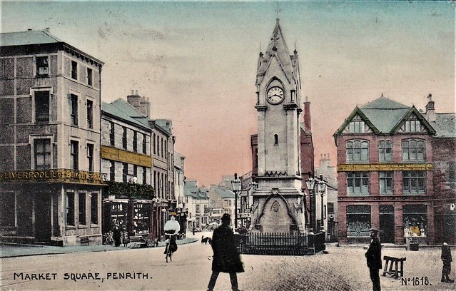
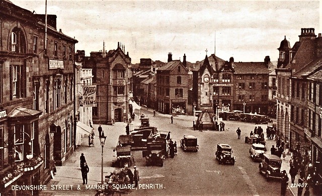
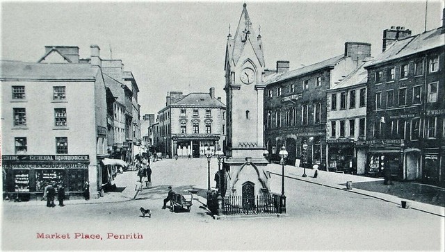
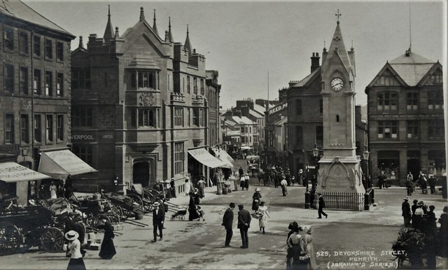
In the centre of the town is the Clock Tower, erected in 1861 to commemorate Philip Musgrave of Edenhall. Hutton Hall, in Friargate preserves a 14th-century pele tower at the rear, attached to an 18th-century building. Dockray Hall (formerly the Gloucester Arms) is said to date from c1470 and may incorporate the remains of another pele tower. Richard, the Duke of Gloucester before he became King Richard III resided here whilst he carried out extensive work at Penrith Castle around 1471.
Penrith has been noted for the number of wells in and around the town, and well-dressing ceremonies were commonplace on certain days in the month of May. Three miles south-east of the town, on the River Eamont are the "Giants' caves", where the well was dedicated to St. Ninian. The caves are enlarged out of Lower Permian sandstones and their associated breccias and purple shales.
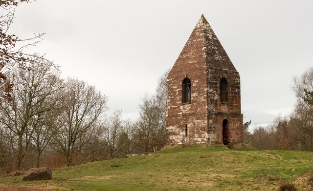
Just to the north of the town is the wooded signal-beacon hill, naturally named Beacon Hill, but originally called Penrith Fell. It last use was probably in 1804 in the war against Napoleon. Traditionally, the Beacon Pike was used to warn of approaching danger from Scotland. Today, although surrounded by a commercial woodland owned by Lowther Estates, the hill still contains some natural woodlands and is visited by locals and tourists. On a clear day the majority of the Eden Valley, the local fells, Pennines and parts of the North Lakes can be seen. It is almost certain that the Beacon Hill gave Penrith its name - in Celtic - of "red hill".
A fibreglass -tall statue of King Kong once stood in the Skirsgill Auction Mart.
Transport
Situated just off Junction 40 of the M6 motorway, the A66, the A6 and the A686 intersect in the town.
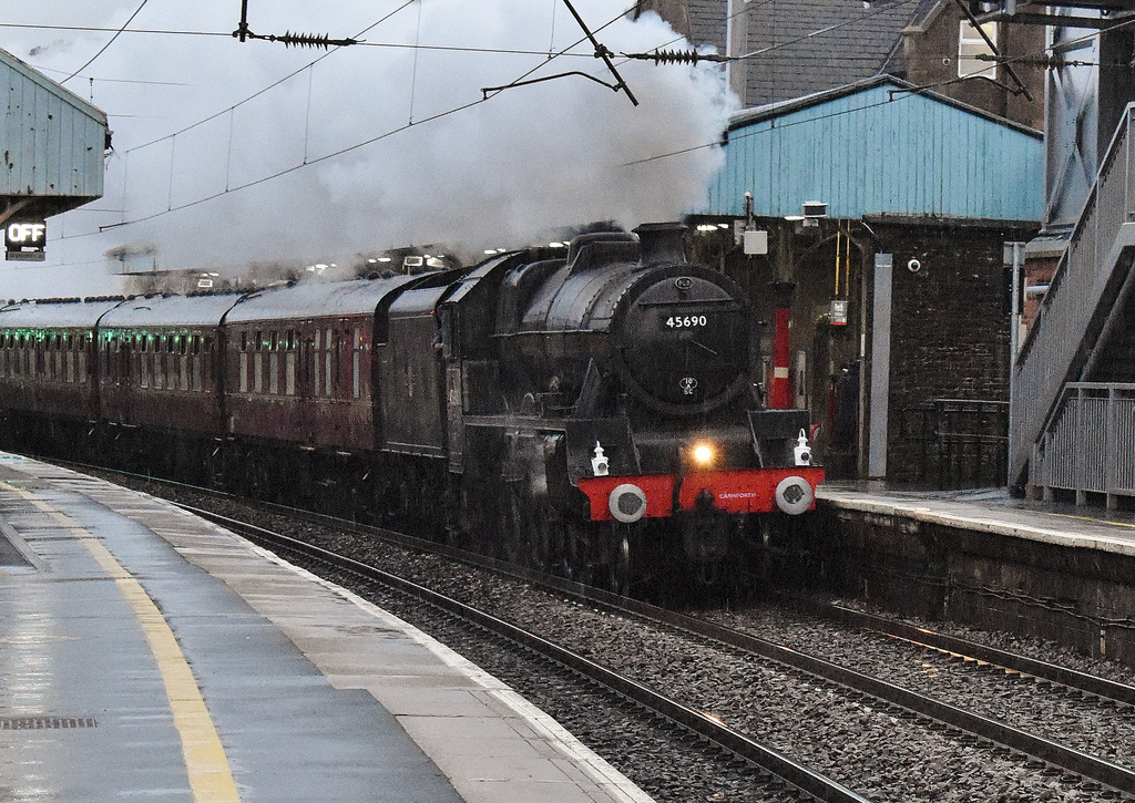
Penrith is also a stop on the West Coast Main Line, with the town's station (dating from 1846) officially known as 'Penrith North Lakes'. Since the upgrade to the West Coast Main Line was completed in 2008, the number of trains stopping at Penrith was reduced, and the town now has an irregular service of fast trains to/from London, Birmingham, Manchester, Glasgow and Edinburgh.
National Express operate two long-distance coach routes with stops in Penrith.
The National Cycle Network's major National Route 7 runs through the town, and National Route 71 stops just short of the southern edge of the town.
Penrith has a number of taxi firms operating in the town which are licensed by Eden District Council. The main taxi rank is on Sandgate in the middle of town, near the bus station, and there is another outside the railway station that is useful for commuters.
Local buses are operated mostly by Stagecoach in Cumbria, with frequent links to Carlisle, Keswick and West Cumbria, Ullswater and less frequent to Windermere, Appleby-in-Westmorland and Kendal but there is also the 646 town service, run by local firm NBM Motors which serves most of the town hourly. Also, the Fellrunner buses connect Penrith to villages in the Eden Valley and a daily service to Alston and Newcastle-upon-Tyne is run by Wright Brothers of Nenthead.
The bus station is in the town centre off Sandgate, but originally was within Sandgste itself. Also, many services stop at the railway station.
Public Services
Health
Penrith Hospital and Health Centre is situated along Bridge Lane at the southern entrance to the town close to the Kemplay Bank roundabout where the A6, A66 and A686 meet. These facilities are administered by the Cumbria Partnership NHS Trust.
The hospital was opened in 1970 replacing the Jubilee Cottage Hospital on Beacon Edge, Fairhill Fever Hospital, and the maternity home at the former workhouse in Castletown. The hospital comprises wards for elderly and mental health care, a minor injuries and Primary Care Assessment unit, a small maternity wing and The Lady Anne Clifford Day Hospital there are various weekly clinics that take place at both the hospital and health centre.
The health centre was opened in 1983 alongside the hospital and brought all 3 of Penrith's NHS medical practices into one building (2 of these practices have since merged) there is also a pharmacy within the centre.
There are several dental practices within the town some offering treatment through the NHS and others exclusively private.
Police
Penrith falls within the territory of the Cumbria Constabulary whose headquarters are at Carleton Hall on the outskirts of the town. Penrith's own police station is located in Hunter Lane.
Fire
Carleton Hall is also the location of Penrith's fire station and headquarters of the Cumbria Fire and Rescue Service.
Ambulance services
The North West Ambulance Service has a station in Tynefield Drive close to hospital.
The Great North Air Ambulance Service has its Cumbrian base close to Penrith at Langwathby and was at one time based at Carleton Hall.
The Penrith Mountain Rescue team whose operating area covers the Eden Valley, North Pennines and the area towards the Scottish border also has a base in Tynefield Drive.
Notable people
Nightlife
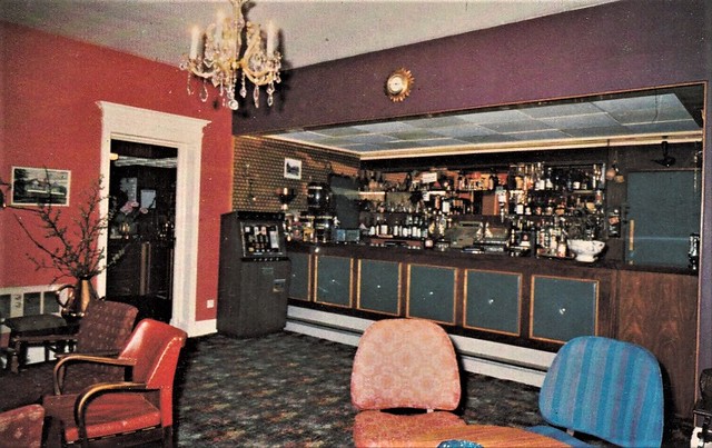
Like other rural towns of its size, Penrith relies on public houses to form the basis of social entertainment, and was once famous for the sheer number of pubs in the town and at one time the town had five working breweries. There were once many more pubs in the town than there are now, and the trend of pub closure is still continuing. Despite this, there are still a considerable number of pubs in the town. These range from traditional, small pubs that have a loyal clientele to the bigger bars which form part of the "circuit". Penrith also has numerous dining places and restaurants.
The Lonsdale (formerly the Alhambra) in Middlegate is a cinema with three screens built in 1910 by William Forrester. There was until the 1980s another cinema called the Regent on Old London Road.
Amateur dramatics and musicals are staged at the Penrith Players Theatre, Ullswater Community College and Queen Elizabeth Grammar School.
Penrith dialect
The Penrith dialect known as Penrithian, is a variant of the Cumbrian dialect spoken around the Penrith and Eden district area.
Media
The local newspaper, the Cumberland and Westmorland Herald, goes on sale every Saturday. Sections of the Herald are updated every following Tuesday on their website. The Herald is independently owned, with offices on King Street, but is printed at the Newsquest's printing works in Glasgow, where the weekly Cumberland News and daily paper the News and Star which also cover some news items from Penrith are printed. A separate edition of the Herald is published for the Keswick area, and is known as the Lake District Herald.
Penrith lies with the ITV Border region and the BBC's North East and Cumbria region. There are three local radio stations serving the Penrith area. Eden FM which is based in Penrith and two others based in Carlisle. These are BBC Radio Cumbria and the independent station CFM.
Penrith was used as a setting in the 1940 book Cue for Treason by Geoffrey Trease and was a setting for the 1987 film Withnail and I by Bruce Robinson.
Education
Uniformed Youth Organisations
Penrith is home to two Community Cadet Forces units:
- 1247 Squadron of the Air Training Corps
- Penrith Detachment of Cumbria Army Cadet Force
Primary schools
- Brunswick School (formerly County Infants), Brunswick Road
- Beaconside Primary, Eden Mount/Brent Road (until 2008 there were separate Beaconside Infant and Junior schools)
- North Lakes School (formerly Wetheriggs Junior; was at first a girls only school), Huntley Avenue - North Lakes is one of the first Schools in England to be awarded a Sing Up Gold Award (Dec 08) and their highest accolade a Sing Up] Platinum Award (Dec 08).
- St Catherines Roman Catholic Primary, Drovers Lane
- Hunter Hall (independent preparatory school), Frenchfield.
Secondary schools
- Ullswater Community College (formerly Ullswater High School, and before that, two single sex secondary modern schools on the same site called Tynefield (girls) and Ullswater (boys)), Wetheriggs Lane.
- Queen Elizabeth Grammar School (QEGS) (selective), Ullswater Road.
Further Education
- The Yorkshire agricultural college Askham Bryan College has a campus just outside the town at Newton Rigg. The University of Cumbria has a centre for Conservation, Forestry, Outdoor Studies and Policing; based on the same campus.
- Ullswater Community College had a large further or adult education centre
Former schools in the town include:
- Girls National School (building now housing school replaced by Beaconside Juniors), Drovers Lane
- Boys National School or St Andrews School for Boys (building now demolished school replaced by Beaconside Juniors), Benson Row
- National Infants School (now Penrith Playgroup Nursery School), Meeting House Lane
- Robinsons School - this was a girls only school founded with 29 pupils which later became a mixed (infant) school founded in 1670 by William Robinson, a local merchant who made good in London. It now houses the town's museum and tourist information centre, Middlegate, and has the following inscription above the door: "Ex sumptibus DN Wil Robinson civis Lond anno 1670 DN"
- County Girls School (building now part of Brunswick Infants the school was replaced by Wetheriggs school), Brunswick Road
- County Boys School (the building now QEGS Sixth Form Centre, also was for a while an annexe to Wetheriggs. The school merged with Wetheriggs Girls to form Wetheriggs Junior), Ullswater Road
- Tynefield Secondary Modern (originally co-educational but later girls only), Wetheriggs Lane
- Ullswater Secondary Modern (boys only), Wetheriggs Lane. Ullswater & Tynefield schools and buildings merged to create Ullswater High in 1980.
Churches
Church of England
- St Andrew's Church is the ancient parish church of Penrith Parish, situated in the centre of Penrith and is the largest church of the four parishes which make up the Penrith Team Ministry.
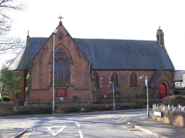
- Christ Church, Drovers Lane/Stricklandgate, open in 1850 and formerly a separate parish but from 1968 to 2008 was part of the United Parish of Penrith. It is now, once again, a separate parish church for the northern part of the town, remaining within the Penrith Team Ministry.
Roman Catholic Church
- St Catherine's, Drovers Lane.
Methodist Church of Great Britain
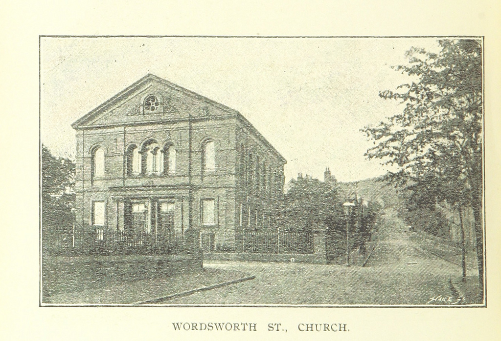
- Penrith Methodist Church, Wordsworth Street.
Others
- United Reformed Church, Lowther Street.
- Society of Friends, Quaker Meeting House, Meeting House Lane.
- Gospel Hall Evangelical Church, Albert Street/Queen Street.
- King's Church Eden - part of the Newfrontiers family of churches.
- Oasis Evangelical Church, Brackenber Court, Musgrave Street
- Salvation Army, Hunter Lane
- Church in the Barn, Castietown Community Centre, Gilwilly
Economy
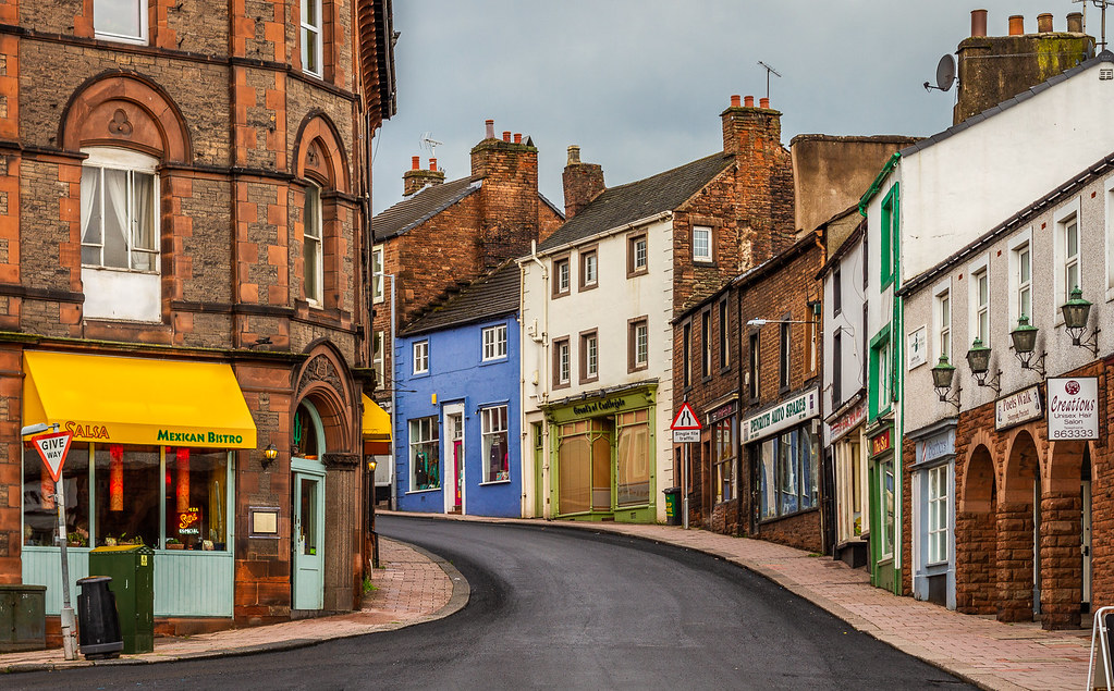
As a small market town relying quite heavily on the tourist trade Penrith benefits from a mix of some high street chain stores and many small local specialist shops. Though as has happened with many towns of a similar size a lot of shops have given way to business such as banks, building societies and travel agents
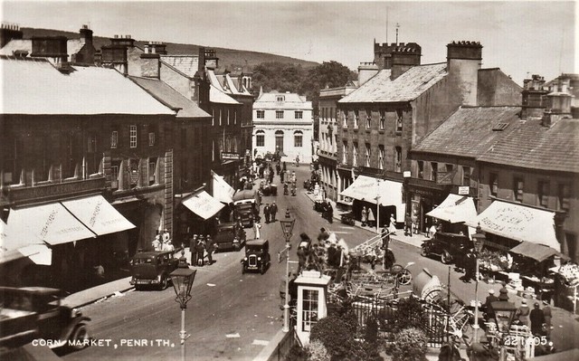
Market days are traditionally Tuesday and Saturday. On Tuesdays there was a small outdoor market in Great Dockray and Cornmarket this market stopped taking place in the early 21st century since then once a month a small Farmers' Market has been held in the Market Square. On Saturdays at the Auction Mart alongside the M6 motorway Junction 40 takes place Cumbria's largest outdoor market.
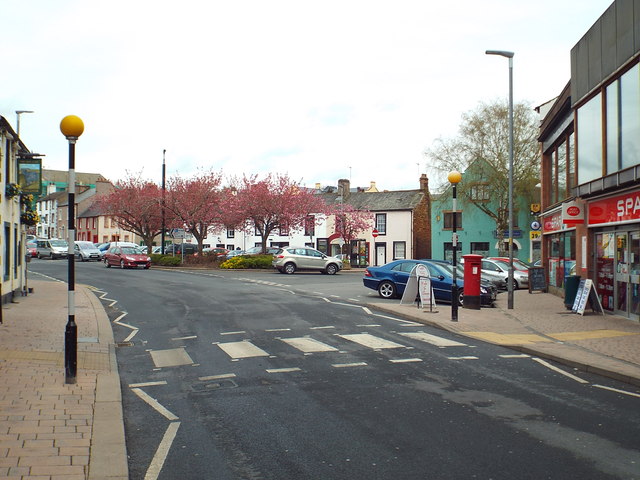
The main shopping areas in the town centre are Middlegate, Little Dockray, Devonshire Street/Market Square, Cornmarket, King Street, Angel Lane and the Devonshire Arcade and Angel Square precincts with some shops in Burrowgate, Brunswick Road and Great Dockray.
Although the main industries in the area are based around tourism and agriculture there are some other industries reperesented within Penrith for example Greggs in 2011 opened a new bakery at Gilwilly replacing 2 bakeries in the Friargate area that used to belong to the Penrith-based Birketts firm; Domino's Pizza have a dough manufacturing site at Gilwilly and the model firm Lilliput Lane (now part of Enesco) was founded in Penrith and until March 2009 had its main factory at Skirsgill Park. Also at Penrith Industrial Estate is the Penrith Door Company factory formerly belonging to Magnet Joinery, now part of the American based JELD-WEN group.
Agricultural based industries include BOCM Pauls who have a large animal feed mill on the Penrith Industrial Estate and until 2005 there was another Feed Mill at Gilwilly originally belonging to Cumberland and Westmorland Farmers Ltd but eventually becoming part of the Carrs Milling Industries group. Local butchers Cranstons have an expanding meat packing, pies and sandwich manufacturing site alongside their shop and head office on Ullswater Road.
In the past Penrith was known for its tanning industry and breweries. The tanning factories were located mainly in the Friargate/Old London Road area of the town. There were at one time five working breweries in the town.
Penrith in recent years has attracted many large, international haulage firms to open depots beside the M6.
Sport
Penrith is home to Penrith Rugby Union Football Club who currently play in the RFU National League 3 North. Home games are played at Winters Park in Penrith.
Penrith Town F.C. play in the Northern Football League.
Penrith also has a skatepark recreational area by the Penrith Leisure Centre. The skatepark opened in 2007.
Penrith has a Golf Club and Driving Range. Penrith Castle Park houses the town's Bowling Club.
Penrith Swimming Club was founded in 1881 and was then based at Frenchfield in the River Eamont. Training sessions originally involved great variations of conditions that challenged the skills of any swimmer. Icy water, strong currents and obstacles like weed and the odd eel or two provided the ultimate test of stamina. It was all a far cry from conditions for today's training sessions, held at Penrith Leisure Centre.
Penrith Canoe Club, founded in 2012, trains at the local leisure centre. Its main discipline is Canoe Polo and the club was represented at the World Championships in Syracuse, Italy 2016 in the u21 Women's squad who finished a respectable 4th.
Penrith Tennis Club is located in the grounds of Penrith Rugby Club at Carleton Village, Penrith.
Twin town
Since 1989 Penrith has had a twinning arrangement with the Australian city named after it in New South Wales.
Regular Events
Mayday Carnival
On every first Monday in May, Penrith holds its Mayday Carnival. The Carnival includes a parade, street dancers and fairground rides. The fairground rides are situated in the Great Dockray and Market Square car parks situated in the commercial area of Penrith. The parade includes over 30 floats, vintage cars, a marching band, various local celebrities and members of the Penrith Lions Club. The parade starts in the yard of Ullswater Community College and ends in the bus station car park. Many of the roads in the town centre are closed for this event. The carnival is held by the Penrith Lions Club.
Penrith Agricultural Show
The first Penrith Show was held in 1834. Since then this annual celebration is held on the fourth Saturday in July each year
The Winter Droving
Held in late October/early November 'The Winter Droving Festival' celebrates all things rural, traditional and fun. The event highlight is a torch lit procession through the town featuring fire, lanterns, masquerade and music and mayhem. The event is a celebration of Penrith and its age old role as the market place for the local area, a place where for centuries livestock and produce has been brought for sale.
Kendal Calling Music Festival held in late July each year at Lowther Deer Park. Headline acts have included the Stereophonics, Tinie Tempah, Editors and the Manic Street Preachers
Potfest in the Pens and Potfest in the Park
Ceramic Festivals held at Skirsgill Auction Mart and Hutton in the Forest.
Lowther Show - held at nearby Lowther Castle each August including the famous Lowther Horse Trials as attended in the past by Prince Phillip.
Visit the page: Penrith, Cumbria for references and further details. You can contribute to this article on Wikipedia.
from Flickr (flickr)
Image taken from page 148 of 'History of Penrith from the earliest record to the present time ... Illustrated'
Pinned by Simon Cotterill
Co-Curate Page
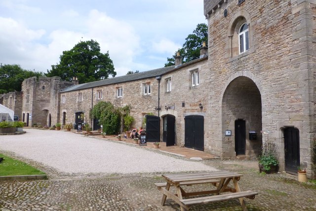
Brougham Hall
- Overview About Brougham Hall Map Street View Brougham Hall is located in the village of Brougham just outside Penrith, Cumbria, England. History The de Burgham family may have held …
Co-Curate Page
Historic Buildings and Monuments in Penrith
- Listed buildings and scheduled monuments in Penrith, Cumbria, from the National Heritage List for England[1]. Use the Search (below) if looking for a specific building / monument. Structure List No. …

from Flickr (flickr)
MARKET SQUARE PENRITH old postcard to Miss Fletcher Page Terrace Norton on Tees
Pinned by Peter Smith
from Flickr (flickr)
OLD - Vintage Postcard - Devonshire Street & Market Square - Penrith
Pinned by Peter Smith

from Flickr (flickr)
RELIABLE SERIES Postcard 1906 MARKET PLACE PENRITH CUMBERLAND
Pinned by Peter Smith
from Flickr (flickr)
Vintage RP Postcard - Devonshire Street , Penrith , Cumbria .
Pinned by Peter Smith
Co-Curate Page
Carleton, Penrith
- Overview About Carleton, Penrith Map Street View Carleton is a suburb of Penrith, on the eastern edge of the town, close to the River Eamont. Carleton, historically in Cumberland, developed …

from Flickr (flickr)
Image taken from page 148 of 'History of Penrith from the earliest record to the present time ... Illustrated'
Pinned by Simon Cotterill
Co-Curate Page
Brougham Hall
- Overview About Brougham Hall Map Street View Brougham Hall is located in the village of Brougham just outside Penrith, Cumbria, England. History The de Burgham family may have held …
Co-Curate Page
Historic Buildings and Monuments in Penrith
- Listed buildings and scheduled monuments in Penrith, Cumbria, from the National Heritage List for England[1]. Use the Search (below) if looking for a specific building / monument. Structure List No. …
from Flickr (flickr)
MARKET SQUARE PENRITH old postcard to Miss Fletcher Page Terrace Norton on Tees
Pinned by Peter Smith
from Flickr (flickr)
OLD - Vintage Postcard - Devonshire Street & Market Square - Penrith
Pinned by Peter Smith
from Flickr (flickr)
RELIABLE SERIES Postcard 1906 MARKET PLACE PENRITH CUMBERLAND
Pinned by Peter Smith
from Flickr (flickr)
Vintage RP Postcard - Devonshire Street , Penrith , Cumbria .
Pinned by Peter Smith
Co-Curate Page
Carleton, Penrith
- Overview About Carleton, Penrith Map Street View Carleton is a suburb of Penrith, on the eastern edge of the town, close to the River Eamont. Carleton, historically in Cumberland, developed …

Cumbria
Beacon Tower, Penrith
Brougham Castle
Brougham Castle Bridge
Burrowgate, Penrith
Church of St Andrew, Penrith
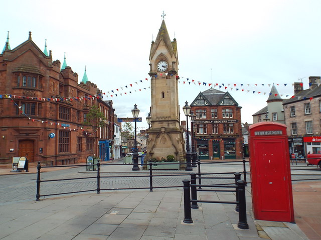
Clock Tower, Market Square, Penrith
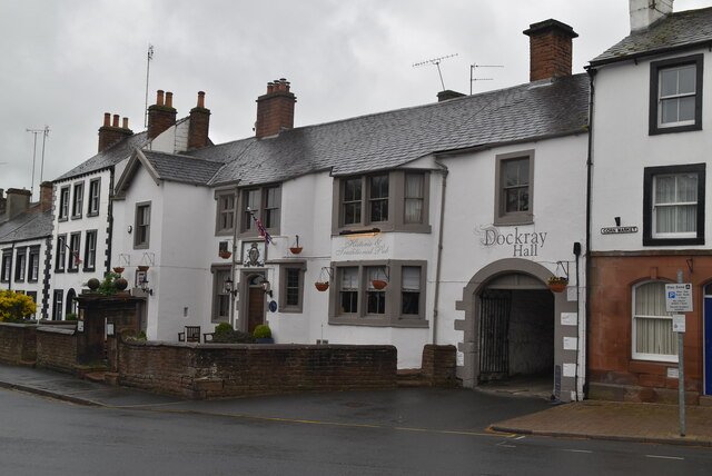
Dockray Hall, Penrith
Friends' Meeting House, Penrith
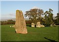
Long Meg and Her Daughters (stone circle)
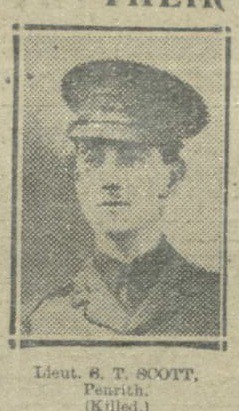
Penrith at War
Penrith Castle

Penrith Conservation Area
Penrith New Streets Conservation Area

Penrith Parish, 1848
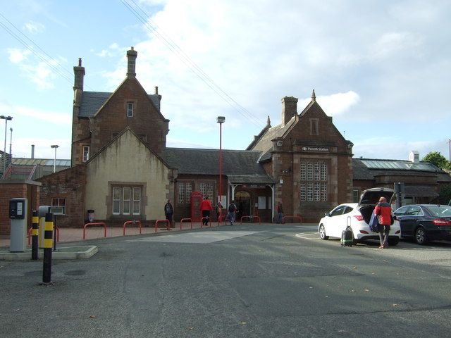
Penrith Station

Penrith, Historical Account, 1890
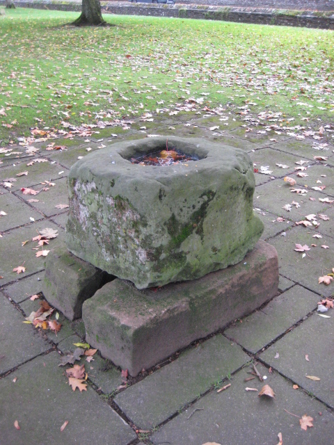
Plague stone, Penrith


