Topics > County Durham > Croxdale > Old Chapel, Croxdale
Old Chapel, Croxdale
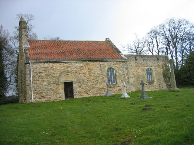
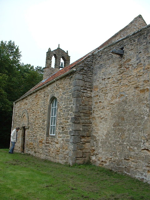
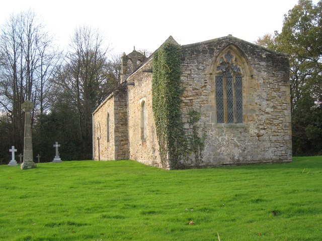
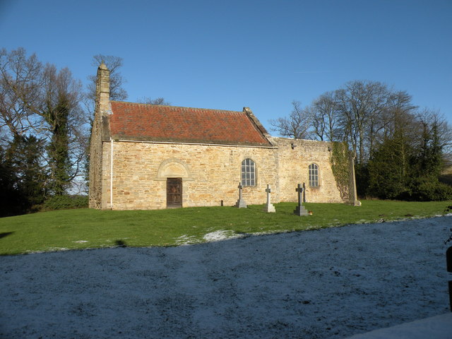
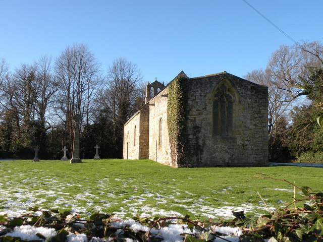
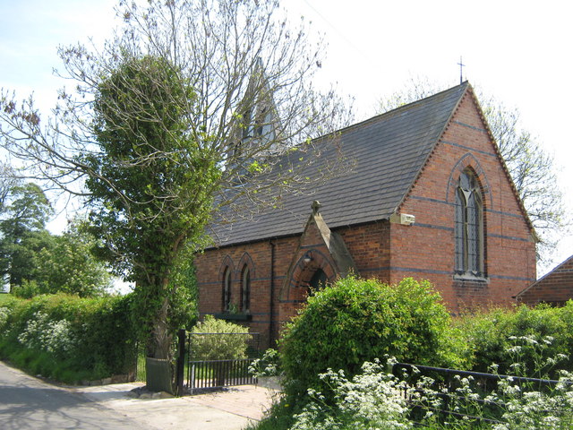
The "Old Church" of St Bartholomew, located by Croxdale Hall, was originally built in the late 11th, or early 12th century. It was formerly a chapel of ease for St Oswald's Church, Durham. The chapel was sold to the Salvin family in c.1845, in exchange for the land to build a new parish church - St Bartholomew's Parish Church, at Sunderland Bridge. The old church was used as a family chapel and the churchyard as a family burial ground.[1] The church is now disused. The old church is Grade I listed on the National Heritage List for England.
from Geograph (geograph)
Croxdale Hall Medieval Church (early 12th Century)
Pinned by Simon Cotterill


from https://historicengland.org.u…
CHURCH 50 METRES NORTH EAST OF CROXDALE HALL - List Entry
- "Disused church. Late C11-early C12 nave; late C12-early C13 chancel, altered in C14 and C15; mainly early C19 windows. Squared sandstone rubble in narrow courses. Pantiled nave roof and felted …
Added by
Simon Cotterill
Co-Curate Page
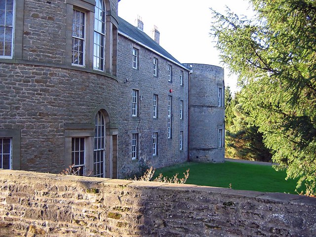
Croxdale Hall
- Overview About Croxdale Hall Map Croxdale Hall is a privately owned country mansion located about half a mile north of the modern village Croxdale in County Durham. The Hall has …
from https://historicengland.org.u…
Croxdale medieval chapel and churchyard cross base
- "....The monument includes a medieval chapel and the socket stone of a churchyard cross, situated 50m north east of Croxdale Hall. Croxdale chapel, now known as Old Croxdale chapel, was …
Added by
Simon Cotterill
Co-Curate Page
Church of St Oswald
- Overview About St Oswald's Church Map Street View St Oswald’s Church is located by the River Wear, on Church Street in the Elvet area of Durham. There has probably been a …

from Geograph (geograph)
Croxdale Hall Medieval Church (early 12th Century)
Pinned by Simon Cotterill
from https://historicengland.org.u…
CHURCH 50 METRES NORTH EAST OF CROXDALE HALL - List Entry
- "Disused church. Late C11-early C12 nave; late C12-early C13 chancel, altered in C14 and C15; mainly early C19 windows. Squared sandstone rubble in narrow courses. Pantiled nave roof and felted …
Added by
Simon Cotterill
Co-Curate Page
Croxdale Hall
- Overview About Croxdale Hall Map Croxdale Hall is a privately owned country mansion located about half a mile north of the modern village Croxdale in County Durham. The Hall has …
from https://historicengland.org.u…
Croxdale medieval chapel and churchyard cross base
- "....The monument includes a medieval chapel and the socket stone of a churchyard cross, situated 50m north east of Croxdale Hall. Croxdale chapel, now known as Old Croxdale chapel, was …
Added by
Simon Cotterill
Co-Curate Page
Church of St Oswald
- Overview About St Oswald's Church Map Street View St Oswald’s Church is located by the River Wear, on Church Street in the Elvet area of Durham. There has probably been a …


List number: 1120740
County: County Durham
Keys to the Past HER: D35839
Grid ref: NZ2740137913


