Topics > Northumberland > Civil Parishes in Northumberland > Kirknewton Civil Parish > Kirknewton Parish, 1855
Kirknewton Parish, 1855
Extract from: History, Topography, and Directory of Northumberland...Whellan, William, & Co, 1855.
KIRK NEWTON PARISH
KIRK NEWTOWN parish Is bounded on the north by the parishes of Ford, Carham, and Branxton, on the west by Scotland, on the south by Coquetdale Ward, and on the east by Doddington and Wooler parishes. It comprises the townships of Akeld, Coldsmouth and Thompson's Walls, Coupland, Crookhouse, Grey's Forest, Heathpool, Howtell, Kilham, Kirk Newton, Lanton, Milfield, Newton West, Paston, Selby's Forest, and Yeavering. whose united area is 37,976 acres. Its population in 1801, was 1,406; in 1811, 1,472; in 1821, 1,701; in 1831, 1,674; in 1841, 1,726; and in 1851, 1,732 souls. The principal landowners are Sir William Davison, Sir F. Blake, Matthew Culley, Esq., George A. Grey, Esq., the Earl of Tankerville, --Morton, Esq., Percival Clennell, Esq., George Rea, Esq., Frank Sitwell, Esq., Lady Stanley, John Ord, Esq., Alexander Thompson, Esq., and Robert Thompson, Esq. This parish occupies an extensive but thinly populated tract, in the south-western part of Glendale Ward.
AKELD is a township and hamlet, containing 2,208 acres, and its population in 1801 , was 153 ; in 1811 , 164 ; in 1821, 167 ; in 1831 , 171 ; in 1841 , 182 ; and in 1851, 186 souls. THE HAMLET of Akeld is situated two and three quarter miles W.N.W. of Wooler.
DIRECTORY. George Cranston, cartwright; and the farmers are John Hogarth, and James Rutherford.
COLDSMOUTH AND THOMPSON’S WALLS form a township, about three miles west of Kirk Newton. The area of the township is 1,415 acres, and the number of its inhabitants in 1801, was 32; in 1811, 49; in 18~H, 44; in 1831, 41; in 18-il, 38; and in 1851, 20 souls. The principal residents are Charles Rea, farmer, Coldsmouth ; and George Tait, farmer, Thompson's Walls.
COUPLAND township, the property of Matthew Culley, Esq., is situated four miles north-west by west of Woo1er, and comprises an area of 1,428 acres. The population in 1801, was 70; in 1811, 101; in 1821,98; in 1831, 100; in1841, 109; and in 1851, 160 souls. Coupland was anciently part of the barony of Wooler, and was held by the Muschampe family. It after- wards became the property of the Wallaces, from whom it passed to the Ogles, and subsequently to the present proprietor. COUPLAND CASTLE is the seat of the Earl of Durham.
DIRECTORY. The Right Hon. the Earl of Durham, Coupland Castle; Adam Richardson, miller; and the farmers are George Fogo, George Howitt, and Adam Richardson.
CROOKHOUSE, a small township, containing 467 acres, is situated six and a half miles W.N.W. of Wooler, and its population in 1801, was 14; in 1811, 12; in 1821, 18; in 1831, 20; in 1841, 18; and in 1851, 29 souls.
GREY'S FOREST township is situated two miles west of Kirk Newton. It comprises an area of 6,615 acres, and the number of its inhabitants in 1801, was 58; in 1811, 49; in 1821, 54; in 1831, 44; in 1841, 56; and in 1851, 44 souls.
HEATHPOOL is a township, five and a half miles west of Wooler. It contains 1,037 acres, and its population in 1801, was 38; in 1811, 48; in 1821, 42; in 1831, 43; in 1841, 51; and in 1851, 44 souls. The principal inhabitants are William Davison, miller, and William Davison, and William Reed, farmers.
HOWTELL is a township and hamlet, containing 1,145 acres, and it contained in 1801, 186; in 1811, 130; in 1821, 190; in 1831, 195; in 1841, 191; and in 1851, 198 inhabitants. THE HAMLET of Howtell is situated two and half miles N.N.W. of Kirk Newton. Here is a Presbyterian Chapel, erected in 1850. It is a fine commodious building, capable of accommodating about 350 persons. Rev. David Taylor, minister.
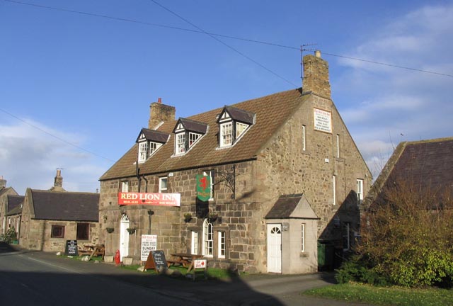
DIRECTORY. Andrew Brown, vict. Plough Inn ; George Douglas, school- master; George Johnson, blacksmith; James Wallace, grocer; and the farmers are Andrew Brown, and Thomas Howie.
KILHAM, a township and village, is the property of the Earl of Tankerville, who is also lord of the manor. The area of the township js 2,855 acres, and its population in 1801, was 206; in l8ll, 252; in 1821,246; in 1831,217; in 1841,279; ·and in 1851,258 souls. THE VILLAGE of Kilham is situated on the north side of Kilham Hills, seven and a half miles W.N.W. of Wooler.
POST OFFICE, KILHAM, Thomas Smith, postmaster. Letters arrive at 5 p.m., and are despatched at 8-30 p.m.
DIRECTORY. George Dickson, joiner and cartwright; George Dickson, jun., joiner and cartwright ; Peter Hogg, shopkeeper ; William Lauder, shop- keeper; Thomas Smith, shoemaker; John Tate, blacksmith; William Percy, tailor; and Alexander Borthwick, farmer.
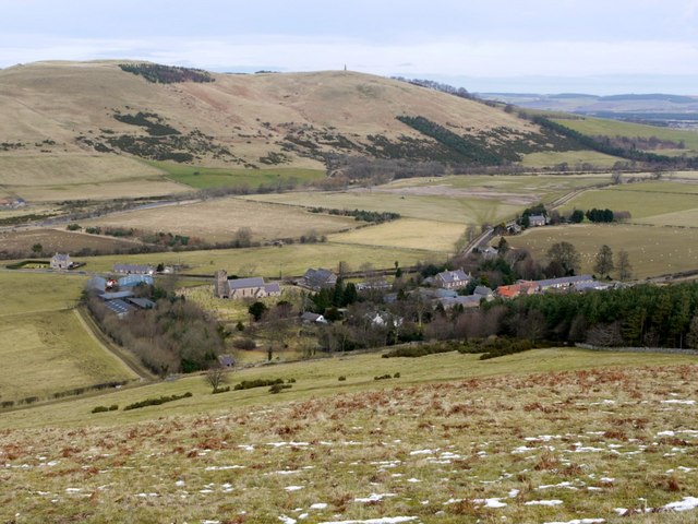
KIRK NEWTON is a township and village, giving name to the parish in which it is situated. The township contains 2,217 acres, and the number of its inhabitants in 1801, was 55; in 1811, 74; in 1821, 83; in 1831, 76; in 1841, 83 ; and in 1851, 88 souls. The manor of Kirk Newton was formerly held under the barony of Wark, by the ancient family of Strothers, from whom it was transferred to John Strother Kerr, Esq., of Nenthorn, in Berwickshire. THE VILLAGE of Kirk Newton is situated five miles W.N.W. of Wooler. THE CHURCH is dedicated to St. Gregory, and the parish register commences in 1790. The living, a vicarage in the archdeaconry of Lindisfarne, and deanery of Bambrough, is valued in the Liber Regis at £3 13s. 4d.; gross income, £-191. Patron, J. Davison, Esq.; incumbent, the Rev. Christopher Robinson, M.A. Here is a National School, a neat small building, attended at present by about 40 children. William Balmer, teacher.
|
Balmer Willimn, schoolmaster and parish clerk Chambers Margaret, vict. Black Bull, Bendor Robinson Rev. Christopher, M.A. vicar Tate John, blacksmith, Thornington
Farmers Anderson James, Hauston Haugh Bromfield James, Reedsford |
Brown Christopher, Tuperie Brown James, Kippie Henderson William, Longley Ford Hunt John, Thornington Rand James, Beaumont Hill Rohson Robert, & William Logan, Sandy House Thompson Alexander Thompson Robert |
LANTON township is situated on the north side of the river Glen, four and a half miles north-west by north of Wooler. It contains 983 acres, and its population in 1801, was 81; in 1811, 60; in 1821, 69 ; in 1831, 78 ; in 1841, 83; and in 1851, 84 souls. Here is a corn mill, worked by Messrs. John and Thomas Hall. The principal inhabitants are John and Thomas Hall, farmers and millers, and Anthony Barber, farmer.
MILFIELD is a township and village, the property of several proprietors, The area of the township is 1,4 71 acres, and its population in 1801, was 193; in 1811, 168; in 1821, 259; in 1831, 262; in 1841, 225; and in 1851, 246 souls. This township was formerly the property of the Muschampe family. THE VILLAGE of Milfield is situated six miles north-west of Wooler, and on its south side is the famed plain of Milfield. In August, 1402, Earl Douglas, who had a grant of the estates of the Earl of March, and anxious to drive him to his ruin entered Northumberland. Ten thousand warriors, the best of Scotland, followed the banner of Douglas, who flew like a meteor from the Lothians to the Tweed, from the Tweed to the Tyne, and carried devastation to the very walls of N e1vcastle, without finding any force to oppose him. He then retraced his steps loaded with plunder. During his advance to the south, the Earl of Northumberland, and his son Hotspur, with his deadly enemy the Earl of March, gathered a numerous army in the rear. Douglas, hampered by his spoil, came suddenly upon this force, which was posted near Milfield. He perceived a strong position between the two armies called Homildon Hill, and he had the good sense to seize it. The English, with the people of the Earl of March, occupied the ridges of a neighbouring hill, but they left it to advance to the assault, and Hotspur was about to charge up the hill of Hornildon, when the Earl of March caught his bridle, and advised him to stay where he was, and begin the fight with his archers, not with his horse. The advice was taken, the English bowmen advanced to the foot of the hill, and shot upwards with wonderful force and correct aim. Instead of charging at first, as Bruce did the English archers at Dannockburn, Douglas did nothing, but left his people drawn up in ranks on the face of the hill, where they presented one general mark to the enemy. Scarcely an English arrow sped in vain, the Scots fell in heaps without fighting. At last Douglas made up his mind to charge down the hill, or, as it is related by Fordun, Swinton, a spirited knight, induced this movement by exclaiming "Oh ! my brave fellow soldiers, what fascinates you to-day, that you stand like deer and fawns in a park to be shot, instead of showing your ancient valour, and meeting your foes hand to hand? Let those who will descend with me, and in the name of the Lord, we will break that host, and conquer; or, if not, at least die with honour, like soldiers." As Douglas descended, the English bowmen retired a little, but they pulled their bows as they withdrew and, presently halting again, sent a flight of arrows so ''sharp and strong," that no armour could withstand it, and as he was spurring forward, the Douglas himself, whose armour was of the most perfect temper, was wounded, though not mortally, in five different places. He fell from his horse, was made prisoner, and then a complete rout of the Scots ensued. Eight hundred of them remained on the field, and five hundred, it is said, were drowned in the Tweed. Besides Douglas, whose principal wound deprived him of an eye, the sort of the Duke of Albany, the Earls of Moray and Angus, two barons, eighty knights, and many other persons of high rank were made prisoners by the Percies. The English men-at-arms, knights and squires, never drew the sword or couched the lance, the whole affair being decided by the archers. Such was the famous battle of Homildon Hill, which was fought on Holy-Rood-Day, 1402.
Roman and other remains have been discovered in this neighbourhood at different periods.
POST OFFICE, MILFIELD, Thomas Clarke, postmaster. Letters arrive at 2-30 p.m., and are despatched at 3-10 p.m.
|
Clark Thomas, draper and grocer Davison Thomas, tailor Gilholme Isabella, shopkeeper Grey George A. Esq. Milfield Hill Grey James, shoemaker Lowrey William, baker |
Marshall William, joiner and cartwright Mowitt Ralph, blacksmith Short John, farmer Thompson Thomas, schoolmaster Turnbull George, farmer Turnbull Gilbert, vict. Red Lion Inn Watson Henry, saddler |
NEWTON (WEST) is a township and hamlet in the above parish, containing 1,063 acres, and the number of its inhabitants in 1801, was 60; in 1811, 68; in 1821, 95; in 1831, 86; in 1841, 83; and in 1851, 91 souls. THE HAMLET of West Newton is situated on the west side of a small rivulet half a mile west of Kirk Newton.
DIRECTORY. James Dodds, farmer and corn miller, Canno Mill; and John Borthwick, farmer.
PASTON is a township and village, containing an area of 2,336 acres, and its population in 1801, was 135; in 1811, 180; in 1821, 209; in 1831, 207; in 1841, 199; and in 1851, 208 souls. It was long the property of a branch of the Selbys of Twizell, who had a seat here. THE VILLAGE of Paston is situated on the south side of the Beaumout, nine miles W.N.W. of Wooler. HARELAW is a hamlet and lofty eminence in Paston township, the miles west of Kirk Newton. The hill, as it name denotes, has been the station of an army, and has a circular entrenchment, with a double rampart and fosse. SHOTTON is another hamlet in this township, situated on the verge of Scotland, five miles west of Kirk Newton.
DIRECTORY. Andrew Thompson, farmer, Shotton; and John Thompson, farmer.
SELBY'S FOREST is an extensive township, consisting of moors and mountains, among the latter of which is the far famed Cheviot, which gives name to an extensive range of hills of various elevations. A lake on the summit of Cheviot is often frozen at midsummer. The area of this township is 11,853 acres, and the number of its inhabitants in 1801, vas 57; in 1811, 60; in 1821, 63; in 1831, 66; in 1841, 61; and in 1851, 49 souls.
YEAVERING is a township and hamlet, containing 883 acres. Population in 1801, 68; in 1811, 59; in 1821, 64; in 1831, 68; in 1841, 68; and in 1851,29 souls. THE HAMLET of Yeavering is situated four and a half miles W.N.W. of Wooler, and appears to have been a place of some importance in ancient times. We find it mentioned as early as the year 627, when it was the residence of Edwin, King of Northumbria, and the scene of the labours of the Roman missionary Paulinus, who, during his stay here, baptized many thousands in the river Glen. The Scots were defeated near this place, in 1414, by Sir Robert Umfraville, then commander of Roxburgh Castle. and the Earl of Westmoreland, then lord warden of the Marches. Sir Robert, with one hundred and forty knights, and three hundred bowmen, defeated four thousand Scots, killed sixty, took one hundred and sixty prisoners, and pursued them for twelve miles into their own country. A rude whinstone column on the south side of the village, points out the scene of this conflict. YEAVERING BELL, a mountain 2,000 feet above the level of the sea, is situated at a little distance south of the hamlet. On its summit is an area enclosed by the remains of a wall 1,000 paces in circumference. Many cairns and druidical remains have been found in this neighbourhood, which seems to have been one of the principal stations of the Druids in the north. The principal resident is Charles Borthwick, farmer.