Topics > Civil Parishes in Cumbria > St John's Castlerigg and Wythburn Civil Parish > Historic Buildings and Monuments in St John's Castlerigg and Wythburn
Historic Buildings and Monuments in St John's Castlerigg and Wythburn
Listed buildings and scheduled monuments in St John's Castlerigg and Wythburn Civil Parish, Cumbria, from the National Heritage List for England[1]. Use the Search (below) if looking for a specific building / monument.
| Structure | List No. | Grade | Built~ | Note |
|---|---|---|---|---|
| No. 1, Stanah Lane | 1144529 | II | ||
| No. 6, Fisher Place | 1144525 | II | ||
| Barn to South East of Burns Farmhouse | 1120889 | II | ||
| Birkett Mire | 1323140 | II | ||
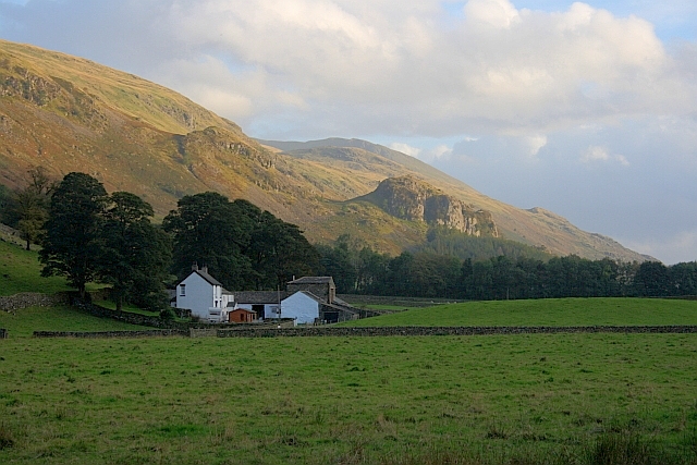
| Bram Crag | 1121122 | II | C17th | St John's in the Vale. Farmhouse. |
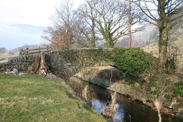
| Bridge North West of Bram Crag | 1144528 | II | C18th | St John's in the Vale. Packhose bridge. |
| Brotto Cottages | 1144530 | II | ||
| Brown Beck Farmhouse and Adjoining Barns | 1120792 | II | ||
| Burns Farmhouse and Adjoining Barn | 1144523 | II | ||
| Castlerigg Hall Farmhouse | 1327193 | II | ||
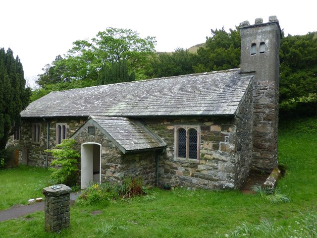
| Church of St John | 1144527 | II | 1845 | St John's in the Vale. |
| Dalehead Cottage | 1144531 | II | ||
| Fornside and Adjoining Barns | 1144524 | II | ||
| Gate, Railings and Wall in Front of Number 6 | 1120827 | II | ||
| Hollin Root | 1323125 | II | ||
| Hollin Root Old House | 1115118 | II | ||
| Kings Head Hotel | 1122678 | II | ||
| Setmabanning | 1122661 | II | ||
| Sosgill Bridge | 1121128 | II | C18th | St John's in the Vale. Packhose bridge. |
| Stone Cottage | 1144526 | II | ||
| Straining Well and Valve House | 1121541 | II | ||
| The Green Farmhouse and Adjoining Barn | 1327194 | II | ||
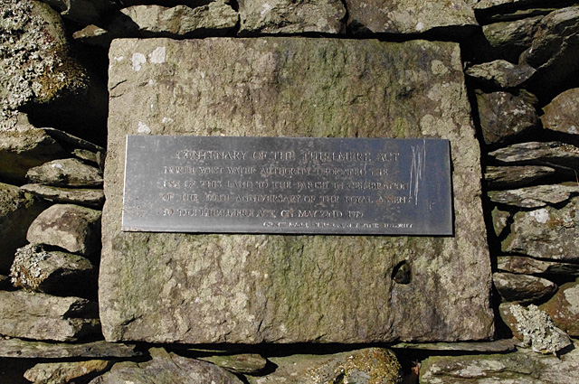
| Wythburn Church | 1144532 | II | 1640 | Wythburn |
| Castlerigg stone circle and two bowl barrows | 1011362 | n/a | 3000 BC | Scheduled Monument |
| Medieval shieling 300m north of Clough Fold | 1012647 | n/a | Scheduled Monument | |
| Two medieval shielings 60m north of Clough Fold | 1012648 | n/a | Scheduled Monument | |
| Two medieval shielings 25m north of Clough Fold | 1012649 | n/a | Scheduled Monument | |
| Two medieval shielings 210m north west of Clough Fold | 1012650 | n/a | Scheduled Monument | |
| Medieval shieling 160m north west of Clough Fold | 1012651 | n/a | Scheduled Monument | |
| Two medieval shielings 240m north west of Clough Fold | 1012652 | n/a | Scheduled Monument | |
| Shoulthwaite Gill hillfort, Thirlmere | 1012942 | n/a | Scheduled Monument | |
| Round cairn on Dunmail Raise | 1011353 | n/a | Scheduled Monument | |
| Prehistoric stone hut circle settlement, irregular aggregate field system,five enclosures,a well,a cairnfield and trackways on St John's and Threlkeld Commons | 1013383 | n/a | Scheduled Monument |
Primary source: the National Heritage List for England - NHLE is the register of nationally protected historic buildings and sites in England, including listed buildings, scheduled monuments, protected wrecks, registered parks and gardens, and battlefields. The list is maintained by Historic England. Check NHLE for updates and new entries. Secondary sources: British Listed Buildings.
Co-Curate Page
Bram Crag farmhouse
- Overview Map Street View Bram Crag farmhouse, in St John's in the Vale, was built in the late 17th century, with alterations in the 20th century.[1] The farmhouse is Grade …
Co-Curate Page
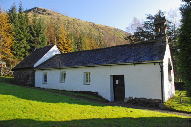
St John's Church
- Overview About St John's Church Map The Parish Church of St John, in St John's in the Vale, was rebuilt in 1845, incorporating maisonary from an earlier church. The Church …
Co-Curate Page
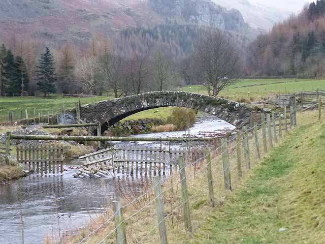
Packhorse Bridge by Bram Crag
- Overview Map Street View The old stone packhorse bridge over St John's Beck, now a footbridge, is located by Bram Crag (farm) near St John's in the Vale. The hump-backed …
Co-Curate Page
Sosgill Bridge
- Overview Map Street View Sosgill Bridge over St John's Beck is located about a quarter of a mile south-west of Bram Cragg (farm) in St John's in the Vale. The …
Co-Curate Page
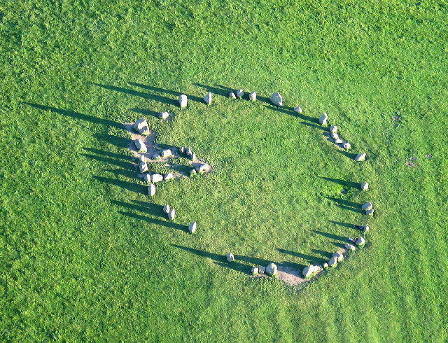
Castlerigg Stone Circle
- Overview About Castlerigg Stone Circle Map Street View Castlerigg Stone Circle, located just over a mile east of Keswick, is one of the earliest stone circles in the UK, thought …
Co-Curate Page
Wythburn Church
- Overview About Wythburn Church Map Street View Wythburn Church is located in an isolated position by the A591 road on the east bank of Thirlmere, Cumbria, England. It is …

Co-Curate Page
Bram Crag farmhouse
- Overview Map Street View Bram Crag farmhouse, in St John's in the Vale, was built in the late 17th century, with alterations in the 20th century.[1] The farmhouse is Grade …
Co-Curate Page
St John's Church
- Overview About St John's Church Map The Parish Church of St John, in St John's in the Vale, was rebuilt in 1845, incorporating maisonary from an earlier church. The Church …
Co-Curate Page
Packhorse Bridge by Bram Crag
- Overview Map Street View The old stone packhorse bridge over St John's Beck, now a footbridge, is located by Bram Crag (farm) near St John's in the Vale. The hump-backed …
Co-Curate Page
Sosgill Bridge
- Overview Map Street View Sosgill Bridge over St John's Beck is located about a quarter of a mile south-west of Bram Cragg (farm) in St John's in the Vale. The …
Co-Curate Page
Castlerigg Stone Circle
- Overview About Castlerigg Stone Circle Map Street View Castlerigg Stone Circle, located just over a mile east of Keswick, is one of the earliest stone circles in the UK, thought …