Topics > Northumberland > Civil Parishes in Northumberland > Heddon-on-the-Wall Civil Parish > Historic Buildings and Monuments in Heddon-on-the-Wall CP
Historic Buildings and Monuments in Heddon-on-the-Wall CP
Listed buildings and scheduled monuments in Heddon-on-the-Wall, Northumberland, from the National Heritage List for England[1]. Use the Search (below) if looking for a specific building / monument.
| Structure | List No. | Grade | Built~ | Notes |
|---|---|---|---|---|
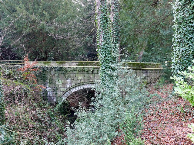
| Bridge Approx 50 Yards West of Close House | 1042804 | II | C18th | |
| Church of St Andrew | 1042770 | I | C7th | With later additions. |
| Close House | 1154745 | II* | 1779 | |
| Close House Lodge and Gateway | 1042802 | II | C19th | |
| Cottage Approx 50 Yards North of West Heddon Farmhouse | 1042772 | II | C17th | |
| Drinking Trough and Fountain in Stable Yard | 1042805 | II | C18th | Close House |
| Farmbuildings and Gingang Attached to East of Heddon Banks Farmhouse | 1154869 | II | C19th | |
| Former Byre and Shelter Sheds North of East Heddon | 1154814 | II | C16th | |
| Garden Wall, Gate and Railings to South of Old Schoolhouse | 1370703 | II | C19th | |
| Ha-Ha Wall, Approx 50 Yards South of Close House | 1042803 | II | c.1779 | |
| Heddon Banks Farmhouse | 1042807 | II | c.1850 | |
| Heddon Hall | 1042769 | II | C18th | |
| Heddon House and West House | 1370685 | II | C18th | |
| Heddon-on-the-Wall Memorial Cross with memorial park walls and gate piers | 1438077 | II | 1922 | |
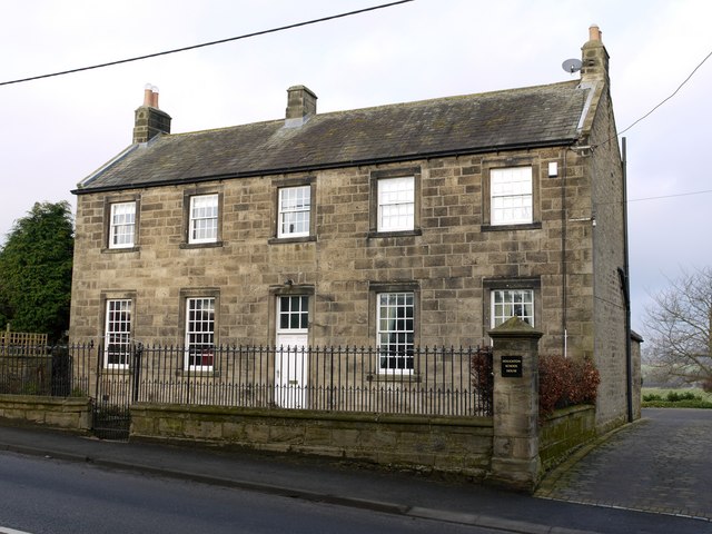
| Houghton North Farmhouse | 1042808 | II | 1802 | Houghton |
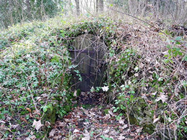
| Icehouse Approx 440 Yds South-West of Close House | 1042806 | II | C19th | |
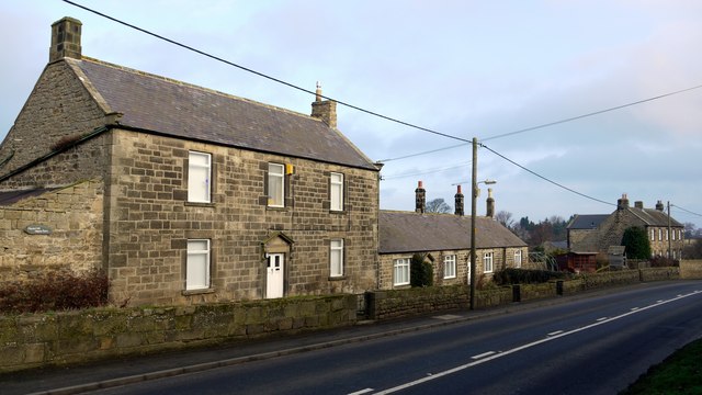
| Merci Beaucoup and No 2 Cottage | 1370702 | II | 1815 | Houghton |
| Old Schoolhouse | 1042767 | II | 1814 | Houghton |
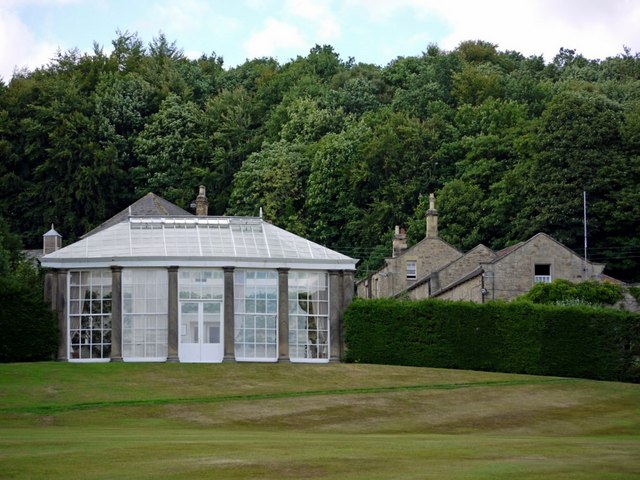
| Orangery Approx 40 Yards West of Close House | 1154794 | II | 1779 | |
| Rudchester (Hall) | 1154705 | II* | C13th | C18th house with medieval tower |
| Shelter Shed, Byre and Granary Approx 30 Yards West of West Heddon Farmhouse | 1042771 | II | ||
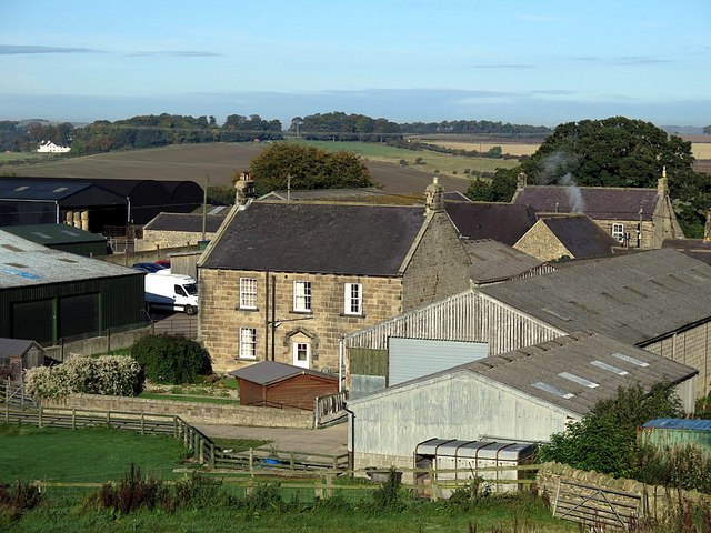
| South Houghton Farmhouse | 1042768 | II | 1826 | Houghton |
| Stable Block and Attached Wall Approx 60 Yards North-West of Close House | 1303648 | II | C18th | |
| Tidestone Approx 200 Yards South-West of Heddon Farmhouse | 1370704 | II | C18th | |
| Water Tower Approx 200 Yards East of Heddon Steads | 1154904 | II | C19th | |
| West Heddon Farmhouse | 1370705 | II | C18th | |
| Whitchester Cottages | 1370706 | II | C18th | |
| Round cairn at Heddon Laws Farm | 1015846 | n/a | Bronze Age | Scheduled Monument |
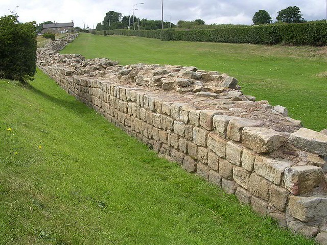
| Hadrian's Wall and vallum from Throckley to East Town House, Heddon-on-the-Wall in wall mile 11 | 1010616 | n/a | Roman | Scheduled Monument |
| Hadrian's Wall and vallum from East Town House, Heddon-on-the-Wall to the A69 trunk road in wall mile 12 | 1010617 | n/a | Roman | Scheduled Monument |
| Defended settlement, 400m south west of South Farm, Houghton | 1014076 | n/a | Iron Age | Scheduled Monument |
| Rudchester Roman fort, associated civil settlement and a section of Hadrian's Wall and vallum from the A69 to the March Burn in wall mile 13 | 1017533 | n/a | Roman | Scheduled Monument. Vindobala. |
| Hadrian's Wall and vallum between the March Burn and Oatens Bank, Harlow Hill in wall miles 13,14 and 15 | 1010618 | n/a | Roman | Scheduled Monument |
Primary source: the National Heritage List for England - NHLE is the register of nationally protected historic buildings and sites in England, including listed buildings, scheduled monuments, protected wrecks, registered parks and gardens, and battlefields. The list is maintained by Historic England. Check NHLE for updates and new entries. Secondary sources: British Listed Buildings and Keys to the Past.
Co-Curate Page
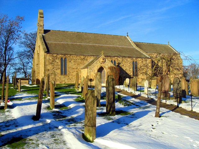
Church of St Andrew
- Overview Map St Andrew's Church in Heddon-on-the-Wall was originally built in c.630 AD.[1] There are still fragments of this 7th century Anglo-Saxon church, within todays building, along with with a …
Co-Curate Page
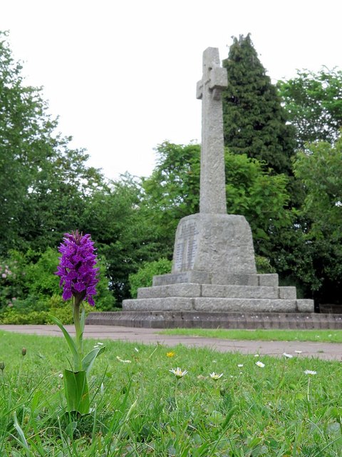
Heddon-on-the-Wall War Memorial
- Overview Map Street View The war memorial in Heddon-on-the-Wall is located in Memorial Park. The memorial cross was unveiled on the 11th of November 1922, by Sir Loftus Bruce. It …
Co-Curate Page
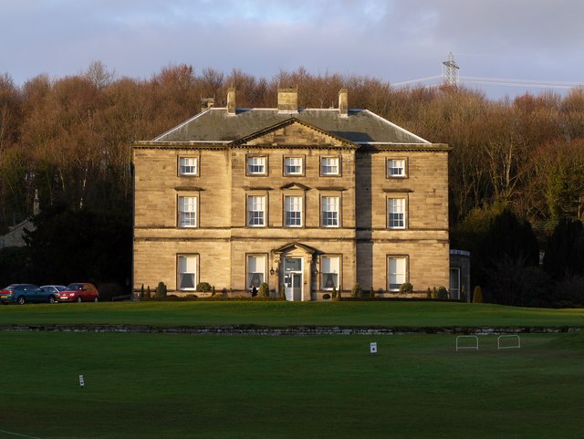
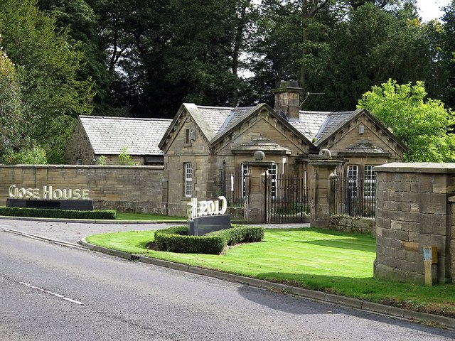
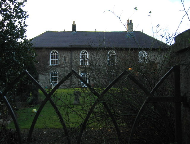
Close House
- Overview About Close House Map Street View Close House is a large country house, estate and golf club located between Heddon-on-the-Wall and Wylam, about 8 miles west of Newcastle. The …
Co-Curate Page
Close House Lodge and Gateway
- Overview Map Street View The lodge and gateway at the entrance to Close House are located off the B6528 road, about half a mile west of Heddon-on-the-Wall. The lodge and …
Co-Curate Page
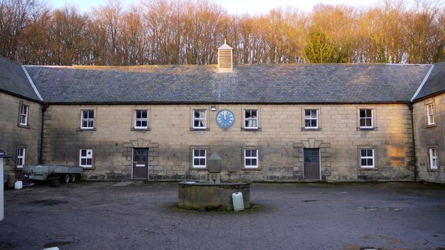
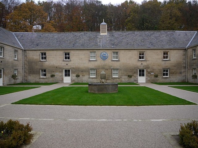
Former Stable Block
- The 18th century stable block at Close House was converted for use as 'The Courtyard' hotel accommodation, which opened in 2012. The building is Grade II listed, as is the flower …
Co-Curate Page
Old School House, Houghton
- Overview Map Street View The Old School House in Houghton, Northumberland, was built in 1814 by Mrs Margaret Bewicke of Close House. At that time it was the only school in the …
Co-Curate Page
Houghton North Farmhouse
- Overview Map Street View The farmhouse at North Farm in Houghton dates from 1802, although there has probably been a farm here from earlier times. Parts of the farm buildings …
Co-Curate Page
Houghton South Farmhouse
- Overview Map The farmhouse at South Farm at Houghton in Northumberland was built in 1826. The farm was part of the Close House Estate. Then in 1953, when the estate was …
Co-Curate Page
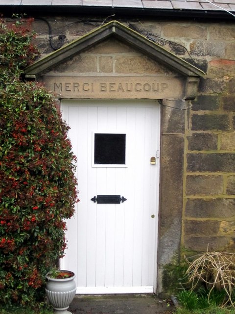
Merci Beaucoup & No. 2 Cottage
- Overview Map Street View 'Merci Beaucoup' and No. 2 are cottages adjacent to the North Farmhouse at Houghton in Northumberland, built in 1815.[1] During the First World War, Sir James …
Co-Curate Page
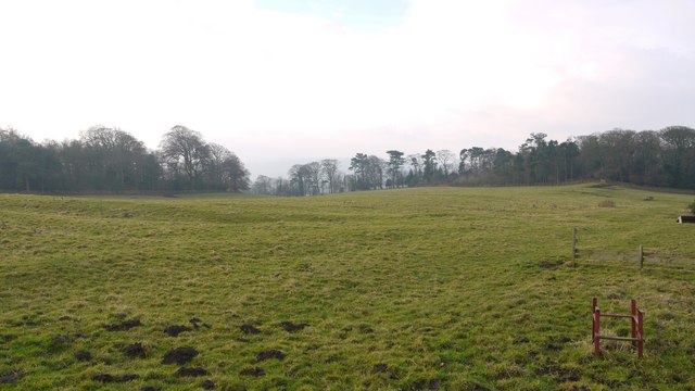
Site of Iron Age Settlement, Houghton
- Overview Aerial View To the south-west of Houghton in Northumberland, by Broomy Hill, are the remains of an Iron Age defended settlement. The remains are not easily visible as most of the defensive …
Co-Curate Page
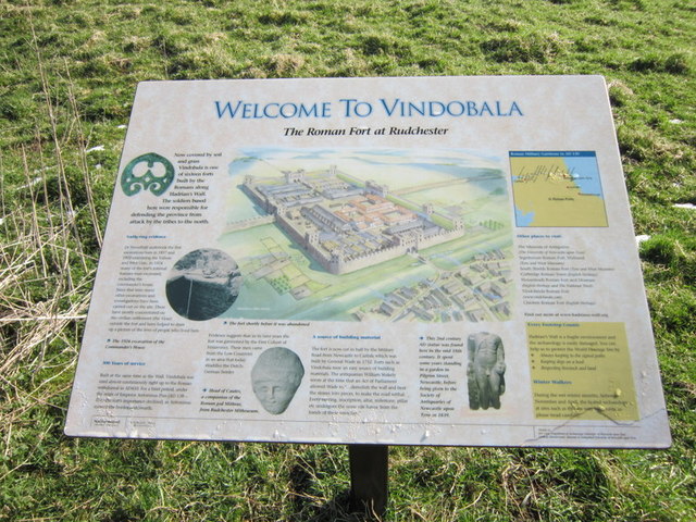
Vindobala
- Overview About Vindobala Map Street View Vindobala (Brytonnic Celtic : windo- fair, white, bala place, situation?, cf. Old Irish bal, bail place, situation, condition, (good) luck) was a Roman …

Co-Curate Page
Wall Mile 12
- <Mile 11 | Mile 12 | Mile 13> Hadrian's Wall - Wall Mile 12 Hadrian's Wall stretches from the east to west coast of England and was an important frontier …
Co-Curate Page
Wall Mile 11
- <Mile 10 | Mile 11 | Mile 12> Hadrian's Wall - Wall Mile 11 Hadrian's Wall stretches from the east to west coast of England and was an important frontier …
Co-Curate Page
Wall Mile 13
- <Mile 12 | Mile 13 | Mile 14> Hadrian's Wall - Wall Mile 13 Hadrian's Wall stretches from the east to west coast of England and was an important frontier …

Co-Curate Page
Church of St Andrew
- Overview Map St Andrew's Church in Heddon-on-the-Wall was originally built in c.630 AD.[1] There are still fragments of this 7th century Anglo-Saxon church, within todays building, along with with a …
Co-Curate Page
Heddon-on-the-Wall War Memorial
- Overview Map Street View The war memorial in Heddon-on-the-Wall is located in Memorial Park. The memorial cross was unveiled on the 11th of November 1922, by Sir Loftus Bruce. It …
Co-Curate Page
Close House
- Overview About Close House Map Street View Close House is a large country house, estate and golf club located between Heddon-on-the-Wall and Wylam, about 8 miles west of Newcastle. The …
Co-Curate Page
Close House Lodge and Gateway
- Overview Map Street View The lodge and gateway at the entrance to Close House are located off the B6528 road, about half a mile west of Heddon-on-the-Wall. The lodge and …
Co-Curate Page
Former Stable Block
- The 18th century stable block at Close House was converted for use as 'The Courtyard' hotel accommodation, which opened in 2012. The building is Grade II listed, as is the flower …
Co-Curate Page
Old School House, Houghton
- Overview Map Street View The Old School House in Houghton, Northumberland, was built in 1814 by Mrs Margaret Bewicke of Close House. At that time it was the only school in the …
Co-Curate Page
Houghton North Farmhouse
- Overview Map Street View The farmhouse at North Farm in Houghton dates from 1802, although there has probably been a farm here from earlier times. Parts of the farm buildings …
Co-Curate Page
Houghton South Farmhouse
- Overview Map The farmhouse at South Farm at Houghton in Northumberland was built in 1826. The farm was part of the Close House Estate. Then in 1953, when the estate was …
Co-Curate Page
Merci Beaucoup & No. 2 Cottage
- Overview Map Street View 'Merci Beaucoup' and No. 2 are cottages adjacent to the North Farmhouse at Houghton in Northumberland, built in 1815.[1] During the First World War, Sir James …
Co-Curate Page
Site of Iron Age Settlement, Houghton
- Overview Aerial View To the south-west of Houghton in Northumberland, by Broomy Hill, are the remains of an Iron Age defended settlement. The remains are not easily visible as most of the defensive …
Co-Curate Page
Vindobala
- Overview About Vindobala Map Street View Vindobala (Brytonnic Celtic : windo- fair, white, bala place, situation?, cf. Old Irish bal, bail place, situation, condition, (good) luck) was a Roman …
Co-Curate Page
Wall Mile 12
- <Mile 11 | Mile 12 | Mile 13> Hadrian's Wall - Wall Mile 12 Hadrian's Wall stretches from the east to west coast of England and was an important frontier …
Co-Curate Page
Wall Mile 11
- <Mile 10 | Mile 11 | Mile 12> Hadrian's Wall - Wall Mile 11 Hadrian's Wall stretches from the east to west coast of England and was an important frontier …


