Topics > Northumberland > Civil Parishes in Northumberland > Embleton Civil Parish > Historic Buildings and Monuments in Embleton Civil Parish
Historic Buildings and Monuments in Embleton Civil Parish
This page includes listed buildings and scheduled monuments in Embleton Civil Parish, Northumberland, from the National Heritage List for England[1]. In addition, it also includes 'local' non-designated heritage assets (NDHA) identified in the Embleton Parish Neighborhood Plan[2]. Use the Search (below) if looking for a specific building / monument.
| Structure | List No. | Grade | Built~ | Notes |
|---|---|---|---|---|
| Atkinson Headstone 15 Metres South of South Aisle of Church of the Holy Trinity | 1041823 | II | 1768 | |
| Attached Outbuilding Range to East of Christon Bank Farmhouse | 1153563 | II | C18th | |
| Christon Bank Farmhouse | 1041821 | II | C18th | |
| Church of the Holy Trinity | 1041822 | I | C11th | |
| Darling Tomb at East End of Church of the Holy Trinity | 1153621 | II | 1835 | Chest tomb. |
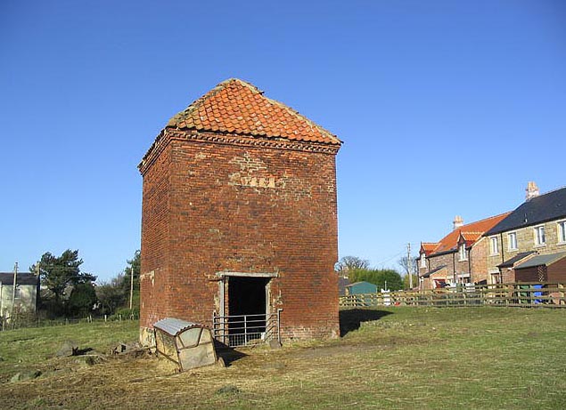
| Dovecote 100 Metres North of Old Vicarage | 1041785 | II | C18th | |
| Dovecote at Rear of Number 4 | 1041790 | II* | C17th | |
| East Farmhouse | 1041787 | II | C17th? | |
| Embleton Cottage | 1371194 | II | c.1840 | |
| Embleton United Reformed Church | 1153701 | II | 1833 | Converted to a private residence. |
| Farmbuilding Group to North of Christon Bank Farmhouse | 1304242 | II | C19th | Planned layout |
| Former Goods Shed on East of Railway Immediately North of B1340 | 1304264 | II | C19th | |
| Garden Walls to North West of Old Vicarage | 1041784 | II | C18th | |
| Garden Walls to South West of Christon Bank Farmhouse | 1371174 | II | C18th | |
| Gazebo attached to south-east corner of The Lookout | 1371196 | II | C18th | |
| Gresham Headstone 6 Metres South of Chancel of Church of the Holy Trinity | 1153629 | II | 1810 | |
| Lamp Post 9 Metres South of Chancel of Church of the Holy Trinity | 1371175 | II | C19th | |
| Mile Post 150 Metres South of Junction with Road to Embleton | 1041819 | II | C19th | |
| Mile Post 700 Metres North of Prickly Bridge | 1041820 | II | C19th | |
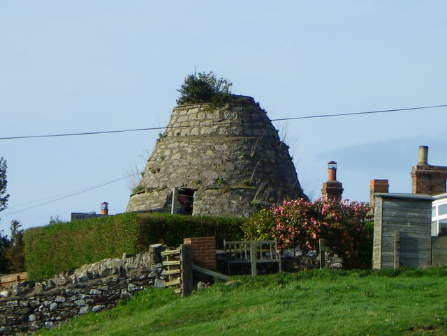
| Old Limekilns 450 Metres South East of Redstead | 1304262 | II | C19th | |
| Roadside Traction Engine Shed at South Farm | 1304260 | II | C19th | |
| Sundial to West of Old Vicarage | 1371193 | II | C19th | |
| The Bluebell Inn | 1041786 | II | 1840 | |
| The Moot Hall | 1153709 | II | C17th | |
| The Old Manse | 1041789 | II | 1833 | |
| The Old Vicarage | 1041824 | I | C14th | Pele tower, with 1828 extensions |
| Thompson Headstone 16 Metres South of South Aisle of Church of the Holy Trinity | 1304193 | II | 1717 | |
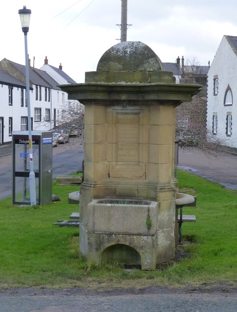
| Village Pant | 1041788 | II | 1911 | |
| Village Pump | 1371195 | II | C19th | |
| Dovecote S of Glebe Farm | 1006572 | n/a | C17th | Scheduled Monument |
| Creighton Memorial Hall | NDHA | n/a | 1903 | aka the Village Hall |
| Glebe Field | NDHA | n/a | Medieval | Historically suppoted the vicar of Embleton |
| Nos 1 & 2 Sycamore Cottages | NDHA | n/a | 1927 | Prefabricated homes built for the Newcastle Exhibition of 1927 |
| Dunstanburgh Castle Hotel | NDHA | n/a | C19th | |
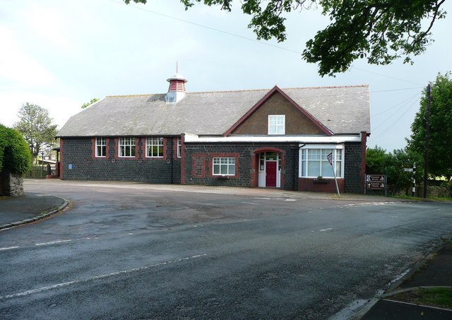
| Vincent Edward’s Primary School | NDHA | n/a | 1890s | |
| Greys Inn Public House | NDHA | n/a | C19th | |
| Old School House | NDHA | n/a | ||
| New Presbyterian Manse | NDHA | n/a | C19th | |
| Water pump near Blue Bell Inn | NDHA | n/a | ||
| Pill Boxes (Glebe Field, Sports Field, adjacent Glebe Farm and adjacent to Nature Reserve Pool at Low Newton) | NDHA | n/a | c.1940 | |
| Village Shop | NDHA | n/a | C19th | |
| Filling Station (including shop and garage) | NDHA | n/a | C19th | |
| Dunstanburgh Castle Golf Club Clubhouse | NDHA | n/a | 1930s | |
| Primitive Methodist Church | NDHA | n/a | 1891 | Christon Bank |
| Blink Bonny Public House | NDHA | n/a | C19th | Christon Bank |
| Well including memorial stone | NDHA | n/a | 1860 | Christon Bank |
| Embleton Conservation Area | - | n/a | Conservation Area |
Primary sources: [1] the National Heritage List for England - NHLE is the register of nationally protected historic buildings and sites in England, including listed buildings, scheduled monuments, protected wrecks, registered parks and gardens, and battlefields. The list is maintained by Historic England. Check NHLE for updates and new entries. [2] NDHA: Non-Designated Heritage Assets in the Parish of Embleton (Background Evidence Paper No 6), The Embleton Parish Neighbourhood Plan (October 2019). Secondary sources: British Listed Buildings and Keys to the Past.
Co-Curate Page
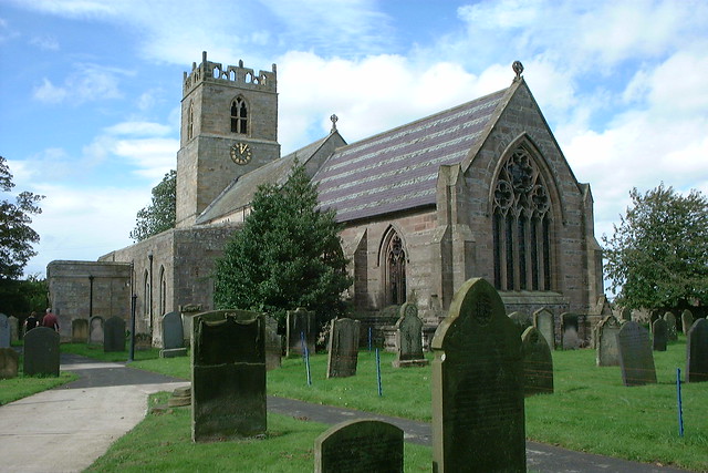
Church of the Holy Trinity
- Overview About the Church Map Street View Holy Trinity Church is the parish church in Embleton, Northumberland. The church dates from the late 11th or early 12th century. It's aisles …
Co-Curate Page
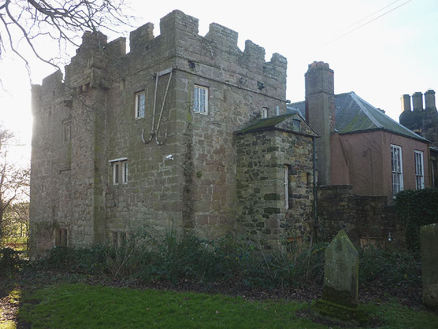
Old Vicarage
- Overview Map Street View The former Vicarage and pele tower, is located next to the Church of the Holy Trinity in Embleton. In 1332 Merton College, patron of Embleton, agreed to …
Co-Curate Page
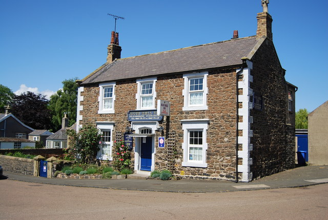
Bluebell Inn
- The Bluebell Inn, Embleton, was built c.1840 and is a Grade II listed building on the National Heritage List for England..
Co-Curate Page
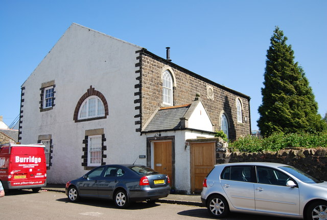
United Reformed Church
- Overview Map Street View The former United Reformed Church in Embleton was originally built as a Presbyterian Church in 1833. The building, altered in the 1920's, is Grade II listed …
Co-Curate Page
Village Hall
- Overview Map Street View Creighton Memorial Hall in Embleton, Northumberland, is reputedly the largest village hall in the county. It is named after Mandell Creighton, who was vicar Embleton from …
Co-Curate Page
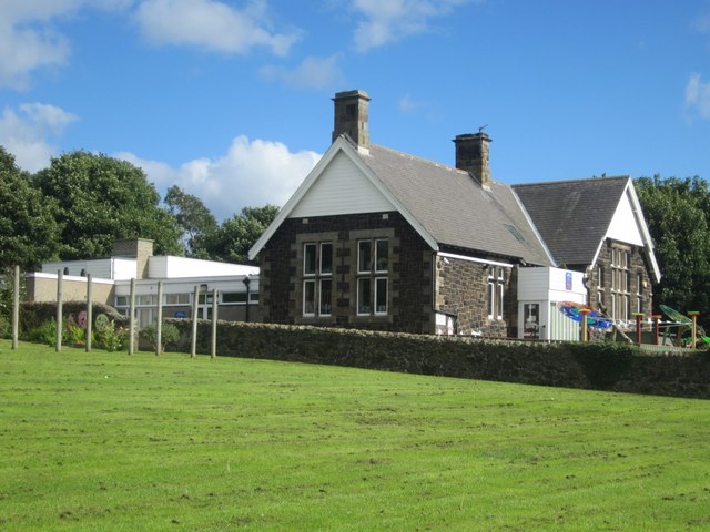
Vincent Edwards Primary School
- Overview Map Street View Embleton Vincent Edwards Church of England Primary School is located on Quakers Row in Embleton, Northumberland. The school has about 50 pupils aged 3 to 11. The …
Co-Curate Page
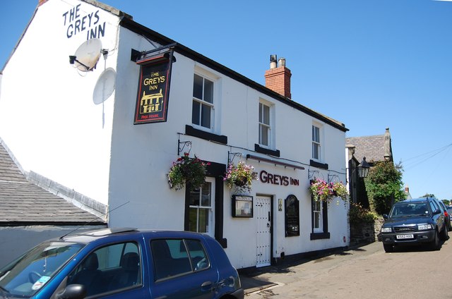
Greys Inn
- Overview Map Street View The Greys Inn is located on Stanley Terrace, by the green in Embleton, Northumberland. The inn was built in the 19th century using local Whinstone. The …
Co-Curate Page
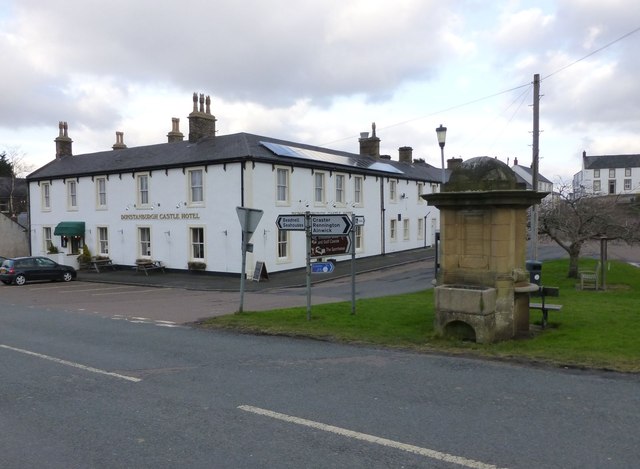
Dunstanburgh Castle Hotel
- Overview Map Street View The Dunstanburgh Castle Hotel is located at the junction of the B1339 and Front Street in Embleton. The hotel was built in the 19th century and …

Co-Curate Page
Church of the Holy Trinity
- Overview About the Church Map Street View Holy Trinity Church is the parish church in Embleton, Northumberland. The church dates from the late 11th or early 12th century. It's aisles …
Co-Curate Page
Old Vicarage
- Overview Map Street View The former Vicarage and pele tower, is located next to the Church of the Holy Trinity in Embleton. In 1332 Merton College, patron of Embleton, agreed to …
Co-Curate Page
Bluebell Inn
- The Bluebell Inn, Embleton, was built c.1840 and is a Grade II listed building on the National Heritage List for England..
Co-Curate Page
United Reformed Church
- Overview Map Street View The former United Reformed Church in Embleton was originally built as a Presbyterian Church in 1833. The building, altered in the 1920's, is Grade II listed …
Co-Curate Page
Village Hall
- Overview Map Street View Creighton Memorial Hall in Embleton, Northumberland, is reputedly the largest village hall in the county. It is named after Mandell Creighton, who was vicar Embleton from …
Co-Curate Page
Vincent Edwards Primary School
- Overview Map Street View Embleton Vincent Edwards Church of England Primary School is located on Quakers Row in Embleton, Northumberland. The school has about 50 pupils aged 3 to 11. The …
Co-Curate Page
Greys Inn
- Overview Map Street View The Greys Inn is located on Stanley Terrace, by the green in Embleton, Northumberland. The inn was built in the 19th century using local Whinstone. The …


