Topics > Civil Parishes in Cumbria > Bewcastle Civil Parish > Historic Buildings and Monuments in Bewcastle Civil Parish
Historic Buildings and Monuments in Bewcastle Civil Parish
Listed buildings and scheduled monuments in Bewcastle Civil Parish, Cumbria, from the National Heritage List for England[1]. Use the Search (below) if looking for a specific building / monument.
| Structure | List No. | Grade | Built~ | Note |
|---|---|---|---|---|
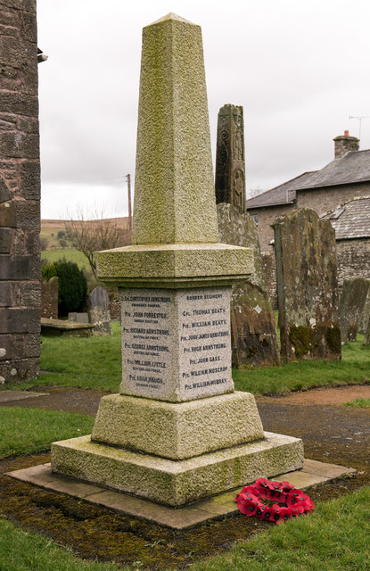
| Bewcastle War Memorial | 1449782 | II | 1919 | Bewcastle |
| Banna | 1205144 | II | 1837 | |
| Knowe United Reformed Church War Memorial | 1470927 | II | 1919 | The Knowe |
| Barn to West of Roanstrees | 1205120 | II | 1832 | |
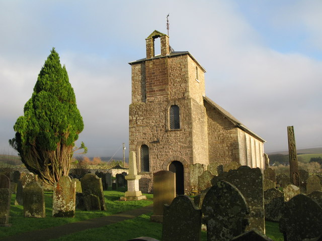
| Church of St Cuthbert | 1087539 | II* | C13th | |
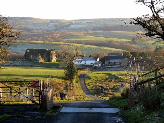
| Crew Castle | 1087533 | II | C16th | |
| Davidson's Monument | 1087540 | II | 1852 | |
| Demesne Farmhouse | 1205133 | II | C17th | Includes stone taken from Bew Castle |
| Flatt Lodge and Adjoining Outbuildings | 1205077 | II | ||
| Former Horse and Farrier Inn | 1205166 | II | ||
| Lordstown | 1087536 | II | ||
| Low Grains | 1205091 | II | ||
| Outbuildings North of Sleetbeck | 1335619 | II | ||
| Peel O'hill | 1280894 | II | ||
| Round House in Centre of Farmyard at Roanstrees | 1087537 | II | ||
| Ruins of the Loan (Not to Be Confused with House of Same Name to East) | 1087534 | II | ||
| Sleetbeck | 1205178 | II | ||
| The Ash | 1335618 | II | 1738 | Farmhouse |
| Town Foot | 1087538 | II | 1763 | Farmhouse |
| Wall to South East of Low Grains | 1087535 | II | ||
| Whintingstown | 1087541 | II | ||
| Bewcastle Roman fort, high cross shaft in St Cuthbert's churchyard, and Bew Castle medieval shell keep castle | 1015728 | n/a | Scheduled Monument. Bewcastle Castle + Medieval Cross Shaft + earlier Roman site | |
| Unfinished high cross shaft on Long Bar 580m north east of Todcrag Loch | 1016397 | n/a | Scheduled Monument | |
| Prehistoric cultivation terraces immediately south east of Nook | 1015765 | n/a | Scheduled Monument | |
| Low Grains bastle | 1015866 | n/a | Scheduled Monument | |
| Medieval shieling on south bank of White Lyne 230m WSW of confluence with Little Hare Grain | 1016406 | n/a | Scheduled Monument | |
| Medieval shieling on south bank of White Lyne 130m WSW of confluence with Little Hare Grain | 1016392 | n/a | Scheduled Monument | |
| Medieval shieling on south bank of White Lyne 410m WSW of confluence with Little Hare Grain | 1016405 | n/a | Scheduled Monument | |
| Crew Castle bastle | 1015738 | n/a | Scheduled Monument | |
| Two medieval shielings on south bank of White Lyne 230m north east of confluence with little Hare Grain | 1016394 | n/a | Scheduled Monument | |
| Dollerline medieval dispersed settlement 250m north of Bush Farm | 1015869 | n/a | Scheduled Monument | |
| Antonstown medieval dispersed settlement 450m south east of Crew Farm | 1015868 | n/a | Scheduled Monument | |
| The Loan medieval bastle and post-medieval cottage | 1016085 | n/a | Scheduled Monument | |
| Four medieval shielings on south bank of White Lyne overlooking confluence with Little Hare Grain | 1016393 | n/a | Scheduled Monument | |
| Hennel Cleugh bowl barrow, 785m south west of High Grains Farm | 1015864 | n/a | Scheduled Monument | |
| White Lyne round cairn 60m NNW of confluence of Gate Grain and White Lyne | 1016396 | n/a | Scheduled Monument | |
| Shiel Knowe round cairn | 1016395 | n/a | Scheduled Monument | |
| The Currick long cairn 710m north east of Cald Well | 1015734 | n/a | Scheduled Monument | |
| Hall Hills medieval dispersed settlement 370m WNW of St Cuthbert's Church | 1016083 | n/a | Scheduled Monument | |
| Prehistoric enclosure, field system and cairnfield, and medieval and early post-medieval settlements and field systems 600m SSW of Blacklyne House | 1016089 | n/a | Scheduled Monument | |
| Ten medieval shielings on north bank of White Lyne overlooking confluence with Little Hare Grain | 1016404 | n/a | Scheduled Monument | |
| Unenclosed stone hut circle settlement on Grey Hill 930m south east of Ashycroft | 1015735 | n/a | Scheduled Monument | |
| The Hill medieval dispersed settlement and an early post-medieval settlement 400m east of Ashycroft | 1016082 | n/a | Scheduled Monument | |
| Stantling Loan medieval shieling | 1016401 | n/a | Scheduled Monument | |
| Horse Head medieval shieling on Greyfell Common 50m west of confluence of Gosling Sike and Horsehead Grain | 1016400 | n/a | Scheduled Monument | |
| Kershopehead medieval shieling 610m north east of Kershopehead | 1015736 | n/a | Scheduled Monument | |
| Two medieval shielings 30m north west of Stantling Loan on Greyfell Common | 1016402 | n/a | Scheduled Monument | |
| Medieval shieling on Greyfell Common 310m north west of Stantling Loan | 1016403 | n/a | Scheduled Monument | |
| Shieling 210m north of Irthing Head | 1010041 | n/a | Scheduled Monument | |
| Round cairn 300m south west of Underwood | 1015727 | n/a | Scheduled Monument | |
| Braes Pele medieval tower and shielings 350m east of Borderrigg | 1015865 | n/a | Scheduled Monument | |
| Lynestead medieval pele tower, early post-medieval farmstead and an associated corn drying kiln | 1016086 | n/a | Scheduled Monument |
Primary source: the National Heritage List for England - NHLE is the register of nationally protected historic buildings and sites in England, including listed buildings, scheduled monuments, protected wrecks, registered parks and gardens, and battlefields. The list is maintained by Historic England. Check NHLE for updates and new entries. Secondary sources: British Listed Buildings.
Co-Curate Page
Church of St Cuthbert
- Overview Map Street View Inside St Cuthbert's Church at Bewcastle was built in the 13th century, on an ancient site, using stone from the old Roman fort here. The church was …
Co-Curate Page
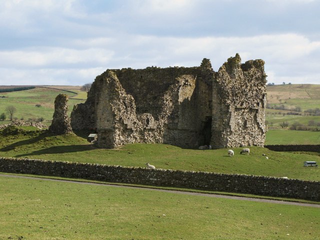
Bewcastle Castle
- Overview About Bew Castle Map Street View Bewcastle Castle is a ruined castle in the parish of Bewcastle in the English county of Cumbria, a few miles from the …
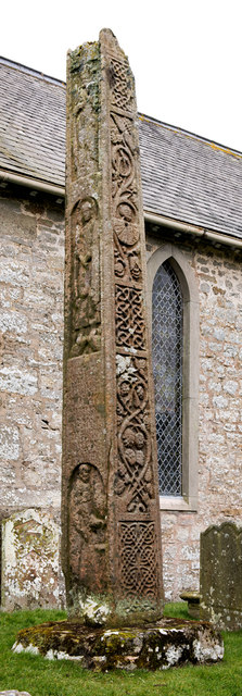
Co-Curate Page
Medieval Bewcastle Cross
- The high cross shaft in the churchyard of St Cuthbert's Church in Bewcastle dates from the 7th century. The Bewcastle Cross is a scheduled monument. The Stone Cross at St …
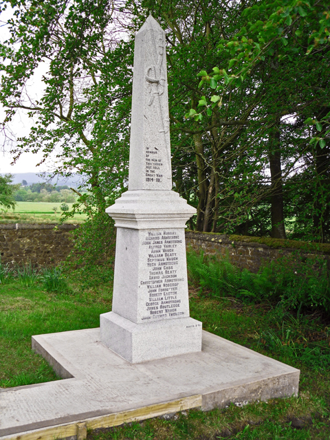
Co-Curate Page
War Memorial, The Knowe, Bewcastle
- Overview Map Street View This war memorial was unveiled on the 28th December 1919 by Mrs Thomas Armstrong, in the churchyard of Knowe Presbyterian Church (now The Knowe United Reformed …


Co-Curate Page
Church of St Cuthbert
- Overview Map Street View Inside St Cuthbert's Church at Bewcastle was built in the 13th century, on an ancient site, using stone from the old Roman fort here. The church was …

Co-Curate Page
Bewcastle Castle
- Overview About Bew Castle Map Street View Bewcastle Castle is a ruined castle in the parish of Bewcastle in the English county of Cumbria, a few miles from the …

Co-Curate Page
Medieval Bewcastle Cross
- The high cross shaft in the churchyard of St Cuthbert's Church in Bewcastle dates from the 7th century. The Bewcastle Cross is a scheduled monument. The Stone Cross at St …

