Topics > Northumberland > Civil Parishes in Northumberland > Harbottle Civil Parish
Harbottle Civil Parish
Area: 41.5 km²
Population:
262 (2021 Census)
256 (2011 Census)
235 (2001 Census)
from https://harbottleparishcounci…
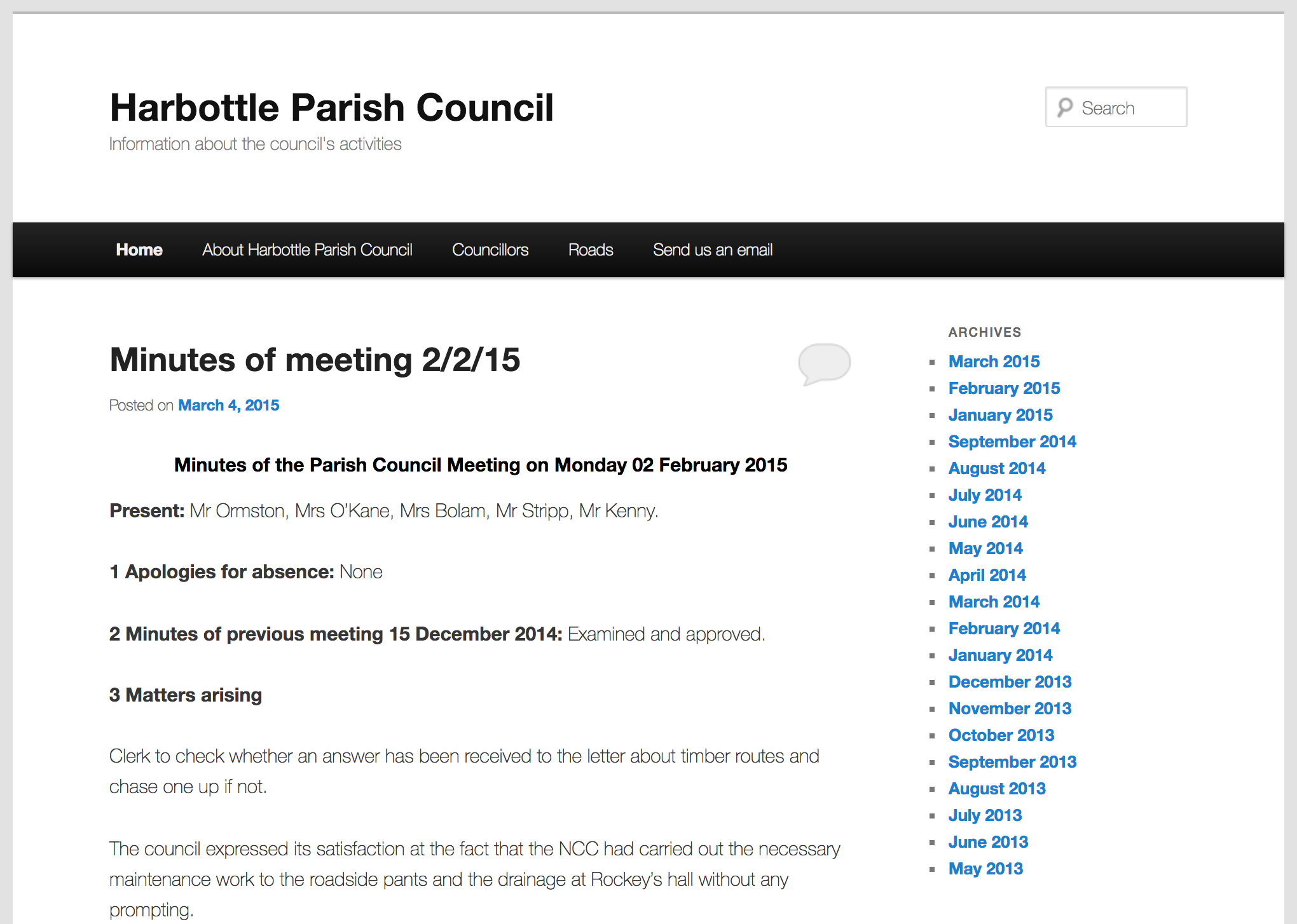
Harbottle Parish Council
- Official Website of Harbottle Parish Council.
Added by
Simon Cotterill

from https://keystothepast.info/se…
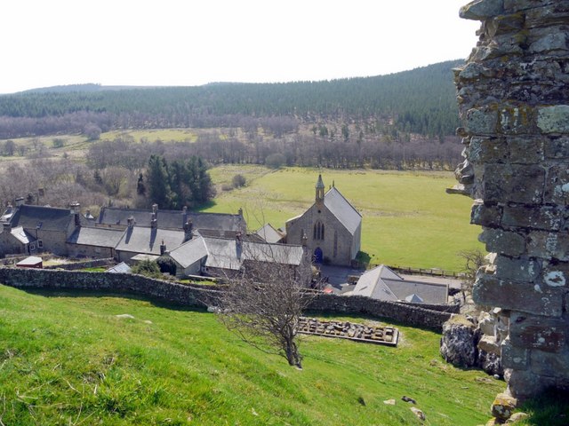
Local History: Harbottle
- "The civil parish of Harbottle lies on the edge of the Cheviots, in Upper Coquetdale. It includes high moorland in the north and west of the parish. The River Coquet …
Added by
Simon Cotterill
Co-Curate Page
Harbottle
- Overview About Harbottle Map Street View Harbottle is a village in Northumberland, located about 20 miles north-west of Morpeth, and situated by the River Coquet. To the west of the …
Co-Curate Page
Holystone
- Overview About Holystone Map Street View Holystone is a village in Northumberland, located by the River Coquet, about 2 miles south-east of Harbottle. To the north of the village is …
Co-Curate Page
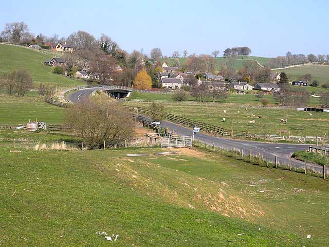
Sharperton
- Overview Map Street View Sharperton is a hamlet in Northumberland situated by the River Coquet. It is located about 6 miles west of Rothbury, a mile and a half south-east …
from https://keystothepast.info/se…
Foxton deserted medieval village
- "Earthworks are all that remain of the medieval hamlet of Foxton, which is mentioned in a document written in 1546. The remains of three steadings and two garths can be …
Added by
Simon Cotterill
Co-Curate Page
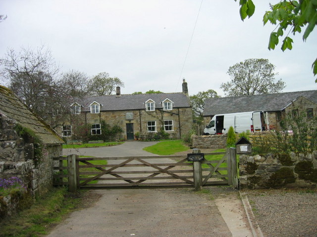
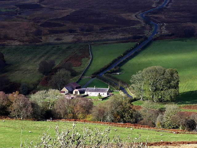
North Yardhope
- Overview Map Street View North Yardhope is a farm in Harbottle Civil Parish, in Northumberland, located about 9 miles west of Rothbury and 2½ miles south-west of the village of …
Co-Curate Page
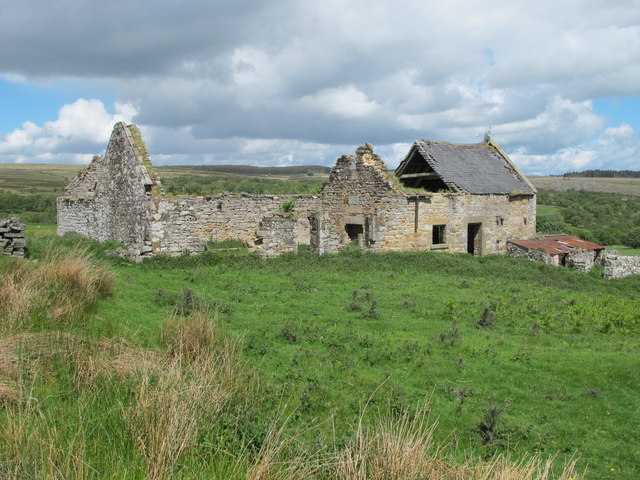
South Yardhope
- South Yardhope was the site of a farm, now in ruins, in Harbottle Civil Parish, Northumberland.
Co-Curate Page
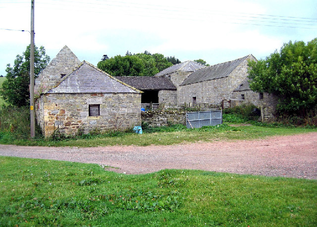
The Peels
- Overview Map The Peels is a farm, located about ½ mile east of Harbottle in Northumberland. The current farmhouse and Brye here dates from the 18th century. Historically, The Peel …

from https://harbottleparishcounci…
Harbottle Parish Council
- Official Website of Harbottle Parish Council.
Added by
Simon Cotterill
from https://keystothepast.info/se…
Local History: Harbottle
- "The civil parish of Harbottle lies on the edge of the Cheviots, in Upper Coquetdale. It includes high moorland in the north and west of the parish. The River Coquet …
Added by
Simon Cotterill
Co-Curate Page
Harbottle
- Overview About Harbottle Map Street View Harbottle is a village in Northumberland, located about 20 miles north-west of Morpeth, and situated by the River Coquet. To the west of the …
Co-Curate Page
Holystone
- Overview About Holystone Map Street View Holystone is a village in Northumberland, located by the River Coquet, about 2 miles south-east of Harbottle. To the north of the village is …
Co-Curate Page
Sharperton
- Overview Map Street View Sharperton is a hamlet in Northumberland situated by the River Coquet. It is located about 6 miles west of Rothbury, a mile and a half south-east …
from https://keystothepast.info/se…
Foxton deserted medieval village
- "Earthworks are all that remain of the medieval hamlet of Foxton, which is mentioned in a document written in 1546. The remains of three steadings and two garths can be …
Added by
Simon Cotterill
Co-Curate Page
North Yardhope
- Overview Map Street View North Yardhope is a farm in Harbottle Civil Parish, in Northumberland, located about 9 miles west of Rothbury and 2½ miles south-west of the village of …
Co-Curate Page
South Yardhope
- South Yardhope was the site of a farm, now in ruins, in Harbottle Civil Parish, Northumberland.
Co-Curate Page
The Peels
- Overview Map The Peels is a farm, located about ½ mile east of Harbottle in Northumberland. The current farmhouse and Brye here dates from the 18th century. Historically, The Peel …


Keys to the Past HER: N13387


