Topics > County Durham > Civil Parishes in County Durham > Dalton-le-Dale Civil Parish > Dalton-le-Dale Parish, 1848
Dalton-le-Dale Parish, 1848
DALTON-LE-DALE (St. Andrew), a parish, in the union of Easington, N. division of Easington ward and of the county of Durham, 11 miles (E. by N.) from Durham, and 7 (S.) from Sunderland; comprising the townships of Dalton, Dawdon, Cold-Hesleton, and East Murton; and containing 2,709 inhabitants, of whom 88 are in the township of Dalton. The parish is situated on the road from Sunderland to Stockton-upon-Tees, and bounded on the east by the German Ocean. The surface is undulated, but the scenery, though enlivened with about 100 acres of plantations, is in other respects bleak and of harsh character; the soil of the arable land is fertile, and the system of agriculture improved. Coal is abundant in the vicinity, and a new mine has been opened at Murton, by the South Hetton Company, at an immense expense; limestone of good quality is quarried, and burnt into lime for manure. The village lies in a deep narrow valley, within 2 miles of the sea, and the inhabitants are employed in agriculture and in the mines and quarries. Two railways for conveying coal from the adjacent collieries to Seaham harbour pass through the parish. The living is a discharged vicarage, valued in the king's books at £6. 0. 7.; patrons and appropriators, the Dean and Chapter of Durham, who have augmented the income to £300. The great tithes of the township of Dalton have been commuted for £70, and the small for £35; there is a vicarial glebe of 26 acres. The church is an ancient structure, in the early English style, with a Norman doorway now built up. The vicaragehouse was erected in 1841, and is a neat edifice, situated on rising ground, a little to the west of the turnpikeroad.
Extract from: A Topographical Dictionary of England comprising the several counties, cities, boroughs, corporate and market towns, parishes, and townships..... 7th Edition, by Samuel Lewis, London, 1848.
Co-Curate Page
Dalton-le-Dale
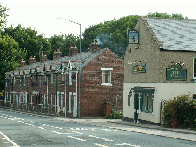
- Overview About Dalton-le-Dale Map Street View Dalton-le-Dale is a small village in County Durham, in England. The parish population taken at the 2011 census was 1,546. It is situated …
Co-Curate Page
Dawdon
- Overview About Dawdon Map Dawdon is located by the coast at the south of Seaham. Dawdon had been a separate small village of 83 houses, before it was extended by …

Co-Curate Page
Seaham-Harbour, 1848
- SEAHAM-HARBOUR, a sea-port, and an ecclesiastical district in the parish of Dalton-le-Dale, union of Easington, N. division of Easington ward and of the county of Durham, 6½ miles (S. by …
Co-Curate Page
Murton
- Overview About Murton Timeline Map Street View MURTON, EAST, a township, in the parish of Dalton-le-Dale, union of Easington, N. division of Easington ward and of the county of Durham, …

Co-Curate Page
Cold Hesleton township, 1848
- HESLETON, COLD, a township, in the parish of Dalton-le-Dale, union of Easington, N. division of Easington ward and of the county of Durham, 8 miles (S.) from Sunderland, and 10 …

Co-Curate Page
Dalton-le-Dale
- Overview About Dalton-le-Dale Map Street View Dalton-le-Dale is a small village in County Durham, in England. The parish population taken at the 2011 census was 1,546. It is situated …
Co-Curate Page
Dawdon
- Overview About Dawdon Map Dawdon is located by the coast at the south of Seaham. Dawdon had been a separate small village of 83 houses, before it was extended by …
Co-Curate Page
Seaham-Harbour, 1848
- SEAHAM-HARBOUR, a sea-port, and an ecclesiastical district in the parish of Dalton-le-Dale, union of Easington, N. division of Easington ward and of the county of Durham, 6½ miles (S. by …
Co-Curate Page
Murton
- Overview About Murton Timeline Map Street View MURTON, EAST, a township, in the parish of Dalton-le-Dale, union of Easington, N. division of Easington ward and of the county of Durham, …


")