Topics > Tyne and Wear > South Tyneside > Cleadon > Cleadon Hills Conservation Area
Cleadon Hills Conservation Area
%
Note: Map data from South Tyneside Council c/o Open Data UK, under the Open Government Licence, imported into Google MyMaps, February 2026. Check with STC for amendments and updates.
Co-Curate Page
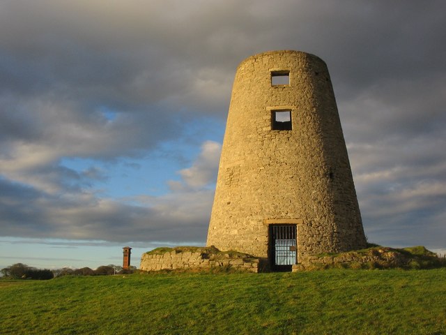
Cleadon Windmill
- Overview Detail The ruined windmill is located on the highest part of Cleadon Hills, built the 1820s. The mill was severely damaged in a storm during the 1870s. Interestingly it …
Co-Curate Page
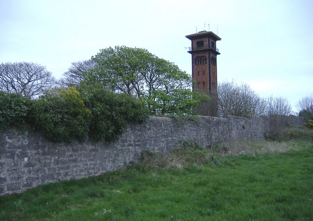
Cleadon Water Tower
- Overview Detail Map Street View Cleadon Water Tower is a prominent landmark based on the Cleadon Hills. The chimney was for a Victorian steam-powered pumping station, built 1860 to 1862 …

Co-Curate Page
Cleadon Windmill
- Overview Detail The ruined windmill is located on the highest part of Cleadon Hills, built the 1820s. The mill was severely damaged in a storm during the 1870s. Interestingly it …