Topics > Newcastle City Centre > Streets > Claremont Road
Claremont Road
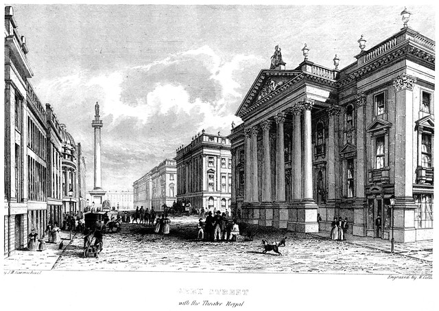
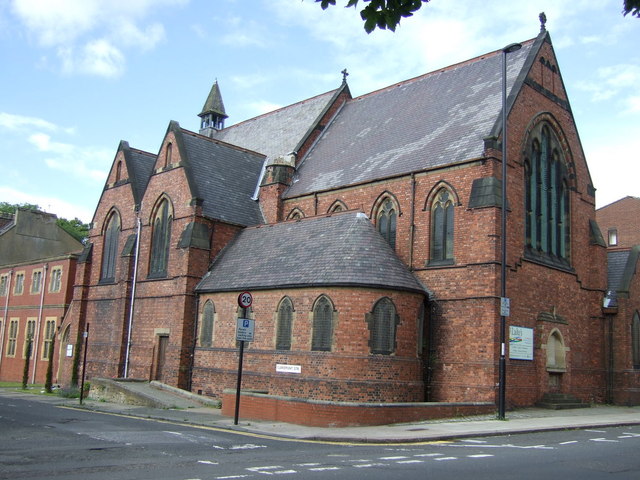
 Clarmont Road is a street in Newcastle, which is 1.2 miles long and runs in a rougly north-westerly direction from Barras Bridge in the City Centre, up to the residential area of Spital Tongues, and ends at the junction with Grandstand Road and the A167. At the south of Clarmont Road are the Hancock Museum, Armstrong Memorial and serveral buildings of Newcastle University, including the Farrell Cente (Claremont Buildings), Henry Daysh Building (aka Clarmont Tower), Stephenson Building, Cassie Building and Ridley Buildings). After the junction with Queen Victoria Road, there is an entrance to Exhibition Park and going north is Spital Tongues with residential terraces and and the North Terrace (pub), St Lukes Church (1890) and Chimney Mill (1782). In the past, Northern Coachbuilders works were located between the church and Chimney Mill.
from Newcastle libraries (flickr)
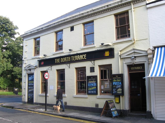
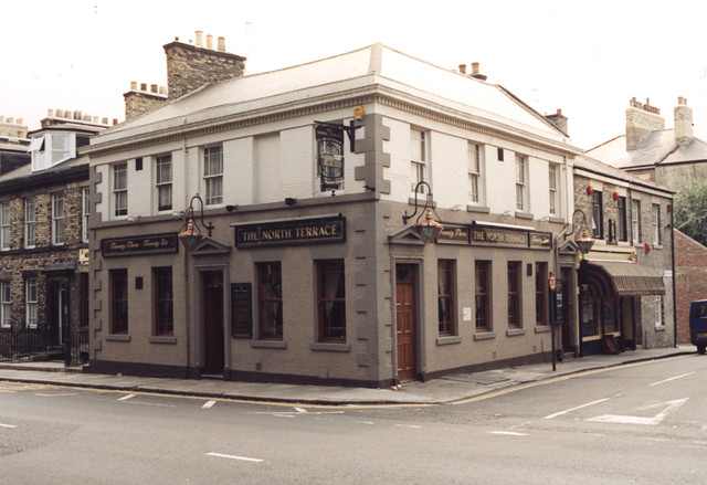
062892:North Terrace Claremont Road Unknown 1995
Pinned by Simon Cotterill
from Newcastle libraries (flickr)
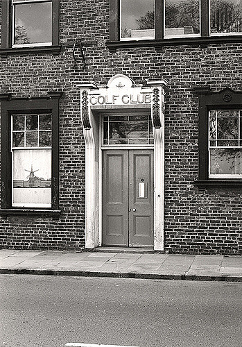
023154:Claremont Road Spital Tongues Unknown c.1910
Pinned by Simon Cotterill
from Newcastle libraries (flickr)
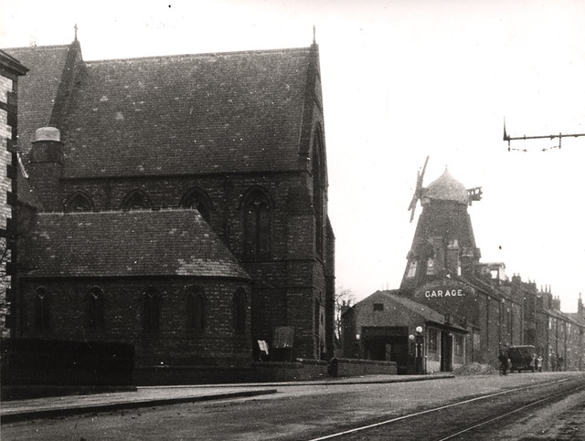
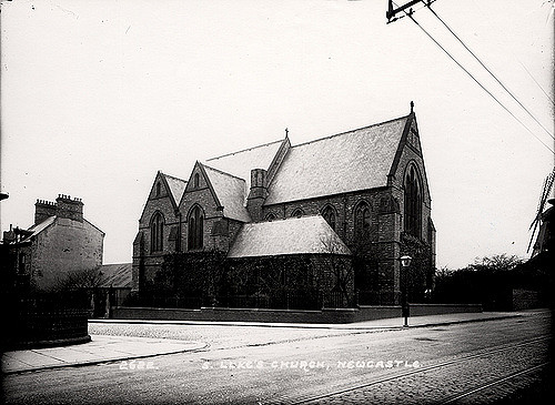
027357:St. Luke's Church Claremont Road/Claremont Terrace Spital Tongues Unknown c.1910
Pinned by Simon Cotterill
Co-Curate Page
Spital Tongues
- Overview About Spital Tongues Map Timeline Street View Spital Tongues is a historic area in the north west of Newcastle upon Tyne. It had been a separate village until the …
from Newcastle libraries (flickr)
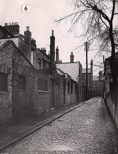
066811:Claremont Road Spital Tongues Unknown 1971
Pinned by Simon Cotterill
from Newcastle libraries (flickr)
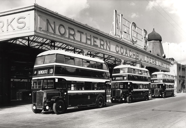
054263:Northern Coachbuilders Ltd Claremont Road Spital Tongues Riddell 1939
Pinned by Simon Cotterill
from Newcastle libraries (flickr)
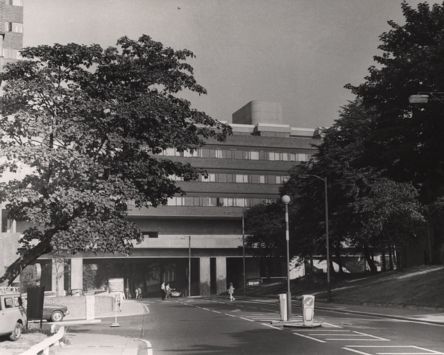
044458:Claremont Road Spital Tongues City Engineers 1966
Pinned by Simon Cotterill
from Newcastle libraries (flickr)
054248:Northern Coachbuilders Ltd Claremont Road Spital Tongues Riddell c.1939
Pinned by Simon Cotterill
from Newcastle libraries (flickr)
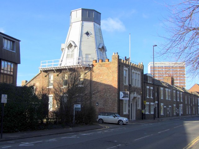
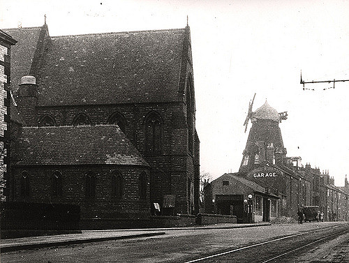
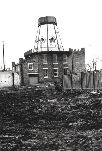
033763:Chimney Mills windmill Claremont Road Spital Tongues Unknown 1977
Pinned by Simon Cotterill
from Newcastle libraries (flickr)
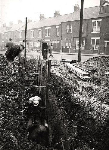
036838:Claremont Road Spital Tongues Dept of Environmental Health c.1935
Pinned by Simon Cotterill
from Newcastle libraries (flickr)
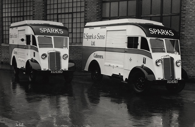
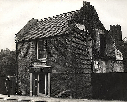
013460:Antique Shop Claremont Road Newcastle upon Tyne 1964
Pinned by Simon Cotterill
from Newcastle libraries (flickr)
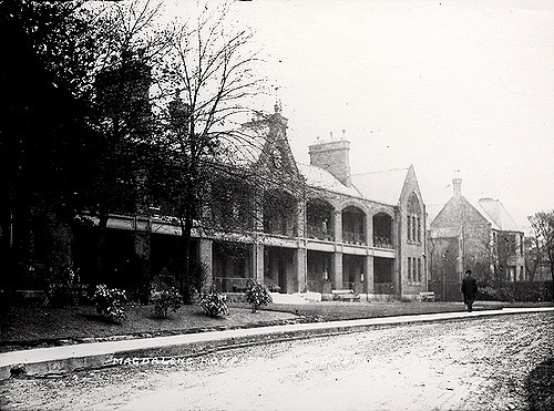
027033:St. Mary Magdalene Hospital Newcastle upon Tyne Unknown c.1910
Pinned by Simon Cotterill
Co-Curate Page
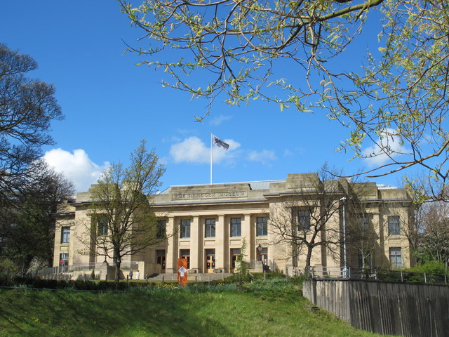
Great North Museum: Hancock
- Overview About the Museum Map Street View The museum was established in 1884 to house the growing collections of the Natural History Society of Northumbria. It was named after John …
Co-Curate Page
Ridley Buildings
- Overview Map Street View The Ridley Buildings of Newcastle University are located on the corner of Queen Victoria Road and Claremont Road, the main entrances are via the pedestrianised Lover's …
Co-Curate Page
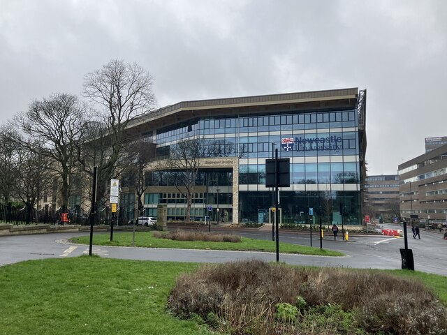
Stephenson Building
- Overview Map Street View The Stephenson Building at Newcastle University is located on Claremont Road. The current building opened in September 2023. It was built to be a School of Engineering …
Co-Curate Page
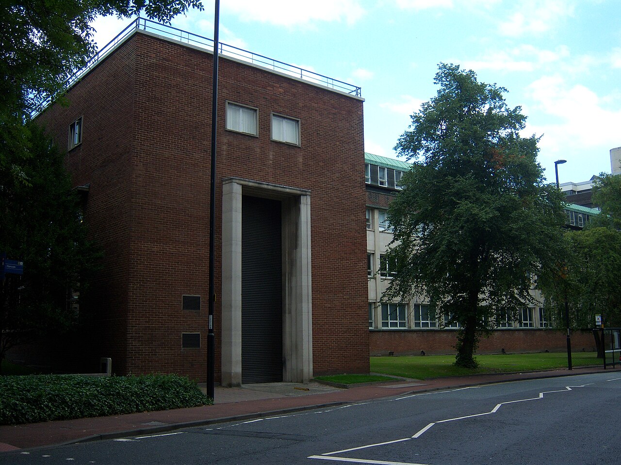
Cassie Building
- Overview Map Street View The Cassie Building at Newcastle University was built in 1955. The main entrance is on Kensington Walk - a walkway between Claremont Road and Kensington Terrace. …
Co-Curate Page
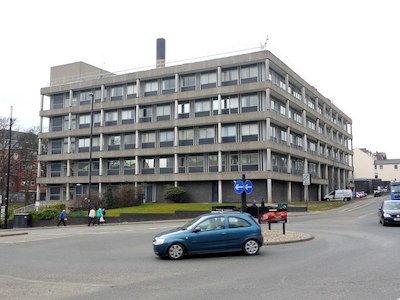
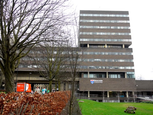
Henry Daysh Building
- Overview Map Street View The Henry Daysh Building of Newcastle University is located on Claremont Road. It was previously known as Claremont Tower, built in 1968, interconnected with the Daysh …

from Newcastle libraries (flickr)
062892:North Terrace Claremont Road Unknown 1995
Pinned by Simon Cotterill
from Newcastle libraries (flickr)
023154:Claremont Road Spital Tongues Unknown c.1910
Pinned by Simon Cotterill
from Newcastle libraries (flickr)
027357:St. Luke's Church Claremont Road/Claremont Terrace Spital Tongues Unknown c.1910
Pinned by Simon Cotterill
Co-Curate Page
Spital Tongues
- Overview About Spital Tongues Map Timeline Street View Spital Tongues is a historic area in the north west of Newcastle upon Tyne. It had been a separate village until the …
from Newcastle libraries (flickr)
066811:Claremont Road Spital Tongues Unknown 1971
Pinned by Simon Cotterill
from Newcastle libraries (flickr)
054263:Northern Coachbuilders Ltd Claremont Road Spital Tongues Riddell 1939
Pinned by Simon Cotterill
from Newcastle libraries (flickr)
044458:Claremont Road Spital Tongues City Engineers 1966
Pinned by Simon Cotterill
from Newcastle libraries (flickr)
054248:Northern Coachbuilders Ltd Claremont Road Spital Tongues Riddell c.1939
Pinned by Simon Cotterill
from Newcastle libraries (flickr)
033763:Chimney Mills windmill Claremont Road Spital Tongues Unknown 1977
Pinned by Simon Cotterill
from Newcastle libraries (flickr)
036838:Claremont Road Spital Tongues Dept of Environmental Health c.1935
Pinned by Simon Cotterill
from Newcastle libraries (flickr)
013460:Antique Shop Claremont Road Newcastle upon Tyne 1964
Pinned by Simon Cotterill
from Newcastle libraries (flickr)
027033:St. Mary Magdalene Hospital Newcastle upon Tyne Unknown c.1910
Pinned by Simon Cotterill
Co-Curate Page
Great North Museum: Hancock
- Overview About the Museum Map Street View The museum was established in 1884 to house the growing collections of the Natural History Society of Northumbria. It was named after John …
Co-Curate Page
Ridley Buildings
- Overview Map Street View The Ridley Buildings of Newcastle University are located on the corner of Queen Victoria Road and Claremont Road, the main entrances are via the pedestrianised Lover's …
Co-Curate Page
Stephenson Building
- Overview Map Street View The Stephenson Building at Newcastle University is located on Claremont Road. The current building opened in September 2023. It was built to be a School of Engineering …
Co-Curate Page
Cassie Building
- Overview Map Street View The Cassie Building at Newcastle University was built in 1955. The main entrance is on Kensington Walk - a walkway between Claremont Road and Kensington Terrace. …