Topics > Civil Parishes in Cumbria > Skelton Civil Parish > Burgh by Sands
Burgh by Sands
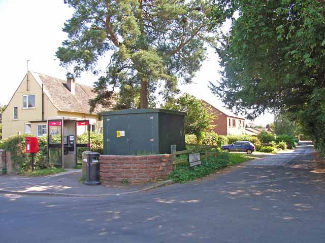
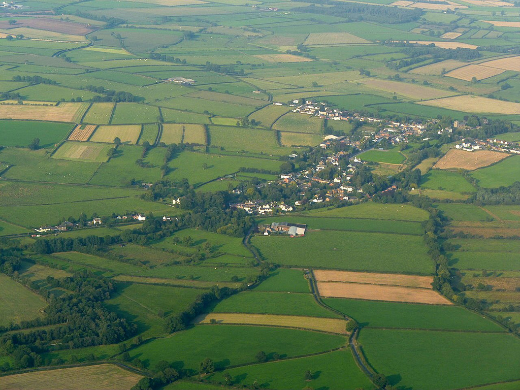
Burgh by Sands ( "Brough") is a village and civil parish in the City of Carlisle district of Cumbria, England, situated near the Solway Firth. The parish includes the village of Burgh by Sands along with Longburgh, Dykesfield, Boustead Hill, Moorhouse and Thurstonfield. It is notable as the place where Edward I of England died.
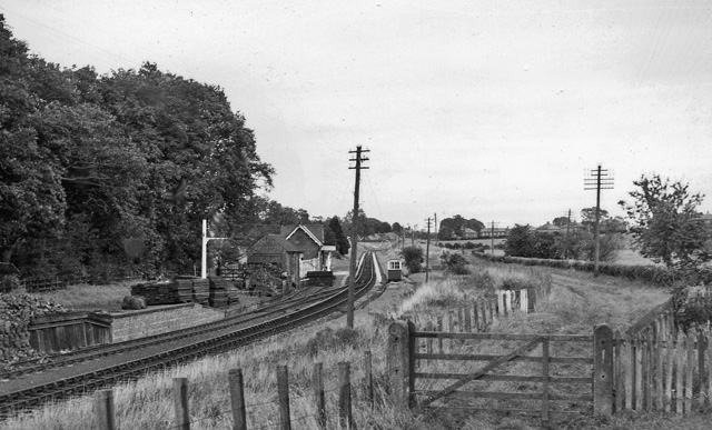
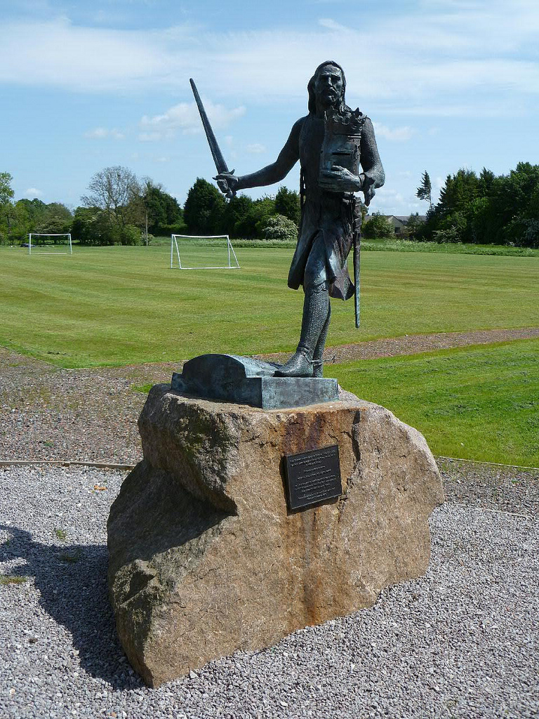
According to the 2011 census the parish had a population of 1,176. The village is about seven miles (11 km) west of Carlisle city centre. The village has a primary school, a pub and a post office. It also has a statue of Edward I at some distance to the north. Burgh was on the Carlisle Navigation canal from 1823 to 1853, after which it was served by the Port Carlisle railway, which was built on the bed of the canal, until its closure in 1932. From 1856 to 1964, railway trains operating on the Carlisle to Silloth line once again stopped at Burgh-by-sands station.
Etymology
Burgh is "doubtless so named from the 'burh' or fort on Hadrian's Wall which ended here." ('Burh' is Old English for 'fortified place', 'town' or 'manor house').
History
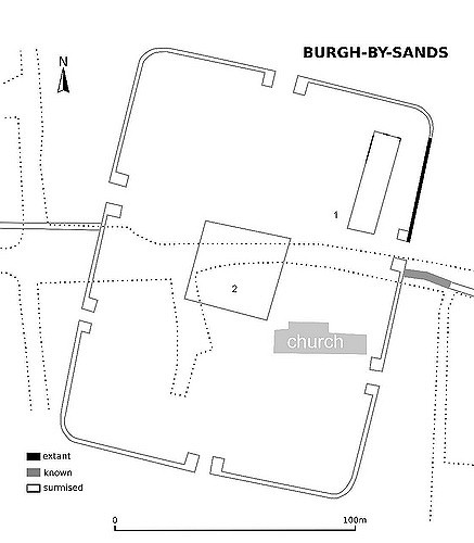
Hadrian's Wall runs through the village, and the site once was that of a Roman fort, Aballava. It is also the death-place of Edward I of England
Feudal barony
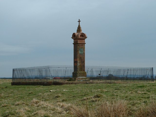
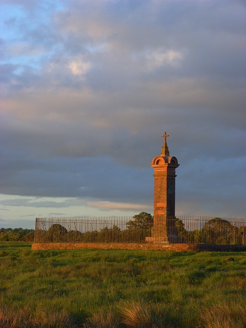
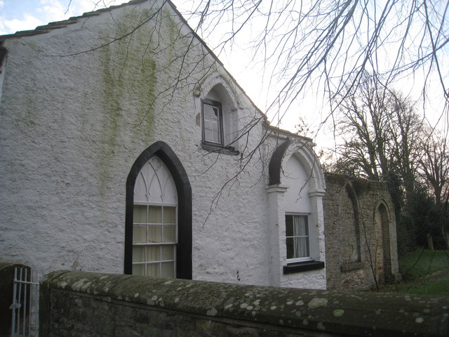
In the 12th century, the castle and lands of Burgh by Sands belonged to a female-dominated line of feudal barons, among them Ada de Engaine. Her granddaughter's second marriage founded a younger branch of the de Multon family, a branch of which held this castle in the 13th century. In the 14th century the Dacre family inherited it by marriage to the heiress. King Edward I, while on his way to war against the Scots, died on the marshes near Burgh, and his corpse lay at the village's 12th-century church until its eventual removal to Westminster Abbey. There is an impressive monument on the marshes erected in 1685 to mark the place where he died. It is 1 miles NNW of the village, is signposted and can be reached on foot.
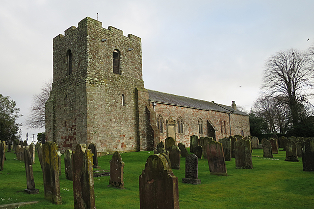
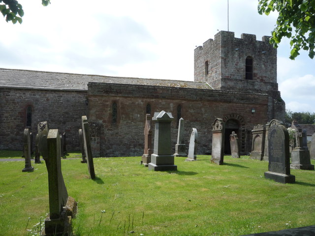
St Michael's Church
The Church of St Michael is built with stone from the Roman wall on the site of a Norman church. It has a broad tower with a base dating from the mid 14th Century, and apart from the 18th century east windows, the rest is Early English. The tower, which can only be reached from within the church, is designed for defence and the ground floor is tunnel-vaulted. The top of the tower is probably 18th century.
Governance
The Parish falls in the electoral ward of Burgh. This wards stretches beyond the boundaries of Burgh by Sands with a total population taken at the 2011 Census of 2,117.
Transport
Public transport currently consists of a bus service from Carlisle five times daily run by Stagecoach.
Visit the page: Burgh By Sands for references and further details. You can contribute to this article on Wikipedia.

from https://historicengland.org.u…
Hadrian's Wall between Fulwood House at Burgh by Sands and Burgh Marsh in wall miles 72 and 73
- "...The monument includes the section of Hadrian's Wall and its associated features between Fulwood House at Burgh by Sands in the east and Burgh Marsh in the west. Hadrian's Wall …
Added by
Simon Cotterill
from https://historicengland.org.u…
Burgh by Sands Roman fort, Beaumont camp, Burgh Castle and Hadrian's Wall from boundary west of churchyard, Beaumont to Burgh Head in wall miles 70 and 71
- "...The monument includes Hadrian's Wall and its associated features between the field boundary at the west side of the churchyard belonging to St Mary's Church at Beaumont in the east …
Added by
Simon Cotterill

Co-Curate Page
Historic Buildings and Monuments in Burgh by Sands Civil Parish
- Listed buildings and scheduled monuments in Burgh by Sands Civil Parish, Cumbria, from the National Heritage List for England[1]. In the absence of a published 'local list', some other public …

from https://historicengland.org.u…
Hadrian's Wall between Fulwood House at Burgh by Sands and Burgh Marsh in wall miles 72 and 73
- "...The monument includes the section of Hadrian's Wall and its associated features between Fulwood House at Burgh by Sands in the east and Burgh Marsh in the west. Hadrian's Wall …
Added by
Simon Cotterill
from https://historicengland.org.u…
Burgh by Sands Roman fort, Beaumont camp, Burgh Castle and Hadrian's Wall from boundary west of churchyard, Beaumont to Burgh Head in wall miles 70 and 71
- "...The monument includes Hadrian's Wall and its associated features between the field boundary at the west side of the churchyard belonging to St Mary's Church at Beaumont in the east …
Added by
Simon Cotterill