Topics > Northumberland > Civil Parishes in Northumberland > Henshaw Civil Parish
Henshaw Civil Parish
Parish boundaries may have changed - for the latest map see the Parish Council or Northumberland County Council.
About the Parish
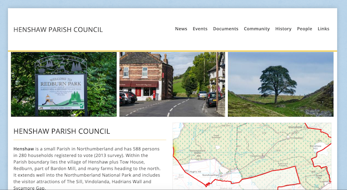
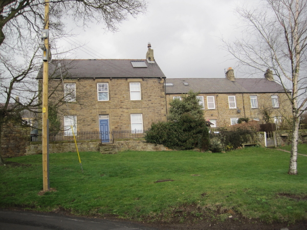
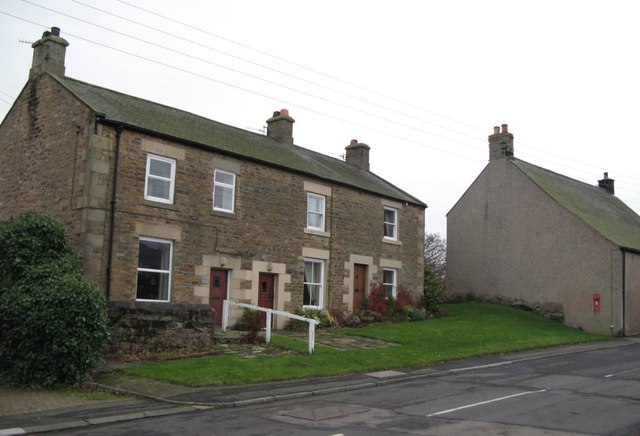
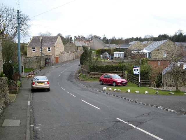
Henshaw is a Civil Parish in Northumberland, located about 10 miles west of Hexham. The bulk of the population is loacted in the south of the parish, which is intersected by the A69 road, in the settlements of Henshaw, Tow House, Redburn, and western part of Bardon Mill. There are many farms heading to the north. The parish extends into the Northumberland National Park and includes 'The Sill' National Landscape Discovery Centre at Once Brewed. Hadrians Wall crosses the parish and there are other Roman sites including Vindolanda (fort).
| Settlements: |
Henshaw, Redburn, Tow House, Bardon Mill (western part) The parish includes several hamlets / farms, including: Once Brewed/Twice Brewed, Winshields |
| Population: |
684 (2021 Census) 762 (2011 Census) 734 (2001 Census) |
| Area: | 12.83/km² |
| Parish Council: | Henshaw Parish Council |
| Unitary Authority: | Northumberland County Council |
Historical |
|
|
Ancient Townships: (in the modern CP area) |
The township of Henshaw included the hamlets of Bardon-Mill and Greenley. Population: 568 in 1801, and 615 in 1851. Gazetteers (directories):
Townships became civil parishes in their own right in 1866 (see below). |
| Ancient Parish: |
The ancient parish of Haltwhistle covered a much wider geographical area, compared to the modern civil parish. It included the townships of Bellister, Blenkinsopp, East Coanwood, Featherstone, Haltwhistle, Hartley-Burn, Henshaw, Melkridge, Plainmellor, Ridley, Thirlwall, Thorngrafton, and Wall-Town. Population: 2,930 in 1801, growing to 5,379 in 1851. Gazetteers (directories):
Ancient parishes refer to the parishes before the split between ecclesiastical (church) and civil parishes in the 19th century. They had a parish church and often were composed of multiple townships and chapelries. In many cases, townships and parishes were originally based on the territory of manors from the feudal system during medieval times. Civil parishes were created following the Poor Law Amendment Act 1866, in which Church of England parishes, extra-parochial areas, townships and chapelries, became "civil parishes" which could set their own poor rate (tax). The reforms of Local Government Act 1894 established elected civil parish councils (or parish meetings for parishes with less than 300 residents) and created urban and rural districts. Boundaries of parishes and civil parishes may have changed over time. |
| Ancient District: |
Tynedale (ward) |
| Poor Law Union: |
Haltwhistle Poor Law Union, formed in 1836. The Union workhouse was located on Greenholme Road in Haltwhistle. Under the Poor Law Amendment Act of 1834 parishes were grouped into Unions, each of which had to build a workhouse if they did not already have one. It ended the old system of locally provided poor relief which had come under strain as numbers out of work grew, following increasing mechanisation of agriculture and the economic downturn after the Napoleonic Wars, along with changing social attitudes. The workhouse provided those unable to support themselves financially with accommodation and work. Inmates were generally segregated into men, women, boys and girls. The workhouse system was abolished by the Local Government Act 1929, but many workhouses lived on as ‘Public Assistance Institutions’ until the National Assistance Act 1948. |
|
District Council: |
Haltwhistle Rural District (1894 - 1974). The district was abolished in 1974, following the Local Government Act 1972. Tynedale District (1974 - 2009). Tynedale covered the area of 5 former districts (Hexham Urban District, Prudhoe Urban District, Bellingham Rural District, Haltwhistle Rural District, and Hexham Rural District). The borough council was abolished when Northumberland County Council became a unitary authority on the 1st of April 2009. |
|
County / Unitary Authority |
In 1572 Parliament passed a bill annexing Hexham and Hexamshire to the County of Northumberland. The ancient county of Northumberland was enlarged following the Counties (Detached Parts) Act 1844; Bedlingtonshire, Norhamshire, Islandshire, the Farne Islands and Monks' House all became part of Northumberland. Up to then they had been enclaves of County Durham. Northumberland County Council formed 1889. Major boundary changes came into effect on the 1st April 1974. This followed the Local Government Act 1972, which formed the non-metropolitan county of Northumberland. This excluded the City of Newcastle upon Tyne and North Tyneside, which up to then had been part of Northumberland, but now became part of the newly formed Tyne & Wear. Northumberland County Council became a unitary authority on the 1st of April 2009. |
See also: ![]() Historic Buildings and Monuments in Henshaw Civil Parish. Note: listed buildings are generally the responsibility of the county council / unitary authority, rather than the parish council.
Historic Buildings and Monuments in Henshaw Civil Parish. Note: listed buildings are generally the responsibility of the county council / unitary authority, rather than the parish council.
from https://northumberlandparishe…
Henshaw Parish Council
- "....Henshaw is a small Parish in Northumberland and has 588 persons in 280 households registered to vote (2013 survey). Within the Parish boundary lies the village of Henshaw plus Tow …
Added by
Simon Cotterill
Co-Curate Page
Henshaw
- Overview Map Street View Henshaw is a village in Northumberland, located near Bardon Mill and lies off the A69 road, 10 miles west of Hexham. Henshaw is situated close to …
Co-Curate Page
Tow House
- Overview Map Street View Tow House is a village in Northumberland, adjacent to Henshaw and Redburn. Tow House is located near Bardon Mill and lies off the A69 road, 10 …
Co-Curate Page
Redburn
- Overview Map Street View Redburn is a village in Northumberland, adjacent to Henshaw and Tow House. Redburn is located near Bardon Mill and lies off the A69 road, 9 miles west of Hexham. The village is …
Co-Curate Page
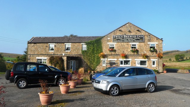
Once Brewed
- Overview About Once Brewed Map Street View Once Brewed is a hamlet in Northumberland, located about 2 miles north-west of Bardon Mill. Once Brewed is within the Northumberland National Park …

Co-Curate Page
Henshaw Township, 1848
- HENSHAW, a township, in the parish and union of Haltwhistle, W. division of Tindale ward, S. division of Northumberland, 11 miles (W.) from Hexham; containing 569 inhabitants. This manor was …

Co-Curate Page
Bardon Mill
- Overview About Bardon Mill Map Street View Bardon Mill is a village in Northumberland, located about 16 miles west of Hexham and 9 miles east of Haltwhistle. It is situated …

from https://northumberlandparishe…
Henshaw Parish Council
- "....Henshaw is a small Parish in Northumberland and has 588 persons in 280 households registered to vote (2013 survey). Within the Parish boundary lies the village of Henshaw plus Tow …
Added by
Simon Cotterill
Co-Curate Page
Henshaw
- Overview Map Street View Henshaw is a village in Northumberland, located near Bardon Mill and lies off the A69 road, 10 miles west of Hexham. Henshaw is situated close to …
Co-Curate Page
Tow House
- Overview Map Street View Tow House is a village in Northumberland, adjacent to Henshaw and Redburn. Tow House is located near Bardon Mill and lies off the A69 road, 10 …
Co-Curate Page
Redburn
- Overview Map Street View Redburn is a village in Northumberland, adjacent to Henshaw and Tow House. Redburn is located near Bardon Mill and lies off the A69 road, 9 miles west of Hexham. The village is …
Co-Curate Page
Once Brewed
- Overview About Once Brewed Map Street View Once Brewed is a hamlet in Northumberland, located about 2 miles north-west of Bardon Mill. Once Brewed is within the Northumberland National Park …
Co-Curate Page
Henshaw Township, 1848
- HENSHAW, a township, in the parish and union of Haltwhistle, W. division of Tindale ward, S. division of Northumberland, 11 miles (W.) from Hexham; containing 569 inhabitants. This manor was …


