Topics > Historical Periods > 19th Century > 1890s > 1896
1896
In Northern England:
- 1896 North Shields Athletic formed (now known as North Shields Football Club)
from Newcastle libraries (flickr)
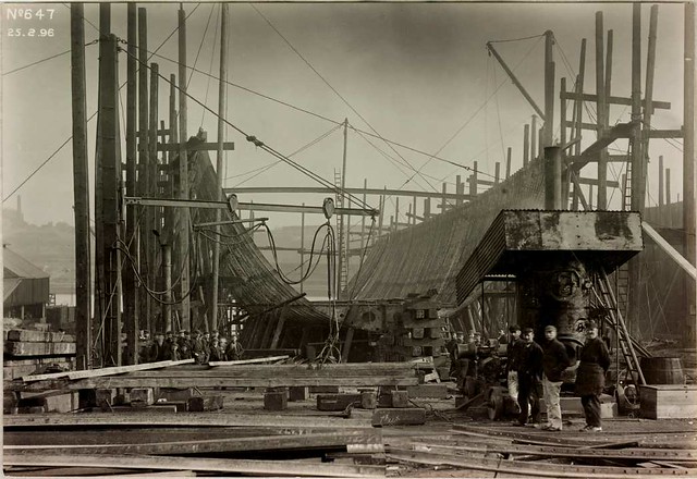
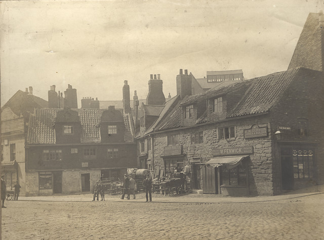
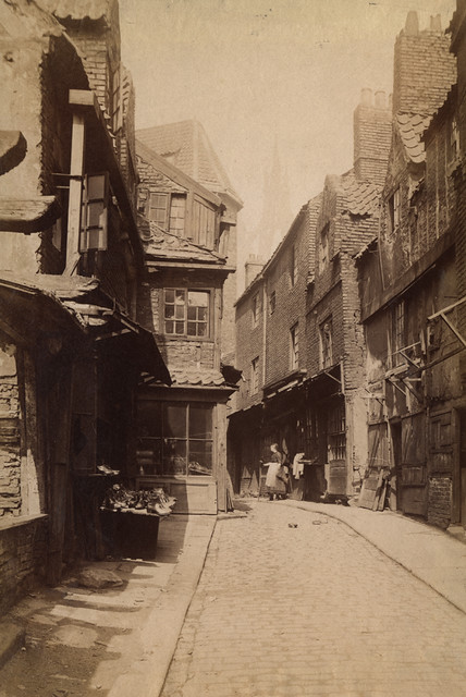
003059d: Cowgate, Newcastle upon Tyne, 1896
Pinned by Simon Cotterill

from Newcastle libraries (flickr)
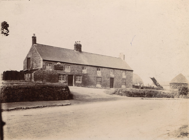
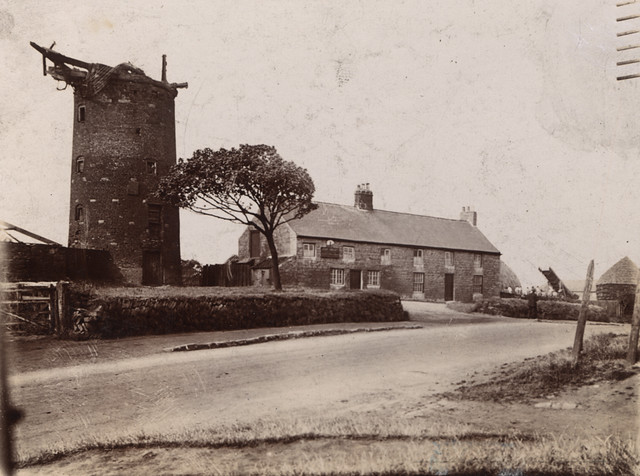
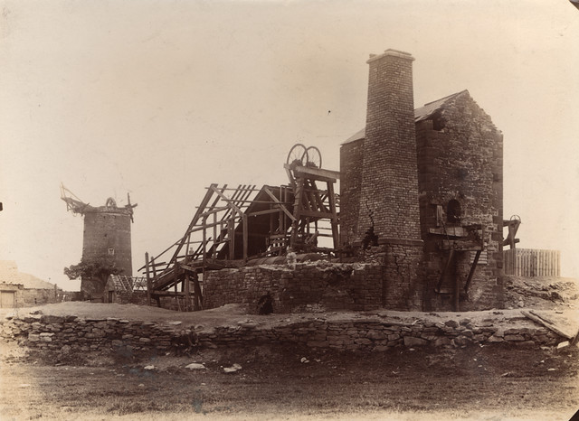
003059b: Windmill and cottages at Cowgate, Newcastle upon Tyne, 1896
Pinned by Simon Cotterill
from Newcastle libraries (flickr)
003059c: Old windmill and cottages at Cowgate, Newcastle upon Tyne, 1896
Pinned by Simon Cotterill
from Newcastle libraries (flickr)
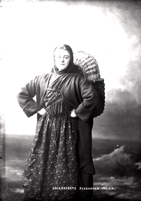
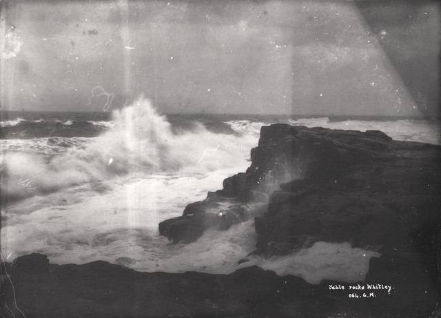
027637:Esther Wakenshaw Fishwife Cullercoats Unknown 1896
Pinned by Simon Cotterill
from Newcastle libraries (flickr)
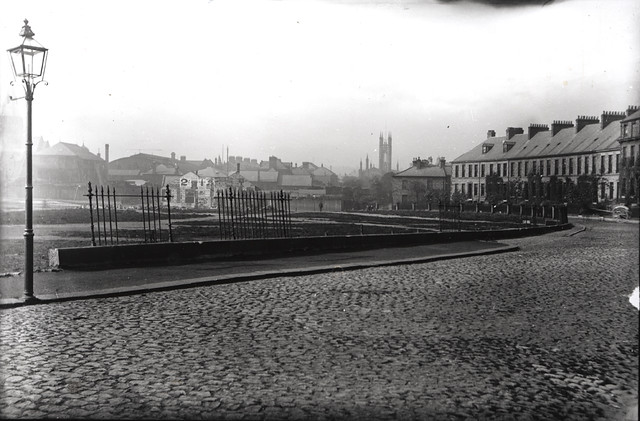
046903:Lovaine Terrace Newcastle upon Tyne Unknown 1896
Pinned by Simon Cotterill
from Newcastle libraries (flickr)
003059a: Old mill at Cowgate, Newcastle upon Tyne, 1896
Pinned by Simon Cotterill
from Newcastle libraries (flickr)
068097: Lovaine Cresent and Lovaine Terrace, Newcastle upon Tyne, 1896
Pinned by Simon Cotterill
from Newcastle libraries (flickr)
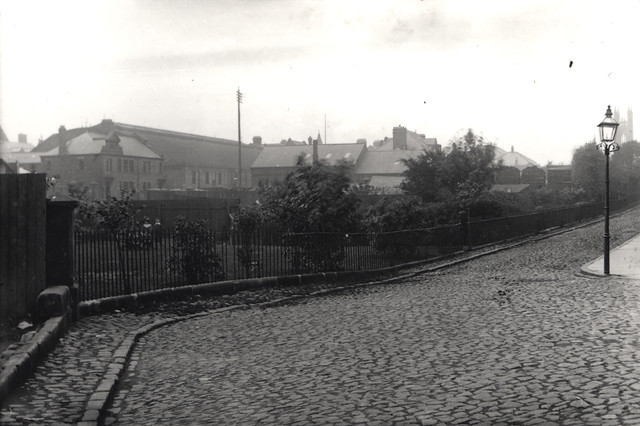
009118:Percy Street Newcastle upon Tyne 1896
Pinned by Simon Cotterill

Co-Curate Page
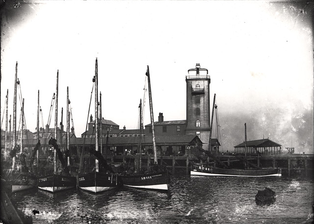
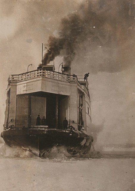
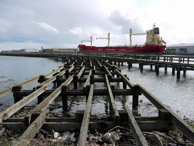
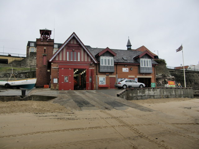
Cullercoats Lifeboat Station
- Overview Map Street View The first lifeboat in Cullercoats was funded by the Duke of Northumberland. This became operational in 1852 following the establishment of The Royal National Lifeboat Institution (RNLI) …
Co-Curate Page
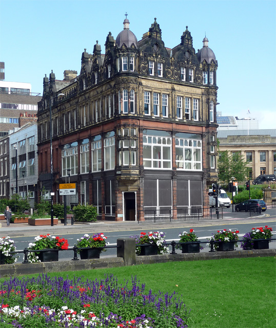
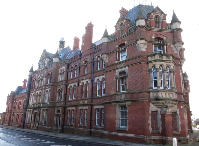
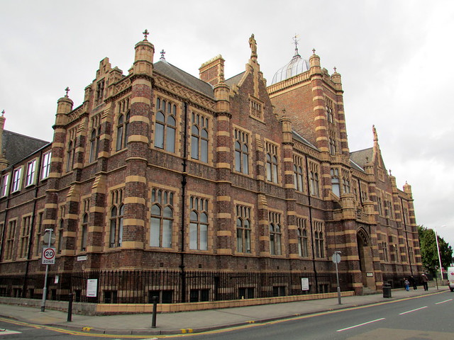
Farrell Centre (Claremont Buildings)
- Overview Map Street View Claremont Buildings are located on Eldon Place, by the corner of Barras Bridge and Claremont Road in Newcastle upon Tyne. Built in 1896, by W. Hope as …
Co-Curate Page
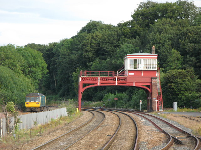
Signal Box
- The overhead railway signal box at Hexham was built in c.1896 by the Newcastle and Carlisle Railway. This, and the signal box at Wylam, are the only 2 surviving examples of this type of …
Co-Curate Page
North Shields FC
- Overview About North Shields FC North Shields Football Club was formed in 1896 as North Shields Athletic, at that time playing in the South Shields and District League. North Shields …

Co-Curate Page
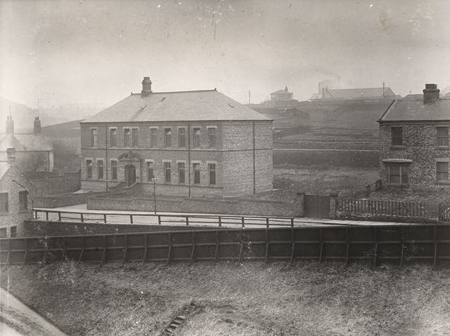
Brougham Primary School
- Overview Map Street View Brougham Primary School is located off Brougham Terrace in the Dyke House area of Hartlepool. The school has about 350 students aged 3 to 11.[1] The school was …
Co-Curate Page
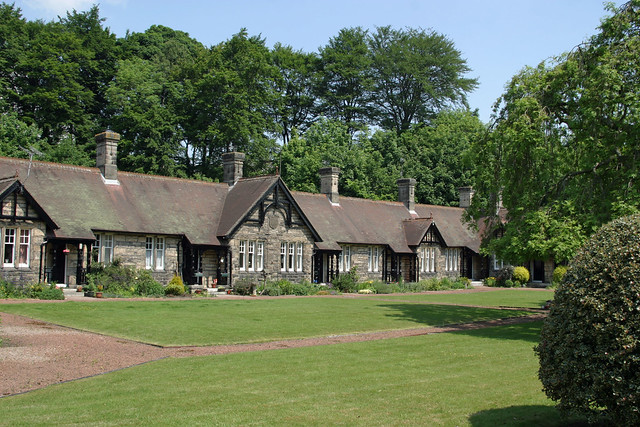
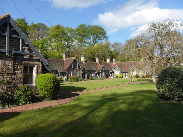
Armstrong Cottages
- Overview Map Street View Twelve almshouses, located off Town Foot in Rothbury, dated 1896. With a plaque inscribed "Erected by WILLIAM GEORGE BARON ARMSTRONG of Cragside in Memory of ANNE …
Co-Curate Page
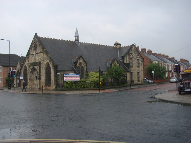
St Cuthbert's Church, Heaton Road
- Overview Map Street View St Cuthbert's Church in Heaton is a United Reformed and Methodist partnership. This former Presbyterian church on the corner of Heaton Road and Cardigan Terrace was built …
Co-Curate Page
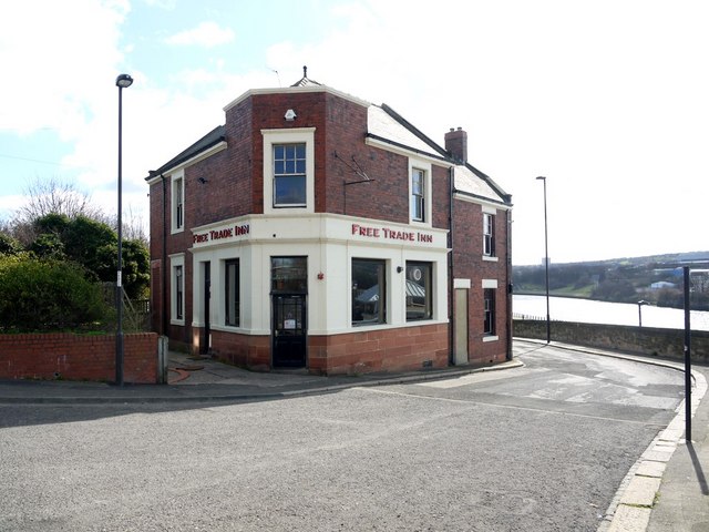
Free Trade Inn, St Lawrence Road
- Overview Map Street View Inside The Free Trade Inn is located on St Lawrence Road in the Ouseburn area of Newcastle. The Inn was rebuilt in 1896, with alterations in …
Co-Curate Page
Old Police Station, Blyth
- Overview Map Street View The former Police Station is located on the south side of Bridge Street in Blyth. The Police Station was built in 1896 by John Cresswell, the County …
Co-Curate Page
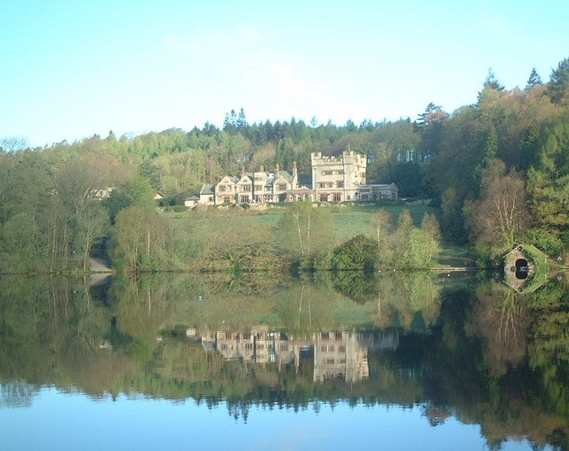
Outward Bound Eskdale
- Overview Map Outward Bound Eskdale is run by The Outward Bound Trust. The centre is located at the north-east side of Eskdale Green, by a tarn (lake). The building is …
Co-Curate Page
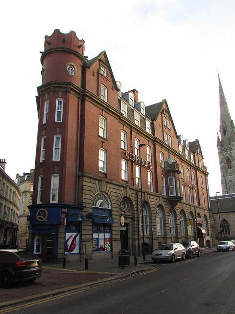
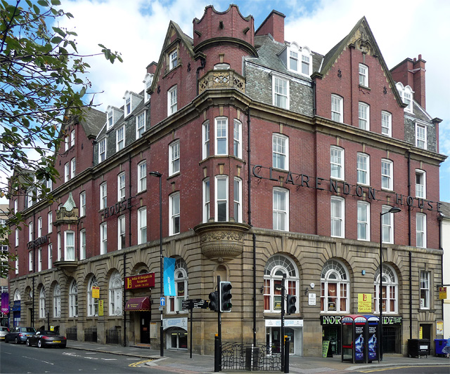
Clarendon House, Clayton Street West
- Overview Map Street View Clarendon House on the corner of Clayton Street West and Bewick Street in Newcastle was originally built as a temperence hotel. It was designed by Oliver …
Co-Curate Page
Whitehall Road Methodist Church, Gateshead
- Overview Map Street View Whitehall Road Methodist Church is located on Whitehall Road in Bensham, Gateshead. The church was opened as Whitehall Road New Connexion Methodist Church on the 29th …
Co-Curate Page
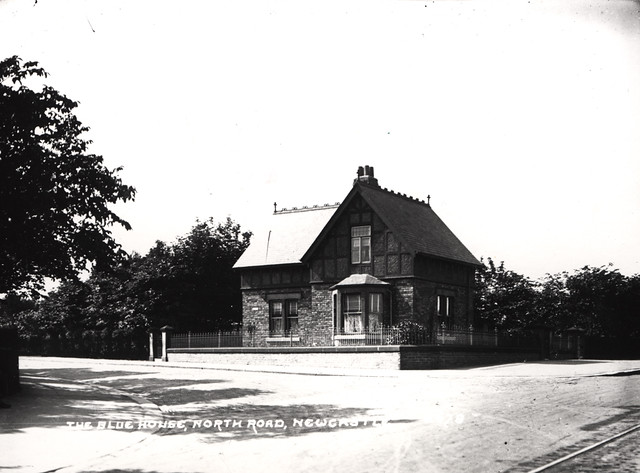
Blue House, Great North Road
- Overview Map Street View The Blue House on Town Moor in Newcastle is located on the juction of Grandstand Road and the Great North Road - and gives its name …

Co-Curate Page
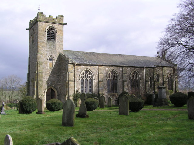
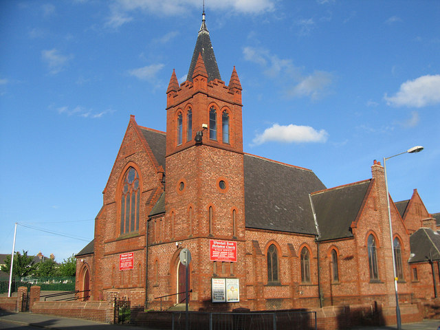
Church of the Holy Sepulchre, Ashington
- Overview Map Street View The Church Of The Holy Sepulchre is located on Wansbeck Road in Ashington. The Parish Church was built 1887-1896, in a late-14th Century style, by W.S. …

from Newcastle libraries (flickr)
003059d: Cowgate, Newcastle upon Tyne, 1896
Pinned by Simon Cotterill
from Newcastle libraries (flickr)
003059b: Windmill and cottages at Cowgate, Newcastle upon Tyne, 1896
Pinned by Simon Cotterill
from Newcastle libraries (flickr)
003059c: Old windmill and cottages at Cowgate, Newcastle upon Tyne, 1896
Pinned by Simon Cotterill
from Newcastle libraries (flickr)
027637:Esther Wakenshaw Fishwife Cullercoats Unknown 1896
Pinned by Simon Cotterill
from Newcastle libraries (flickr)
046903:Lovaine Terrace Newcastle upon Tyne Unknown 1896
Pinned by Simon Cotterill
from Newcastle libraries (flickr)
003059a: Old mill at Cowgate, Newcastle upon Tyne, 1896
Pinned by Simon Cotterill
from Newcastle libraries (flickr)
068097: Lovaine Cresent and Lovaine Terrace, Newcastle upon Tyne, 1896
Pinned by Simon Cotterill
from Newcastle libraries (flickr)
009118:Percy Street Newcastle upon Tyne 1896
Pinned by Simon Cotterill
Co-Curate Page
Cullercoats Lifeboat Station
- Overview Map Street View The first lifeboat in Cullercoats was funded by the Duke of Northumberland. This became operational in 1852 following the establishment of The Royal National Lifeboat Institution (RNLI) …
Co-Curate Page
Farrell Centre (Claremont Buildings)
- Overview Map Street View Claremont Buildings are located on Eldon Place, by the corner of Barras Bridge and Claremont Road in Newcastle upon Tyne. Built in 1896, by W. Hope as …
Co-Curate Page
Signal Box
- The overhead railway signal box at Hexham was built in c.1896 by the Newcastle and Carlisle Railway. This, and the signal box at Wylam, are the only 2 surviving examples of this type of …
Co-Curate Page
North Shields FC
- Overview About North Shields FC North Shields Football Club was formed in 1896 as North Shields Athletic, at that time playing in the South Shields and District League. North Shields …
Co-Curate Page
Brougham Primary School
- Overview Map Street View Brougham Primary School is located off Brougham Terrace in the Dyke House area of Hartlepool. The school has about 350 students aged 3 to 11.[1] The school was …
Co-Curate Page
Armstrong Cottages
- Overview Map Street View Twelve almshouses, located off Town Foot in Rothbury, dated 1896. With a plaque inscribed "Erected by WILLIAM GEORGE BARON ARMSTRONG of Cragside in Memory of ANNE …
Co-Curate Page
St Cuthbert's Church, Heaton Road
- Overview Map Street View St Cuthbert's Church in Heaton is a United Reformed and Methodist partnership. This former Presbyterian church on the corner of Heaton Road and Cardigan Terrace was built …
Co-Curate Page
Free Trade Inn, St Lawrence Road
- Overview Map Street View Inside The Free Trade Inn is located on St Lawrence Road in the Ouseburn area of Newcastle. The Inn was rebuilt in 1896, with alterations in …
Co-Curate Page
Old Police Station, Blyth
- Overview Map Street View The former Police Station is located on the south side of Bridge Street in Blyth. The Police Station was built in 1896 by John Cresswell, the County …
Co-Curate Page
Outward Bound Eskdale
- Overview Map Outward Bound Eskdale is run by The Outward Bound Trust. The centre is located at the north-east side of Eskdale Green, by a tarn (lake). The building is …
Co-Curate Page
Clarendon House, Clayton Street West
- Overview Map Street View Clarendon House on the corner of Clayton Street West and Bewick Street in Newcastle was originally built as a temperence hotel. It was designed by Oliver …
Co-Curate Page
Whitehall Road Methodist Church, Gateshead
- Overview Map Street View Whitehall Road Methodist Church is located on Whitehall Road in Bensham, Gateshead. The church was opened as Whitehall Road New Connexion Methodist Church on the 29th …
Co-Curate Page
Blue House, Great North Road
- Overview Map Street View The Blue House on Town Moor in Newcastle is located on the juction of Grandstand Road and the Great North Road - and gives its name …
Co-Curate Page
Church of the Holy Sepulchre, Ashington
- Overview Map Street View The Church Of The Holy Sepulchre is located on Wansbeck Road in Ashington. The Parish Church was built 1887-1896, in a late-14th Century style, by W.S. …
Church of the Holy Sepulchre, Ashington
Free Trade Inn, St Lawrence Road, Newcastle
Clarendon House, Clayton Street West, Newcastle
Whitehall Road Methodist Church, Gateshead
Former Technical College building, Northgate, Darlington
Brougham Primary School, Hartlepool
Farrell Centre (Claremont Buildings)


