Topics > Historical Periods > 19th Century > 1890s > 1893
1893
In Northern England:
- 1893: Dunston Staiths on the River Tyne built by the North Eastern Railway Company.
- 1893: opening of Randolph Colliery near Evenwood, County Durham.
- 8th Nov 1893: opening of Tullie House Public Library, Museum and School of Art, Carlisle
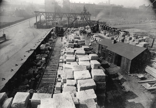
from Newcastle libraries (flickr)
047331:Stone Yard City Road Newcastle upon Tyne Unknown 1893
Pinned by Simon Cotterill
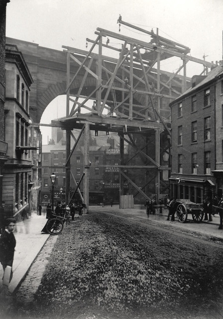
from Newcastle libraries (flickr)
047328: Dene Street, Newcastle upon Tyne, 1893
Pinned by Simon Cotterill
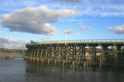
Co-Curate Page
Dunston Staiths
- Overview About Dunston Staiths Timeline Map Street View "Dunston Staiths on the River Tyne is believed to be the largest timber structure in Europe, at its height, 5.5m tonnes of …
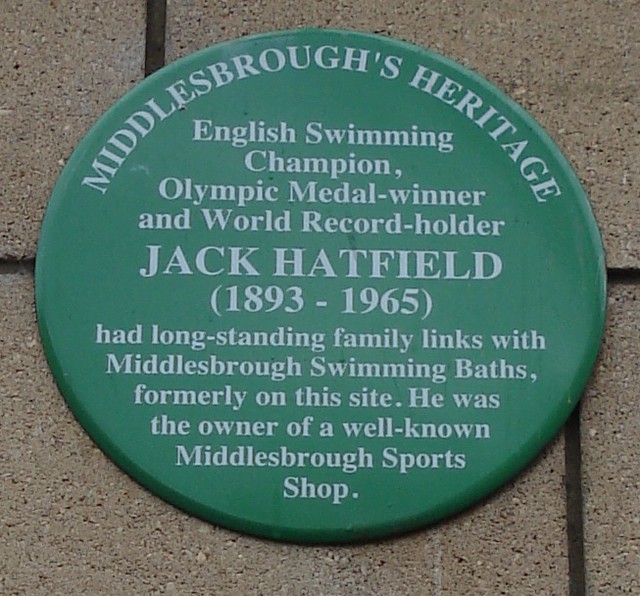
from Flickr (flickr)
Middlesbrough Heritage plaque - Jack Hatfield 1893 -1965 - on site of former Middlesbrough Swimming Baths.
Pinned by Simon Cotterill
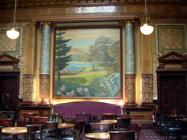
Co-Curate Page
Centurion Bar, Newcastle Central Station
- Overview Map Street View The Centurion Bar was originally built in 1893 as a grand waiting lounge and bar for first class passengers, designed by John Dobson as part of Newcastle …
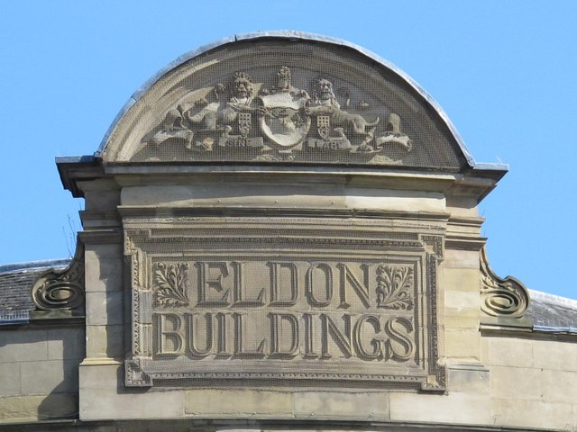
Co-Curate Page
Eldon Buildings
- Overview Map Street View The Eldon Buildings is a curved corner building on the junction of Blackett Street and Grey Street in Newcastle. The building includes Nos. 29, 31, 33 …
Co-Curate Page
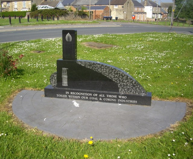
Randolph Colliery (1893 - 1962)
- Randolph Colliery, near Evenwood in County Durham, opened in 1893. At its peak, in 1914, there were 1,039 people employed at the colliery (782 working below ground and 257 on the …
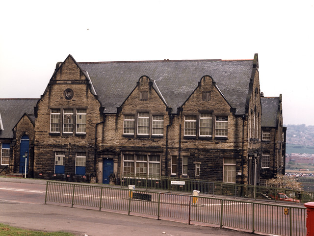
Co-Curate Page
South Benwell School (1893 - 1980)
- South Benwell School was located near the bottom of Atkinson Road in Benwell and opened in 1893. By the early 20th century the school had over 1,000 pupils (age 5 …
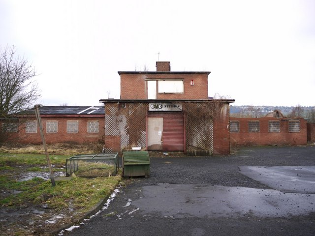
Co-Curate Page
Clara Vale Colliery (1893 - 1966)
- Clara Vale Colliery was establised in the township of Crawcrook in July 1893. It was owned by the Stella Coal Company. Housing was built for the miners and their families, …
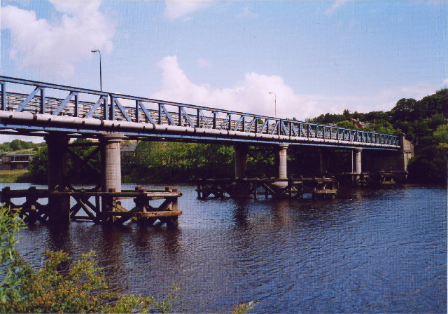
Co-Curate Page
Newburn Bridge
- Overview About Newburn Bridge Map Street View Newburn Bridge is a road bridge over the River Tyne between Newburn in the City of Newcastle upon Tyne and Ryton in the …
Co-Curate Page
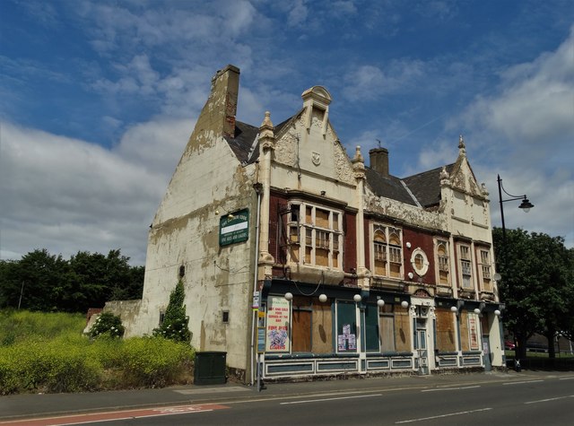
Captain Cook Pub, Durham St, Middlesbrough
- Overview Map Street View The Captain Cook was a public house on Durham Street in the Middlehaven area of Middlesbrough. The pub, named after Captain James Cook, designed in a …
Co-Curate Page
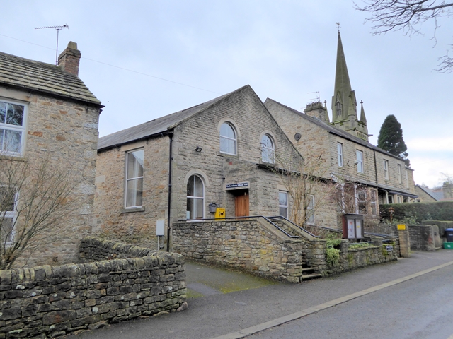
Village Hall, Cotherstone
- Overview Map Street View The village hall in Cotherstone was originally built in 1893 as a Temperance Hall. It has been modernised for it's use as a village hall and …
Co-Curate Page
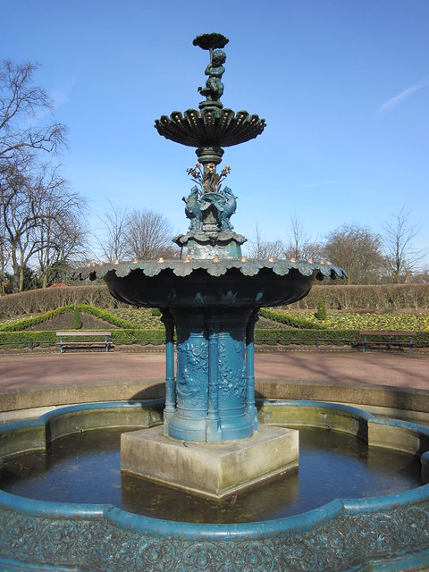
Fountain, Ropner Park
- Overview Map Street View At the centre of Ropner Park is a three-tiered cast iron ornamental fountain. It was built in 1893, made by Walter Macfarlane and Company of Saracen …
Co-Curate Page
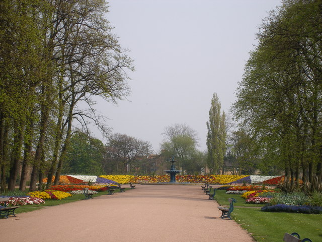
Ropner Park
- Overview Map Street View Ropner Park is a public park in Stockton-on-Tees. In 1890, Robert Ropner of Preston Hall, donated the money for Stockton-on-Tees Town Council to purchase land known …
Co-Curate Page
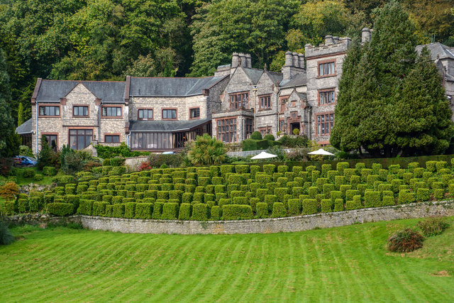
Netherwood Hotel, Grange-over-Sands
- Overview Map Street View The Netherwood Hotel is located on the hillside, by Lindale Road in Grange-over-Sands. Formerly it was a country house known as Blawith, buit in 1893, by …
Co-Curate Page
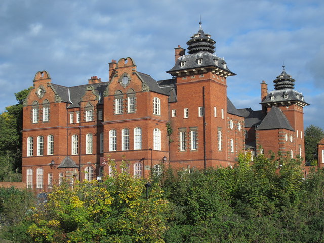
Former Ouseburn Schools, Walker Road
- Overview Map Street View Newcastle Enterprise Centre (aka Ouseburn House) is a large building located on Walker Road by it's junctions with Albion Row and Ford Streets. The building was originally …
Co-Curate Page
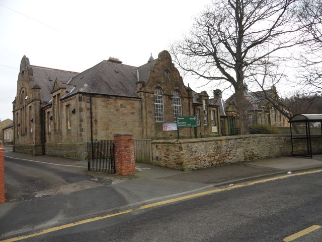
Burnopfield Community Centre
- Overview Map Street View Burnopfield Community Centre is located on Syke Road in Buropfield. The Jacobean style building dates from 1893 and was originally built as Leazes Board School. The school opened …
Co-Curate Page
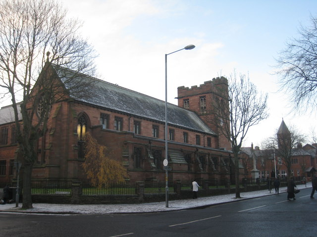
Our Lady & Saint Joseph's Church, Carlisle
- Overview Map Street View Our Lady & Saint Joseph's Catholic Church is located on Warwick Road in Carlisle. The foundation stone was laid on the 18th of May 1891, on …

Co-Curate Page
Tullie (museum & gallery)
- Overview Map Street View Inside Tullie is a museum, art gallery, community hub in Carlisle, with it's main entrance on Castle Street. It opened as Tullie House Public Library, Museum …
Co-Curate Page
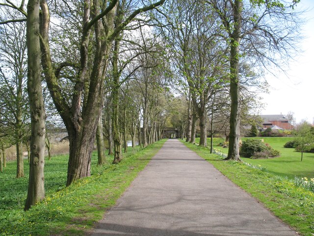
Bitts Park
- Overview Map Street View Bitts Park in Carlisle is located east and north of Carlisle Castle, by the River Eden, near its confluence with the River Caldew. It was the …


from Newcastle libraries (flickr)
047331:Stone Yard City Road Newcastle upon Tyne Unknown 1893
Pinned by Simon Cotterill

from Newcastle libraries (flickr)
047328: Dene Street, Newcastle upon Tyne, 1893
Pinned by Simon Cotterill

Co-Curate Page
Dunston Staiths
- Overview About Dunston Staiths Timeline Map Street View "Dunston Staiths on the River Tyne is believed to be the largest timber structure in Europe, at its height, 5.5m tonnes of …

from Flickr (flickr)
Middlesbrough Heritage plaque - Jack Hatfield 1893 -1965 - on site of former Middlesbrough Swimming Baths.
Pinned by Simon Cotterill

Co-Curate Page
Centurion Bar, Newcastle Central Station
- Overview Map Street View The Centurion Bar was originally built in 1893 as a grand waiting lounge and bar for first class passengers, designed by John Dobson as part of Newcastle …

Co-Curate Page
Eldon Buildings
- Overview Map Street View The Eldon Buildings is a curved corner building on the junction of Blackett Street and Grey Street in Newcastle. The building includes Nos. 29, 31, 33 …

Co-Curate Page
Randolph Colliery (1893 - 1962)
- Randolph Colliery, near Evenwood in County Durham, opened in 1893. At its peak, in 1914, there were 1,039 people employed at the colliery (782 working below ground and 257 on the …

Co-Curate Page
South Benwell School (1893 - 1980)
- South Benwell School was located near the bottom of Atkinson Road in Benwell and opened in 1893. By the early 20th century the school had over 1,000 pupils (age 5 …

Co-Curate Page
Clara Vale Colliery (1893 - 1966)
- Clara Vale Colliery was establised in the township of Crawcrook in July 1893. It was owned by the Stella Coal Company. Housing was built for the miners and their families, …

Co-Curate Page
Newburn Bridge
- Overview About Newburn Bridge Map Street View Newburn Bridge is a road bridge over the River Tyne between Newburn in the City of Newcastle upon Tyne and Ryton in the …

Co-Curate Page
Captain Cook Pub, Durham St, Middlesbrough
- Overview Map Street View The Captain Cook was a public house on Durham Street in the Middlehaven area of Middlesbrough. The pub, named after Captain James Cook, designed in a …

Co-Curate Page
Village Hall, Cotherstone
- Overview Map Street View The village hall in Cotherstone was originally built in 1893 as a Temperance Hall. It has been modernised for it's use as a village hall and …

Co-Curate Page
Fountain, Ropner Park
- Overview Map Street View At the centre of Ropner Park is a three-tiered cast iron ornamental fountain. It was built in 1893, made by Walter Macfarlane and Company of Saracen …

Co-Curate Page
Ropner Park
- Overview Map Street View Ropner Park is a public park in Stockton-on-Tees. In 1890, Robert Ropner of Preston Hall, donated the money for Stockton-on-Tees Town Council to purchase land known …

Co-Curate Page
Netherwood Hotel, Grange-over-Sands
- Overview Map Street View The Netherwood Hotel is located on the hillside, by Lindale Road in Grange-over-Sands. Formerly it was a country house known as Blawith, buit in 1893, by …

Co-Curate Page
Former Ouseburn Schools, Walker Road
- Overview Map Street View Newcastle Enterprise Centre (aka Ouseburn House) is a large building located on Walker Road by it's junctions with Albion Row and Ford Streets. The building was originally …

Co-Curate Page
Burnopfield Community Centre
- Overview Map Street View Burnopfield Community Centre is located on Syke Road in Buropfield. The Jacobean style building dates from 1893 and was originally built as Leazes Board School. The school opened …

Co-Curate Page
Our Lady & Saint Joseph's Church, Carlisle
- Overview Map Street View Our Lady & Saint Joseph's Catholic Church is located on Warwick Road in Carlisle. The foundation stone was laid on the 18th of May 1891, on …

Co-Curate Page
Tullie (museum & gallery)
- Overview Map Street View Inside Tullie is a museum, art gallery, community hub in Carlisle, with it's main entrance on Castle Street. It opened as Tullie House Public Library, Museum …

Co-Curate Page
Bitts Park
- Overview Map Street View Bitts Park in Carlisle is located east and north of Carlisle Castle, by the River Eden, near its confluence with the River Caldew. It was the …

Former Ouseburn Schools, Walker Road

Our Lady & Saint Joseph's Church, Carlisle

South Benwell School (1893 - 1980)

Tullie museum and gallery, Carlisle

Clara Vale Colliery (1893 - 1966)
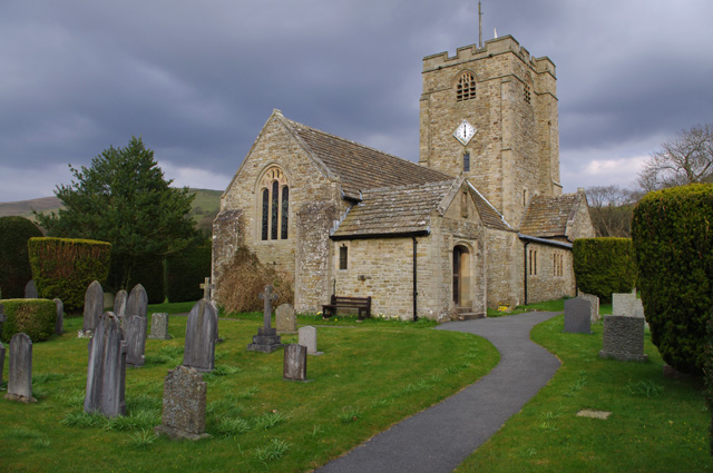
Church of St Bartholomew, Barbon

Randolph Colliery (1893 - 1962)

Centurion Bar, Newcastle Central Station

Captain Cook Pub, Durham St, Middlesbrough

Netherwood Hotel, Grange-over-Sands
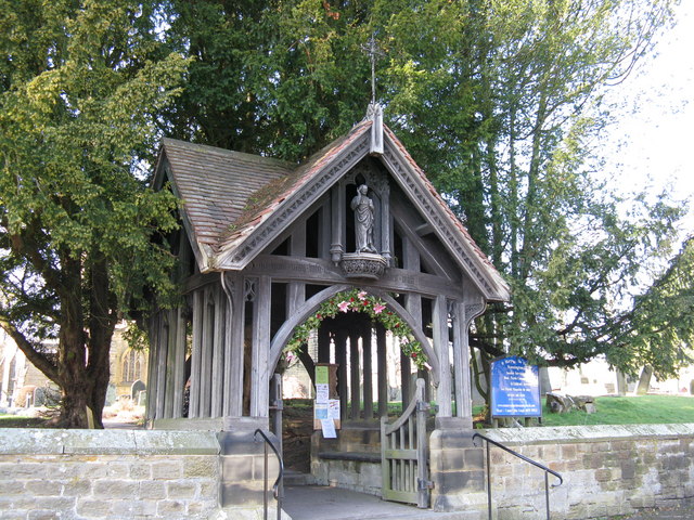
Lych Gate to St Mary's Church, Stannington
