Topics > Historical Periods > 19th Century > 1830s > 1833
1833
In Northern England:
- 1833: completion of the Clarence Railway, built to connect Stockton-on-Tees to the newly developed port at Samphire Batts.
from http://books.google.co.uk/boo…
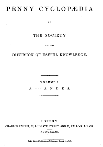
The Penny Cyclopædia of the Society for the Diffusion of Useful Knowledge, Volume 1. C Knight, 1833.
- Book published in 1833, digitised and available as a free Google eBook.
Added by
Simon Cotterill
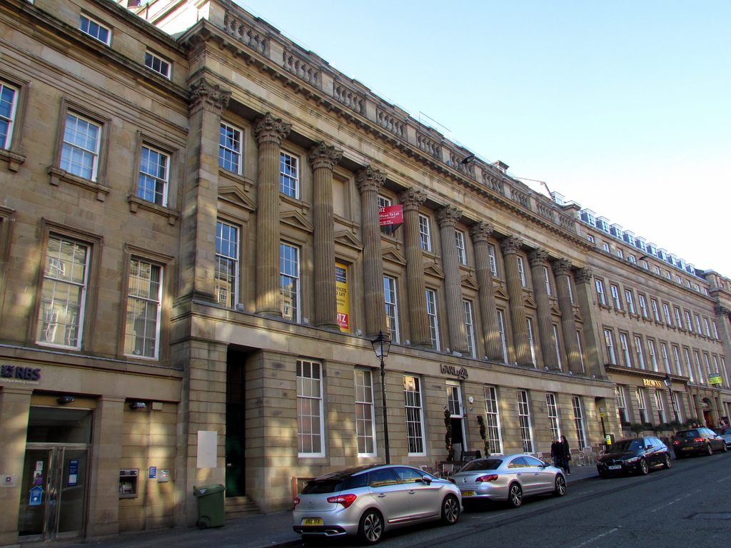
from Newcastle libraries (flickr)
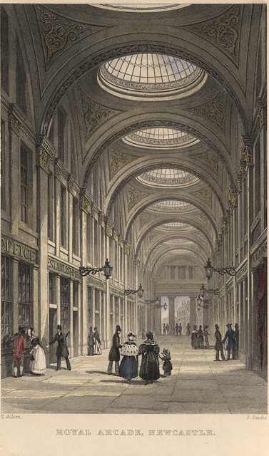
a101:Royal Arcade Newcastle upon Tyne; T. Allom;1833
Pinned by Simon Cotterill
from Newcastle libraries (flickr)
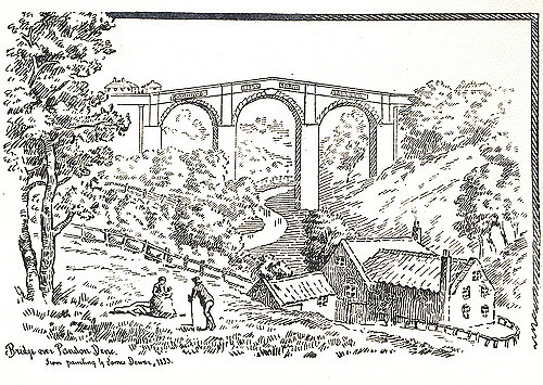
008583:Pandon Dene Bridge Newcastle upon Tyne James Dewar 1833
Pinned by Simon Cotterill
from Victoria Sage (flickr)
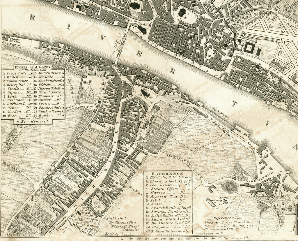
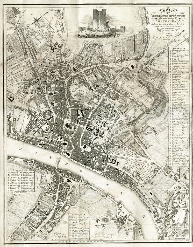
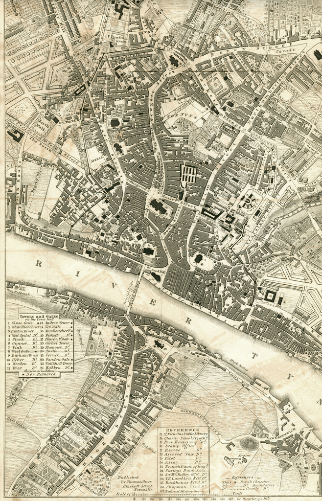
Map of Newcastle Upon Tyne and Gateshead, 1833
Pinned by Simon Cotterill
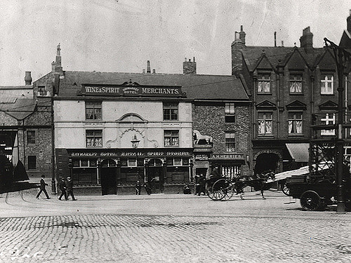
from Newcastle libraries (flickr)
033789:Haymarket Hotel Haymarket Unknown c. 1900
Pinned by Simon Cotterill

Co-Curate Page
Church of St. James, Benwell
- Overview Map Street View St James’ Church in Benwell first opened as a Chapel of Ease in 1833. The church was extended in 1864 by addition of chancel and south aisle, designed …
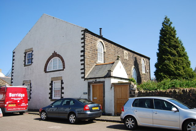
Co-Curate Page
United Reformed Church
- Overview Map Street View The former United Reformed Church in Embleton was originally built as a Presbyterian Church in 1833. The building, altered in the 1920's, is Grade II listed …
Co-Curate Page
Church of St Jude, Knarsdale
- Overview Map Street View The Church of St Jude in Knarsdale was rebuilt in 1833, on the site of earlier 14th and 17th century churches.[1] An inscription on the south …

from https://blog.nls.uk/just-who-…
The Wandering Piper - 1833
- Print of 1833 by Douglas and Kent, 99 Side, Newcastle. Image from the National Library of Scotland: https://blog.nls.uk/just-who-was-the-wandering-piper/
Added by
Simon Cotterill
Co-Curate Page
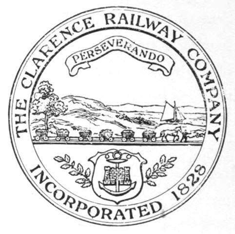
Clarence Railway
- Overview About the Clarence Railway The Clarence Railway was an early railway company that operated in north-east England between 1833 and 1853. The railway was built to take coal …
Co-Curate Page
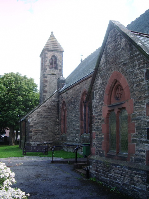
Church of St Paul, Seaton
- Overview Map Street View St Paul's Church on Church Road in Seaton, Cumbria, was built in 1882, designed by George Watson of Keswick. The church opened in July 1883. It …
Co-Curate Page
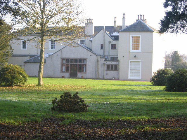
Camerton Hall
- Overview Map Street View Camerton Hall, built on the site of a medieval tower house, is situated by the River Derwent, located to the south-west of the village of Camerton …
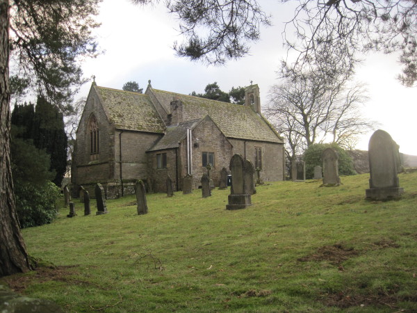
Co-Curate Page
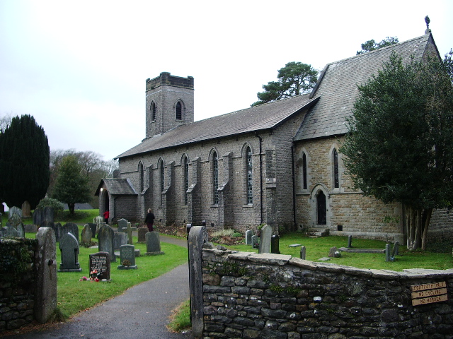
Church of Holy Trinity, Casterton
- Overview Map Street View Holy Trinity Church at Casterton was built 1831-1833, it's chancel was added in c1860, by Crowther. Some of it's stained glass was by stained glass by …
Co-Curate Page
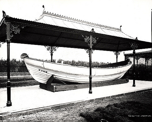
Lifeboat, Ocean Road, South Shields
- The "Tyne" lifeboat was built in South Shields by J. Oliver in 1833, and was one of the earliest, purpose-built lifeboats. The Tyne served for over six decades, and her …

from http://books.google.co.uk/boo…
The Penny Cyclopædia of the Society for the Diffusion of Useful Knowledge, Volume 1. C Knight, 1833.
- Book published in 1833, digitised and available as a free Google eBook.
Added by
Simon Cotterill
from Newcastle libraries (flickr)
a101:Royal Arcade Newcastle upon Tyne; T. Allom;1833
Pinned by Simon Cotterill
from Newcastle libraries (flickr)
008583:Pandon Dene Bridge Newcastle upon Tyne James Dewar 1833
Pinned by Simon Cotterill
from Victoria Sage (flickr)
Map of Newcastle Upon Tyne and Gateshead, 1833
Pinned by Simon Cotterill
from Newcastle libraries (flickr)
033789:Haymarket Hotel Haymarket Unknown c. 1900
Pinned by Simon Cotterill
Co-Curate Page
Church of St. James, Benwell
- Overview Map Street View St James’ Church in Benwell first opened as a Chapel of Ease in 1833. The church was extended in 1864 by addition of chancel and south aisle, designed …
Co-Curate Page
United Reformed Church
- Overview Map Street View The former United Reformed Church in Embleton was originally built as a Presbyterian Church in 1833. The building, altered in the 1920's, is Grade II listed …
Co-Curate Page
Church of St Jude, Knarsdale
- Overview Map Street View The Church of St Jude in Knarsdale was rebuilt in 1833, on the site of earlier 14th and 17th century churches.[1] An inscription on the south …
from https://blog.nls.uk/just-who-…
The Wandering Piper - 1833
- Print of 1833 by Douglas and Kent, 99 Side, Newcastle. Image from the National Library of Scotland: https://blog.nls.uk/just-who-was-the-wandering-piper/
Added by
Simon Cotterill
Co-Curate Page
Clarence Railway
- Overview About the Clarence Railway The Clarence Railway was an early railway company that operated in north-east England between 1833 and 1853. The railway was built to take coal …
Co-Curate Page
Church of St Paul, Seaton
- Overview Map Street View St Paul's Church on Church Road in Seaton, Cumbria, was built in 1882, designed by George Watson of Keswick. The church opened in July 1883. It …
Co-Curate Page
Camerton Hall
- Overview Map Street View Camerton Hall, built on the site of a medieval tower house, is situated by the River Derwent, located to the south-west of the village of Camerton …
Co-Curate Page
Church of Holy Trinity, Casterton
- Overview Map Street View Holy Trinity Church at Casterton was built 1831-1833, it's chancel was added in c1860, by Crowther. Some of it's stained glass was by stained glass by …