Topics > Heritage Sites > Hadrian's Wall > Wall Mile 67
Wall Mile 67
Hadrian's Wall - Wall Mile 67
Hadrian's Wall stretches from the east to west coast of England and was an important frontier of the Roman Empire. Building of the wall began in AD 122 and took six years to complete it’s 84 mile (80 Roman mile) length. Soldiers were garrisoned along the line of the wall in large forts, smaller milecastles, and intervening turrets. The Vallum, a large ditch with mounds on either side, ran along the south side of the wall, protecting the rear of the frontier. Hadrian's Wall was designated as a World Heritage Site in 1987.
Wall mile 67 was originally a turf wall, later replaced by stone. From Milecastle 49 to the western end of Hadrian's Wall on the Solway Firth, the wall was originally constructed from turf, possibly due to the absence of limestone. Subsequently, the turf wall was demolished and replaced with a stone wall.
Wall Mile 67:
- Milecastle 67 (Stainton) - exact location uncertain; it probably lay at the south end of Wavery Railway Viaduct.
- Turret 67a - exact location unknown
- Turret 67b - exact location unknown
Hadrian's Wall survives as a buried feature in Wall Mile 67. Milecastle 67 probably lay at the south end of Waverley Railway Viaduct, where Roman coins were found in 1861 while making the railway cutting. Hadrian's Wall Path and cycleway run alongside the south banks of the River Eden and pass by the viaduct.
Scheduled Monument (#1018309): Hadrian's Wall between the east end of Davidson's Banks and road to Grinsdale and vallum between Davidson's Banks and dismantled railway in wall miles 67 and 68
Click the headings below to expand (selected extracts from the Historic England scheduling)
Map showing the buried remains of Hadrian's Wall and Vallum in this section.
%
Hadrian's Wall survives as a buried feature throughout the whole of this section with no remains visible above ground. Its course, as depicted on Ordnance Survey maps, is based on MacLauchlan's 1857 survey. The course follows the crest of the river cliff overlooking the River Eden to the north. There was probably no wall ditch along this section as the steep river cliff, which is now being eroded back by the river, would have rendered a ditch here superfluous.
The exact locations of turrets 67a, 67b and 68a have also not yet been confirmed. On the basis of the usual spacing they are anticipated to lie on the line of the wall at the eastern end of the monument; below the electricity transmission lines which cross Davidson's Banks; and 240m ESE of the Recreation Hall on the road to Grinsdale respectively.
The course of the Vallum is known throughout most of this section, in places as a buried feature, and as a slight intermittent earthwork visible on the ground as a low depression averaging 30m wide. The north mound survives up to 0.5m high at the east end of this section with crossings still evident.
The course of the Roman road known as the Military Way, which ran along the corridor between the Wall and the Vallum linking turrets, milecastles and forts, has not yet been confirmed in this section.
Scheduled Monument (#1014692): Hadrian's Wall vallum between the dismantled railway north of Knockupworth Cottage and the dismantled railway south of Boomby Gill in wall mile 67
Click the headings below to expand (selected extracts from the Historic England scheduling)
Map showing the buried remains of Hadrian's Wall Vallum in this section.
%
The vallum survives as a buried feature throughout most of this section. The only feature visible on the ground is the vallum ditch which can be traced as a shallow depression, averaging 30m wide, at the east end of this section.


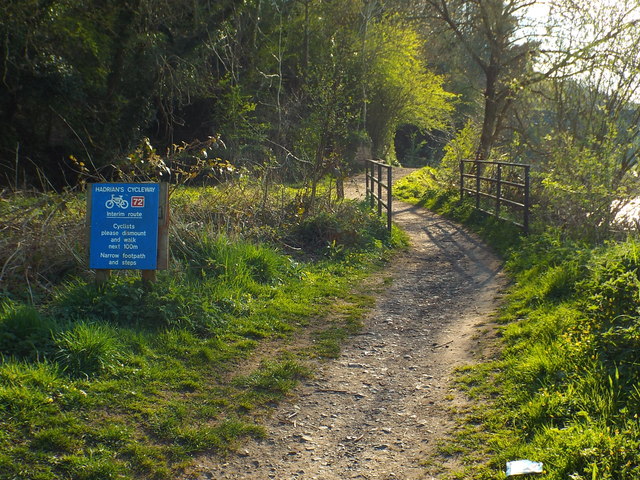
from Geograph (geograph)
View from embankment of dismantled railway towards Hadrian's Wall path
Pinned by Simon Cotterill

from https://www.heritagegateway.o…
Milecastle 67
- Grid Ref : NY3819056430
Summary : Probable site of a Roman milecastle, Roman coins were found in 1861 during railway construction, no visible remains.
Added by
Simon Cotterill

Co-Curate Page
Waverley Viaduct, Carlisle
- Overview Map Street View Waverley Viaduct (aka Engine Lonning Bridge) is a disused railway bridge over the River Eden in Carlisle. The viaduct was built in 1861 for the North …

from https://historicengland.org.u…
Hadrian's Wall between the east end of Davidson's Banks and road to Grinsdale and vallum between Davidson's Banks and dismantled railway in wall miles 67 and 68 - List Entry
- ...The section of Hadrian's Wall between the east end of Davidson’s Banks and the road to Grinsdale and the Vallum between Davidson’s Banks and the dismantled railway in Wall miles …
Added by
Simon Cotterill
from https://historicengland.org.u…
Hadrian's Wall vallum between the dismantled railway north of Knockupworth Cottage and the dismantled railway south of Boomby Gill in wall mile 67 - List Entry
- ...The monument includes the section of Hadrian's Wall vallum between the dismantled railway north of Knockupworth Cottage in the east and the dismantled railway to the south of Boomby Gill …
Added by
Simon Cotterill

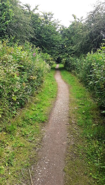
from Geograph (geograph)
View from embankment of dismantled railway towards Hadrian's Wall path
Pinned by Simon Cotterill
from https://www.heritagegateway.o…
Milecastle 67
- Grid Ref : NY3819056430
Summary : Probable site of a Roman milecastle, Roman coins were found in 1861 during railway construction, no visible remains.
Added by
Simon Cotterill
Co-Curate Page
Waverley Viaduct, Carlisle
- Overview Map Street View Waverley Viaduct (aka Engine Lonning Bridge) is a disused railway bridge over the River Eden in Carlisle. The viaduct was built in 1861 for the North …
from https://historicengland.org.u…
Hadrian's Wall between the east end of Davidson's Banks and road to Grinsdale and vallum between Davidson's Banks and dismantled railway in wall miles 67 and 68 - List Entry
- ...The section of Hadrian's Wall between the east end of Davidson’s Banks and the road to Grinsdale and the Vallum between Davidson’s Banks and the dismantled railway in Wall miles …
Added by
Simon Cotterill
from https://historicengland.org.u…
Hadrian's Wall vallum between the dismantled railway north of Knockupworth Cottage and the dismantled railway south of Boomby Gill in wall mile 67 - List Entry
- ...The monument includes the section of Hadrian's Wall vallum between the dismantled railway north of Knockupworth Cottage in the east and the dismantled railway to the south of Boomby Gill …
Added by
Simon Cotterill

")
