Topics > Heritage Sites > Hadrian's Wall > Wall Mile 6
Wall Mile 6
Hadrian's Wall - Wall Mile 6
Hadrian's Wall stretches from the east to west coast of England and was an important frontier of the Roman Empire. Building of the wall began in AD 122 and took six years to complete it's 84 mile (80 Roman mile) length. Soldiers were garrisoned along the line of the wall in large forts, smaller milecastles, and intervening turrets. The Vallum, a large ditch with mounds on either side, ran along the south side of the wall, protecting the rear of the frontier. Hadrian's Wall was designated as a World Heritage Site in 1987.
Wall Mile 6:
- Milecastle 6 (Benwell Grove)
- Turret 6a
- Turret 6s (Benwell Hill)
- Condercum Roman fort
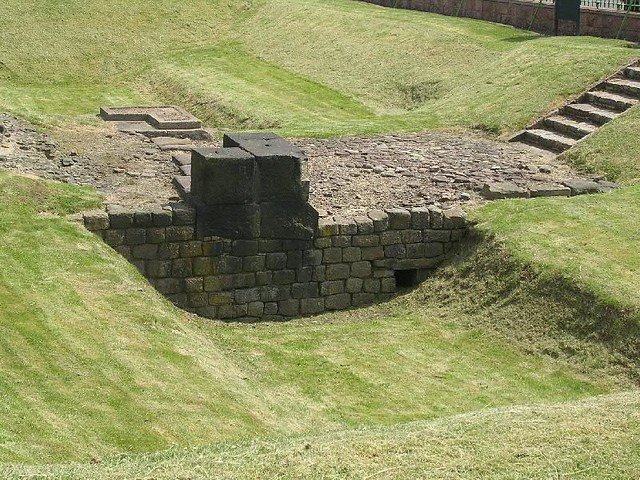
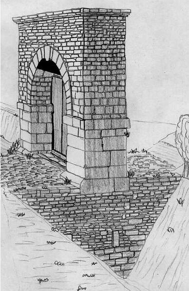
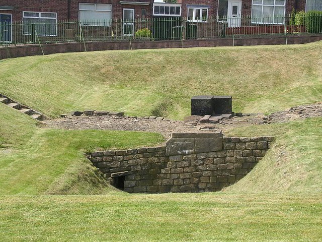
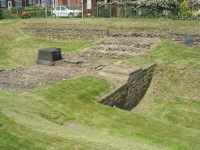
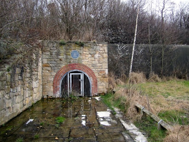
- Vallum Crossing (Benwell)
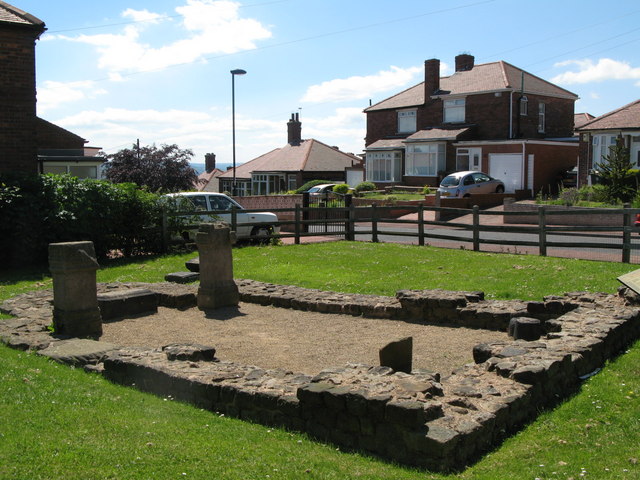
- Temple of Antenociticus (located close to the fort)
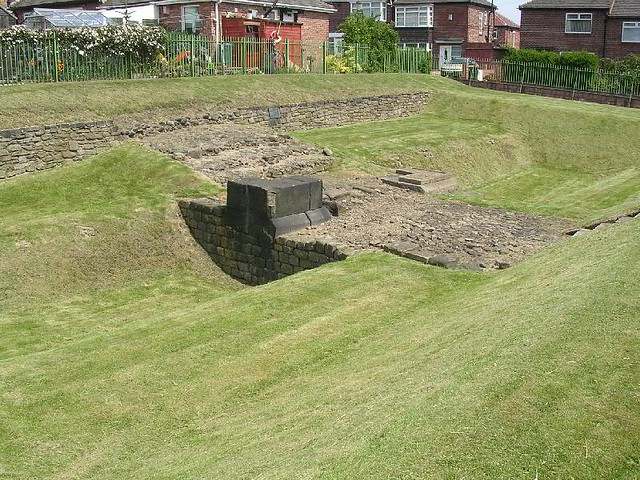
Scheduled Monument (#1003499): Hadrian's Wall in wall mile 6, Condercum Roman fort, Benwell
Click the heading below to expand (map of the Scheduled Monument area)
Map showing the buried remains of Hadrian's Wall in this section (Scheduled Monument area).
%
Scheduled Monument (#1003498): Hadrian's Wall vallum in wall mile 6, Benwell length of vallum of Hadrian's Wall in grounds of St Cuthbert's School
Click the heading below to expand (map of the Scheduled Monument area)
Map showing the buried remains of Hadrian's Wall vallum in this section (Scheduled Monument area).
%

Co-Curate Page
Benwell Vallum Crossing / Condercum
- Overview About Condercum Map Street View "Nothing is now visible of the fort at Benwell (Condercum) in Newcastle, which was occupied throughout most of the Roman period by the Asturian …

Co-Curate Page
Benwell Temple of Antenociticus
- Overview About Antenociticus Map Street View "The fort at Benwell, which was occupied throughout most of the Roman period by the cavalry regiment ala I Asturum, is no longer visible. …

from https://www.twsitelines.info/…
Hadrian's Wall, Benwell Grove to Benwell Hill (Wall mile 6)
- The Wall is thought to run from the 'deduced' site of Milecastle 6 under West Road until west of Benwell Fort, when it returns to the south side to the …
Added by
Simon Cotterill

from https://historicengland.org.u…
Hadrian's Wall in wall mile 6, Condercum Roman fort, Benwell
Added by
Simon Cotterill
from https://historicengland.org.u…
Hadrian's Wall vallum in wall mile 6, Benwell length of vallum of Hadrian's Wall in grounds of St Cuthbert's School
Added by
Simon Cotterill
from https://www.twsitelines.info/…
Hadrian's Wall, Benwell Fort (Condercum)
- The fort measured 581 feet north-south by 417 feet east-west, and covered 5.64 acres. Though its existence was known, its hill-top site a reservoir was built over the northern third …
Added by
Simon Cotterill

Co-Curate Page
Benwell Vallum Crossing / Condercum
- Overview About Condercum Map Street View "Nothing is now visible of the fort at Benwell (Condercum) in Newcastle, which was occupied throughout most of the Roman period by the Asturian …
Co-Curate Page
Benwell Temple of Antenociticus
- Overview About Antenociticus Map Street View "The fort at Benwell, which was occupied throughout most of the Roman period by the cavalry regiment ala I Asturum, is no longer visible. …
from https://www.twsitelines.info/…
Hadrian's Wall, Benwell Grove to Benwell Hill (Wall mile 6)
- The Wall is thought to run from the 'deduced' site of Milecastle 6 under West Road until west of Benwell Fort, when it returns to the south side to the …
Added by
Simon Cotterill
from https://historicengland.org.u…
Hadrian's Wall in wall mile 6, Condercum Roman fort, Benwell
Added by
Simon Cotterill
from https://historicengland.org.u…
Hadrian's Wall vallum in wall mile 6, Benwell length of vallum of Hadrian's Wall in grounds of St Cuthbert's School
Added by
Simon Cotterill
from https://www.twsitelines.info/…
Hadrian's Wall, Benwell Fort (Condercum)
- The fort measured 581 feet north-south by 417 feet east-west, and covered 5.64 acres. Though its existence was known, its hill-top site a reservoir was built over the northern third …
Added by
Simon Cotterill

")

