Topics > Heritage Sites > Hadrian's Wall > Wall Mile 0
Wall Mile 0
| | Mile 0 | Mile 1>
Hadrian's Wall: Wall Mile 0
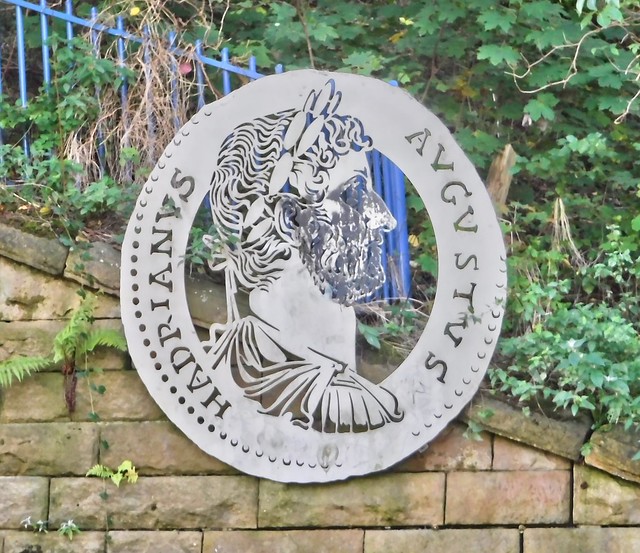
Hadrian's Wall stretches from the east to west coast of England and was an important frontier of the Roman Empire. Building of the wall began in AD 122 and took six years to complete it’s 84 mile (80 Roman mile) length. Soldiers were garrisoned along the line of the wall in large forts, smaller milecastles, and intervening turrets. The Vallum, a large ditch with mounds on either side, ran along the south side of the wall, protecting the rear of the frontier. Hadrian's Wall was designated as a World Heritage Site in 1987.
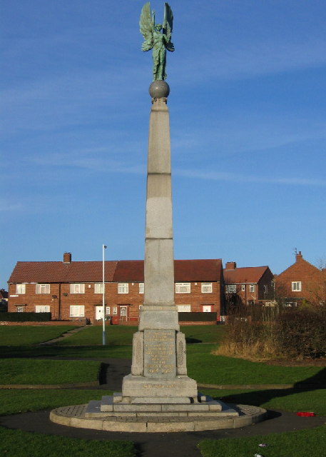
Hadrian's Wall originally began at Pons Aelius (Newcastle upon Tyne). Then in c. 127 AD, the wall was extended eastwards to what is now Wallsend.
Wall Mile 0:
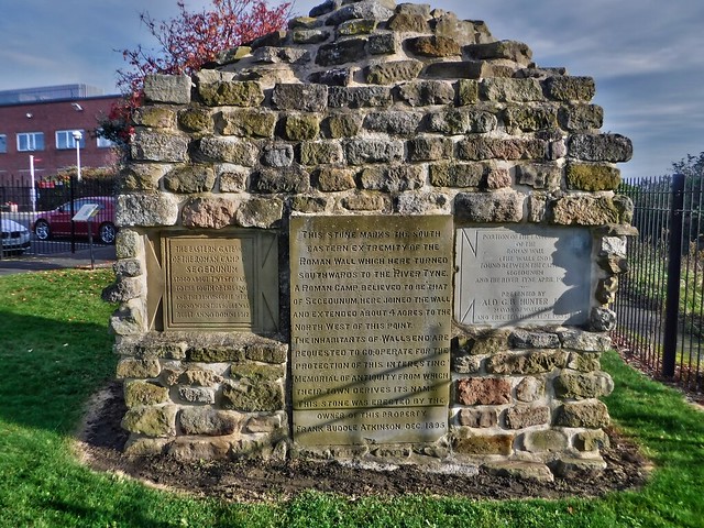
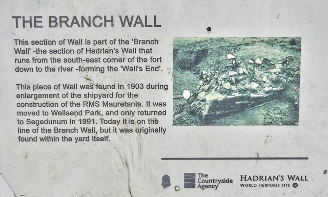
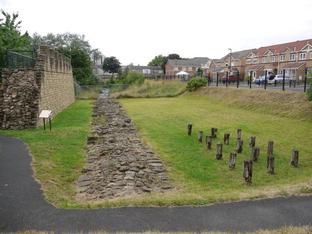
Sections of the Roman wall can be seen at Segadunum and near Buddle Street in Wallsend. A reconstruction of the wall has been built along side the remains of the Roman wall near Buddle Street.
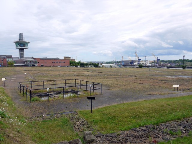
- Segedunum fort - significant remains (now with museum and visitor centre).
- Milecastle 0? -possible milecastle, which may have predated Segedunum, but no remains/evidence.
- Turret 0a - no remains, presumed site near Carville Primary School, Wallsend
- Turret 0b - no surface remains - reported found during building in 1886, but may have been destroyed when Stott's Road was extended in 1936.
Scheduled Monument (#1005914): Hadrian's Wall in wall mile 0, Wallsend Roman fort, Segedunum
Click the heading below to expand (map of the Scheduled Monument area)
%
Scheduled Monument (#1005915): Hadrian's Wall in wall mile 0, two sections of Hadrian's Wall between Sharpe Road and The Avenue
Click the heading below to expand (map of the Scheduled Monument area)
Map showing the buried remains of Hadrian's Wall in this section (Scheduled Monument area).
%
Scheduled Monument (#1003506): Hadrian's Wall in wall mile 0, section between Eastfield Avenue and Tumulus Avenue
Click the heading below to expand (map of the Scheduled Monument area)
Map showing the buried remains of Hadrian's Wall in this section (Scheduled Monument area).
%
Hadrian's Wall Path is a footpath which runs for 84 miles (135 km), from Wallsend on the East coast of England to Bowness on Solway on the West coast. Most of the route follows close to the line of Hadrian's Wall. Hadrian's Wall Path was designated the 15th National Trail, with an official opening ceremony held on the 23rd May 2003.
Co-Curate Page
Segedunum
- Overview About Segedunum Map Segedunum was a Roman fort built at the eastern end of Hadrian's Wall near the banks of the River Tyne. It is located in modern-day Wallsend, …


from Flickr (flickr)
Hadrians Wall, MC 0, Segedunum Fort, Wallsend, Newcastle, 23102019, jcw1967 (1)
Pinned by Simon Cotterill
from Flickr (flickr)
Hadrians Wall, MC 0, Segedunum Fort, Wallsend, Newcastle, 23102019, jcw1967 (2)
Pinned by Simon Cotterill
from Flickr (flickr)
Hadrians Wall, MC 0, Segedunum Fort, Wallsend, Newcastle, 23102019, jcw1967 (11)
Pinned by Simon Cotterill

from https://historicengland.org.u…
Hadrian's Wall in wall mile 0, Wallsend Roman fort, Segedunum - List Entry
Added by
Simon Cotterill
from https://historicengland.org.u…
Hadrian's Wall in wall mile 0, two sections of Hadrian's Wall between Sharpe Road and The Avenue - List Entry
Added by
Simon Cotterill

from https://www.twsitelines.info/…
Hadrian's Wall, Wallsend Fort - St. Francis Presbytery (WM1)
- Foundations of the wall were located in 1929 in 3 places between the south side of Buddle St (where the 2 surviving courses were bonded with the West gate of …
Added by
Simon Cotterill


from Geograph (geograph)
Remains of Hadrian's Wall, off Buddle Street, Wallsend
Pinned by Simon Cotterill

from https://historicengland.org.u…
Hadrian's Wall in wall mile 0, Wallsend Roman fort, Segedunum - List Entry
Added by
Simon Cotterill
from https://historicengland.org.u…
Hadrian's Wall in wall mile 0, section between Eastfield Avenue and Tumulus Avenue
Added by
Simon Cotterill
from https://www.twsitelines.info/…
Hadrian's Wall, Wallsend Fort to the Tyne
- The Roman Wall ran from the south-east corner of Wallsend Fort and probably terminated at a quay on the edge of the deep water channel (c. 590 feet long). It …
Added by
Simon Cotterill

from https://perlineamvalli.wordpr…
Wall Mile 0
- Wall Mile 0 (May 29, 2012). Mike Bishop's PLV blog about walking Hadrian’s Wall written from an archaeologist’s point of view. "Just when everybody has been telling you Hadrian’s Wall …
Added by
Simon Cotterill
Co-Curate Page
Hadrian's Wall - Interactive Glossary and Primer
- :root { --bg:#f7f7f8; --card:#ffffff; --text:#1f2937; --muted:#6b7280; --accent:#1f6feb; --border:#e5e7eb; } [data-theme="dark"] { --bg:#0b1220; --card:#111827; --text:#e5e7eb; --muted:#9ca3af; --accent:#60a5fa; --border:#1f2937; } body { margin:0; font-family: system-ui,-apple-system, Segoe UI, Roboto, "Helvetica Neue", Arial, "Noto …


Co-Curate Page
Segedunum
- Overview About Segedunum Map Segedunum was a Roman fort built at the eastern end of Hadrian's Wall near the banks of the River Tyne. It is located in modern-day Wallsend, …
from Flickr (flickr)
Hadrians Wall, MC 0, Segedunum Fort, Wallsend, Newcastle, 23102019, jcw1967 (1)
Pinned by Simon Cotterill
from Flickr (flickr)
Hadrians Wall, MC 0, Segedunum Fort, Wallsend, Newcastle, 23102019, jcw1967 (2)
Pinned by Simon Cotterill
from Flickr (flickr)
Hadrians Wall, MC 0, Segedunum Fort, Wallsend, Newcastle, 23102019, jcw1967 (11)
Pinned by Simon Cotterill
from https://historicengland.org.u…
Hadrian's Wall in wall mile 0, Wallsend Roman fort, Segedunum - List Entry
Added by
Simon Cotterill
from https://historicengland.org.u…
Hadrian's Wall in wall mile 0, two sections of Hadrian's Wall between Sharpe Road and The Avenue - List Entry
Added by
Simon Cotterill
from https://www.twsitelines.info/…
Hadrian's Wall, Wallsend Fort - St. Francis Presbytery (WM1)
- Foundations of the wall were located in 1929 in 3 places between the south side of Buddle St (where the 2 surviving courses were bonded with the West gate of …
Added by
Simon Cotterill
from Geograph (geograph)
Remains of Hadrian's Wall, off Buddle Street, Wallsend
Pinned by Simon Cotterill
from https://historicengland.org.u…
Hadrian's Wall in wall mile 0, Wallsend Roman fort, Segedunum - List Entry
Added by
Simon Cotterill
from https://historicengland.org.u…
Hadrian's Wall in wall mile 0, section between Eastfield Avenue and Tumulus Avenue
Added by
Simon Cotterill
from https://www.twsitelines.info/…
Hadrian's Wall, Wallsend Fort to the Tyne
- The Roman Wall ran from the south-east corner of Wallsend Fort and probably terminated at a quay on the edge of the deep water channel (c. 590 feet long). It …
Added by
Simon Cotterill
from https://perlineamvalli.wordpr…
Wall Mile 0
- Wall Mile 0 (May 29, 2012). Mike Bishop's PLV blog about walking Hadrian’s Wall written from an archaeologist’s point of view. "Just when everybody has been telling you Hadrian’s Wall …
Added by
Simon Cotterill
Co-Curate Page
Hadrian's Wall - Interactive Glossary and Primer
- :root { --bg:#f7f7f8; --card:#ffffff; --text:#1f2937; --muted:#6b7280; --accent:#1f6feb; --border:#e5e7eb; } [data-theme="dark"] { --bg:#0b1220; --card:#111827; --text:#e5e7eb; --muted:#9ca3af; --accent:#60a5fa; --border:#1f2937; } body { margin:0; font-family: system-ui,-apple-system, Segoe UI, Roboto, "Helvetica Neue", Arial, "Noto …