Topics > Northumberland > Berwick upon Tweed > Tweedmouth > Springhill Camp
Springhill Camp
Scheduled Monument areas - based on Historic England data (Open Government Licence).
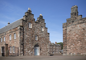
This site is located close to Spring Hill, to the south of Tweedmouth in Northumberland. It is scheduled as a Roman marching camp, but it's age and usage is unclear. An enclosure was identified here by aerial photography in the 1950s, originally interpreted as a Roman Fort and a possible Iron Age hillfort. Earlier, in 1946, a trench had been excavated in the vicinity, and what was described as an 'Antonine sherd' had been recovered. It has also been suggested as the site of a Romano-British settlement. However, trenches excavated in 2019 to evaluate the site found no trace of the camp. In several of these trenches, bedrock was close to the surface, with the bedrock in a stepped or ridged formation. As such, it was suggested there is a possibility that the features interpreted as cropmarks of a Roman camp in the 1950s may actually derive from geological or later industrial activity.[1] The site is partially destroyed by road cutting and construction of a reservoir. It is a Scheduled Monument (legally protected).
EN2036 Springhill, Northumberland
Click the headings below to expand (selected extracts from the Atlas of Hillforts of Britain and Ireland)
S of Tweedmouth, close to Spring Hill, an enclosure discovered on aerial photographs by J.K. St.Joseph. It was originally interpreted as a Roman Fort and a possible hillfort. Scheduled as a Roman marching camp. It survives mainly as a cropmark of two concentric ditches over 3m wide separated by a gap of approximately 10m. It is estimated that the site once covered 0.98ha but is now destroyed by a reservoir and road cutting in the W. A trench was excavated in the vicinity of the enclosure in 1946 (Sir W de la Aitchison in 1949) and an 'antonine sherd' recovered. It is not shown on historic OS mapping and is undated but described by Northumberland HER as a Roman village.
Source: Lock, Gary and Ralston, Ian. 2024. Atlas of Hillforts of Britain and Ireland. Available at: https://hillforts.arch.ox.ac.uk (CC BY-SA 4.0)

from https://keystothepast.info/se…
Springhill (Berwick upon Tweed)
- excavated a trench in 1946 in the vicinity of the Roman fort discovered on aerial photographs by Dr J K St Joseph (CUC B41) and found an Antonine Sherd'. (1)(10c) …
Added by
Simon Cotterill


from https://keystothepast.info/se…
Springhill (Berwick upon Tweed)
- excavated a trench in 1946 in the vicinity of the Roman fort discovered on aerial photographs by Dr J K St Joseph (CUC B41) and found an Antonine Sherd'. (1)(10c) …
Added by
Simon Cotterill