Topics > Cumbria > Rampside > Rampside, 1848
Rampside, 1848
RAMSYDE, or Rampside, a chapelry, in the parish of Dalton-in-Furness, union of Ulverston, hundred of Lonsdale north of the Sands, N. division of Lancashire, 5¼ miles (S. by E.) from the town of Dalton; containing 561 inhabitants. This place is delightfully situated at the southern extremity of the large peninsula formed by the Irish Sea on the west side, and Morecambe bay on the east; it is resorted to for sea-bathing, for which there is ample, though not elegant, accommodation, at very moderate expense. Opposite to Ramsyde is Pile or Peel Harbour, a commodious port, protected by Walney Island on the south-west, and where a first-rate ship of war may float at low water. By an act of the 6th of Her present Majesty, John Abel Smith, Esq., was authorised to construct a pier or jetty from Ramsyde to Roe Island, and thence into Pile Harbour, with the necessary wharfs and works for the convenience of shipping and of passengers. The Furness railway was opened in June 1846; it is 14 miles in length, and runs from Pile Harbour, by Ramsyde, past the town of Dalton to Kirkby-Ireleth, where the Whitehaven railway commences. The chapel, standing on an eminence, is a neat whitewashed structure, lately built, and in the later English style, with a tower: the living is a perpetual curacy, in the patronage of the Vicar of Dalton; net income, £100. A national school has been established.
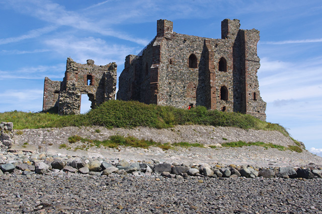
The Pile (of Fouldrey) is a rocky island, of a few acres, about a mile to the north of the lighthouse on the isle of Walney. Here, according to Camden, one of the abbots of Furness built a castle, in the first year of the reign of Edward III., to guard the entrance to the harbour; the castle was probably intended also as a retreat for the monks and their vassals on the approach of an enemy, and as a place of security for their effects against the Scotch invaders. The strength and magnitude of the structure prove how ample were the means of the monastic institution by which it was built. In the Burghley Papers, temp. Elizabeth, it is stated that "betweene Mylford Haven in Wales, and Carhill on the borders of Scotlande, ther is not one good haven for greate shyppes to lond or ryde in, but one, whiche is in the furthest part of Lancashire, called the Pylle of Folder;" and it is added, that "the same pylle is an old decayed castell of the dowchie of Lancaster, in Furnes Felles." The period when the castle was reduced to ruins is not well ascertained; but it was probably one of the fortresses that fell under the dismantling ordinances of the Commonwealth. Great part of the ruins have been washed away by the sea, and the falling walls only are now to be seen, in solitary grandeur above the waters between Walney lighthouse and the shore at Old Garth below Ramsyde.
Extract from: A Topographical Dictionary of England comprising the several counties, cities, boroughs, corporate and market towns, parishes, and townships..... 7th Edition, by Samuel Lewis, London, 1848.

Co-Curate Page
Piel Castle
- Overview About Piel Castle Map Street View Piel Castle, also known as Fouldry Castle or the Pile of Fouldray, is a castle situated on the south-eastern point of Piel …

Co-Curate Page
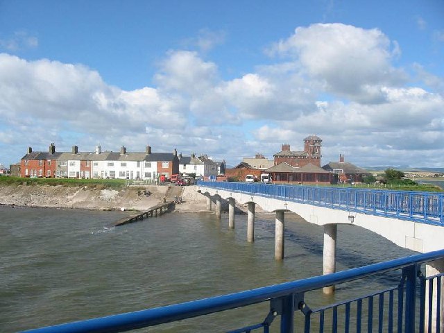
Roa Island
- Overview About Roa Island Map Street View Roa Island is a tidal island located about 3 miles south-east of Barrow-in-Furness. A causeway, built in 1847, connects Roa Island with Rampside …

Co-Curate Page
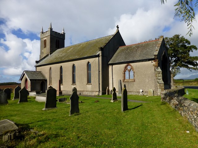
Church of St Michael
- Overview Map Street View St Michael's Church is located on the A5087 road over half a mile north of the village of Rampside, Cumbria. The present Church was built in …


Co-Curate Page
Piel Castle
- Overview About Piel Castle Map Street View Piel Castle, also known as Fouldry Castle or the Pile of Fouldray, is a castle situated on the south-eastern point of Piel …

Co-Curate Page
Roa Island
- Overview About Roa Island Map Street View Roa Island is a tidal island located about 3 miles south-east of Barrow-in-Furness. A causeway, built in 1847, connects Roa Island with Rampside …


