Topics > Northumberland > Plashetts
Plashetts
Plashetts was a village in Northumberland, located roughly 4 miles north-west of Falstone. There was farm here and possibly a deserted medieval settlement. Then in the 1850s Plashetts Colliery was opened and in 1861 Plashettes railway station opened near the colliery. A brickworks was also establshed here in 1886. In the c.1890s, Plashetts village, consisting of 4 rows of terraced houses, was built for the miners. There was also a chapel here. By 1914 there were 126 people employed at Plashetts Colliery.[1] However, the brickworks closed in 1914 and after the 1920's only a handful of miners worked at the colliery, which finally closed in 1962. The village no longer exists, but the foundations of the terraces and the occasional Plashett's brick can be found in Kielder Forest.[2] The site of the former colliery, the station and Plashetts Farm are now under Kielder Water, which was built in 1982.
Not be be confused with Plashetts Farm near Great Bavington.
from IllustratedChronicles (flickr)
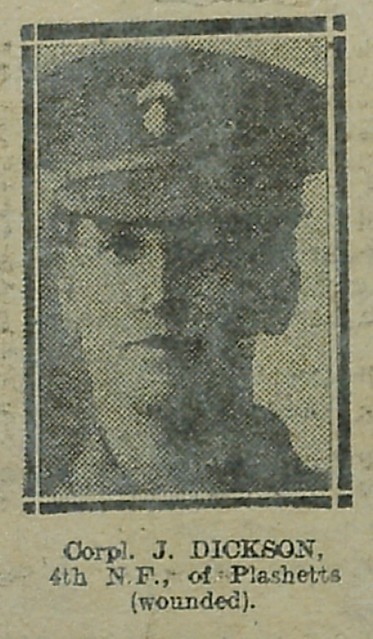
J Dickson - 4th NF - Plashetts (wounded)
Pinned by Simon Cotterill
from IllustratedChronicles (flickr)
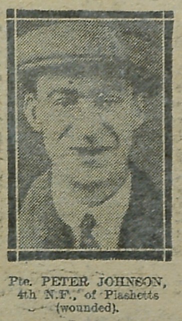
Peter Johnson - 4th NF - Plashetts (wounded)
Pinned by Simon Cotterill
from IllustratedChronicles (flickr)
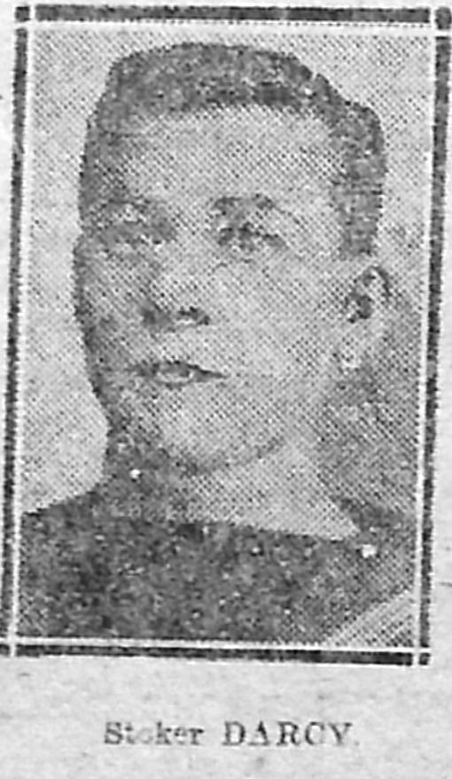
JC Darcy, Plashetts, lost with HMS Bulwark
Pinned by Simon Cotterill


from http://kielderartandarchitect…
Plashetts village 1890 - 1920
- "....Plashetts village was located on a hill overlooking the north Tyne valley and housed miners and their families who worked in the nearby Plashetts coal mine. The village, which existed …
Added by
Simon Cotterill
Co-Curate Page
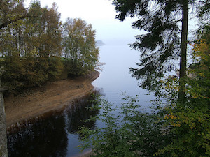
Kielder Water & Forest Park
- Overview About Kielder Water About Kielder Forest Map Street View Kielder Water is a resevoir in Northumberland, which is the largest artificial lake in the UK by water capacity. It …
Co-Curate Page
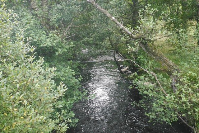
Plashetts Burn
- Plashetts Burn is a small river which flows into Kielder Water in Northumberland. The catchment area of Plashetts Burn, incorporating other smaller burns, is 5km long and covers an area …

from https://keystothepast.info/se…
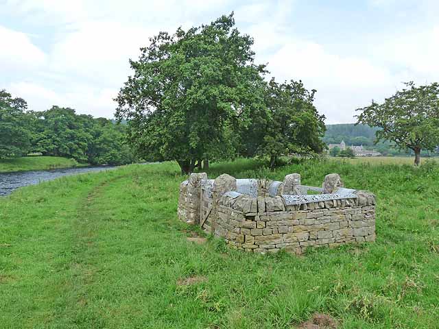
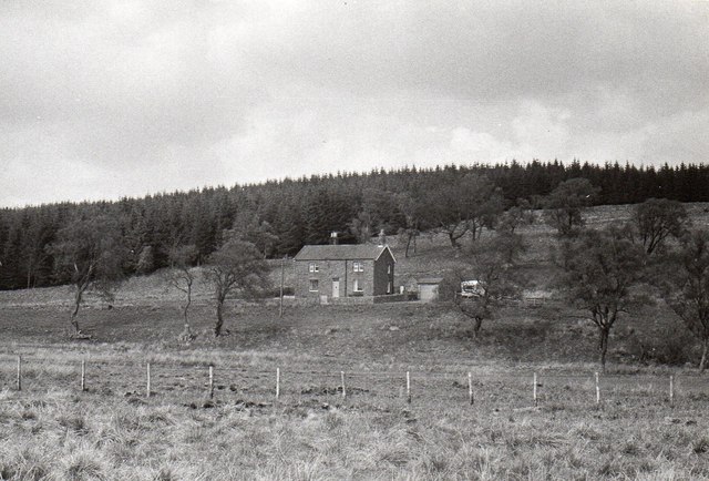
Plashetts Farm, Falstone Forest
- "The remains of a small farm now lie submerged beneath Kielder Water reservoir. The farm was recorded in the 1970s before the flooding and comprised at least one stone-built rectangular …
Added by
Simon Cotterill
from https://metalanddust.org/2016…
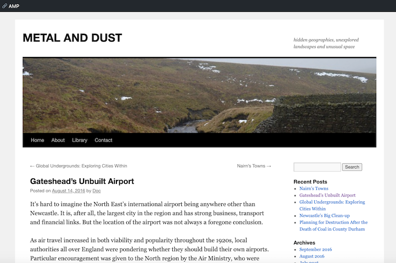
England’s Underwater Cities – Plashetts
- "....Although a cartographic analysis will confirm that parts of what was formerly the village of Plashetts are submerged under Kielder Water, the true story is slightly more nuanced than folklore …
Added by
Peter Smith

from IllustratedChronicles (flickr)
J Dickson - 4th NF - Plashetts (wounded)
Pinned by Simon Cotterill
from IllustratedChronicles (flickr)
Peter Johnson - 4th NF - Plashetts (wounded)
Pinned by Simon Cotterill
from IllustratedChronicles (flickr)
JC Darcy, Plashetts, lost with HMS Bulwark
Pinned by Simon Cotterill
from http://kielderartandarchitect…
Plashetts village 1890 - 1920
- "....Plashetts village was located on a hill overlooking the north Tyne valley and housed miners and their families who worked in the nearby Plashetts coal mine. The village, which existed …
Added by
Simon Cotterill
Co-Curate Page
Kielder Water & Forest Park
- Overview About Kielder Water About Kielder Forest Map Street View Kielder Water is a resevoir in Northumberland, which is the largest artificial lake in the UK by water capacity. It …
Co-Curate Page
Plashetts Burn
- Plashetts Burn is a small river which flows into Kielder Water in Northumberland. The catchment area of Plashetts Burn, incorporating other smaller burns, is 5km long and covers an area …
from https://keystothepast.info/se…
Plashetts Farm, Falstone Forest
- "The remains of a small farm now lie submerged beneath Kielder Water reservoir. The farm was recorded in the 1970s before the flooding and comprised at least one stone-built rectangular …
Added by
Simon Cotterill
from https://metalanddust.org/2016…
England’s Underwater Cities – Plashetts
- "....Although a cartographic analysis will confirm that parts of what was formerly the village of Plashetts are submerged under Kielder Water, the true story is slightly more nuanced than folklore …
Added by
Peter Smith