Topics > Newcastle City Centre > Streets > Pandon
Pandon
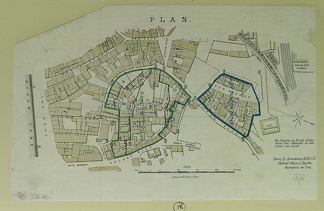
Today, Pandon is a street in Newcastle which winds down towards the Quayside.
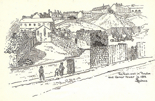
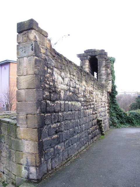
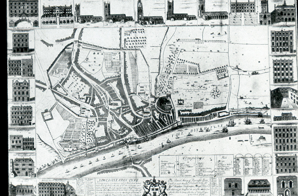
In the Medieval times Pandon was a village, separate to Newcastle, near what is now the Quayside. It was united with Newcastle in 1299 by King Edward I, and was added to the town's defences by 1307. The Corner Tower, represented a change in direction of the Town Walls, which were extended eastwards to accommodate Pandon.
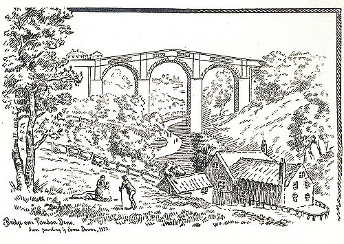
There was a large valley formed by Pandon Burn. The valley was filled and the burn was culverted, making it one of Newcastle's 'hidden' rivers.
from Newcastle libraries (flickr)
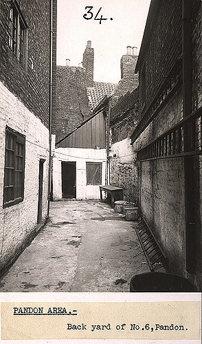
034644:Pandon Newcastle upon Tyne Dept of Environmental Health c.1935
Pinned by Simon Cotterill
from Newcastle libraries (flickr)
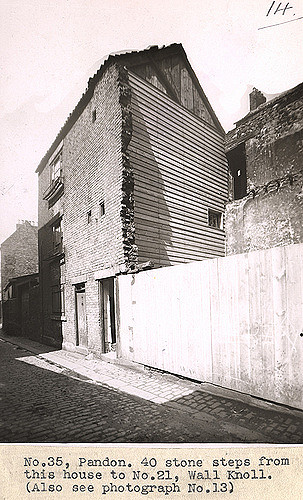
036720:Pandon Newcastle upon Tyne Dept of Environmental Health c.1935
Pinned by Simon Cotterill
from Newcastle libraries (flickr)
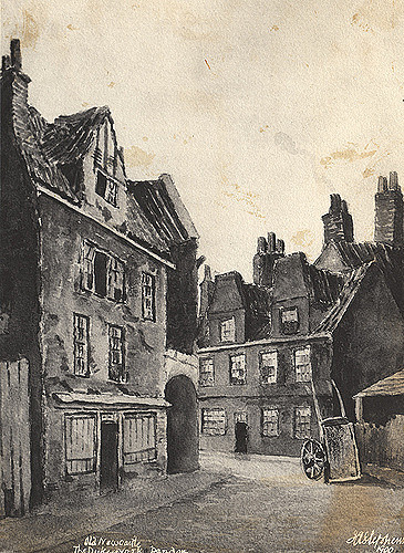
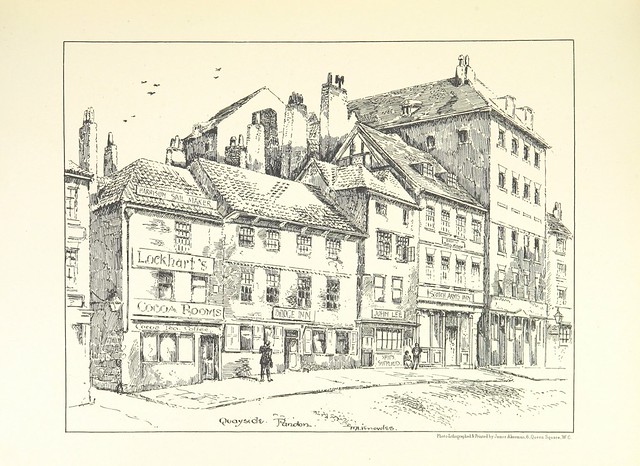
001515:The Duke of York Pandon Stephens J. A. 1900
Pinned by Simon Cotterill
from Newcastle libraries (flickr)
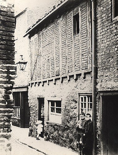
003980:Pandon Newcastle upon Tyne C.1910
Pinned by Simon Cotterill
Co-Curate Page
Pandon Burn
- Pandon Burn is a "hidden" river in Newcastle, which once flowed through a deep valley known as Pandon Dene. The burn was fully culverted (covered) by 1886, with its course …
from https://co-curate.ncl.ac.uk/r…
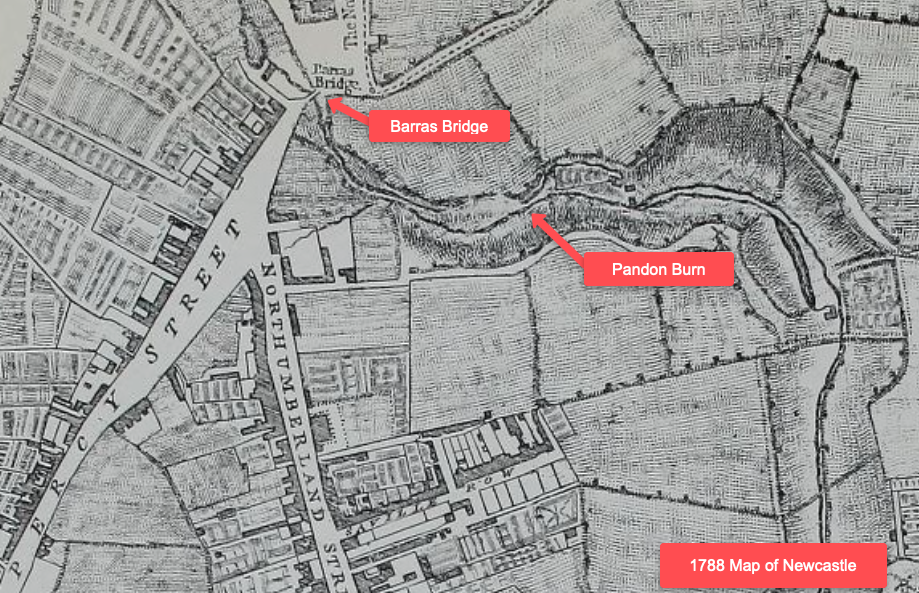
Pandon Burn and Barras Bridge, Newcastle 1788
- Annotated section from the map of Newcastle and Gateshead, engraved by R. Beilby, 1788. This shows Barras Bridge to the north of Percy Street and Northumberland Street. Pandon Dean is …
Added by
Simon Cotterill
from Newcastle libraries (flickr)
003757:Town Wall and Corner Tower Pandon Holmes S. 1882
Pinned by Simon Cotterill
Co-Curate Page
Corner Tower
- Overview Map Street View Corner Tower and a small upstanding section of the Town Wall are located off City Road, by Croft Stairs in Newcastle. This was different to the …
Co-Curate Page
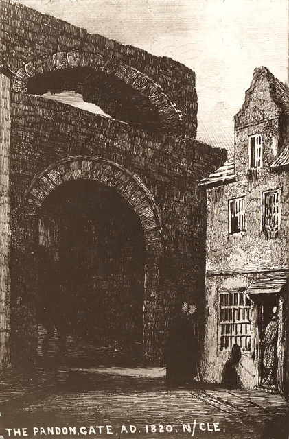
Pandon Gate
- Pandon Gate was a smaller gate on the Medieval town walls which had a single archway, folding iron gates, and no portcullis. Pandon became part of Newcastle in 1299; requiring …

from Newcastle libraries (flickr)
034644:Pandon Newcastle upon Tyne Dept of Environmental Health c.1935
Pinned by Simon Cotterill
from Newcastle libraries (flickr)
036720:Pandon Newcastle upon Tyne Dept of Environmental Health c.1935
Pinned by Simon Cotterill
from Newcastle libraries (flickr)
001515:The Duke of York Pandon Stephens J. A. 1900
Pinned by Simon Cotterill
from Newcastle libraries (flickr)
003980:Pandon Newcastle upon Tyne C.1910
Pinned by Simon Cotterill
Co-Curate Page
Pandon Burn
- Pandon Burn is a "hidden" river in Newcastle, which once flowed through a deep valley known as Pandon Dene. The burn was fully culverted (covered) by 1886, with its course …
from https://co-curate.ncl.ac.uk/r…
Pandon Burn and Barras Bridge, Newcastle 1788
- Annotated section from the map of Newcastle and Gateshead, engraved by R. Beilby, 1788. This shows Barras Bridge to the north of Percy Street and Northumberland Street. Pandon Dean is …
Added by
Simon Cotterill
from Newcastle libraries (flickr)
003757:Town Wall and Corner Tower Pandon Holmes S. 1882
Pinned by Simon Cotterill
Co-Curate Page
Corner Tower
- Overview Map Street View Corner Tower and a small upstanding section of the Town Wall are located off City Road, by Croft Stairs in Newcastle. This was different to the …
")


