Topics > Cumbria > Shap > Milepost near A6 turn to Sleddale
Milepost near A6 turn to Sleddale
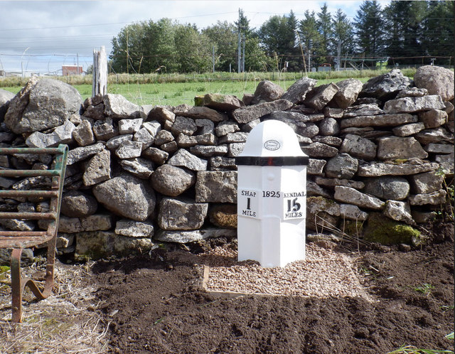
This milepost, located 1 mile to the south of Shap is dated 1825. It was built for the Heron Syke Turnpike Trust which ran the toll road from Heron Syke to Kendal and on to Eamont Bridge. The oval foundry mark on it's top indicates it was made at the Gatebeck Foundary.[1] The milestone was moved a short distance away from it's original location by the A6 road and restored in c.2020 (Milestone Society National ID: WE_KDSP15).[2] The milestone is Grade II listed on the National Heritage List for England.
KENDAL 15 MILES

from https://historicengland.org.u…
MILEPOST (325 YARDS NORTH OF TURN TO SLEDDALE) - Shap - List Entry
- "Milepost, dated 1825, for Heron Syke Turnpike Trust. Oval foundry mark on top centre: T. WINDER GATEBECK FOUNDRY. Cast-iron c.3 ft high. 3 concave sides with ogee domical top. Separate …
Added by
Simon Cotterill