Topics > Cumbria > Lake District > Haweswater Reservoir > Mardale Green
Mardale Green
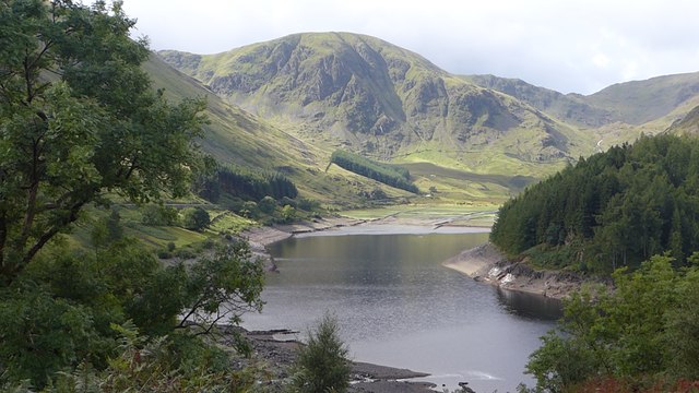
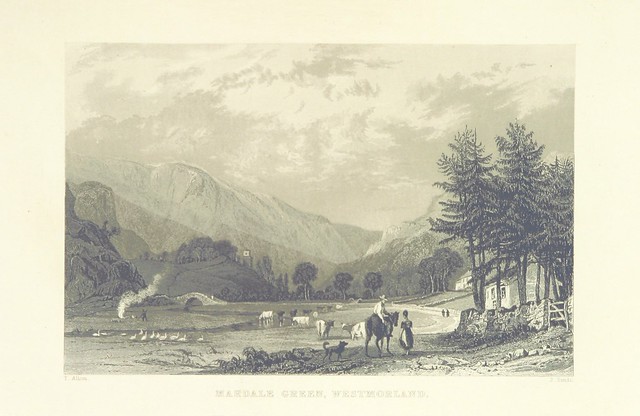
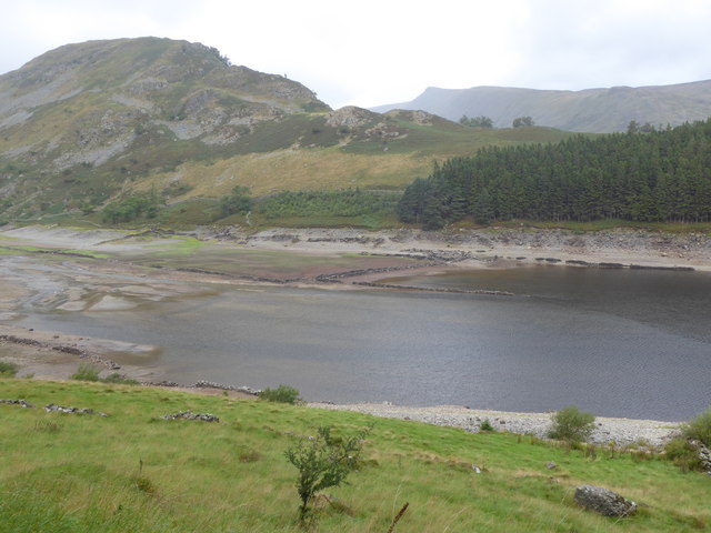
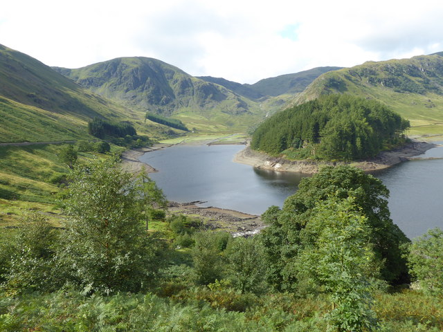
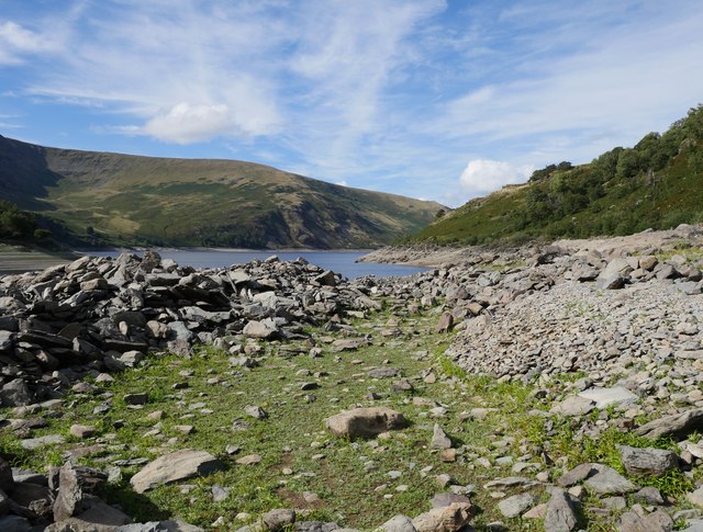
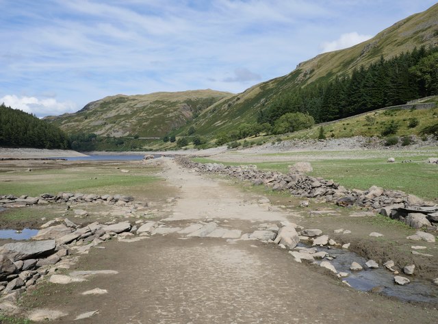
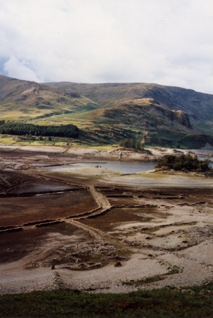
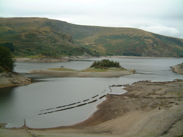
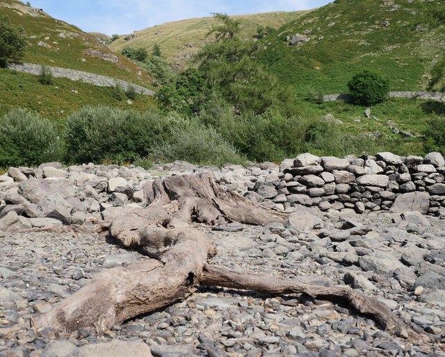
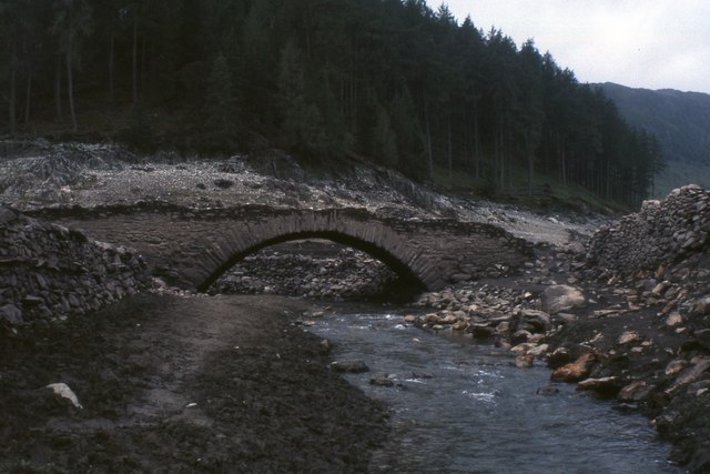
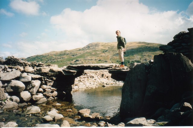
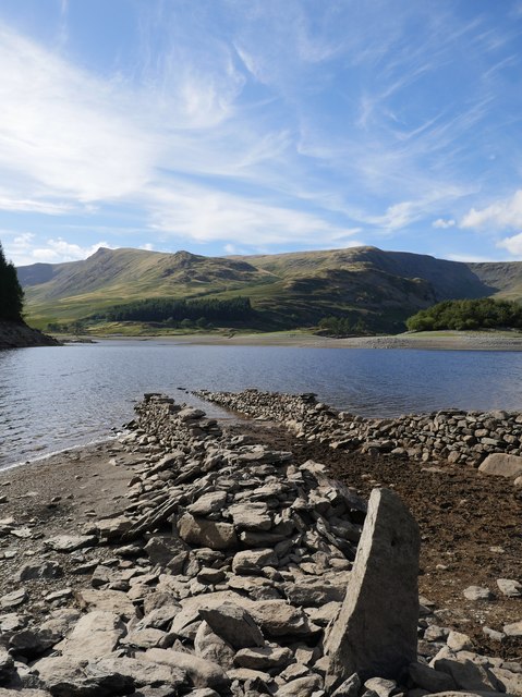
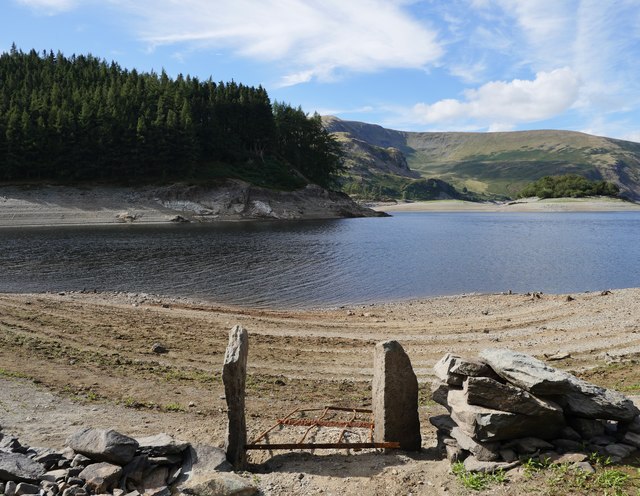
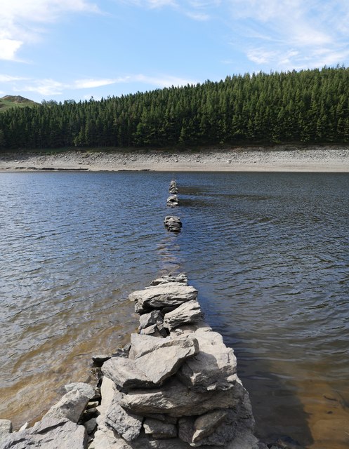
Mardale Green was a village in Westmoreland (now part of Cumbria) which was flooded in c.1935, following the construction of the dam built to fill Haweswater Reservoir. An Act of Parliament in 1929 gave Manchester Corporation permission to build the reservoir to supply water for the urban conurbations of north-west England. The farms and houses of the villages of Mardale and Measand, and the Dun Bull Inn were demolished after the villagers were evicted and relocated. After a final service in August 1935, Mardale church was demolished and bodies from the graveyard were removed and buried in Shap. During times of drought the remains of Mardale Green, including dry stone walls and an old bridge, are occasionally visible when the water level drops.
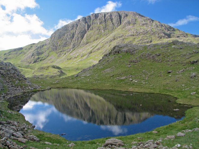
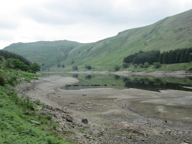
Mardale is a glacial valley in the Lake District, in northern England. The valley used to have a hamlet at its head, called Mardale Green, but this village was submerged in the late 1930s when the water level of the valley's lake, Haweswater, was raised to form Haweswater Reservoir by Manchester Corporation.
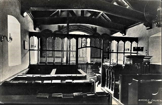
Most of the village's buildings were blown up by the Royal Engineers, who used them for demolition practice. The exception was the small church, which could accommodate only 75 people, and had an all-ticket congregation for its last service. It was then dismantled in April 1937, stone by stone, and the stones and windows were re-used to build the water take-off tower which is situated along the Western shore of the reservoir. Some 97 sets of remains were disinterred from the churchyard and transferred to Shap. Alfred Wainwright protested bitterly about the loss of Mardale in his series of pictorial guides to the Lakeland fells, having first visited it in 1930. The ruins of the abandoned village occasionally reappear when the water level in the reservoir is low.
In response to the submerging of the village, Manchester Corporation provided a new access road that runs for four miles along the south-eastern side of the reservoir to a car park at Gatescarth. From here ascents of the peaks surrounding the head of the valley, such as Harter Fell, High Street and Kidsty Pike may be made.

from https://www.countryliving.com…
The remains of a lost Lake District village appear as heatwave dries up reservoir
- July, 2018. "Country ramblers have shared impressive pictures on social media...."
Added by
Simon Cotterill

from https://www.visitcumbria.com/…
Haweswater
- "Haweswater is a reservoir built in the valley of Mardale. The controversial construction of the Haweswater dam was started in 1929, after Parliament passed an Act giving Manchester Corporation permission …
Added by
Simon Cotterill

from Flickr (flickr)
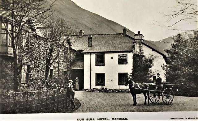
MARDALE DUN BULL HOTEL HORSE & TRAP - RARE REAL PHOTO POSTCARD!
Pinned by Peter Smith
from Flickr (flickr)
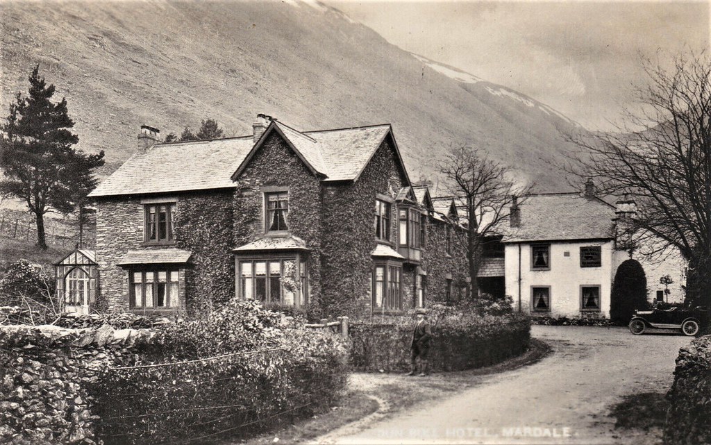
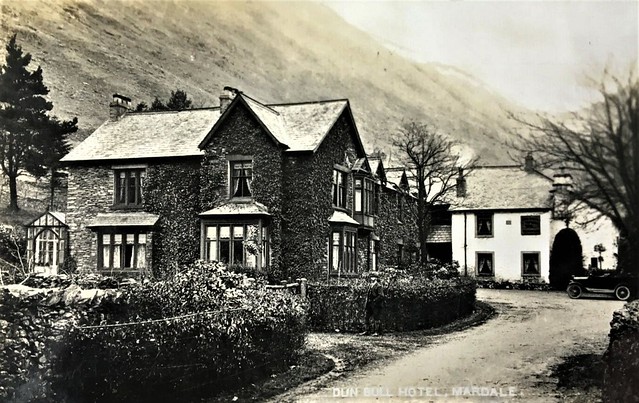
MARDALE DUN BULL HOTEL, CAR OUTSIDE - CLASSIC REAL PHOTO POSTCARD!
Pinned by Peter Smith
from Flickr (flickr)
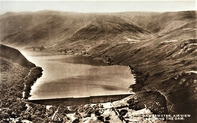
MARDALe HAWESWATER DAM, AERIAL VIEW - NICE REAL PHOTO POSTCARD!
Pinned by Peter Smith

from https://www.countryliving.com…
The remains of a lost Lake District village appear as heatwave dries up reservoir
- July, 2018. "Country ramblers have shared impressive pictures on social media...."
Added by
Simon Cotterill
from https://www.visitcumbria.com/…
Haweswater
- "Haweswater is a reservoir built in the valley of Mardale. The controversial construction of the Haweswater dam was started in 1929, after Parliament passed an Act giving Manchester Corporation permission …
Added by
Simon Cotterill
from Flickr (flickr)
MARDALE DUN BULL HOTEL HORSE & TRAP - RARE REAL PHOTO POSTCARD!
Pinned by Peter Smith
from Flickr (flickr)
MARDALE DUN BULL HOTEL, CAR OUTSIDE - CLASSIC REAL PHOTO POSTCARD!
Pinned by Peter Smith
from Flickr (flickr)
MARDALe HAWESWATER DAM, AERIAL VIEW - NICE REAL PHOTO POSTCARD!
Pinned by Peter Smith