The lost village of Mardale Green

-
Description
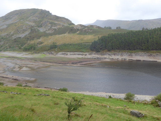
"This was towards the end of the long hot summer of 2018 when water levels were unusually low and the walls and roads of the old village of Mardale Green could be seen. Work to build the dam started in 1929. Before the valley was flooded in 1935, all the farms and dwellings of the villages of Mardale Green and Measand were demolished. A full description of the work can be seen at https://en.wikipedia.org/wiki/Haweswater_Reservoir incliding maps of how the lake increased in size after it became a reservoir. This view is near the head of Haweswater, looking to the wooded slopes of The Rigg on the right to the remains of Mardale Green on the beach ahead." Photo by Marathon, 2018. -
Owner
Marathon -
Source
Geograph (Geograph) -
License
What does this mean? Creative Commons License
-
Further information
Link: http://www.geograph.org.uk/photo/5912879
Resource type: Image
Added by: Simon Cotterill
Last modified: 7 years, 8 months ago
Viewed: 1054 times
Picture Taken: 2018-08-24 -
Co-Curate tags


