Topics > Northumberland > Civil Parishes in Northumberland > Sandhoe Civil Parish > Historic Buildings and Monuments in Sandhoe Civil Parish
Historic Buildings and Monuments in Sandhoe Civil Parish
About the Parish Listed buildings and Scheduled Monuments....
| Structure | List No. | Grade | Built~ | Locality | Note |
|---|---|---|---|---|---|
| Beaufront Castle | 1043009 | I | 1841 | Country house by John Dobson | |
| Corbridge (Corstopitum) Roman station | 1006611 | n/a | Roman | Scheduled Monument (partly in the parish) | |
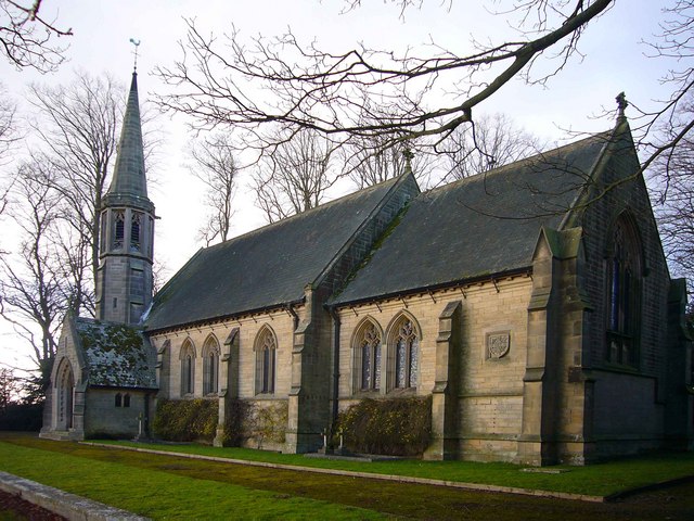
| Chapel of St Aidan | 1042981 | II | 1885 | Stagshaw | |
| Hadrian's Wall and vallum between field boundary east of milecastle 24 and field boundary west of the site of turret 25b in wall miles 24 to 25 | 1010958 | n/a | Roman | Scheduled Monument (partly in the parish) | |
| Hadrian's Wall and vallum between the track to Portgate Cottage and the field boundary east of milecastle 24 in wall miles 22 and 23 | 1010626 | n/a | Roman | Scheduled Monument (partly in the parish) | |
| Round cairn 530m west of Stanley Cottages | 1017734 | n/a | Bronze Age | Scheduled Monument | |
| Anick Farmhouse | 1043007 | II | C16th | Anik | |
| Apple Store and Adjacent Walls on North of Kitchen Garden | 1156424 | II | C18th | ||
| Appletrees | 1043018 | II | C19th | Sandhoe | House |
| Bank Foot Farmhouse | 1043008 | II | C17th | Anik | |
| Barn 40 metres south-west of Bank Foot Farmhouse | 1370592 | II | C18th | Anik | |
| Beaufront Woodhead Farmhouse and Adjacent Cottage | 1043014 | II | C18th | Beaufront Woodhead | |
| Bridge End House and Bridge End Cottage | 1370560 | II | C18th | ||
| Butlers Cottage and House to Right of Butlers Cottage | 1156587 | II | C18th | Sandhoe | |
| Byre 15 Metres West of Bank Foot Farmhouse | 1302955 | II | C18th | Anik | |
| Cartshed 30 Metres North-East of Beaufront Woodhead Farmhouse | 1302839 | II | C18th | Beaufront Woodhead | |
| Cross at End of Terrace 100 Metres West of Sandhoe Hall | 1156594 | II | |||
| Dovecote 50 Metres South-West of Red House Farm House | 1302835 | II | |||
| Entrance Screen and Gates to Sandhoe Hall | 1043021 | II | |||
| Fountain on Lawn 100 Metres East of Beaufront Castle | 1302942 | II | |||
| Fox and Hounds Inn | 1043006 | II | House - former pub. | ||
| Front Garden Wall to Bridge End House | 1156526 | II | |||
| Game Larder 20 Metres North of Stagshaw House | 1370578 | II | |||
| Garden Cottage | 1043011 | II | |||
| Group of Farmbuildings on North Side of Road, and Walls Attached | 1156518 | II | C19th | Beaufront Woodhead | Now houses |
| High House West | 1043017 | II | |||
| Homeaway | 1302958 | II | |||
| Ice House on North Bank of Stream 180 Metres West of Sandhoe Hall | 1042979 | II | |||
| Ice House on West Side of Path 50 Metres South-East of St Aidans Chapel | 1302779 | II | |||
| Icehouse on East Bank of Stream 500 Metres North-North-West of Beaufront | 1156471 | II | |||
| North Lodge with Adjacent Gatepiers | 1370593 | II | |||
| Potting Shed with Attached Walls and Steps in Kitchen Garden | 1370595 | II | |||
| Range of Farmbuildings 20 Metres North of Anick Farmhouse | 1156208 | II | Anik | ||
| Range of Outbuildings 20 Metres North of Fox and Hounds Inn | 1156189 | II | |||
| Range of Outbuildings to West of Anick Farmhouse | 1370591 | II | Anik | ||
| Red House Farmhouse and Attached Farmbuildings Range to West | 1043013 | II | |||
| Sandhoe Hall | 1043019 | II | |||
| Sandhoe High House | 1302799 | II | |||
| Screen with Gateway on North of Beaufront Castle Stable Court | 1156283 | II | |||
| South Lodge and Attached Quadrant Walls | 1156323 | II | |||
| Stable Block 50 Metres North-West of Stagshaw House | 1042980 | II | |||
| Stagshaw House with Attached Gateway | 1156599 | II | C19th | Stagshaw | Extended 1920. |
| Sundial 12 Metres South of Sandhoe Hall | 1043020 | II | Sandhoe | ||
| Terrace Wall Below Lower Garden, 180 Metres South-West of Beaufront Castle | 1043012 | II | |||
| Terrace Wall to South of Beaufront Castle | 1043010 | II | |||
| Terrace Walls to South of Sandhoe High House | 1302801 | II | Sandhoe | ||
| Terrace Walls to South of Stagshaw House | 1156607 | II | |||
| The Kennels 500 Metres North of Beaufront Woodhead Farmhouse | 1043015 | II | C19th | Beaufront Woodhead | House |
| Village Well | 1043016 | II | C19th | Sandhoe | |
| Walls Around Rose Garden 170 Metres South-West of Beaufront Castle | 1302927 | II | |||
| Walls of Walled Garden 100 Metres South-West of Beaufront Castle | 1370594 | II | |||
| Woodhead Cottages | 1370559 | II | C18th | Beaufront Woodhead |
Co-Curate Page
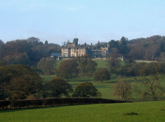
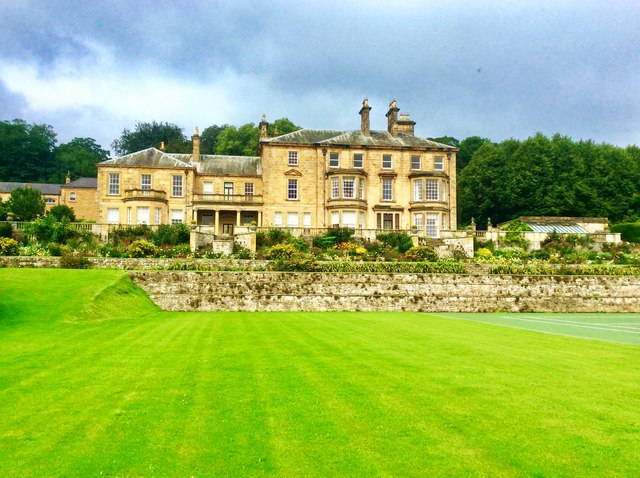
Beaufront Castle
- Overview About Beaufront Castle Map Aerial View Beaufront Castle is an extensive privately owned country house, located about a mile and a half north-east of Hexham, situated between the villages …
Co-Curate Page
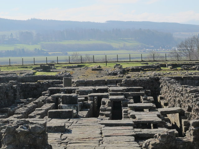
Corbridge Roman Town and Fort
- Overview About Corbridge Roman Fort/Town Map Street View Corstopitum Coria was a fort and town 2.5 miles (4.0 km) south of Hadrian's Wall, in the Roman province of Britannia at a …

Co-Curate Page
Farmhouse, Beaufront Woodhead
- Overview Map Street View The farmhouse at Beaufront Woodhead dates from the 18th Century. It was built in several phases in the 18th century, incorporating parts of an earlier building; …
Co-Curate Page
The Kennels, Beaufront Woodhead
- Overview Map Street View 'The Kennels' (house) and attached cottage, to the north-east of Beaufront Woodhead, date from the early 19th century; built in two phases. The actual kennels are …

Co-Curate Page
Woodhead Cottages, Beaufront Woodhead
- Overview Map Street View Woodhead Cottages in Beaufront Woodhead are a terrace of 2, formerly 3, houses. They date from the 18th century, and were remodelled with an addition of …
Co-Curate Page
Former Cartshed, Beaufront Woodhead
- Overview Map Street View This former cartshed, by the farmhouse at Beaufront Woodhead, has 3 segmental arches and dates from the late 18th century. The former cartshed is Grade II …

Co-Curate Page
Beaufront Castle
- Overview About Beaufront Castle Map Aerial View Beaufront Castle is an extensive privately owned country house, located about a mile and a half north-east of Hexham, situated between the villages …
Co-Curate Page
Corbridge Roman Town and Fort
- Overview About Corbridge Roman Fort/Town Map Street View Corstopitum Coria was a fort and town 2.5 miles (4.0 km) south of Hadrian's Wall, in the Roman province of Britannia at a …
Co-Curate Page
Farmhouse, Beaufront Woodhead
- Overview Map Street View The farmhouse at Beaufront Woodhead dates from the 18th Century. It was built in several phases in the 18th century, incorporating parts of an earlier building; …
Co-Curate Page
The Kennels, Beaufront Woodhead
- Overview Map Street View 'The Kennels' (house) and attached cottage, to the north-east of Beaufront Woodhead, date from the early 19th century; built in two phases. The actual kennels are …
Co-Curate Page
Woodhead Cottages, Beaufront Woodhead
- Overview Map Street View Woodhead Cottages in Beaufront Woodhead are a terrace of 2, formerly 3, houses. They date from the 18th century, and were remodelled with an addition of …

