Topics > Northumberland > Civil Parishes in Northumberland > Elsdon Civil Parish > Historic Buildings and Monuments in Elsdon Civil Parish
Historic Buildings and Monuments in Elsdon Civil Parish
Listed buildings and scheduled monuments in Elsdon Civil Parish, Northumberland, from the National Heritage List for England[1]. Use the Search (below) if looking for a specific building / monument.
| Structure | List No. | Grade | Built~ | Notes |
|---|---|---|---|---|
| 3 Headstones Circa 20 Yards South West of Church of St Cuthbert | 1041237 | II | C18th | |
| Alderson, Hall and Hall Headstones Circa 10 Yards South of Church of St Cuthbert | 1041239 | II | C18th | |
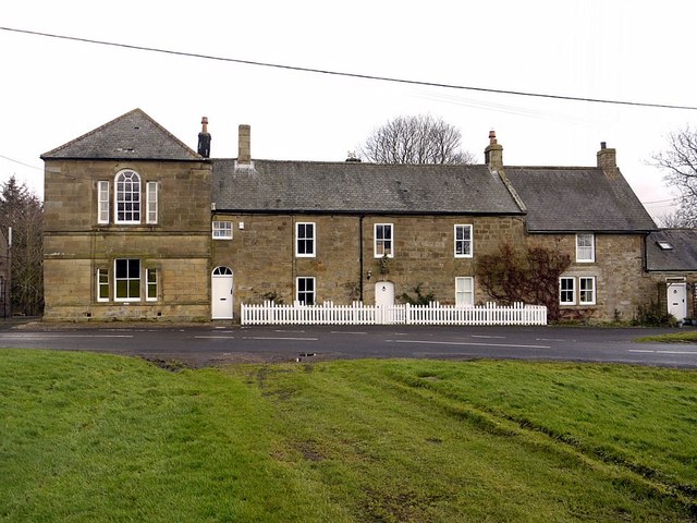
| Bacchus House | 1371476 | II | C18th | |
| Bastle House Circa 50 Yards North of Whitlees | 1155121 | II | C16th | |
| Bastle Houses at Ottercops Farm | 1371455 | II | C17th | |
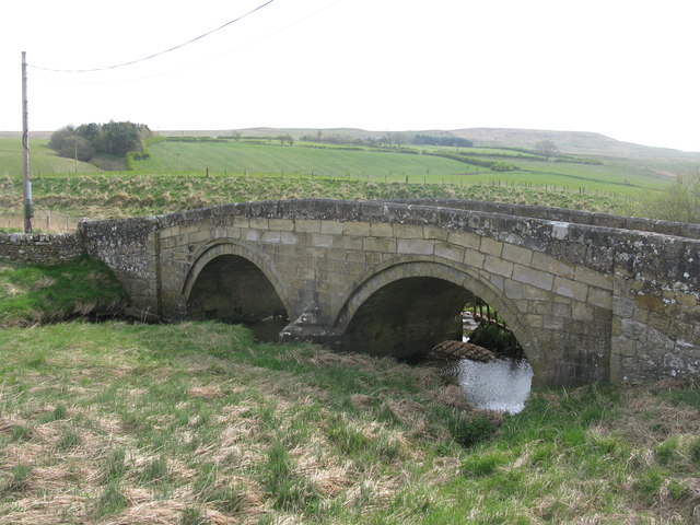
| Bridge over Elsdon Burn Circa 150 Yards South of the Mill | 1041272 | II | C18th | Hump-backed bridge |
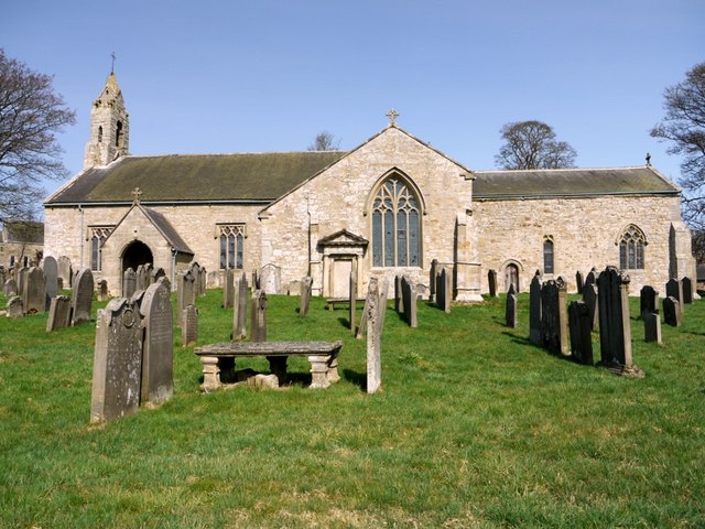
| Church of St Cuthbert | 1155072 | I | C12th | Elsdon. Restored C19th |
| Dobson Headstone Circa 15 Yards South of Church of St Cuthbert | 1303514 | II | 1756 | |
| Elsdon Bridge | 1371475 | II | C18th | Bridge over Elsdon Burn. |
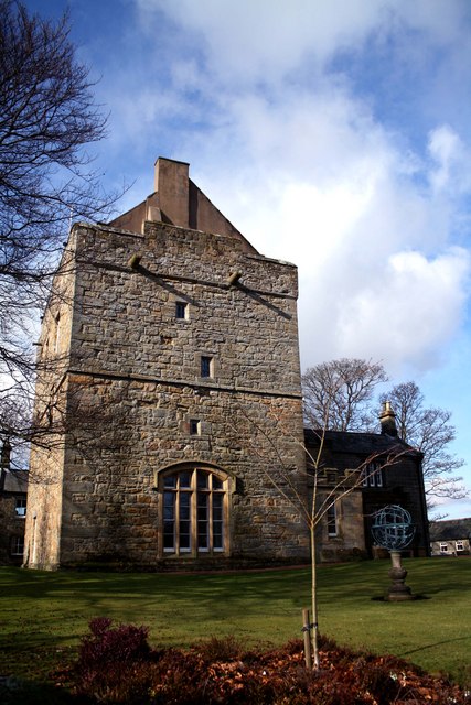
| Elsdon Tower | 1371439 | I | C13th | |
| Farmbuildings Attached to Left of the Crown | 1041233 | II | C18th | |
| Headstone of Katharin... Circa 10 Yards South of Church of St Cuthbert | 1303503 | II | C18th | |
| Milestone Circa 1000 Yards South of Blaxter Cottages | 1371456 | II | c.1829 | |
| Milestone Circa 400 Yards North West of Ottercops Road End | 1041270 | II | c.1829 | |
| Milestone Circa a Quarter of a Mile West of Raylees | 1041271 | II | c.1829 | |
| Pair of Headstones Circa 20 Yards South of Church of St Cuthbert | 1041238 | II | 1754 | |
| Scott's House | 1041231 | II | C19th | |
| Snaith Headstone Circa 25 Yards South of Church of St Cuthbert | 1041240 | II | 1761 | |
| The Bird in the Bush Inn | 1041234 | II | C18th | |
| The Coach House | 1041232 | II | C18th | |
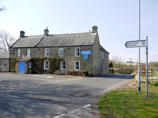
| The Crown | 1371477 | II | 1729 | Farmhouse; former inn. |
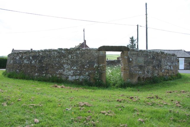
| The Pinfold | 1041235 | II | C18th | |
| Townfoot and Attached Kennel | 1041230 | II | C18th | |
| Turnbull Headstone Circa 2 Yards South of Church of St Cuthbert | 1041236 | II | 1735 | |
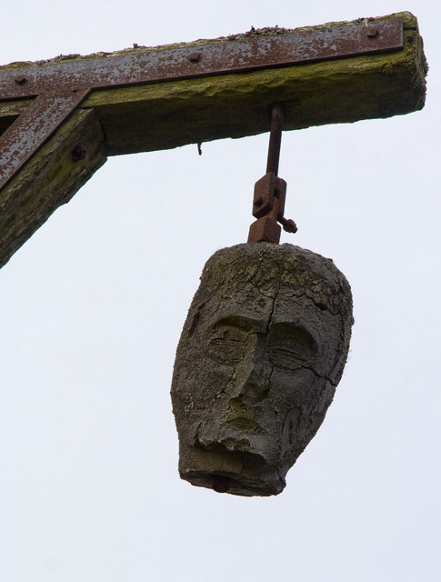
| Winter's Gibbet and Adjacent Crossbase of Steng Cross | 1041241 | II | Medieval | Medieval cross base +C19th gallows. |
| Prehistoric settlement, funerary and agricultural remains, 650m south of South Monkridge Bridge | 1006467 | n/a | Scheduled Monument. Remains of Romano-British settlements. | |
| Ant Hills (burial mounds), Monkridge | 1006608 | n/a | Scheduled Monument | |
| Mote Hills motte and bailey castle | 1007524 | n/a | C11th | Scheduled Monument. Earthwork remains. |
| Defended settlement, 470m south west of Haining | 1009608 | n/a | Scheduled Monument | |
| Cup and ring marked rock on Tod Crag | 1013542 | n/a | Prehistoric | Scheduled Monument |
| Manside defended settlement and medieval cross | 1007521 | n/a | Scheduled Monument |
Primary source: the National Heritage List for England - NHLE is the register of nationally protected historic buildings and sites in England, including listed buildings, scheduled monuments, protected wrecks, registered parks and gardens, and battlefields. The list is maintained by Historic England. Check NHLE for updates and new entries. Secondary sources: British Listed Buildings and Keys to the Past.
Co-Curate Page
Elsdon Tower
- Overview About Elsdon Tower Map Street View "Elsdon Tower is a medieval towerhouse, now converted for residential use. It was recorded as a 'Vicar's Pele' in 1415 and thought to …
Co-Curate Page
Church of St Cuthbert
- Overview About St Cuthbert's Church Map Street View St Cuthbert's Parish Church in Elsdon, Northumberland, dates from the 12th century, with alterations and additions in the 14th and 17th centuries. The …
Co-Curate Page
Bacchus House
- Bacchus House in Elsdon is a former coaching inn, built in the early 18th century. It is Grade II listed on the National Heritage List for England.
Co-Curate Page
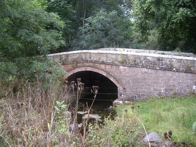
Former Road Bridge over Elsdon Burn
- Overview Map Street View The former road bridge over Elsdon Burn, at the north-end of the village of Elsdon was built in the late 18th or early 19th century.[1] The …
Co-Curate Page
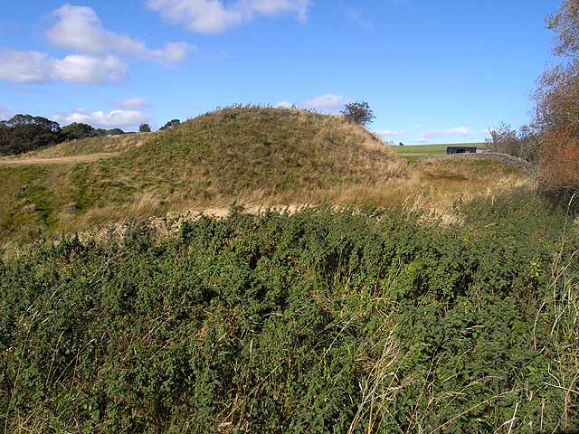
Mote Hills (Elsdon Castle)
- Overview About Elsdon Castle Map Street View Mote Hills at the village of Elsdon are the earthwork remains of a medieval motte and bailey castle. The castle was built on …
Co-Curate Page
Winter's Gibbet and Steng Cross
- Overview Map Street View Winter's Gibbet is a 19th century replica of the gallows from which William Winter was hung for the murder of Margaret Crozier in 1791. It is …

Co-Curate Page
Cup and ring marked rock on Tod Crag
- Tod Crag is a sandstone outcrop, located about 2km north of Rochester and 5km south-east of Elsdon in Northumberland. There are a series of relatively well preserved cup and ring …

Co-Curate Page
Elsdon Tower
- Overview About Elsdon Tower Map Street View "Elsdon Tower is a medieval towerhouse, now converted for residential use. It was recorded as a 'Vicar's Pele' in 1415 and thought to …
Co-Curate Page
Church of St Cuthbert
- Overview About St Cuthbert's Church Map Street View St Cuthbert's Parish Church in Elsdon, Northumberland, dates from the 12th century, with alterations and additions in the 14th and 17th centuries. The …
Co-Curate Page
Bacchus House
- Bacchus House in Elsdon is a former coaching inn, built in the early 18th century. It is Grade II listed on the National Heritage List for England.
Co-Curate Page
Former Road Bridge over Elsdon Burn
- Overview Map Street View The former road bridge over Elsdon Burn, at the north-end of the village of Elsdon was built in the late 18th or early 19th century.[1] The …
Co-Curate Page
Mote Hills (Elsdon Castle)
- Overview About Elsdon Castle Map Street View Mote Hills at the village of Elsdon are the earthwork remains of a medieval motte and bailey castle. The castle was built on …
Co-Curate Page
Winter's Gibbet and Steng Cross
- Overview Map Street View Winter's Gibbet is a 19th century replica of the gallows from which William Winter was hung for the murder of Margaret Crozier in 1791. It is …


