Topics > Civil Parishes in Cumbria > Askerton Civil Parish > Historic Buildings and Monuments in Askerton Civil Parish
Historic Buildings and Monuments in Askerton Civil Parish
Listed buildings and scheduled monuments in Askerton Civil Parish, Cumbria, from the National Heritage List for England[1]. Use the Search (below) if looking for a specific building / monument.
| Structure | List No. | Grade | Built~ | Notes |
|---|---|---|---|---|
| Arch East of Church of St Kentigern | 1205070 | II | ||
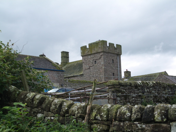
| Askerton Castle | 1087531 | I | C14th | |
| Barn and Byres to South West of Askerton Castle | 1280901 | II | ||
| Bastle House | 1335617 | II | ||
| Byres to South East of Askerton Castle | 1280908 | II | ||
| Knorren Lodge | 1335616 | II | ||
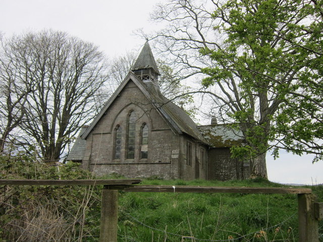
| St Kentigern's Church | 1436853 | II | 1885 | Kirkcambeck. Replacing C13th church. |
| Woodhead | 1087532 | II | ||
| Medieval dispersed settlement at Askerton Park 170m WSW of Parkgate Bridge | 1016087 | n/a | Scheduled Monument | |
| Hazel Gill shieling | 1014052 | n/a | Scheduled Monument | |
| Three shielings on Foulbog Rigg; the westernmost of a group of seven | 1014053 | n/a | Scheduled Monument | |
| Shieling on Foulbog Rigg; the easternmost of a group of seven | 1014054 | n/a | Scheduled Monument | |
| Shieling on Foulbog Rigg; one of a group of seven | 1014055 | n/a | Scheduled Monument | |
| Two shielings on Foulbog Rigg; part of a group of seven | 1014878 | n/a | Scheduled Monument | |
| Stone hut circle and round cairn 800m east of Woodhead | 1015729 | n/a | Scheduled Monument | |
| Stone hut circle 740m east of Woodhead | 1015730 | n/a | Scheduled Monument | |
| Round cairn 610m south east of High Grains | 1015731 | n/a | Scheduled Monument | |
| Barron's Pike bowl barrow | 1015732 | n/a | Scheduled Monument | |
| Towerbrae round cairn | 1015733 | n/a | Scheduled Monument | |
| Medieval shieling on Espy Bank 35m south of Esby Well | 1015737 | n/a | Scheduled Monument | |
| Round cairn in Mollen Wood, 640m east of Parkgate Bridge | 1015766 | n/a | Scheduled Monument | |
| Two round cairns in Mollen Wood, 660m east of Parkgate Bridge | 1015767 | n/a | Scheduled Monument | |
| High Grains medieval pele tower and three shielings 200m west of High Grains Farm | 1015867 | n/a | Scheduled Monument | |
| Medieval dispersed settlement 210m WNW of Lukes Cottage | 1016084 | n/a | Scheduled Monument | |
| Early post-medieval dispersed settlement on Mount Hulie | 1016088 | n/a | Scheduled Monument | |
| Medieval shieling 800m east of Woodhead | 1016251 | n/a | Scheduled Monument | |
| Prehistoric cup marked stone 380m south of Gillalees | 1016399 | n/a | Scheduled Monument | |
| High Grains bastle and shieling 130m west of High Grains Farm | 1017461 | n/a | Scheduled Monument | |
| Dollerline medieval dispersed settlement 250m north of Bush Farm | 1015869 | n/a | Scheduled Monument | |
| Maiden Way Roman road from B6318 to 450m SW of High House, Gillalees Beacon signal station and Beacon Pasture early post-medieval dispersed settlement | 1018242 | n/a | Scheduled Monument |
Primary source: the National Heritage List for England - NHLE is the register of nationally protected historic buildings and sites in England, including listed buildings, scheduled monuments, protected wrecks, registered parks and gardens, and battlefields. The list is maintained by Historic England. Check NHLE for updates and new entries.
Secondary sources: British Listed Buildings.

Co-Curate Page
Askerton Castle
- Overview About Askerton Castle Map Street View Askerton Castle is a medieval fortified manor house in Cumbria, England. History Askerton Castle was built in the parish of Askerton in …


