Topics > Civil Parishes in Cumbria > Arthuret Civil Parish > Historic Buildings and Monuments in Arthuret Civil Parish
Historic Buildings and Monuments in Arthuret Civil Parish
Listed buildings and scheduled monuments in Arthuret Civil Parish, Cumbria, from the National Heritage List for England[1]. Use the Search (below) if looking for a specific building / monument.
| Structure | List No. | Grade | Built~ | Notes |
|---|---|---|---|---|
| Nos. 2 and 4a, Graham Street | 1280962 | II | ||
| Barns to North West of Brackenhill Farmhouse | 1087522 | II | C18th | Brackenhill |
| Brackenhill Farmhouse | 1335608 | II | C18th | Brackenhill |
| Brackenhill Tower | 1087521 | II* | 1585 | Brackenhill |
| Carwinley Mill | 1087527 | II | ||
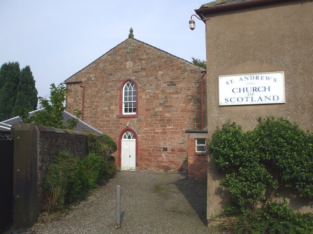
| Church of St Andrew | 1087526 | II | 1834 | Longtown. |
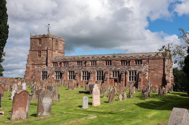
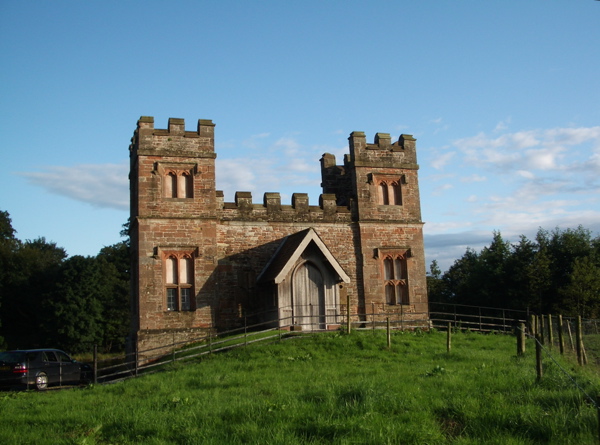
| Church of St Michael | 1087523 | II* | 1609 | Arthuret. |
| Churchyard Cross West of Church of St Michael | 1087524 | II* | ||
| Churchyard Wall East of Church of St Michael | 1335610 | II | ||
| Coachman's House and Stables Adjoining to North of Netherby Hall | 1335614 | II | ||
| Coop House North West of Netherby Hall | 1204976 | II* | 1772 | Netherby |
| East Lodge | 1205018 | II | ||
| Graham Arms Hotel | 1280958 | II | ||
| Ice House North East of Netherby Hall | 1087529 | II | ||
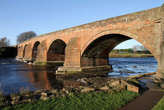
| Longtown Bridge | 1087528 | II | 1756 | Longtown. Bridge over the River Esk. |
| Milestone at Ngr 3806 6838 | 1280992 | II | ||
| Milestone South West of Netherby Hall at Ngr 395 708 | 1280928 | II | ||
| Milestone, Hopesike Woods at Ngr 388 669 | 1335609 | II | ||
| Netherby Hall | 1204948 | II* | ||
| Nook House | 1335613 | II | ||
| South Lodge | 1335615 | II | ||
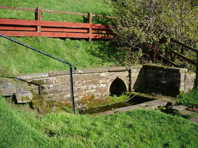
| St Michael's Well, North West of Church of St Michael | 1335611 | II | C17th | Arthuret |
| Suspension Bridge | 1087530 | II | ||
| The Bush Hotel | 1335612 | II | ||
| The Globe Tavern | 1087525 | II | ||
| Westlinton Bridge | 1335593 | II | c.1793 | Partly in this parish |
| Battle of Solway Moss 1542 | 1000034 | n/a | 1542 | Listed Historic Battlefield |
| Longtown Conservation Area | - | n/a | Conservation Area |
Primary source: the National Heritage List for England - NHLE is the register of nationally protected historic buildings and sites in England, including listed buildings, scheduled monuments, protected wrecks, registered parks and gardens, and battlefields. The list is maintained by Historic England. Check NHLE for updates and new entries. Secondary sources: British Listed Buildings.
Co-Curate Page
Church of St Michael, Arthuret
- Overview Map Street View St Michael's Church in Arthuret was built in 1609, replacing and earlier medieval church. The tower was completed in c.1700, and the church was restored in …

Co-Curate Page
Battle of Solway Moss, 1542
- Overview About the Battle of Solway Moss The Battle of Solway Moss took place on the 24th of November 1542 near Arthuret, about 7 miles north of Carlisle, just south …

Co-Curate Page
Brackenhill Tower
- Overview About Brackenhill Tower Map Brackenhill Tower was built in 1586 by the infamous Border Reiver Ritchie Graham. It is thought to have been built on the site of an …
Co-Curate Page
Westlinton Bridge
- Overview Map Street View Westlinton Bridge is located immediately north of the village of Westlinton and carries the A7 road over the River Lyne. The red sandstone bridge has 2 …

Co-Curate Page
Church of St Michael, Arthuret
- Overview Map Street View St Michael's Church in Arthuret was built in 1609, replacing and earlier medieval church. The tower was completed in c.1700, and the church was restored in …
Co-Curate Page
Battle of Solway Moss, 1542
- Overview About the Battle of Solway Moss The Battle of Solway Moss took place on the 24th of November 1542 near Arthuret, about 7 miles north of Carlisle, just south …
Co-Curate Page
Brackenhill Tower
- Overview About Brackenhill Tower Map Brackenhill Tower was built in 1586 by the infamous Border Reiver Ritchie Graham. It is thought to have been built on the site of an …


")