Topics > Transport and Travel > Railway > Ingleton Branch Line
Ingleton Branch Line
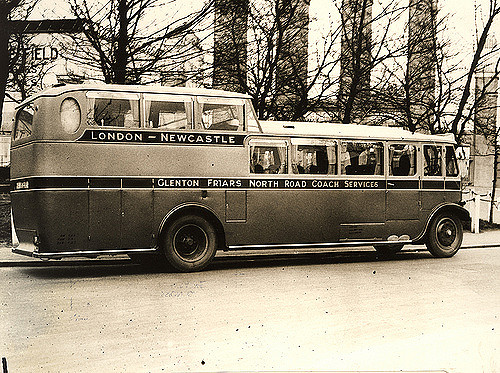
Ingleton Branch Line was opened by the Lancaster and Carlisle Railway company in 1861. The 18 mile long branch line served the towns of Ingleton, Kirkby Lonsdale and Sedbergh. It closed to passengers in 1954 and the tracks were dismantled in 1967.
The Ingleton branch line was a rural railway line in the West Riding of Yorkshire, Lancashire and Westmorland in England (now North Yorkshire, Lancashire and Cumbria). It was originally planned in 1846 to form part of a main line route from London to Scotland, but fell victim to rivalry between railway companies. Completion was delayed until 1861, and it was only ever a rural branch line, serving the towns of Ingleton, Kirkby Lonsdale and Sedbergh. It closed to passengers in 1954 and was dismantled in 1967.
Plans
In 1846, the North Western Railway (NWR) was formed to connect the Leeds and Bradford Extension Railway at Skipton to the Lancaster and Carlisle Railway (L&CR) south of Tebay, with a secondary branch from Clapham to Lancaster. In 1849, the route between and Ingleton opened, but further work northward was abandoned due to financial difficulties, the company deciding to concentrate instead on the cheaper branch to Lancaster. When the route from Skipton to Lancaster opened in 1850, the short section from to Ingleton closed.
Other railway companies had an interest in the line north of Ingleton being built, as it could form part of a main-line route from London to Scotland shorter than the existing West Coast Main Line. Over the next few years were many negotiations between the NWR and the L&CR, the Midland Railway (MR), the Great Northern Railway (GNR) and the London and North Western Railway (LNWR). The original time limit, set by Parliament in 1846, for the construction of the line was about to expire, so a further five-year extension was obtained by the NWR in 1852. However, negotiations failed and it became clear the line could not be built even within the new timescale. Eventually, in 1857, two rival bills were put before Parliament. One was from the NWR, with the support of the GNR who hoped to form a mainline route from London to Scotland. The proposed route was from Ingleton to Kirkby Lonsdale, then straight up the Lune valley to join the L&CR line just south of Tebay. The other bill was from the L&CR itself, which wanted to block its rival GNR's ambitions to reach Scotland. The L&CR route differed from the proposed NWR route in two ways: it passed closer to the town of Sedbergh and it joined the main L&CR line significantly further south at the existing Low Gill station. A Commons' Committee decided to accept the L&CR scheme, and its bill was passed on 25 August 1857.
Construction
The line was built by the Lancaster and Carlisle Railway between 1858 and 1861, and the work was split into four contracts.
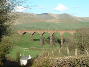
Contract 1A covered 1 mile 6 chains (1.7 km) from Lowgill, and included the Lowgill Viaduct of 11 arches each 45 feet (14 m) wide, with a maximum height of 90 feet (27 m). It was awarded to Samuel Buxton of Leeds.
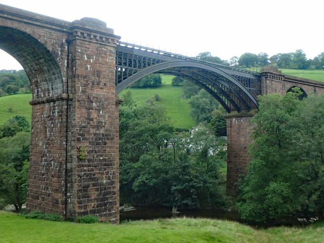
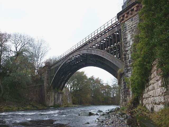
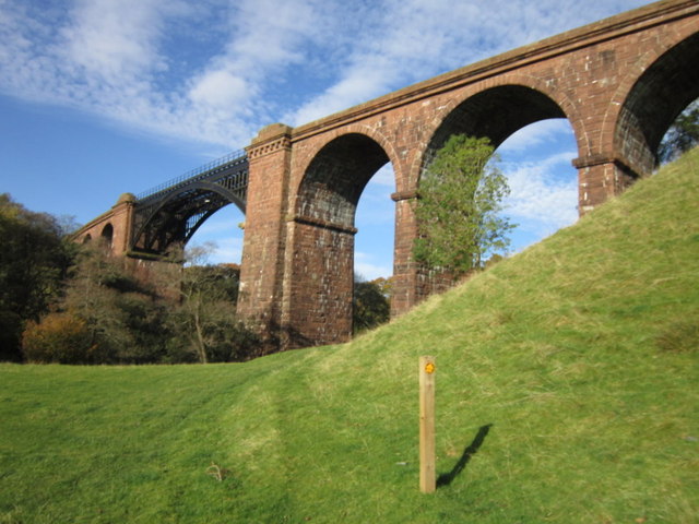
Contract 1 covered 4 miles 38 chains (7.2 km) and included two major bridges, one over the River Rawthey near Sedbergh, 120 feet (37 m) long and 53 feet (16 m) high, the other over the River Lune, known as Waterside Viaduct, 530 feet (162 m) long and 100 feet (30 m) high, both with a cast metal central arch of similar style to each other. It was awarded to Coulthard and Allen, who had built the Clapham to Ingleton NWR line some 10 years earlier.
Contract 2 covered 7 miles 27 chains (11.8 km) over flatter ground with no major works, and was awarded to James Taylor.
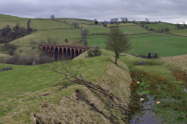
Contract 3 covered the final 5 miles 78 chains (9.6 km) ending at the Ingleton Viaduct of 11 arches each 57 feet (17 m) wide, 800 feet (240 m) long with a maximum height of 80 feet (24 m) (the foundations of which had been laid ten years earlier by the NWR). It was also awarded to James Taylor.
Some 1,600 navvies and 70 horses were used to build the 18-mile (29 km) line.
Before construction, the line had been referred to as the "Orton branch" or the "Lune Valley line", but, once built, it was officially known as the "Ingleton branch".
Operation
The line was opened to passengers on 16 September 1861, by which time the LNWR had taken control of the L&CR, and its rival the MR had taken over the NWR, which still owned the line beyond Ingleton. The rival companies could not come to agreement over the sharing of the Midland station at Ingleton, and so the L&CR built its own station at Ingleton, the two stations being at opposite ends of the Ingleton Viaduct. In the early days of the line, through passengers had to walk nearly a mile (1½ km) between the two Ingleton stations, descending into the valley below and climbing up the other side, where they often had a long wait as the companies did not cooperate over timetabling either. Soon after, the MR agreed to allow LNWR trains to terminate at the Midland station, but both Ingleton stations remained open and connections were not timetabled. It was not until the 1923 "grouping" of the LNWR and MR into the London, Midland and Scottish Railway that the division at Ingleton was removed, and the whole route from Clapham to Tebay was operated as a single line. Ingleton (LNWR) station was then closed.
The Midland Railway wanted to use the Ingleton branch to form part of a main line from London to Scotland, but the LNWR, which already had its own London–Scotland line, refused to cooperate. This led to the Midland obtaining a bill in 1866 to construct the Settle–Carlisle Line, which would serve the same purpose. Subsequently, the MR and LNWR came to an agreement over the Ingleton branch and the MR wished to abandon its plan for the Settle–Carlisle Line but Parliament refused in 1869, so the line was built anyway. This sealed the fate of the Ingleton branch to remain a rural branch line and never obtain main line status. Nevertheless, the line was used as an relief route whenever other lines to Scotland were temporarily closed.
The line was double throughout. The steepest gradient was the final 4 3⁄4 miles (7.6 km) to Low Gill at 1 in 100. The ruling speed limit was 60 mph, with 45 mph at Ingleton and the last 5 miles, and 20 mph over Waterside and Rawthey bridges. Each station controlled its signals and there was an intermediate block post at Newby Moor until 1937, installed after a crash on 22 July 1891 between a goods and a mixed train. All the stations were of stone, with low, short platforms. Sedbergh had a water tank and column. Ingleton Midland had a bay. Mostly the line had 1 goods and four 2-coach passenger trains a day in each direction, but reduced to 2 in 1944, 1947 and 1951.
Closure
All but Ingleton and Barbon stations were distant from their towns, collieries at Ingleton closed in 1925 and 1935, as did 2 limestone quarries, Barbon creamery switched its traffic to road and Middleton on Lune station closed on 1 May 1935. After rail nationalisation in 1948, it was becoming uneconomical to operate both the Ingleton Line and the parallel Settle–Carlisle Line. Although the Ingleton line was much shorter and would have been cheaper to maintain, it was decided that the loss of the Settle line would have much greater impact on rural communities, and so on 30 January 1954 the Ingleton line closed to regular passenger traffic. The line was still occasionally used for weekend excursions and to transport pupils to and from local boarding schools. Goods traffic continued until 1 October 1964, although a goods service between Clapham and Ingleton continued for another five months after that. The line was maintained as a possible relief route until April 1967 when the tracks were lifted.
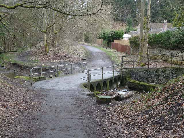
The line today
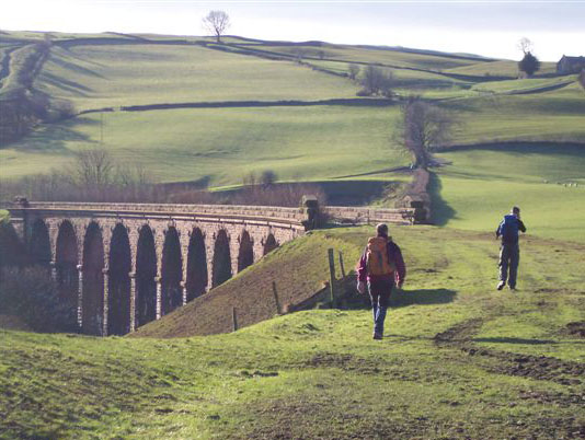
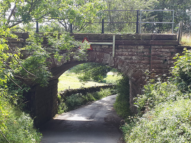
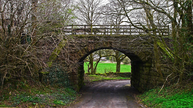
The route can easily be traced throughout its length, although a number of bridges have been removed and a section of the trackbed south of Kirkby Lonsdale (near Cowan Bridge) taken over by the re-aligned A65 road, which runs close to the old formation for much of the way between there and Ingleton. Several of the old stations have been adapted as private residences (e.g. , and Sedbergh), although both of those at Ingleton have been demolished – the former LNWR depot is now in commercial use, whilst the ex-MR site is now occupied by a car park and community/tourist information centre. The three major viaducts at Ingleton, Sedbergh and Lowgill are however still intact (all three are now Grade II listed buildings), as is the impressive iron girder bridge over the River Rawthey near Sedbergh (which carries a gas supply pipe).
Visit the page: Ingleton branch line for references and further details. You can contribute to this article on Wikipedia.
Co-Curate Page
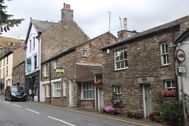
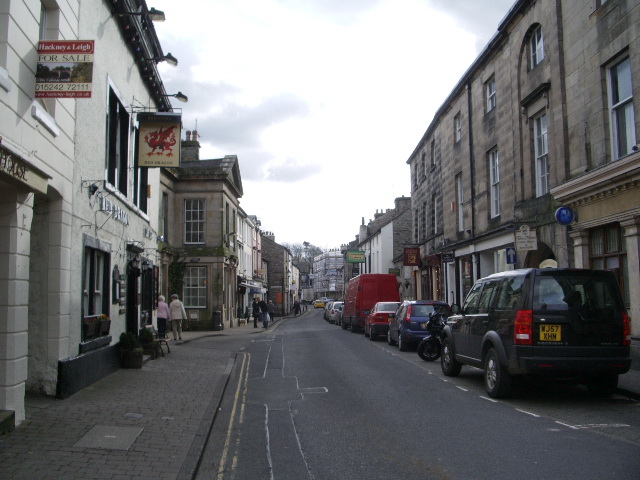
Sedbergh
- Overview About Sedbergh Map Street View Sedbergh is a small town and civil parish in Cumbria, England. Historically part of the West Riding of Yorkshire, it lies about 10 …
Co-Curate Page
Kirkby Lonsdale
- Overview About Kirkby Lonsdale Map Street View Kirkby Lonsdale is a market town in Cumbria, located about 10 miles south of Kendal. St Mary's Church was built in the 12th …
Co-Curate Page
Lowgill Viaduct
- Overview Map Street View Lowgill Viaduct was built in 1859 by Joseph Locke and John Errington for the Ingleton Branch Line of the London and North Western Railway.[1] The 11 …

Co-Curate Page
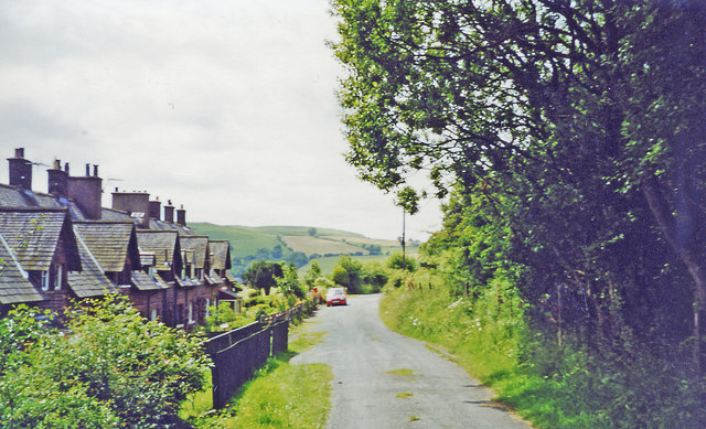
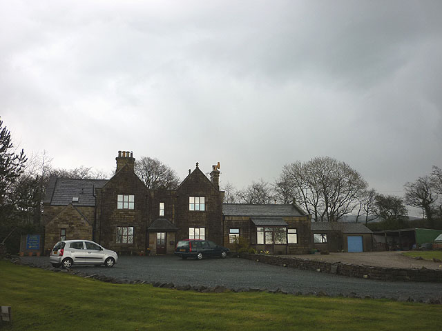
Lowgill
- Overview Map Street View Lowgill is a hamlet by the River Lune in Cumbria, located about 7 miles north-west of Kendal and 4 miles north-east of Sedbergh. Lowgill was an …
from Geograph (geograph)
Approaching site of former Middleton-on-Lune station
Pinned by Simon Cotterill
Co-Curate Page
Rawthey Bridge (rail), Brigflatts
- Overview Map Rawthey Bridge carried the railway over River Rawthey, near Brigflatts, about 4 miles northof Sedbergh, in Cumbria. It was built 1857-1861, for the Lancaster and Carlisle Railway Company. …
Co-Curate Page
Lune Viaduct at Newbys Dub
- Overview Map Street View The Lune Viaduct at Newbys Dub is located near the hamlet of Waterside and about 1½ miles north-west of Sedbergh. It was built to carry the …

Co-Curate Page
Sedbergh
- Overview About Sedbergh Map Street View Sedbergh is a small town and civil parish in Cumbria, England. Historically part of the West Riding of Yorkshire, it lies about 10 …
Co-Curate Page
Kirkby Lonsdale
- Overview About Kirkby Lonsdale Map Street View Kirkby Lonsdale is a market town in Cumbria, located about 10 miles south of Kendal. St Mary's Church was built in the 12th …
Co-Curate Page
Lowgill Viaduct
- Overview Map Street View Lowgill Viaduct was built in 1859 by Joseph Locke and John Errington for the Ingleton Branch Line of the London and North Western Railway.[1] The 11 …
Co-Curate Page
Lowgill
- Overview Map Street View Lowgill is a hamlet by the River Lune in Cumbria, located about 7 miles north-west of Kendal and 4 miles north-east of Sedbergh. Lowgill was an …
from Geograph (geograph)
Approaching site of former Middleton-on-Lune station
Pinned by Simon Cotterill
Co-Curate Page
Rawthey Bridge (rail), Brigflatts
- Overview Map Rawthey Bridge carried the railway over River Rawthey, near Brigflatts, about 4 miles northof Sedbergh, in Cumbria. It was built 1857-1861, for the Lancaster and Carlisle Railway Company. …
Co-Curate Page
Lune Viaduct at Newbys Dub
- Overview Map Street View The Lune Viaduct at Newbys Dub is located near the hamlet of Waterside and about 1½ miles north-west of Sedbergh. It was built to carry the …