Topics > County Durham > Civil Parishes in County Durham > Rokeby Civil Parish > Historic Buildings and Monuments in Rokeby Civil Parish
Historic Buildings and Monuments in Rokeby Civil Parish
Listed buildings and scheduled monuments in Rokeby Civil Parish, County Durham, from the National Heritage List for England[1]. Use the Search (below) if looking for a specific building / monument.
| Structure | List No. | Grade | Built~ | Note |
|---|---|---|---|---|
| 8 Urns on Lawn to South of Rokeby Park | 1121681 | II | ||
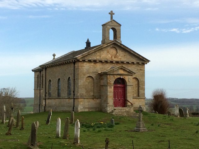
| Church of St Mary | 1121673 | II* | 1778 | Rokeby |
| Cross Base Circa 50 Metres North West of Dairy Bridge | 1121643 | II | ||
| Cross Lanes Farmhouse with Adjacent Outbuildings on West | 1160765 | II | ||
| Dairy Bridge Cottage | 1121684 | II | ||
| Dairy Bridge over the River Greta | 1160953 | II | ||
| East Entrance Screen to Rokeby Park, with Attached Walls and Railings | 1160819 | II | ||
| East Lodge to Rokeby Park | 1121678 | II | ||
| Farmbuilding Group to North of Garden House | 1310321 | II | ||
| Farmbuildings to East of Mortham Tower and Attached Walls | 1310361 | II | ||
| Footbridge 220 Metres South East of Mortham Tower | 1322731 | II | ||
| Gable End | 1160774 | II | ||
| Garden House, Outbuildings and Walls, to South West of Rokeby Park | 1121683 | II | ||
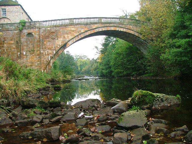
| Greta Bridge | 1160430 | II* | 1773 | Bridge over River Greta |
| Group of Tombstones Circa 50 Metres North West of Dairy Bridge | 1160963 | II | ||
| Gunroom on North of Rokeby Park Rear Court | 1121682 | II | ||
| Herm of Ceres 40 Metres West of Mortham Tower | 1121679 | II | ||
| Ice House 40 Metres East of Rokeby Park | 1160922 | II | ||
| Milestone 100 Metres West of Junction with B6277 | 1121675 | II | ||
| Milestone 80 Metres West of Entrance to Tutta Beck Farm | 1121674 | II | ||
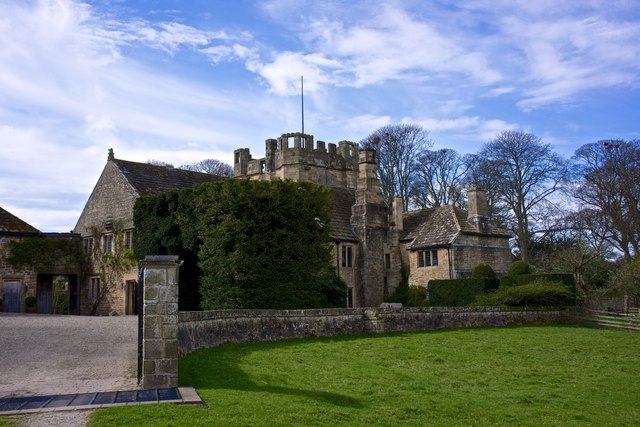
| Mortham Tower | 1160832 | I | C15th | Pele Tower, with later house. |
| Piers and Railings 500 Metres South West of Rokeby Park | 1160738 | II | ||
| Platform with Roman Altars on Lawn West of Rokeby Park | 1160901 | II | ||
| Rokeby Grove | 1322728 | II | ||
| Rokeby Park and Attached Stables | 1121680 | I | 1731 | Country house |
| Roman Milestone Against West Wall of Rokeby Park | 1160889 | II | ||
| Sir Walter Scott's Grotto, in Bank of River Greta South West of Mortham Tower | 1310358 | II | ||
| Stable Block 180 Metres South West of Rokeby Park | 1322733 | II | ||
| Stable to West of Rokeby Grove | 1121676 | II | ||
| Stableyard Cottage, to South West of Rokeby Park | 1160928 | II | ||
| Sundial on Lawn 10 Metres South of Rokeby Grove | 1310398 | II | ||
| Sundial on Lawn West of Rokeby Park | 1322732 | II | ||
| Terrace Wall to South of Mortham Tower | 1322730 | II | ||
| The Square | 1322729 | II | ||
| The Square (Numbers 3 to 6 Consecutive) with Farmbuilding Range to Left of Number 6 | 1160811 | II | ||
| The Square Range of Farmbuildings to Rear of Number 5 | 1121677 | II | ||
| Tutta Beck Cottages | 1310402 | II | ||
| West Lodge and Entrance Screen | 1322734 | II | ||
| Rokeby Park | 1000733 | II* | Listed Park and Garden | |
| Remains of St Michael's Church, 50m north west of Dairy Bridge, Rokeby Park | 1016875 | n/a | Scheduled Monument | |
| Greta Bridge Roman fort, vicus and section of Roman road | 1019074 | n/a | Scheduled Monument | |
| Greta Bridge | 1002319 | n/a | 1773 | Scheduled Monument |
Primary source: the National Heritage List for England - NHLE is the register of nationally protected historic buildings and sites in England, including listed buildings, scheduled monuments, protected wrecks, registered parks and gardens, and battlefields. The list is maintained by Historic England. Check NHLE for updates and new entries.
Secondary sources: British Listed Buildings and Keys to the Past.

Co-Curate Page
Church of St Mary, Rokeby
- Overview Map Street View St Mary's is a Parish Church in Rokeby, County Durham. The church was consecrated 1778, and believed to be designed by Sir Thomas Robinson.It replaced an …

Co-Curate Page
Mortham Tower
- Mortham Tower, near Greta Bridge, is a Grade I listed fortified courtyard house and pele tower which dates from the reign of King Henry VII (1485-1509). The estate was the …

Co-Curate Page
Greta Bridge (bridge)
- Overview Map Street View The stone bridge over the River Greta at Great Bridge village in County Durham, was built in 1773 by John Carr for John Sawry Morritt. It replaced …

Co-Curate Page
Rokeby Park
- Overview About Rokeby Park Map Rokeby Park is a Palladian style country house with extensive grounds located by the confluence of the River Tees and River Greta, close to Greta Bridge. …


Co-Curate Page
Church of St Mary, Rokeby
- Overview Map Street View St Mary's is a Parish Church in Rokeby, County Durham. The church was consecrated 1778, and believed to be designed by Sir Thomas Robinson.It replaced an …

Co-Curate Page
Mortham Tower
- Mortham Tower, near Greta Bridge, is a Grade I listed fortified courtyard house and pele tower which dates from the reign of King Henry VII (1485-1509). The estate was the …

Co-Curate Page
Greta Bridge (bridge)
- Overview Map Street View The stone bridge over the River Greta at Great Bridge village in County Durham, was built in 1773 by John Carr for John Sawry Morritt. It replaced …


