Topics > Civil Parishes in Cumbria > Natland Civil Parish > Historic Buildings and Monuments in Natland Civil Parish
Historic Buildings and Monuments in Natland Civil Parish
Listed buildings and scheduled monuments in Natland Civil Parish, Cumbria, from the National Heritage List for England[1]. Use the Search (below) if looking for a specific building / monument.
| Structure | List No. | Grade | Built~ | Notes |
|---|---|---|---|---|
| Barn to East of High House Farmhouse | 1312183 | II | ||
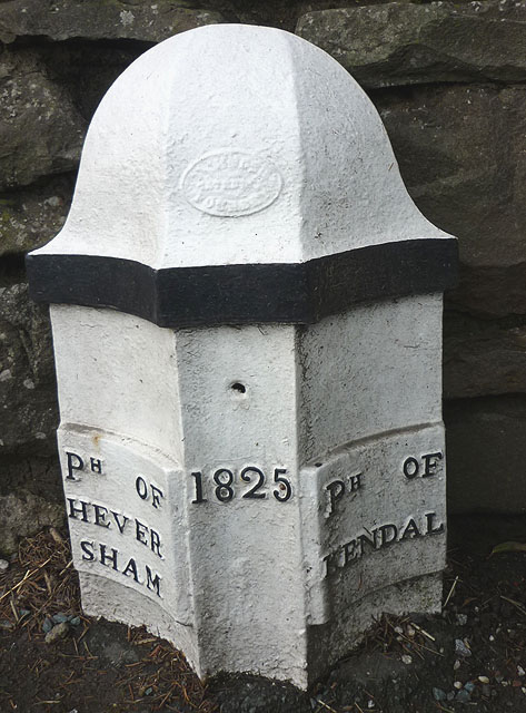
| Boundary Post Approximately 200 Yards North of Punch Bowl Public House | 1086581 | II | 1825 | Barrows Green. Old parish boundry. |
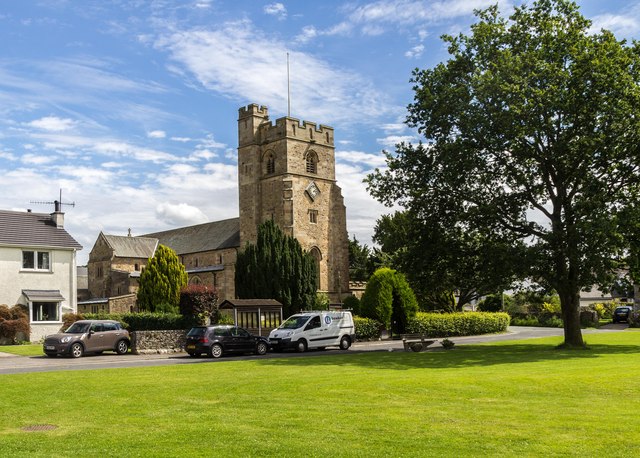
| Church of St Mark | 1137760 | II* | 1910 | Parish church |
| Cowhouse, Stables Used As Henhouse and Stable with Hayloft to West of Natland Hall | 1318869 | II | ||
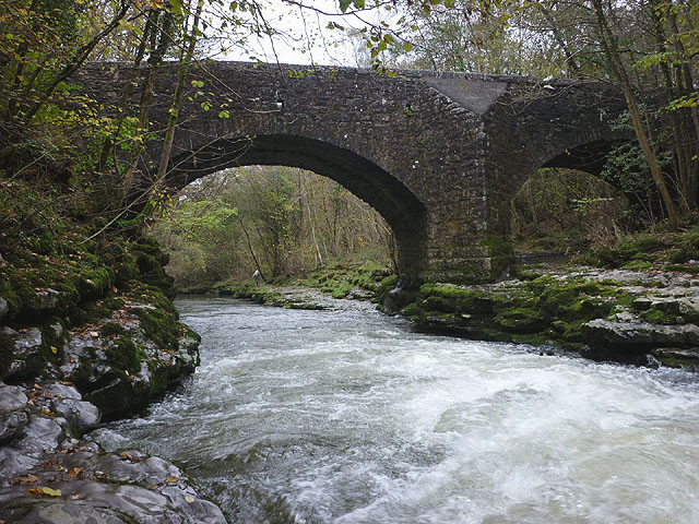
| Hawes Bridge over the River Kent | 1145744 | II | C18th | |
| Helme Lodge | 1336097 | II | ||
| High House Farmhouse | 1086582 | II | ||
| Lancaster Kendal Canal, Crowpark Bridge over Lancaster/Kendal Canal | 1336095 | II | ||
| Lancaster Kendal Canal, Natland Hall Bridge over Lancaster Kendal Canal | 1086580 | II | ||
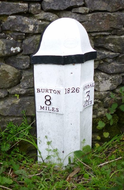
| Milestone Approximately 250 Yards North of Punch Bowl Public House | 1137641 | II | 1826 | Barrows Green. A65. |
| Natland Hall and Attached Outbuildings | 1086583 | II | ||
| Natland Mill Beck Farmhouse and Attached Cottage | 1086584 | II | ||
| Natland War Memorial | 1457167 | II | ||
| The Abbey | 1336096 | II | ||
| Watercrook Roman fort and civil settlement | 1007178 | n/a | Scheduled Monument | |
| Castlesteads small multivallate hillfort on The Helm | 1008263 | n/a | Scheduled Monument |
Primary source: the National Heritage List for England - NHLE is the register of nationally protected historic buildings and sites in England, including listed buildings, scheduled monuments, protected wrecks, registered parks and gardens, and battlefields. The list is maintained by Historic England. Check NHLE for updates and new entries.
Secondary sources: British Listed Buildings and Keys to the Past.
Co-Curate Page
Church of St Mark, Natland
- Overview About St Mark's Church Map Street View There has been a chapel or church in Natland since medieval times. The current church of St Mark's was built from 1909-1910, …
Co-Curate Page
Hawes Bridge, Nantland
- Overview Map Street View Hawes Bridge is a road bridge which carries Hawes Lane over the River Kent, just west of Natland and east of Prizet. The bridge dates from …
Co-Curate Page
Old Boundary Post, Barrows Green
- Overview Map Street View This old boundary post is located by the A65 road on a garden wall of a house located about 200 yrds north of the Punch Bowl …
Co-Curate Page
Old Milepost, Barrows Green
- Overview Map Street View This old milespost is located by the A65 road at the north of Barrows Green. The cast-iron half-hexagonal shaped milepost is dated 1826. It is one …

Co-Curate Page
Church of St Mark, Natland
- Overview About St Mark's Church Map Street View There has been a chapel or church in Natland since medieval times. The current church of St Mark's was built from 1909-1910, …
Co-Curate Page
Hawes Bridge, Nantland
- Overview Map Street View Hawes Bridge is a road bridge which carries Hawes Lane over the River Kent, just west of Natland and east of Prizet. The bridge dates from …
Co-Curate Page
Old Boundary Post, Barrows Green
- Overview Map Street View This old boundary post is located by the A65 road on a garden wall of a house located about 200 yrds north of the Punch Bowl …


")
