Topics > Northumberland > Civil Parishes in Northumberland > Longframlington Civil Parish > Historic Buildings and Monuments in Longframlington
Historic Buildings and Monuments in Longframlington
Listed buildings and scheduled monuments in Longframlington Civil Parish, Northumberland, from the National Heritage List for England[1]. Use the Search (below) if looking for a specific building / monument.
| Structure | List No. | Grade | Built~ | Note |
|---|---|---|---|---|
| Cairnfield including ring cairn and cup and ring marked rocks 500m north west of Snook Bank | 1015635 | n/a | Bronze Age | |
| 1, Church Street | 1041849 | II | ||
| 2 Boundary Stones on Boundary with Longframlington | 1041992 | II | ||
| 2 Boundary Stones on Boundary with Longframlington Civil Parish | 1042039 | II | ||
| 3 Boundary Stones on Boundary with Longframlington Civil Parish | 1041999 | II | ||
| 3, Church Street | 1041850 | II | ||
| 4, Church Street | 1371152 | II | ||
| Boundary Stone on Moor 300 Metres North West of Snook Bank Farm | 1041857 | II | ||
| Boundary Stones on Boundary with Longframlington Civil Parish 460 Metres North of Shirlaw Pike | 1304364 | II | ||
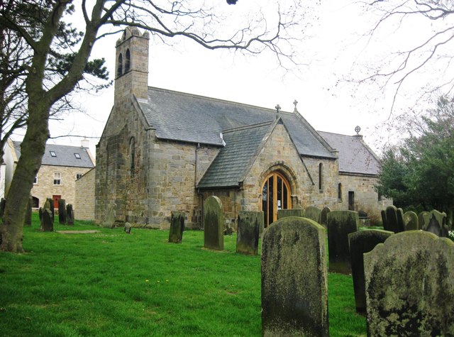
| Church of St Mary | 1303513 | I | c.1190 | |
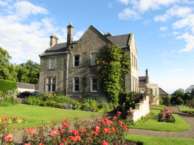
| Embleton Hall | 1154981 | II | c.1730 | |
| Entrance Screen and Attached Wall to North West of Newmoor Hall | 1303506 | II | ||
| Farmbuilding Group to North West of Embleton Hall | 1041851 | II | ||
| Garden Walls and Attached Kennels to North of Embleton Hall | 1041852 | II | ||
| Gate Piers Gates and Quadrant Walls to Church of St Mary | 1371155 | II | ||
| Kielland | 1303540 | II | ||
| Lamp Standard North West of Gates to Church of St Mary | 1155145 | II | ||
| Lishman House | 1371153 | II | ||
| Milepost 180 Metres North of Framlington Gate | 1371150 | II | ||
| Milepost Opposite Besom Barn Restaurant | 1041848 | II | ||
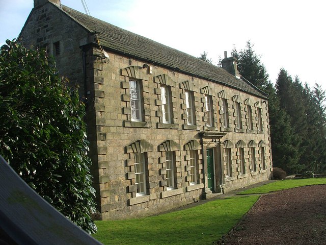
| Newmoor Hall | 1041854 | II* | c.1720 | NE of Longframlington |
| Northern Farmhouse at Low Town | 1155037 | II | ||
| Outbuilding to North of Embleton Hall | 1154991 | II | ||
| Pair of Boundary Stones to North of Hill Summit | 1041993 | II | ||
| Pair of Stones on Cartington Longframlington Parish Boundary | 1371154 | II | ||
| Pair of Stones on Cartington/Longframlington Boundary | 1155070 | II | ||
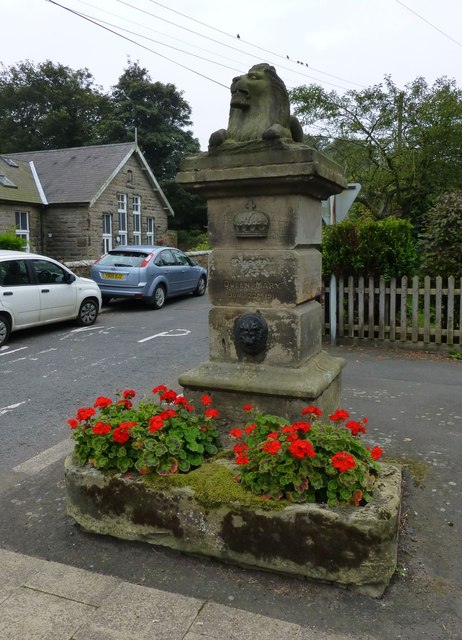
| Pant on North of Junction with Church Street | 1041853 | II | 1911 | |
| Quince Cottage | 1371151 | II | ||
| Rookwood House and Adjacent Cottage | 1041856 | II | ||
| Row of 4 Stones on Longframlington Newton on the Moor Boundary | 1155179 | II | ||
| Row of 5 Boundary Stones on Moor to North West of Snook Bank Farm | 1303440 | II | ||
| Stable Cottage | 1041855 | II | ||
| Walled Garden to North West of Rookwood House | 1371156 | II |
Primary source: the National Heritage List for England - NHLE is the register of nationally protected historic buildings and sites in England, including listed buildings, scheduled monuments, protected wrecks, registered parks and gardens, and battlefields. The list is maintained by Historic England. Check NHLE for updates and new entries.
Secondary sources: British Listed Buildings and Keys to the Past.

from Geograph (geograph)
The church of St Mary the Virgin, Longframlington, Northumberland
Pinned by Simon Cotterill

Co-Curate Page
Embleton Hall
- Embleton Hall in Longframlington is a country manor house built in c.1730 for Thomas Embleton. It was bought by the Fenwick family in 1780 and remained in the Fenwick Family …

Co-Curate Page
Old Pant
- This distinctive water pant with a stone lion is located at the junction of Front Street and Church Street in Longframlington, Northumberland. It was built in 1911 to commemorate the …

Co-Curate Page
Newmoor Hall, nr Longframlington
- Newmoor Hall is located about a mile and a half north-east of Longframlington, Northumberland. It was built in c.1720, incorporating fabric from an earlier building. The building was altered in c.1870 …


from Geograph (geograph)
The church of St Mary the Virgin, Longframlington, Northumberland
Pinned by Simon Cotterill

Co-Curate Page
Embleton Hall
- Embleton Hall in Longframlington is a country manor house built in c.1730 for Thomas Embleton. It was bought by the Fenwick family in 1780 and remained in the Fenwick Family …

Co-Curate Page
Old Pant
- This distinctive water pant with a stone lion is located at the junction of Front Street and Church Street in Longframlington, Northumberland. It was built in 1911 to commemorate the …


