Topics > Civil Parishes in Cumbria > Kirkby Lonsdale Town Council area > Historic Buildings and Monuments in Kirkby Lonsdale
Historic Buildings and Monuments in Kirkby Lonsdale
Listed buildings and scheduled monuments in Kirkby Lonsdale Civil Parish, Cumbria, from the National Heritage List for England[1]. In the absence of a published 'local list', some other public buildings of interest are included. Use the Search (below) if looking for a specific building / monument. Jump to Photos and links to more detailed information.
| Structure | List No. | Grade | Built~ | Note |
|---|---|---|---|---|
| Nos. 1 New Road and 32 Main Street | 1145772 | II | C19th | New Road / Main Street, Kirkby Lonsdale |
| Nos. 1, 3, 5, 7, 9, 13 and 15, Market Square | 1145756 | II | 1822 | Market Square, Kirkby Lonsdale |
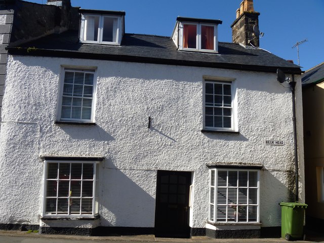
| No. 1, Beck Head | 1318951 | II | C19th | Beck Head, Kirkby Lonsdale |
| No. 1, Fairbank | 1311967 | II | C18th | Fairbank, Kirkby Lonsdale |
| No. 1, Market Street | 1318969 | II | C19th | Market Street, Kirkby Lonsdale |
| Nos. 10 and 12, Horse Market | 1318942 | II | C18th | Horse Market, Kirkby Lonsdale |
| No. 10, Mill Brow | 1311713 | II | C19th | Swinemarket, Mill Brow, Kirkby Lonsdale |
| No. 10, Mitchelgate | 1158021 | II | C18th | Mitchelgate, Kirkby Lonsdale |
| Nos. 11 and 13, Main Street | 1145790 | II | C19th | Main Street, Kirkby Lonsdale |
| No. 11, Fairbank | 1138186 | II | C19th | Fairbank, Kirkby Lonsdale |
| No. 11, Market Street | 1157884 | II | C19th | Market Street, Kirkby Lonsdale |
| No. 12, Queens Square | 1158103 | II | C19th | Queens Square, Kirkby Lonsdale |
| Nos. 13, 15, Market Street | 1318970 | II | C19th | Market Street, Kirkby Lonsdale |
| No. 13, Fairbank | 1145809 | II | C19th | Fairbank, Kirkby Lonsdale |
| No. 13, New Road | 1318939 | II | C19th | New Road, Kirkby Lonsdale |
| Nos. 14 and 16, Fairbank | 1145812 | II | C19th | Fairbank, Kirkby Lonsdale |
| Nos. 14 and 16, Horse Market | 1145778 | II | C18th | Horse Market, Kirkby Lonsdale |
| No. 14, Market Street | 1157950 | II | C19th | Market Street, Kirkby Lonsdale |
| No. 14, Mitchelgate | 1145770 | II | C18th | Mitchelgate, Kirkby Lonsdale |
| No. 15, Fairbank | 1138195 | II | C19th | Fairbank, Kirkby Lonsdale |
| Nos. 16 and 16a, Main Street | 1318947 | II | 1765 | Main Street, Kirkby Lonsdale |
| No. 16, Mitchelgate | 1158041 | II | C18th | Mitchelgate, Kirkby Lonsdale |
| Nos. 17 and 19, Main Street | 1146433 | II | C19th | Main Street, Kirkby Lonsdale |
| No. 17, Mitchelgate | 1145771 | II | C18th | Mitchelgate, Kirkby Lonsdale |
| No. 18 Main Street | 1138361 | II | C18th | Main Street, Kirkby Lonsdale |
| Nos. 19 and 21, Mitchelgate | 1158051 | II | C19th | Mitchelgate, Kirkby Lonsdale |
| Nos. 2 and 8, Vicarage Lane | 1145738 | II | C18th | Vicarage Lane, Kirkby Lonsdale |
| No. 2, Horse Market | 1318941 | II | C18th | Horse Market, Kirkby Lonsdale |
| No. 2, Market Square | 1318968 | II | C19th | Market Square, Kirkby Lonsdale |
| No. 2, Market Street | 1145760 | II | C19th | Market Street, Kirkby Lonsdale |
| No. 2, Mitchelgate | 1158008 | II | C18th | Mitchelgate, Kirkby Lonsdale |
| Nos. 20 and 22 Main Street | 1145785 | II | C19th | Main Street, Kirkby Lonsdale |
| No. 20, Market Street | 1157959 | II | C19th | Market Street, Kirkby Lonsdale |
| Nos. 21 and 23, Main Street | 1145791 | II | C19th | Main Street, Kirkby Lonsdale |
| No. 25, Main Street | 1311805 | II | C19th | Main Street, Kirkby Lonsdale |
| Nos. 29 and 31, Main Street | 1145792 | II | C18th | Main Street, Kirkby Lonsdale |
| Nos. 3, 5, 7, 9 and 11, New Road | 1158086 | II | C19th | New Road, Kirkby Lonsdale |
| No. 3, Fairbank | 1145808 | II | C18th | Fairbank, Kirkby Lonsdale |
| No. 31, Mitchelgate | 1318938 | II | C19th | Mitchelgate, Kirkby Lonsdale |
| Nos. 32 and 34, Main Street | 1146322 | II | C18th | Main Street, Kirkby Lonsdale |
| No. 35, Main Street | 1146463 | II | C18th | Main Street, Kirkby Lonsdale |
| No. 36a, Main Street | 1145786 | II | C18th | Main Street, Kirkby Lonsdale |
| No. 37, Main Street | 1318949 | II | C18th | Main Street, Kirkby Lonsdale |
| No. 39, Main Street | 1146469 | II | C19th | Main Street, Kirkby Lonsdale |
| Nos. 4 and 6, Fairbank | 1318931 | II | C18th | Fairbank, Kirkby Lonsdale |
| No. 4, Church Street | 1145806 | II | C18th | Church Street, Kirkby Lonsdale |
| No. 4, Horse Market | 1145776 | II | 1797 | Horse Market, Kirkby Lonsdale |
| No. 4, Market Street | 1311720 | II | C18th | Market Street, Kirkby Lonsdale |
| No. 4, Mill Brow | 1145763 | II | C19th | Mill Brow, Kirkby Lonsdale |
| No. 4, Mitchelgate | 1145768 | II | C18th | Mitchelgate, Kirkby Lonsdale |
| Nos. 40, 42a, 42b, 44, Main Street | 1146348 | II | C17th | Main Street, Kirkby Lonsdale |
| No. 41, Main Street | 1145794 | II | C18th | Main Street, Kirkby Lonsdale |
| No. 45, Main Street | 1146476 | II | C19th | Main Street, Kirkby Lonsdale |
| Nos. 47 and 49, Main Street | 1318950 | II | C18th | Main Street, Kirkby Lonsdale |
| Nos. 48, 50 and 52, Main Street | 1145787 | II | C19th | Main Street, Kirkby Lonsdale |
| Nos. 5 and 7, Queens Square | 1145773 | II | C19th | Queens Square, Kirkby Lonsdale |
| No. 5, Beck Head | 1145798 | II | C19th | Beck Head, Kirkby Lonsdale |
| No. 51, Main Street | 1146491 | II | C18th | Main Street, Kirkby Lonsdale |
| Nos. 54 and 56, Main Street | 1146364 | II | C17th | Main Street, Kirkby Lonsdale |
| No. 57, Main Street | 1146494 | II | C19th | Main Street, Kirkby Lonsdale |
| No. 58, Main Street | 1145788 | II | C19th | Main Street, Kirkby Lonsdale |
| Nos. 6 and 8, Horse Market | 1145777 | II | C18th | Horse Market, Kirkby Lonsdale |
| Nos. 6 and 8, Mitchelgate | 1145769 | II | C18th | Mitchelgate, Kirkby Lonsdale |
| No. 6, Mill Brow | 1311708 | II | C19th | Mill Brow, Kirkby Lonsdale |
| Nos. 63 and 65, Main Street | 1145753 | II | C18th | Main Street, Kirkby Lonsdale |
| No. 67, Main Street | 1145754 | II | C18th | Main Street, Kirkby Lonsdale |
| Nos. 8 and 12, Fairbank | 1138219 | II | C19th | Fairbank, Kirkby Lonsdale |
| No. 8, Market Street | 1157934 | II | C18th | Market Street, Kirkby Lonsdale |
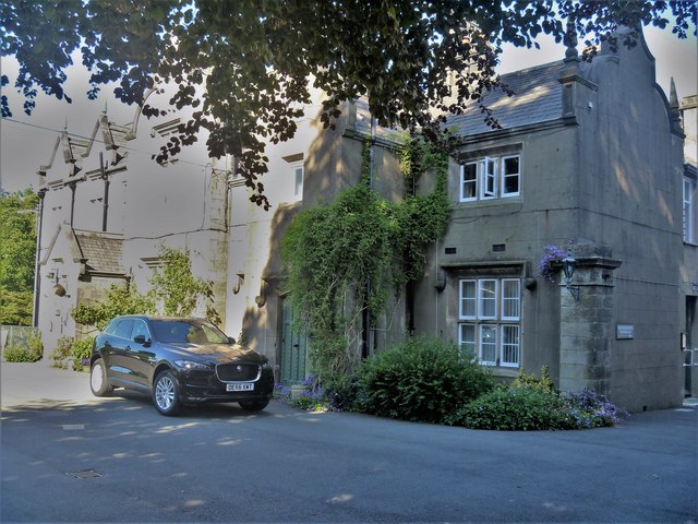
| Abbeyfield Lodge | 1145811 | II | 1825 | Fairbank, Kirkby Lonsdale |
| Abbot Hall | 1311673 | II | C17th | Mitchelgate, Kirkby Lonsdale |
| Biggins Cottage and Attached Outbuilding | 1145803 | II | C18th | High Biggins |
| Biggins Hall Farmhouse | 1138063 | II | C19th | High Biggins |
| Biggins House | 1145804 | II | C19th | High Biggins |
| Biggins Lodge Farmhouse with Barn Attached at Rear | 1145802 | II | C19th | High Biggins |
| Cherkeby Cottages | 1138141 | II | C18th | Church Street, Kirkby Lonsdale |
| Church Brow Cottage | 1311544 | II* | C19th | Church Brow, Kirkby Lonsdale |
| Church of St Mary | 1145774 | I | C12th | Restored 1866 |
| Churchyard Gates | 1145807 | II | 1823 | Church Street, Kirkby Lonsdale |
| Cross Cottage | 1145764 | II | C19th? | Swinemarket, Mill Brow, Kirkby Lonsdale |
| Deans Biggin Farmhouse | 1318967 | II | C16th | Deansbiggin |
| Devil's Bridge | 1086899 | I | 1370 | Partly in this parish |
| Dutch Barn (Approximately 100 Metres North East of Home Farm Farmhouse | 1158193 | II | C19th | Underlay Park |
| Dutch barn (approximately 50 metres south west of Home Farm Cottage) | 1318957 | II | C19th | Underlay Park |
| Fairbank Cottage and Wall Between Fairbank Cottage and Number 4 Fairbank | 1311947 | II | C18th | Fairbank, Kirkby Lonsdale |
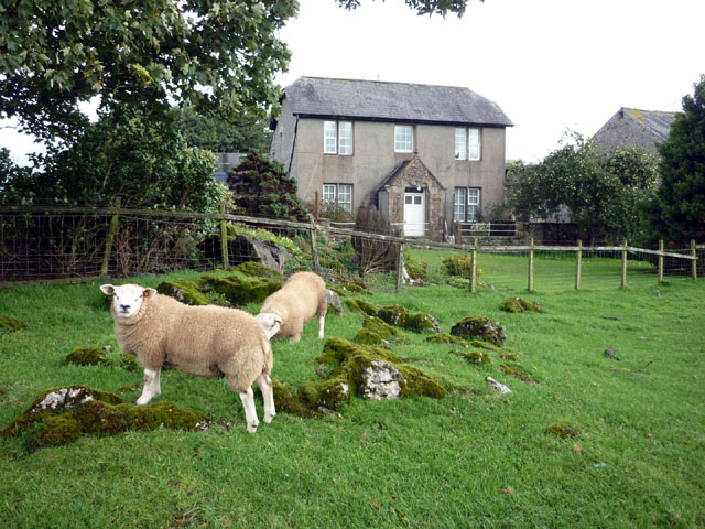
| Fell Side Farmhouse | 1145783 | II | C17th | off Kendal Road |
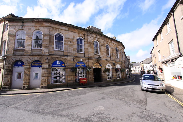
| Former Trustee Savings Bank | 1145757 | II | 1847 | Market Square, Kirkby Lonsdale |
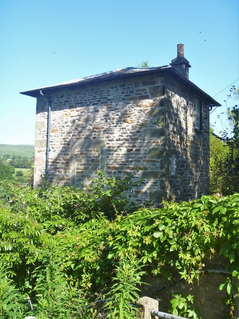
| Former Weigh House | 1157985 | II | C19th | Swinemarket, Mill Brow, Kirkby Lonsdale |
| Fountain House | 1145799 | II | C18th | Beck Head, Kirkby Lonsdale |
| Game Larder Adjacent to Home Farm Cottage | 1145736 | II | 1871 | Underlay Park |
| Gatepiers at Underley Lodge | 1158258 | II | C19th | Underlay Park |
| Gatepiers to Cemetery North of Cockpit Hill | 1145775 | II | C18th | |
| Gazebo in Churchyard to North of Church of St Mary | 1145739 | II | C18th | |
| Hawes Cottage | 1311609 | II | C19th | Underlay Park |
| High Biggins Old Hall | 1145801 | II* | C15th | High Biggins |
| High Moorgate | 1311914 | II | C19th | Kearstwick Road |
| Home Farm Cottage | 1158213 | II | c. 1870 | Underlay Park |
| Home Farm Farmhouse, Attached Game Larder and Coach House | 1145735 | II | 1872 | Underlay Park |
| Home Farm Stable Approximately 75 Metres North East of Home Farm Cottage | 1311590 | II | 1882 | Underlay Park |
| Ivy Cottage | 1145779 | II | C19th | Kearstwick |
| Jingling End | 1318943 | II | 1829 | Jingling Lane, Kirkby Lonsdale |
| Kearstwick Cottages | 1138300 | II | C19th | Kearstwick |
| Kearstwick Hill | 1145781 | II | 1753 | Kearstwick |
| Kearstwick Institiute | 1318944 | II | 1902 | Now house. Kearstwick |
| Kearstwick Lodge | 1145780 | II | 1857 | Kearstwick |
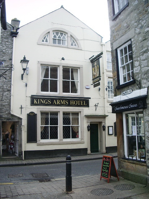
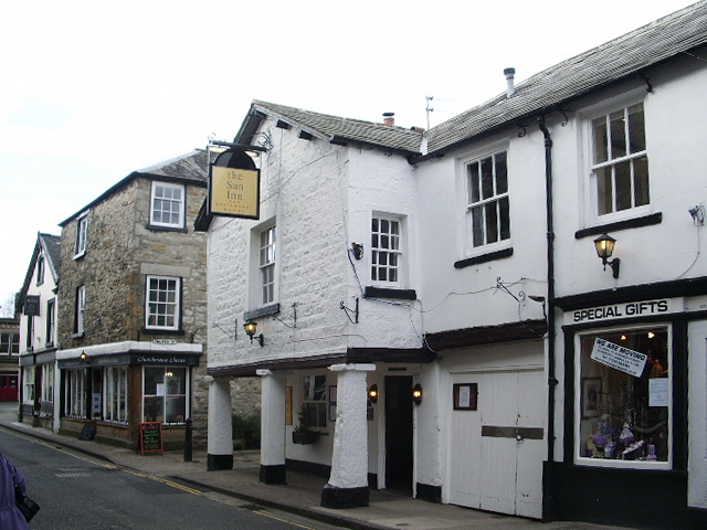
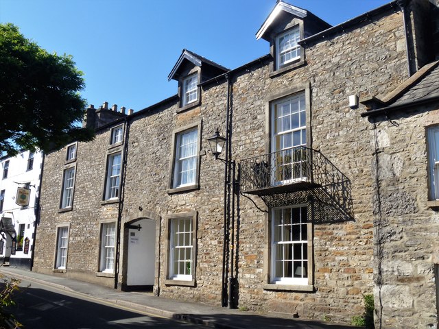
| Kings Arms | 1145759 | II | C16th | Market Street, Kirkby Lonsdale |
| Laundry Cottage | 1138095 | II | C19th | High Biggins |
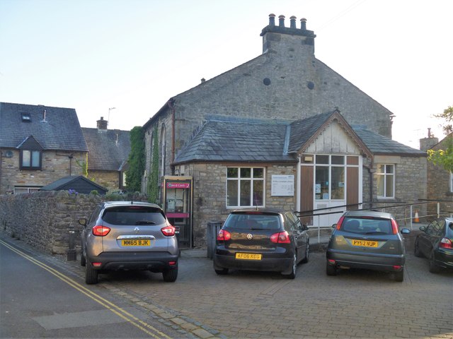
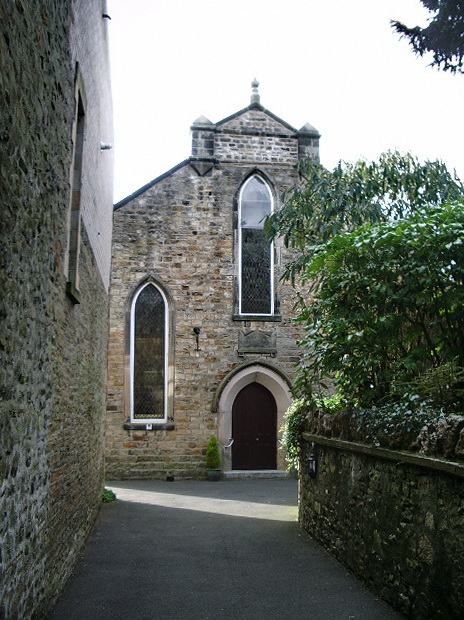
| Library | 1138114 | II | 1820 | Chapel Street, Kirkby Lonsdale |
| Low Moorgate | 1318945 | II | C19th | |
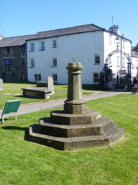
| Market Cross (Market Square) | 1145758 | II | 1905 | Market Square, Kirkby Lonsdale |
| Market Cross (Swinemarket) | 1145765 | II | Medieval | Cross base, Swinemarket |
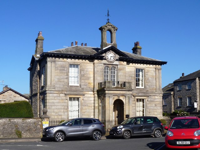
| Market House | 1311751 | II | 1854 | Market Street /Main Street, Kirkby Lonsdale |
| Milestone Approximately 650 Yards North West of Tearnside Hall | 1138325 | II | C19th | Tearnside |
| Milestone Immediately South East of Town End House | 1145789 | II | C18th | Main Street, Kirkby Lonsdale |
| Mill Brow House | 1145767 | II | 1811 | Mill Brow, Kirkby Lonsdale. Former workhouse |
| Monument entitled Obelisk, in the churchyard to the west of the Church of St Mary | 1318956 | II | 1821 | to victims of Rose & Crown fire. |
| Monument to Christopher Preston 1763 and Achilles Preston 1814 in the Churchyard and to the South of the Church of St Mary | 1158155 | II | 1763 | St Mary's churchyard |
| Monument to Dorothy Cartwright in the Churchyard to East of St Mary | 1145731 | II | 1742 | St Mary's churchyard |
| Monument to Edward Theobalds in the Churchyard to the West of the Church of St Mary | 1158166 | II | 1818 | St Mary's churchyard |
| Monument to John Dent, in the Churchyard to East of Church of St Mary | 1158139 | II | 1709 | St Mary's churchyard |
| Monument to Richard Turner and Family, in the Churchyard and to the South of the Church of St Mary | 1318955 | II | 1790's | St Mary's churchyard |
| Monument to Rowland Tarham in the Churchyard to East of Church of St Mary | 1318940 | II | 1716 | St Mary's churchyard |
| Monument to the Burrow Family in the Churchyard to East of Church of St Mary | 1158113 | II | C18th | St Mary's churchyard |
| Monument to Thomas Newby in the Churchyard to South of the Church of St Mary | 1311635 | II | 1775 | St Mary's churchyard |
| Monument to Thomas Tiffin in the Churchyard to the West of the Church of St Mary | 1145733 | II | 1787 | St Mary's churchyard |
| National Westminster Bank | 1145795 | II | C19th | Main Street, Kirkby Lonsdale |
| No. 10, Main Street | 1311895 | II | C19th | Main Street, Kirkby Lonsdale |
| No. 17 and 19, Fairbank | 1145810 | II | C19th | Fairbank, Kirkby Lonsdale |
| No. 3, Mill Brow | 1311683 | II | C18th | Mill Brow, Kirkby Lonsdale |
| Nos 1 and 3 (Nether Riggs) | 1145800 | II | C17th | Low Biggins |
| Number 16 and 18 and Outbuildings Along East Side of Yard and Backing Onto Churchyard | 1145762 | II | C19th | Market Street, Kirkby Lonsdale |
| Number 18 and Smithy | 1138258 | II | C19th | Fairbank, Kirkby Lonsdale |
| Number 2 and Attached Stable | 1318937 | II | C18th | Mill Brow, Kirkby Lonsdale |
| Number 3 and Workshop at Rear | 1318926 | II | C18th | Beck Head, Kirkby Lonsdale |
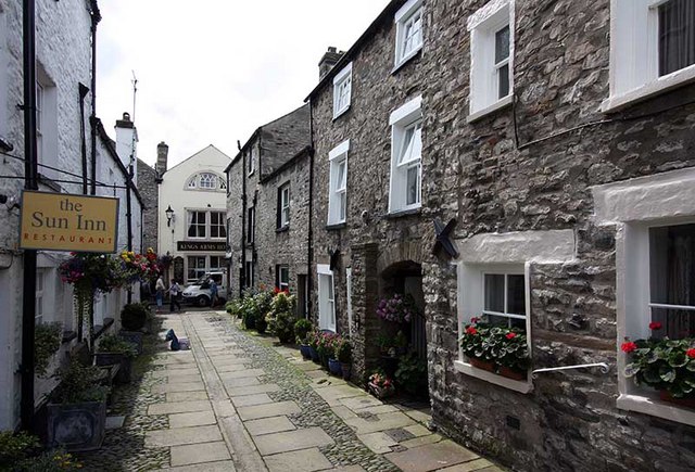
| Number 6 (Sun Inn) and Block to Rear Now Part of Sun Inn | 1145761 | II | C17th | Market Street, Kirkby Lonsdale |
| Number 62 the Cottage Behind Number 62 | 1311821 | II | C19th | Main Street, Kirkby Lonsdale |
| Number 69 and Adjoining Range Along Mill Brow | 1318966 | II | C19th | Mill Brow, Kirkby Lonsdale |
| Number 9, Garden Wall and Gatepiers Fronting Road Immediately to North | 1146420 | II | C19th | Main Street, Kirkby Lonsdale |
| Numbers 10 and 12 and Outbuildings Backing Onto Churchyard | 1318936 | II | C19th | Market Street, Kirkby Lonsdale |
| Numbers 2 and 4 with Barn Attached at Rear | 1145797 | II | C18th | Beck Head, Kirkby Lonsdale |
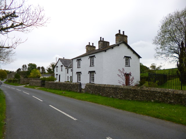
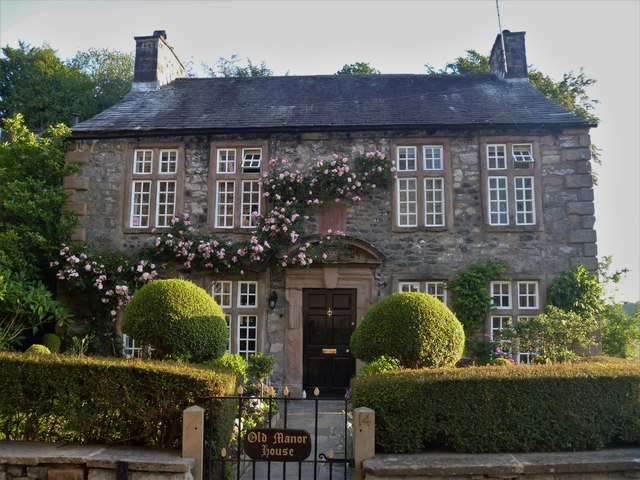
| Old Manor House | 1145766 | II | c.1700 | Mill Brow, Kirkby Lonsdale |
| Rectory and St Mary's Lodge | 1318959 | II | 1783 | Vicarage Lane, Kirkby Lonsdale |
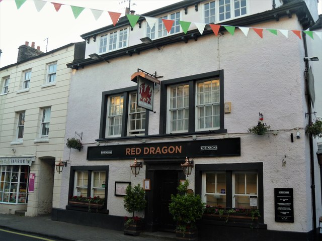
| Red Dragon Hotel | 1145796 | II | C17th | Main Street, Kirkby Lonsdale |
| Rose Cottage | 1145805 | II | C18th | Chapel Lane, Kirkby Lonsdale |
| Rose Tree Cottage | 1138306 | II | C18th | Kendal Road, Kirkby Lonsdale |
| Royal Hotel | 1318948 | II | C19th | Main Street, Kirkby Lonsdale |
| Scar Brow | 1145755 | II | C17th | Mansergh Road |
| Schoolroom at Queen Elizabeth Grammar School | 1318927 | II | 1846 | Biggins Lane, Kirkby Lonsdale |
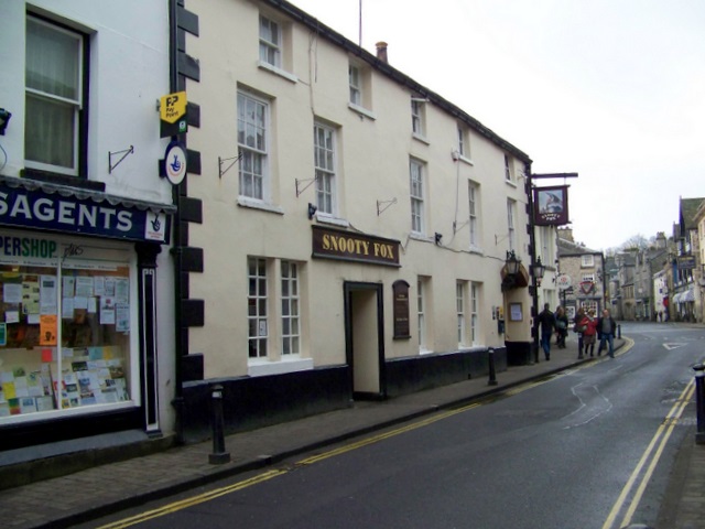
| Snooty Fox Tavern | 1145793 | II | C17th | Main Street, Kirkby Lonsdale |
| Spital Farmhouse | 1318946 | II | C19th | Kendal Road, Kirkby Lonsdale |
| Stables to South East at the Gables | 1138200 | II | 1866 | Fairbank, Kirkby Lonsdale |
| Summerhouse to South of Green Close | 1311887 | II | 1668 | Main Street, Kirkby Lonsdale |
| Tearnside Cottage and Attached Barn | 1138314 | II | C19th | Tearnside |
| Tearnside Hall and Attached Stable and Barn | 1145782 | II* | 1686 | Tearnside |
| The Courtyard | 1138174 | II | 1811 | Fairbank, Kirkby Lonsdale |
| The Gables | 1318930 | II | 1825 | Fairbank, Kirkby Lonsdale |
| The Orange Tree | 1318929 | II | C18th | Fairbank, Kirkby Lonsdale |
| Town End House and the Courts | 1145784 | II | 1777 | Main Street, Kirkby Lonsdale |
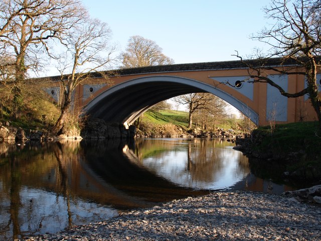
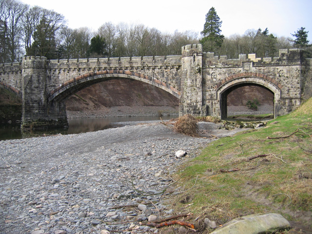
| Underley Bridge | 1086923 | II | 1872 | Undeley Park |
| Underley Hall School | 1311597 | II* | 1828 | |
| Underley Home Farm Farmyard (Front Range) | 1145734 | II | C19th | Underlay Park |
| Underley Lodge | 1145737 | II | C19th | Underlay Park |
| Unknown Monument to South of Monument to the Burrow Family in the Churchyard East of Church of St Mary | 1145732 | II | C18th | St Mary's churchyard |
| Wood End Farmhouse | 1318928 | II | C18th | Low Biggins |
| Cockpit Hill, medieval motte castle | 1007153 | n/a | Medieval | Scheduled Monument |
| Devil's Bridge | 1007209 | n/a | 1370 | Scheduled Monument |
| Scalford settlement near Kirkby Lonsdale | 1007194 | n/a | Romano-British | Scheduled Monument |
| not listed | n/a | C19th | Kearstwick | |
| not listed | n/a | 1932 | A65, Kirkby Lonsdale | |
| not listed | n/a | 1834 | Queens Square, Kirkby Lonsdale | |
| not listed | n/a | 1868 | Queens Square, Kirkby Lonsdale | |
| not listed | n/a | 1921 | St Mary's churchyard | |
| not listed | n/a | 1994 | Replica of C18th sundial. | |
| Kirkby Lonsdale Conservation Area | - | n/a | Conservation Area |
Primary source: the National Heritage List for England - NHLE is the register of nationally protected historic buildings and sites in England, including listed buildings, scheduled monuments, protected wrecks, registered parks and gardens, and battlefields. The list is maintained by Historic England. Check NHLE for updates and new entries. Secondary sources: British Listed Buildings.
Co-Curate Page
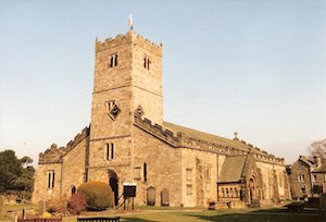
Church of St Mary
- Overview About St Mary's Church Map Street View St Mary's Church is located by the River Lune in Kirkby Lonsdale. The church was built in the 12th Century, with later extensions, …
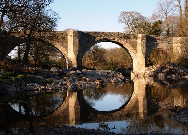
Co-Curate Page
Devil's Bridge
- Overview Map Street View Devil's Bridge crosses the River Lune to the south-east of the town of Kirkby Lonsdale. The bridge straddles the civil parishes of Kirkby Lonsdale and Casterton. …
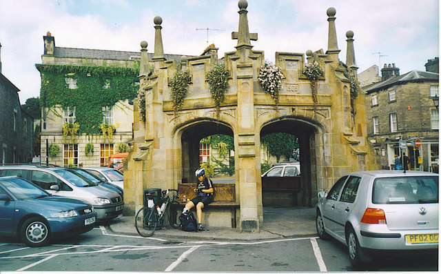
Co-Curate Page
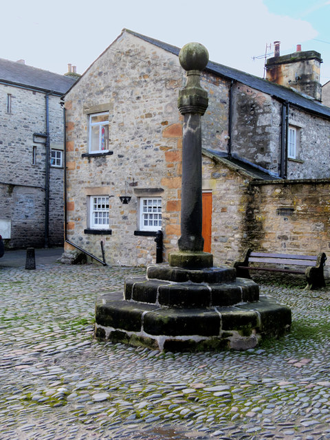
Market Cross
- The Market Cross in Kirkby Lonsdale was built in 1905. The octagonal stone structure was built in a Tudor-Gothic syle. It was presented to the town by the Rev. J.W. Davies, …
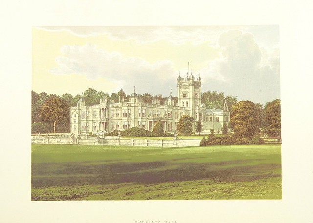
Co-Curate Page
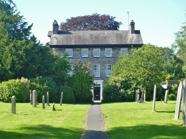
Underley Hall
- Overview About Underley Hall Map Underley Hall is a large country house near Kirkby Lonsdale in Cumbria. It was designed in a Jacobean Revival style by the architect George …
Co-Curate Page
Old Market Cross, Kirkby Lonsdale
- Overview Map Street View The medieval market cross is located on the cobbled square of the Swinemarket in Kirkby Lonsdale. The cross originally stood at junction of Main Street, Market …
Co-Curate Page
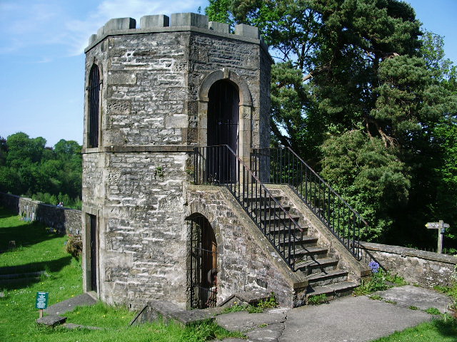
Gazebo in Churchyard, St Mary's Church
- Overview Map Street View There is a distinctive octagonal stone gazebo, which looks a little like a castle turret, in the churchyard of St Mary's Church in Kirkby Londsdale. It …
Co-Curate Page
Former Kearstwick Institute
- This former reading room and institute at Kearstwick was built in 1902. It was built by Henry and Olivia Bentinck of nearby Underley Hall in memory of Thomas Earl of …
Co-Curate Page
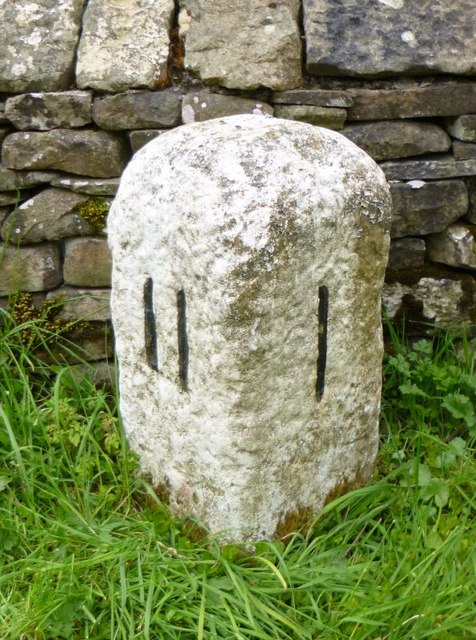
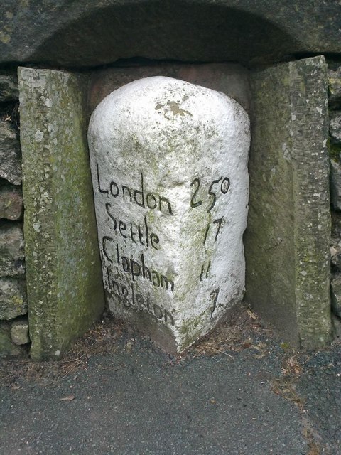
Old Milestone, B6254, Kearstwick
- Overview Map Street View This old milestone is located on the B6254 road by Kearstwick Hill (house) at the north end of the village of Kearstwick. The milestone was erected …
Co-Curate Page
Kearstwick Hill
- Overview Map Street View Kearstwick Hill is a cottage at the north end of Kearstwick. It has a date plaque incribed "F.G.H. 1753". The building is Grade II lsted on …

Co-Curate Page
Kearstwick Lodge
- Overview Map Street View Kearstwick Lodge is located on the 6254 road, by the junction with Phil Lane to Underlay. This house, at the south end of Kearstwick, was built …
Co-Curate Page
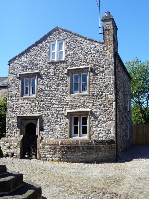
Old Manor House, Kirkby Lonsdale
- Overview Map Street View The Old Manor House is located on Mill Brow (No. 14), in Kirkby Lonsdale. The former manor house was built in c.1700, incorporating the fabric of …
Co-Curate Page
Stanley Bridge
- Overview Map Street View Stanley Bridge carries the A65 road over the River Lune at the south-east of Kirkby Lonsdale. The bridge and new road route to by-pass the town …
Co-Curate Page
Wood End, Low Biggins
- Overview Map Street View Wood End (aka Woodend) is located at the eastern end of Biggins Lane in Low Biggins, near Kirkby Lonsdale. The farmhouse here dates from the 18th …
Co-Curate Page
Kings Arms Hotel, Kirkby Lonsdale
- Kings Arms Hotel, Market Street, Kirkby Lonsdale. C16 or early C17 inn, refaced C18, now three properties. Although an inn since Cl7, this group was built as the manor house …
Co-Curate Page
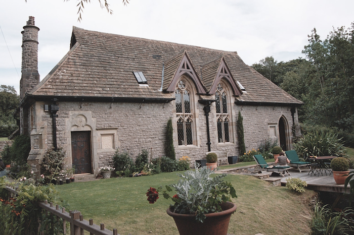
Kirkby Lonsdale Library
- Overview Map Street View Kirkby Lonsdale Library is located on Chapel Lane, by the junction with Tram Lane, in Kirkby Lonsdale. The library is hosted in a Sandemanian chapel, which …
Co-Curate Page
Abbeyfield Lodge
- Overview Map Street View Abbeyfield Lodge is a house on Fairbank (road) in Kirkby Lonsdale. It was built in 1825 (datestone) and is the former town lodge of Underley Hall. …
Co-Curate Page
Abbot Hall, Kirkby Lonsdale
- Overview Map Street View Abbot Hall is located on Mitchelgate, by the junction with Abbotsgate, in Kirkby Lonsdale. the building dates from the 17th century and was at that time …

Co-Curate Page
Old Milestone, A65, Tearnside
- There is an old 19th century milestone on the A65 road, north of Tearnside. It is a triangular carved stone with a pivot benchmark on the top of the milestone. …
Co-Curate Page
Old Milestone, Main Street, Kirkby Lonsdale
- Overview Map Street View There is an old milestone on Main Street (B6254) in Kirkby Lonsdale, situated in an alcove in the garden wall of Milestone House. The triangular milestone …
Co-Curate Page
The Snooty Fox, Kirkby Lonsdale
- Overview Map Street View The Snooty Fox is a public house and inn, located on Main Street in Kirkby Lonsdale. Prior to the 1990s it was known as the Green …
Co-Curate Page
The Red Dragon, Kirkby Lonsdale
- Overview Map Street View The Red Dragon is a public house and inn, located on Main Street in Kirkby Lonsdale. The building dates back to the 17th or early 18th …

Co-Curate Page
Old Grammar School building, Kirkby Lonsdale
- Overview Map Street View The old Queen Elizabeth Grammar School buiding is located on Biggins Road in Kirkby Lonsdale. It was built in 1848 after the school had moved here …
Co-Curate Page
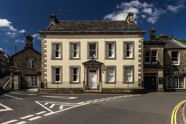
No. 9, Market Square (Former Trustee Savings Bank)
- Overview Map Street View No. 9, Market Square in Kirkby Lonsdale is the former Trustee Savings Bank, built in 1847 by Thompson and Webster of Kendal. The building is Grade …

Co-Curate Page
The Royal Hotel, Kirkby Lonsdale
- Overview Map Street View The Royal Hotel & Restaurant in Kirkby Lonsdale is located on Main Street (No. 30) on the junction with New Road. The 3 storey inn dates from …
Co-Curate Page
Kirkby Lonsdale Methodist Church
- Overview Map Street View Kirkby Lonsdale Methodist Church is located in Queens Square, Kirkby Lonsdale. It was built in 1834 as a Wesleyan Methodist chapel, replacing an earlier meeting house …
Co-Curate Page
Old Market Hall, Kirkby Lonsdale
- Overview Map Street View Market House, incorporating the Old Market Hall, is a building in Kirkby Lonsdale which turns the corner of Main Street and Market Street, opposite the junction …
Co-Curate Page
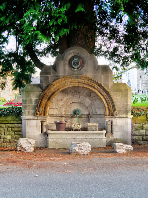
Drinking Fountain, Queen's Square
- Overview Map Street View There is an old stone drinking fountain and water trough in the wall of the churchyard, on the east side of Queens Square, in Kirkby Lonsdale. …
Co-Curate Page
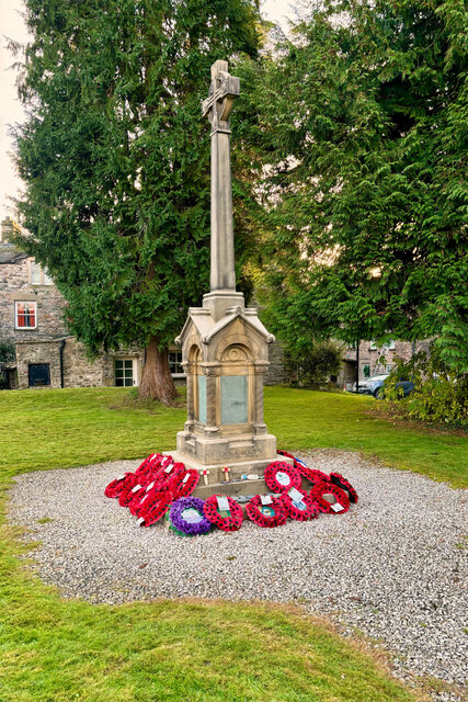
War Memorial
- Overview Map Street View The war memorial in Kirkby Lonsdale is located In the churchyard of St Mary's Church, near Queens Square. It is a Celtic cross set on a …
Co-Curate Page
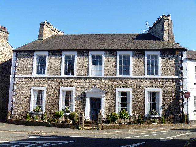
Nos. 5 and 7, Queens Square
- Nos. 5 and 7, Queens Square in Kirkby Lonsdale are a pair of early 19th century houses. The buildngs, of 3 storeys, are Grade II listed on the National Heritage …
Co-Curate Page
No. 12, Queens Square
- No. 12, Queens Square, in Kirkby Lonsdale, dates from the mid-19th century. It is a Grade II listed building on the National Heritage List for England.
Co-Curate Page
Town End House and The Courts, Kirkby Lonsdale
- Town End House and The Courts are located on Main Street in Kirkby Lonsdale. Town End House is dated 1777, with rainwater heads inscribed "R.G. 1777" (for Richard Gathorne). An …
Co-Curate Page
Fountain House, Kirkby Lonsdale
- Fountain House is No. 8, Beck Head, in Kirkby Lonsdale. The house dates from the mid-18th century and stands in a promenant position near the head of Market Street, by …

Co-Curate Page
NatWest, Kirkby Lonsdale
- Overview Map Street View NatWest bank is located at No.55, Main Street in Kirkby Lonsdale. The building dates from the mid-19th century. It is Grade II listed on the National …
Co-Curate Page
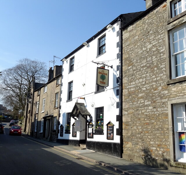
The Orange Tree, Kirkby Lonsdale
- Overview Map Street View The Orange Tree is an inn located on Fairbank on Kirkby Lonsdale. The inn dates from the mid 18th century and was previously named The Fleece …
Co-Curate Page
St Marys Vicarage, Kirkby Lonsdale
- St Marys Vicarage is located off Vicarage Lane, by the churchyard of St Mary's Church in Kirkby Lonsdale. The Vicarage (aka Rectory) dates from 1783. Adjacent is St Mary's Lodge …
Co-Curate Page
Nos. 2 & 8 Vicarage Lane, Kirkby Lonsdale
- Nos. 2 & 8 Vicarage Lane in Kirkby Lonsdale date from the 18th century. Originally two cottages, it is now one house. The building is Grade II listed on the …
Co-Curate Page
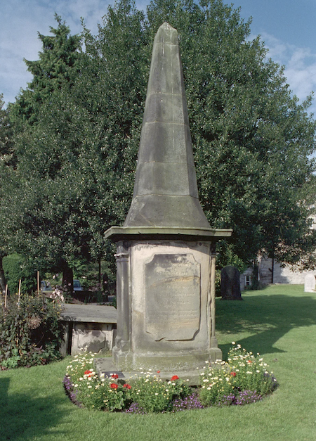
Rose and Crown Obelisk, St Mary's Church
- Overview Map Street View This obelisk in the churchyard of St Mary's Church, in Kirkby Lonsdale, commemorates the lives of 5 women who died in a fire at the Rose …
Co-Curate Page
Sundial, St Mary's churchyard, Kirkby Lonsdale
- The metal sundial is mounted on a stone pedestal in the churchyard of St Mary's Church in Kirkby Lonsdale. The replica metal sundial was made by Cary of London and …
Co-Curate Page
The Sun Inn, Kirkby Lonsdale
- Overview Map Street View The Sun Inn is located on Market Street (No. 6) in Kirkby Lonsdale. The inn dates from the 17th century and incorporates the 18th century block …
Co-Curate Page
No. 4, Church Street
- No. 4, Church Street, Kirkby Lonsdale. C18 or C19. A Grade II listed building on the National Heritage List for England.
Co-Curate Page
Old Weigh-House
- Overview Map Street View The Old Weigh-House is located on the east side of the Swinemarket, on Mill Brow in Kirksby Lonsdale. The buiding dates from the 19th century and …
Co-Curate Page
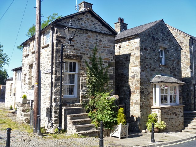
No. 10, Mill Brow, Kirkby Lonsdale
- Overview Map Street View No. 10, Mill Brow, in Kirkby Lonsdale, stands at the north end of the Swinemarket, opposite the Old Market Cross. The house dates from the 19th …
Co-Curate Page
Cross Cottage, No. 8, Mill Brow
- Overview Map Street View Cross Cottage, No. 8, Mill Brow, is situated in the north-west corner of the Swinemarket in Kirkby Lonsdale. The cottage is Grade II listed on the …
Co-Curate Page
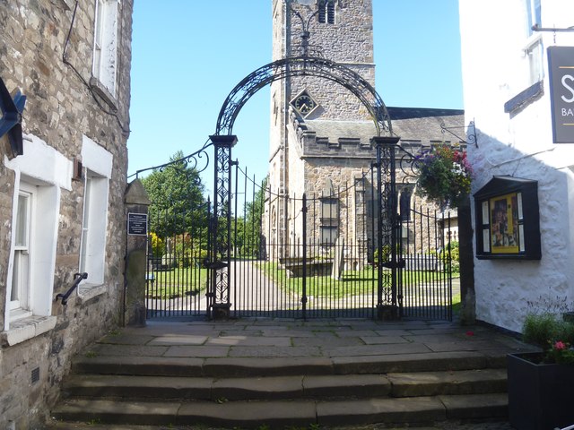
Churchyard Gates, St Mary's, Kirkby Lonsdale
- Overview Map Street View At the top of Church Street in Kirkby Lonsdale is the ornate the churchyard gateway to St Mary's Church. The triple wrought iron gateway has two …
Co-Curate Page
The Gables
- Overview Map Street View The Gables is a large house on Fairbank (road) in Kirkby Lonsdale. The Tudor-style house was built in 1825, with a larger extension in 1866. The …
Co-Curate Page
The Courtyard
- Overview Map Street View Nos. 5 and 7, Fairbank ('The Courtyard') in Kirkby Londale were built in 1811 as a large house planned symmetrically in four bays around an entrance …
Co-Curate Page
No. 3, Beck Head, Kirkby Lonsdale
- No. 3, Beck Head in Kirkby Lonsdale dates from the 18th century. The house was previously a shop with accommodation above. No. 3 Beck Head is a Grade II listed …
Co-Curate Page
No. 5, Beck Head, Kirkby Lonsdale
- No. 5, Beck Head is a 3 storey building dating from the early 19th century in Kirkby Lonsdale. It is a Grade II listed buildng on the National Heritage List …
Co-Curate Page
Nos. 2 & 4, Beck Head, Kirkby Lonsdale
- Nos. 2 & 4, Beck Head in Kirkby Lonsdale, date from the late 18th or early 19th century. The building, with an attached barn at the rear, is Grade II …
Co-Curate Page
Underley Bridge,
- Bridge over river Lune. 1872. For Earl of Bective. Rock-faced stone with ashlar dressings and parapet. 2 double-chamfered segmental arches with 4 ribs, and smaller segmental arch to north-east end …

Co-Curate Page
Church of St Mary
- Overview About St Mary's Church Map Street View St Mary's Church is located by the River Lune in Kirkby Lonsdale. The church was built in the 12th Century, with later extensions, …
Co-Curate Page
Devil's Bridge
- Overview Map Street View Devil's Bridge crosses the River Lune to the south-east of the town of Kirkby Lonsdale. The bridge straddles the civil parishes of Kirkby Lonsdale and Casterton. …
Co-Curate Page
Market Cross
- The Market Cross in Kirkby Lonsdale was built in 1905. The octagonal stone structure was built in a Tudor-Gothic syle. It was presented to the town by the Rev. J.W. Davies, …
Co-Curate Page
Underley Hall
- Overview About Underley Hall Map Underley Hall is a large country house near Kirkby Lonsdale in Cumbria. It was designed in a Jacobean Revival style by the architect George …
Co-Curate Page
Old Market Cross, Kirkby Lonsdale
- Overview Map Street View The medieval market cross is located on the cobbled square of the Swinemarket in Kirkby Lonsdale. The cross originally stood at junction of Main Street, Market …
Co-Curate Page
Gazebo in Churchyard, St Mary's Church
- Overview Map Street View There is a distinctive octagonal stone gazebo, which looks a little like a castle turret, in the churchyard of St Mary's Church in Kirkby Londsdale. It …
Co-Curate Page
Former Kearstwick Institute
- This former reading room and institute at Kearstwick was built in 1902. It was built by Henry and Olivia Bentinck of nearby Underley Hall in memory of Thomas Earl of …
Co-Curate Page
Old Milestone, B6254, Kearstwick
- Overview Map Street View This old milestone is located on the B6254 road by Kearstwick Hill (house) at the north end of the village of Kearstwick. The milestone was erected …
Co-Curate Page
Kearstwick Hill
- Overview Map Street View Kearstwick Hill is a cottage at the north end of Kearstwick. It has a date plaque incribed "F.G.H. 1753". The building is Grade II lsted on …
Co-Curate Page
Kearstwick Lodge
- Overview Map Street View Kearstwick Lodge is located on the 6254 road, by the junction with Phil Lane to Underlay. This house, at the south end of Kearstwick, was built …
Co-Curate Page
Old Manor House, Kirkby Lonsdale
- Overview Map Street View The Old Manor House is located on Mill Brow (No. 14), in Kirkby Lonsdale. The former manor house was built in c.1700, incorporating the fabric of …
Co-Curate Page
Stanley Bridge
- Overview Map Street View Stanley Bridge carries the A65 road over the River Lune at the south-east of Kirkby Lonsdale. The bridge and new road route to by-pass the town …
Co-Curate Page
Wood End, Low Biggins
- Overview Map Street View Wood End (aka Woodend) is located at the eastern end of Biggins Lane in Low Biggins, near Kirkby Lonsdale. The farmhouse here dates from the 18th …
Co-Curate Page
Kings Arms Hotel, Kirkby Lonsdale
- Kings Arms Hotel, Market Street, Kirkby Lonsdale. C16 or early C17 inn, refaced C18, now three properties. Although an inn since Cl7, this group was built as the manor house …
Co-Curate Page
Kirkby Lonsdale Library
- Overview Map Street View Kirkby Lonsdale Library is located on Chapel Lane, by the junction with Tram Lane, in Kirkby Lonsdale. The library is hosted in a Sandemanian chapel, which …
Co-Curate Page
Abbeyfield Lodge
- Overview Map Street View Abbeyfield Lodge is a house on Fairbank (road) in Kirkby Lonsdale. It was built in 1825 (datestone) and is the former town lodge of Underley Hall. …
Co-Curate Page
Abbot Hall, Kirkby Lonsdale
- Overview Map Street View Abbot Hall is located on Mitchelgate, by the junction with Abbotsgate, in Kirkby Lonsdale. the building dates from the 17th century and was at that time …
Co-Curate Page
Old Milestone, A65, Tearnside
- There is an old 19th century milestone on the A65 road, north of Tearnside. It is a triangular carved stone with a pivot benchmark on the top of the milestone. …
Co-Curate Page
Old Milestone, Main Street, Kirkby Lonsdale
- Overview Map Street View There is an old milestone on Main Street (B6254) in Kirkby Lonsdale, situated in an alcove in the garden wall of Milestone House. The triangular milestone …
Co-Curate Page
The Snooty Fox, Kirkby Lonsdale
- Overview Map Street View The Snooty Fox is a public house and inn, located on Main Street in Kirkby Lonsdale. Prior to the 1990s it was known as the Green …
Co-Curate Page
The Red Dragon, Kirkby Lonsdale
- Overview Map Street View The Red Dragon is a public house and inn, located on Main Street in Kirkby Lonsdale. The building dates back to the 17th or early 18th …
Co-Curate Page
Old Grammar School building, Kirkby Lonsdale
- Overview Map Street View The old Queen Elizabeth Grammar School buiding is located on Biggins Road in Kirkby Lonsdale. It was built in 1848 after the school had moved here …
Co-Curate Page
No. 9, Market Square (Former Trustee Savings Bank)
- Overview Map Street View No. 9, Market Square in Kirkby Lonsdale is the former Trustee Savings Bank, built in 1847 by Thompson and Webster of Kendal. The building is Grade …
Co-Curate Page
The Royal Hotel, Kirkby Lonsdale
- Overview Map Street View The Royal Hotel & Restaurant in Kirkby Lonsdale is located on Main Street (No. 30) on the junction with New Road. The 3 storey inn dates from …
Co-Curate Page
Kirkby Lonsdale Methodist Church
- Overview Map Street View Kirkby Lonsdale Methodist Church is located in Queens Square, Kirkby Lonsdale. It was built in 1834 as a Wesleyan Methodist chapel, replacing an earlier meeting house …
Co-Curate Page
Old Market Hall, Kirkby Lonsdale
- Overview Map Street View Market House, incorporating the Old Market Hall, is a building in Kirkby Lonsdale which turns the corner of Main Street and Market Street, opposite the junction …
Co-Curate Page
Drinking Fountain, Queen's Square
- Overview Map Street View There is an old stone drinking fountain and water trough in the wall of the churchyard, on the east side of Queens Square, in Kirkby Lonsdale. …
Co-Curate Page
War Memorial
- Overview Map Street View The war memorial in Kirkby Lonsdale is located In the churchyard of St Mary's Church, near Queens Square. It is a Celtic cross set on a …
Co-Curate Page
Nos. 5 and 7, Queens Square
- Nos. 5 and 7, Queens Square in Kirkby Lonsdale are a pair of early 19th century houses. The buildngs, of 3 storeys, are Grade II listed on the National Heritage …
Co-Curate Page
No. 12, Queens Square
- No. 12, Queens Square, in Kirkby Lonsdale, dates from the mid-19th century. It is a Grade II listed building on the National Heritage List for England.
Co-Curate Page
Town End House and The Courts, Kirkby Lonsdale
- Town End House and The Courts are located on Main Street in Kirkby Lonsdale. Town End House is dated 1777, with rainwater heads inscribed "R.G. 1777" (for Richard Gathorne). An …
Co-Curate Page
Fountain House, Kirkby Lonsdale
- Fountain House is No. 8, Beck Head, in Kirkby Lonsdale. The house dates from the mid-18th century and stands in a promenant position near the head of Market Street, by …
Co-Curate Page
NatWest, Kirkby Lonsdale
- Overview Map Street View NatWest bank is located at No.55, Main Street in Kirkby Lonsdale. The building dates from the mid-19th century. It is Grade II listed on the National …
Co-Curate Page
The Orange Tree, Kirkby Lonsdale
- Overview Map Street View The Orange Tree is an inn located on Fairbank on Kirkby Lonsdale. The inn dates from the mid 18th century and was previously named The Fleece …
Co-Curate Page
St Marys Vicarage, Kirkby Lonsdale
- St Marys Vicarage is located off Vicarage Lane, by the churchyard of St Mary's Church in Kirkby Lonsdale. The Vicarage (aka Rectory) dates from 1783. Adjacent is St Mary's Lodge …
Co-Curate Page
Nos. 2 & 8 Vicarage Lane, Kirkby Lonsdale
- Nos. 2 & 8 Vicarage Lane in Kirkby Lonsdale date from the 18th century. Originally two cottages, it is now one house. The building is Grade II listed on the …
Co-Curate Page
Rose and Crown Obelisk, St Mary's Church
- Overview Map Street View This obelisk in the churchyard of St Mary's Church, in Kirkby Lonsdale, commemorates the lives of 5 women who died in a fire at the Rose …
Co-Curate Page
Sundial, St Mary's churchyard, Kirkby Lonsdale
- The metal sundial is mounted on a stone pedestal in the churchyard of St Mary's Church in Kirkby Lonsdale. The replica metal sundial was made by Cary of London and …
Co-Curate Page
The Sun Inn, Kirkby Lonsdale
- Overview Map Street View The Sun Inn is located on Market Street (No. 6) in Kirkby Lonsdale. The inn dates from the 17th century and incorporates the 18th century block …
Co-Curate Page
No. 4, Church Street
- No. 4, Church Street, Kirkby Lonsdale. C18 or C19. A Grade II listed building on the National Heritage List for England.
Co-Curate Page
Old Weigh-House
- Overview Map Street View The Old Weigh-House is located on the east side of the Swinemarket, on Mill Brow in Kirksby Lonsdale. The buiding dates from the 19th century and …
Co-Curate Page
No. 10, Mill Brow, Kirkby Lonsdale
- Overview Map Street View No. 10, Mill Brow, in Kirkby Lonsdale, stands at the north end of the Swinemarket, opposite the Old Market Cross. The house dates from the 19th …
Co-Curate Page
Cross Cottage, No. 8, Mill Brow
- Overview Map Street View Cross Cottage, No. 8, Mill Brow, is situated in the north-west corner of the Swinemarket in Kirkby Lonsdale. The cottage is Grade II listed on the …
Co-Curate Page
Churchyard Gates, St Mary's, Kirkby Lonsdale
- Overview Map Street View At the top of Church Street in Kirkby Lonsdale is the ornate the churchyard gateway to St Mary's Church. The triple wrought iron gateway has two …
Co-Curate Page
The Gables
- Overview Map Street View The Gables is a large house on Fairbank (road) in Kirkby Lonsdale. The Tudor-style house was built in 1825, with a larger extension in 1866. The …
Co-Curate Page
The Courtyard
- Overview Map Street View Nos. 5 and 7, Fairbank ('The Courtyard') in Kirkby Londale were built in 1811 as a large house planned symmetrically in four bays around an entrance …
Co-Curate Page
No. 3, Beck Head, Kirkby Lonsdale
- No. 3, Beck Head in Kirkby Lonsdale dates from the 18th century. The house was previously a shop with accommodation above. No. 3 Beck Head is a Grade II listed …
Co-Curate Page
No. 5, Beck Head, Kirkby Lonsdale
- No. 5, Beck Head is a 3 storey building dating from the early 19th century in Kirkby Lonsdale. It is a Grade II listed buildng on the National Heritage List …
Co-Curate Page
Nos. 2 & 4, Beck Head, Kirkby Lonsdale
- Nos. 2 & 4, Beck Head in Kirkby Lonsdale, date from the late 18th or early 19th century. The building, with an attached barn at the rear, is Grade II …


